Anstruther Easter

Settlement in Fife

Scotland

Anstruther Easter

Silver street to St Abbs The reflection of the full moon seems to lead from Cellardyke foreshore towards St Abbs Head. The island to the left is the Isle of May.
Silver street to St Abbs Credit: James Allan

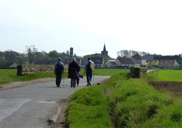
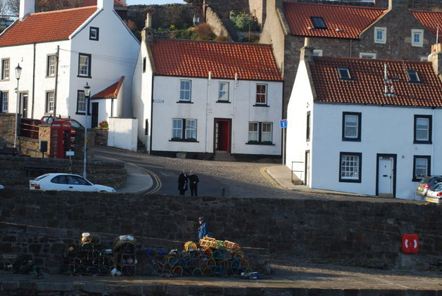
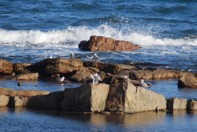
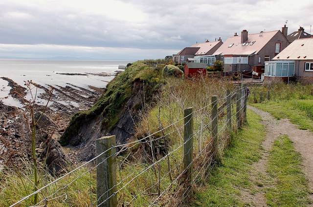
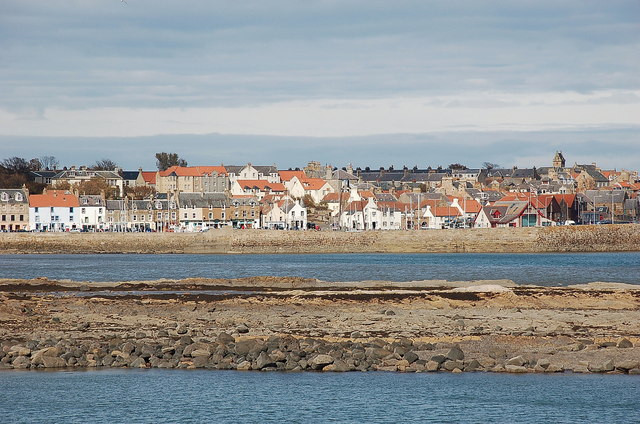
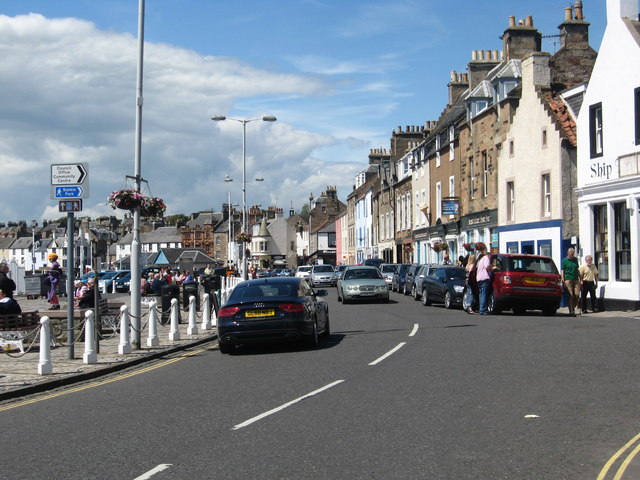
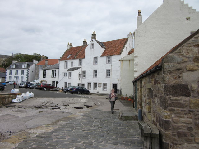
Anstruther Easter is a charming coastal village located in the historic county of Fife, Scotland. Situated on the east coast of the country, it forms part of a group of villages known as the East Neuk, renowned for their picturesque beauty and fishing heritage. Anstruther Easter, often simply referred to as Anstruther, is nestled between the villages of Cellardyke and Pittenweem.

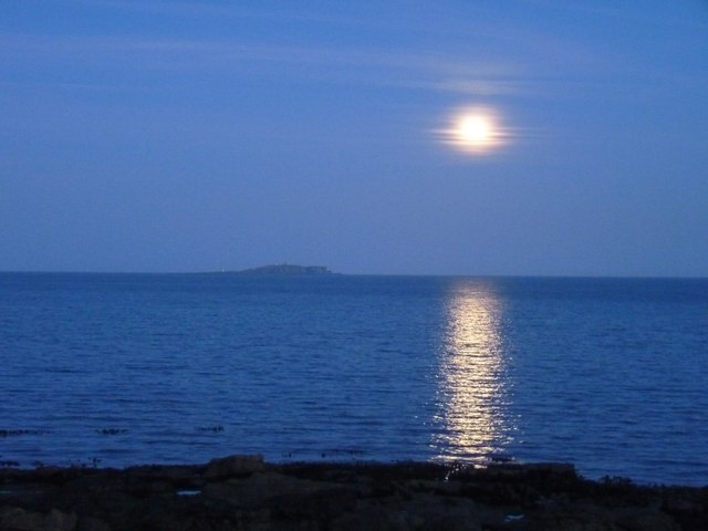
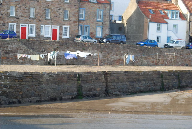
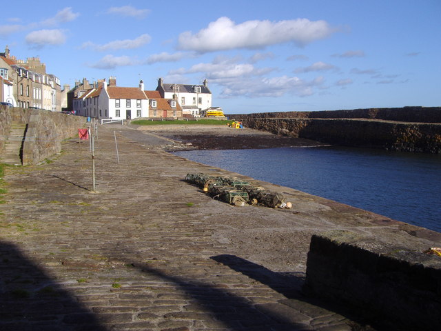
The village boasts a rich history, with evidence of settlement dating back to prehistoric times. Its name originates from the Scottish Gaelic language, meaning "ford over the stream," referring to its location next to the Dreel Burn. Anstruther Easter flourished during the Middle Ages, becoming an important trading port and fishing hub. Today, it retains its maritime character, with a bustling harbor filled with colorful fishing boats.

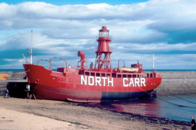
Visitors to Anstruther Easter can enjoy a range of attractions and activities. The Scottish Fisheries Museum is a popular destination, showcasing the area's fishing heritage and featuring exhibits on the life and work of fishermen. The village is also famous for its award-winning fish and chips, drawing food enthusiasts from near and far. The Anstruther Golf Club offers stunning views of the coastline and a challenging round for golf enthusiasts.

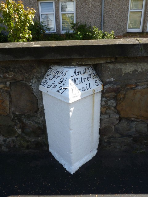
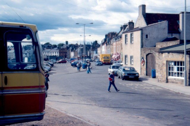
The village is well-connected, with regular bus services and a nearby train station in the town of Leuchars. Whether exploring the narrow streets lined with traditional cottages, enjoying fresh seafood by the sea, or simply taking in the idyllic coastal scenery, Anstruther Easter offers a welcoming and authentic Scottish experience.

If you have any feedback on the listing, please let us know in the comments section below.

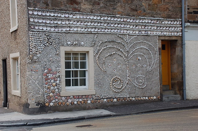
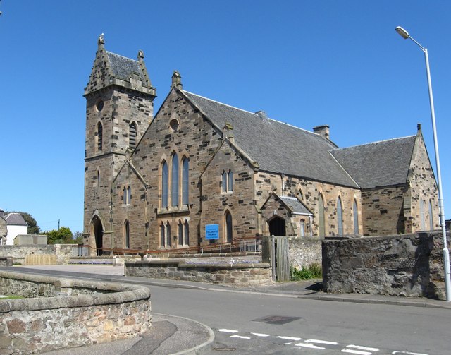
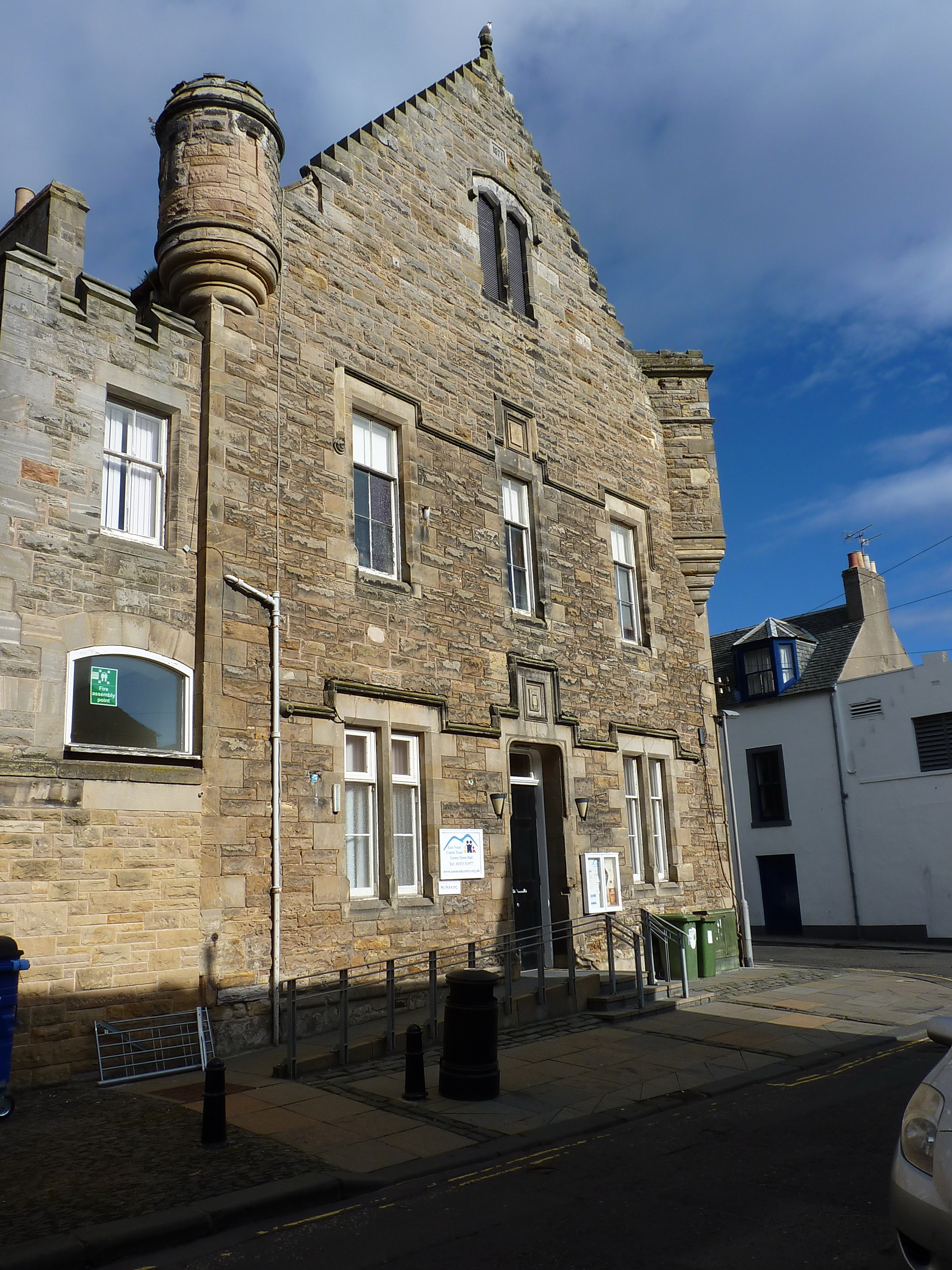
Anstruther Easter Images

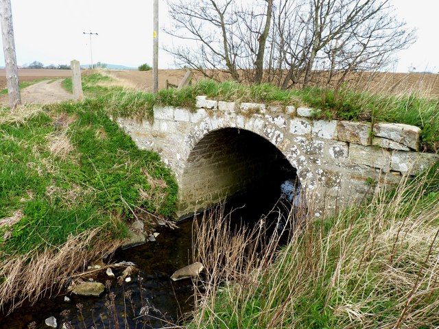
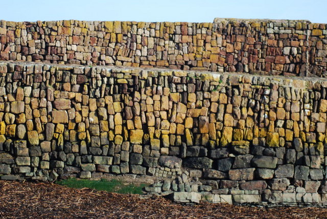
Images are sourced within 2km of 56.222839/-2.700531 or Grid Reference NO5603. Thanks to Geograph Open Source API. All images are credited.

Silver street to St Abbs The reflection of the full moon seems to lead from Cellardyke foreshore towards St Abbs Head. The island to the left is the Isle of May.
Silver street to St Abbs
The reflection of the full moon seems to lead from Cellardyke foreshore towards St Abbs Head. The island to the left is the Isle of May.
Bridge near Crawhill A substantial stone bridge carrying a farm track across a wee burn.
Bridge near Crawhill
A substantial stone bridge carrying a farm track across a wee burn.
Coming in to Kilrenny Walkers crossing what once was a bridge across a railway.
Coming in to Kilrenny
Walkers crossing what once was a bridge across a railway.
Wall Detail The Cellardyke harbour wall is both beautifully crafted and coloured - a work of art.
Wall Detail
The Cellardyke harbour wall is both beautifully crafted and coloured - a work of art.
Blowing in the Wind Typical of many fife coastal villages the washing is dried by the harbour.  These houses and cottages rarely have front gardens.
Blowing in the Wind
Typical of many fife coastal villages the washing is dried by the harbour. These houses and cottages rarely have front gardens.
Fishing Village Houses Typical of the Neuk of Fife these attractive houses in the Royal Burgh of Cellardyke have pantiled roofs
Fishing Village Houses
Typical of the Neuk of Fife these attractive houses in the Royal Burgh of Cellardyke have pantiled roofs
Over the Harbour Wall Looking down on the seaward side of Anstruther's harbour wall there is a rocky shore which is enjoyed by the bird life.
Over the Harbour Wall
Looking down on the seaward side of Anstruther's harbour wall there is a rocky shore which is enjoyed by the bird life.
Milestone, Pittenweem I think you have to know the area pretty well to understand this milestone!
Milestone, Pittenweem
I think you have to know the area pretty well to understand this milestone!
Anstruther - 1987 North Carr Lightship moored at Anstruther harbour.
North Carr is the last remaining Scottish lightship.
Anstruther - 1987
North Carr Lightship moored at Anstruther harbour. North Carr is the last remaining Scottish lightship.
Anstruther - 1987 Anstruther, Fife, Scotland, East Shore (B9131)
Anstruther - 1987
Anstruther, Fife, Scotland, East Shore (B9131)
Anstruther - 1987 Anstruther, Fife, Scotland, East Shore (B9131)
Anstruther - 1987
Anstruther, Fife, Scotland, East Shore (B9131)
Clifftop path, Pittenweem These houses on the east side of Pittenweem are not far from the cliff edge. The path continues east to Anstruther.
Clifftop path, Pittenweem
These houses on the east side of Pittenweem are not far from the cliff edge. The path continues east to Anstruther.
Anstruther from the southwest Blue water and the red and white houses give a Mediterranean feel in this view of the town across the harbour.
Anstruther from the southwest
Blue water and the red and white houses give a Mediterranean feel in this view of the town across the harbour.
Decorated house wall, Anstruther Shells decorate the wall of this house on a corner of the main road.
Decorated house wall, Anstruther
Shells decorate the wall of this house on a corner of the main road.
The main street in Anstruther in Fife Overlooking the harbour.
The main street in Anstruther in Fife
Overlooking the harbour.
The Parish Kirk at Cellardyke in Fife.
Cellardyke Harbour Cellardyke Harbour or Skinfast Haven dates back to 1542 and was constructed with the aid of Dutch dyke builders.  Further improvement to the harbour came in 1829 with assistance from the Fishery Board, although it should be noted that the fishermen themselves raised a third of the required investment.
Cellardyke Harbour
Cellardyke Harbour or Skinfast Haven dates back to 1542 and was constructed with the aid of Dutch dyke builders. Further improvement to the harbour came in 1829 with assistance from the Fishery Board, although it should be noted that the fishermen themselves raised a third of the required investment.
Restored houses by Pittenweem Harbour This 17th century A listed house was restored under the National Trust for Scotland little house scheme.
Restored houses by Pittenweem Harbour
This 17th century A listed house was restored under the National Trust for Scotland little house scheme.
Show me another place!

Anstruther Easter is located at Grid Ref: NO5603 (Lat: 56.222839, Lng: -2.700531)

Unitary Authority: Fife

Police Authority: Fife

What 3 Words

///fixture.laughs.slide. Near Anstruther, Fife

Related Wikis

Nearby Amenities

Located within 500m of 56.222839,-2.700531
Mini Roundabout
Direction: clockwise
Lat/Long: 56.2234474/-2.7027633
Mini Roundabout
Direction: clockwise
Lat/Long: 56.2242034/-2.7053212
Chalmers Lighthouse
Man Made: lighthouse
Seamark Fog Signal Category: horn
Seamark Fog Signal Group: 3
Seamark Fog Signal Period: 60
Seamark Information: Horn sounded when fishing boats are expected
Seamark Light Category: vertical
Seamark Light Character: F
Seamark Light Colour: red
Seamark Light Height: 5
Seamark Light Multiple: 2
Seamark Light Range: 4
Seamark Light Reference: A 3078
Seamark Type: light_minor
Source: US NGA Pub. 114. 2011-05-26.
Lat/Long: 56.2196207/-2.6969786
Man Made: beacon
Seamark Light Character: Fl
Seamark Light Colour: green
Seamark Light Height: 6
Seamark Light Period: 3
Seamark Light Range: 4
Seamark Light Reference: A 3080
Seamark Type: light_minor
Source: US NGA Pub. 114. 2011-05-26.
Lat/Long: 56.2192179/-2.6966181
Post Box
Brand: Royal Mail
Brand Wikidata: Q638098
Brand Wikipedia: en:Royal Mail
Collection Times: Mo-Fr 16:30; Sa 11:15
Operator: Royal Mail
Operator Wikidata: Q638098
Post Box Mounting: painted_wall
Post Box Type: wall
Ref: KY10 258
Royal Cypher: GVIR
Royal Cypher Wikidata: Q33102169
Lat/Long: 56.2223587/-2.6984524
Atm
Operator: Post Office
Wheelchair: yes
Lat/Long: 56.2223482/-2.6984214
Telephone
Booth: KX100
Covered: booth
Lat/Long: 56.2221907/-2.6983414
Post Box
Brand: Royal Mail
Brand Wikidata: Q638098
Brand Wikipedia: en:Royal Mail
Collection Times: Mo-Fr 16:30; Sa 11:15
Operator: Royal Mail
Operator Wikidata: Q638098
Post Box Type: pillar
Ref: KY10 255
Royal Cypher: scottish_crown
Lat/Long: 56.2226088/-2.6992748
Crossing
Crossing: zebra
Crossing Island: no
Tactile Paving: yes
Lat/Long: 56.2226549/-2.6997552
Bus Stop
Anstruther St Andrews Road
Bench: no
Bin: no
Bus: yes
Lit: no
Public Transport: platform
Shelter: no
Tactile Paving: no
Lat/Long: 56.2230607/-2.7037117
Post Box
Collection Times: Mo-Fr 09:00; Sa 07:00
Postal Code: KY10
Ref: KY10 406
Royal Cypher: scottish_crown
Lat/Long: 56.224515/-2.7024135
Leisure: slipway
Lat/Long: 56.2194935/-2.7053205
Mini Roundabout
Direction: clockwise
Lat/Long: 56.224125/-2.7052237
Barrier: bollard
Bollard: fixed
Lat/Long: 56.2226596/-2.6946598
Crossing
Button Operated: yes
Crossing: traffic_signals
Crossing Island: no
Tactile Paving: yes
Lat/Long: 56.224288/-2.7055921
Mini Roundabout
Direction: clockwise
Lat/Long: 56.2255678/-2.7036374
Crossing
Crossing: uncontrolled
Crossing Ref: zebra
Lat/Long: 56.2269605/-2.7030698
Anstruther
Historic Railway: station
Railway: site
Wikidata: Q4770792
Wikipedia: en:Anstruther railway station
Lat/Long: 56.2231475/-2.7075584
Seamark Light Category: lower
Seamark Light Character: F
Seamark Light Colour: green
Seamark Light Height: 7
Seamark Light Range: 4
Seamark Light Reference: A 3082
Seamark Type: light_minor
Lat/Long: 56.22165/-2.6957333
Seamark Light Category: upper
Seamark Light Character: F
Seamark Light Colour: green
Seamark Light Height: 11
Seamark Light Range: 4
Seamark Light Reference: A 3084
Seamark Type: light_minor
Lat/Long: 56.2219955/-2.6955978
Crossing
Crossing: marked
Crossing Island: no
Crossing Ref: zebra
Tactile Paving: yes
Lat/Long: 56.2220551/-2.6977195
Ferry Terminal
Lat/Long: 56.2214587/-2.6977468
Anstruther Fishery Office
Addr City: Anstruther
Addr Housenumber: 28
Addr Postcode: KY10 3DF
Addr Street: Cunzie Street
Office: government
Lat/Long: 56.2231963/-2.7002287
Entrance: main
Lat/Long: 56.2249652/-2.7070578
Recycling
Recycling Cans: yes
Recycling Glass Bottles: yes
Recycling Paper: yes
Recycling Plastic: no
Recycling Plastic Packaging: yes
Recycling Type: container
Lat/Long: 56.2251867/-2.6990975
Tourism: picnic_site
Lat/Long: 56.2252268/-2.697566
Bench
Backrest: yes
Check Date: 2023-08-03
Lat/Long: 56.225333/-2.6974795
Tourism: picnic_site
Lat/Long: 56.225355/-2.6978759
Waste Basket
Check Date: 2023-08-03
Lat/Long: 56.225363/-2.6974795
Tourism: picnic_site
Lat/Long: 56.2254972/-2.6980093
Restaurant
Eastern Touch at Anstruther
Addr City: Anstruther
Addr Housenumber: 35
Addr Postcode: KY10 3DF
Addr Street: Cunzie Street
Cuisine: indian
Fhrs Id: 94090
Opening Hours: Tu-Su 16:30-22:00
Lat/Long: 56.2229996/-2.7004929
Access: yes
Leisure: playground
Lat/Long: 56.222795/-2.6949979
Phone: +44 1333 310697
Tourism: guest_house
Lat/Long: 56.2233592/-2.6944859
Pub
The Bank
Addr City: Anstruther
Addr Housenumber: 25
Addr Postcode: KY10 3DQ
Addr Street: High Street East
Fhrs Id: 110441
Lat/Long: 56.2230067/-2.7031073
Tourism: guest_house
Lat/Long: 56.2228654/-2.6958553
Bus Stop
Anstruther, Fisheries Museum
Bench: yes
Bin: yes
Bus: yes
Lit: yes
Naptan AtcoCode: 6500N0336
Naptan NaptanCode: 34329863
Public Transport: platform
Ref: 34329863
Shelter: yes
Tactile Paving: no
Lat/Long: 56.2217236/-2.6971633
Anstruther, Fisheries Museum
Bus: yes
Public Transport: stop_position
Ref: 34329868
Lat/Long: 56.2217301/-2.6968837
Bus Stop
Anstruther, Fisheries Museum
Bench: no
Bin: yes
Bus: yes
Lit: no
Naptan AtcoCode: 6500N0335
Naptan NaptanCode: 34329868
Public Transport: platform
Ref: 34329868
Shelter: no
Tactile Paving: no
Lat/Long: 56.2217806/-2.6968506
Anstruther, Fisheries Museum
Bus: yes
Public Transport: stop_position
Ref: 34329863
Lat/Long: 56.2217784/-2.6971495
Tourism: picnic_site
Lat/Long: 56.2214537/-2.6967661
Defibrillator
Emergency: defibrillator
Lat/Long: 56.221481/-2.6975269
Board Type: history
Check Date: 2023-08-01
Information: board
Tourism: information
Lat/Long: 56.2216531/-2.6968384
Vending Machine
Check Date: 2023-08-01
Payment Coins: yes
Vending: parking_tickets
Lat/Long: 56.2216611/-2.6969403
Toilets
Access: yes
Fee: no
Operator: Scottish Fisheries Museum
Toilets Disposal: flush
Toilets Position: seated;urinal
Wheelchair: yes
Lat/Long: 56.2218455/-2.6970702
Entrance: main
Lat/Long: 56.221868/-2.6971508
Pharmacy
T & K Brown Pharmacy
Healthcare: pharmacy
Lat/Long: 56.2225002/-2.6988296
Anstruther
Alt Name Gd: Ànsruthair;Port na h-Eanstraich
Name Ga: Ánstruthair
Name Gd: Eanstair
Name Sco: Ainster
Place: town
Population: 3810
Wikidata: Q570401
Wikipedia: en:Anstruther
Lat/Long: 56.2227638/-2.7005643
Crossing
Crossing: zebra
Crossing Island: no
Tactile Paving: yes
Lat/Long: 56.2242982/-2.7052114
Chrichton House
Name En: Chrichton House
Tourism: guest_house
Lat/Long: 56.2217845/-2.7060058
Pub
Dreel Tavern
Addr City: Anstruther
Addr Housenumber: 16
Addr Postcode: KY10 3DL
Addr Street: High Street West
Fhrs Id: 110550
Opening Hours: We-Su 12:00-10:30
Source Addr: FHRS Open Data
Lat/Long: 56.2221547/-2.7053856
Anstruther Easter
Place: suburb
Lat/Long: 56.2242925/-2.698339
Mercat Cross
Historic: memorial
Memorial: mercat_cross
Lat/Long: 56.2227313/-2.7005381
Restaurant
The Cellar
Addr City: Anstruther
Addr Housenumber: 24
Addr Postcode: KY10 3AA
Addr Street: East Green
Fhrs Id: 98766
Website: https://www.thecellaranstruther.co.uk/
Lat/Long: 56.2220549/-2.6963498
The Royal Hotel
Addr City: Anstruther
Addr Housenumber: 20
Addr Postcode: KY10 3DU
Addr Street: Rodger Street
Fhrs Id: 132095
Tourism: hotel
Lat/Long: 56.2231685/-2.7019471
Bus Stop
Anstruther Harbour
Bench: yes
Bin: yes
Bus: yes
Lit: no
Public Transport: platform
Shelter: yes
Tactile Paving: no
Lat/Long: 56.2228688/-2.700664
Bus Stop
Anstruther
Bench: yes
Bin: yes
Bus: yes
Lit: no
Public Transport: platform
Shelter: yes
Tactile Paving: no
Lat/Long: 56.2227412/-2.7006519
Pub
Ship Tavern
Addr City: Anstruther
Addr Housenumber: 49
Addr Postcode: KY10 3AQ
Addr Street: Shore Street
Fhrs Id: 133682
Outdoor Seating: yes
Lat/Long: 56.2220978/-2.697588
Crossing
Crossing: traffic_signals
Crossing Island: yes
Tactile Paving: yes
Lat/Long: 56.2259049/-2.6969368
Crossing
Crossing: traffic_signals
Crossing Island: no
Tactile Paving: yes
Lat/Long: 56.2215969/-2.7064905
Bus Stop
Bench: no
Bin: no
Bus: yes
Lit: no
Public Transport: platform
Shelter: yes
Tactile Paving: no
Lat/Long: 56.2214838/-2.7067806
Shop: hairdresser
Lat/Long: 56.2210023/-2.7078004
Bus Stop
Bench: no
Bin: no
Bus: yes
Public Transport: platform
Shelter: no
Tactile Paving: no
Lat/Long: 56.2211497/-2.7072541
Crossing
Crossing: uncontrolled
Crossing Island: no
Crossing Ref: zebra
Tactile Paving: yes
Lat/Long: 56.2235431/-2.7025994
The Flower House
Addr City: Anstruther
Addr Housenumber: 11
Addr Street: Shore Street
Shop: florist
Lat/Long: 56.2228038/-2.7001677
Bench
Backrest: yes
Lat/Long: 56.2226171/-2.7000715
Bench
Backrest: yes
Lat/Long: 56.2225778/-2.7000906
Bench
Backrest: yes
Lat/Long: 56.2226303/-2.7000063
Bench
Backrest: yes
Lat/Long: 56.2226153/-2.6999467
Cafe
Coast Coffee
Addr City: Anstruther
Addr Housenumber: 13
Addr Postcode: KY10 3EA
Addr Street: Shore Street
Fhrs Id: 133673
Lat/Long: 56.2227405/-2.6998355
Pub
Masonic Arms
Addr City: Anstruther
Addr Housenumber: 12
Addr Postcode: KY10 3EA
Addr Street: Shore Street
Fhrs Id: 133672
Lat/Long: 56.2227718/-2.7000217
Fast Food
Fish and Chips on the Waterfront
Addr City: Anstruther
Addr Housenumber: 14-15
Addr Postcode: KY10 3EA
Addr Street: Shore Street
Cuisine: fish_and_chips
Drive Through: no
Phone: +44 01333 311110
Website: https://www.fishandchipsonthewaterfront.co.uk/
Lat/Long: 56.2227734/-2.6996694
Fast Food
The Wee Chippy
Addr City: Anstruther
Addr Housenumber: 4
Addr Postcode: KY10 3EA
Addr Street: Shore Street
Cuisine: fish_and_chips
Drive Through: no
Phone: +44 1333 310106
Lat/Long: 56.2229392/-2.7011972
Restaurant
The Waterfront
Lat/Long: 56.2226952/-2.6993949
Fast Food
Dervish
Addr City: Anstruther
Addr Housenumber: 34
Addr Postcode: KY10 3AQ
Addr Street: Shore Street
Fhrs Id: 133679
Source Addr: FHRS Open Data
Lat/Long: 56.2224516/-2.6986338
Shop: hairdresser
Lat/Long: 56.2221259/-2.6977209
Restaurant
Anstruther Fish Bar
Addr City: Anstruther
Addr Housenumber: 42 - 44
Addr Postcode: KY10 3AQ
Addr Street: Shore Street
Cuisine: fish_and_chips
Opening Hours: Mo-Su 11:30-22:00
Outdoor Seating: no
Takeaway: yes
Website: https://www.anstrutherfishbar.co.uk/
Wikidata: Q4770788
Wikipedia: en:Anstruther Fish Bar
Lat/Long: 56.222229/-2.6979665
Pharmacy
East Neuk Pharmacy
Addr City: Anstruther
Addr Housenumber: 23
Addr Postcode: KY10 3DU
Addr Street: Rodger Street
Dispensing: yes
Fhrs Id: 132096
Healthcare: pharmacy
Opening Hours: Mo-Sa 09:00-18:00,09:00-13:00
Lat/Long: 56.2229588/-2.7019137
Shop: optician
Lat/Long: 56.2230084/-2.7020185
Shop: hairdresser
Lat/Long: 56.2230485/-2.7020788
Location Transition: yes
Power: pole
Lat/Long: 56.2238809/-2.7061625
Material: wood
Power: pole
Lat/Long: 56.2227483/-2.7085644
School
Waid Academy
Addr City: Anstruther
Addr Postcode: KY10 3HD
Addr Street: St Andrews Road
Email: waidacademy.enquiries@fife.gov.uk
Operator: Fife Council
Operator Wikidata: Q28530258
Phone: +44 1334 659404
Ref GB Uprn: 320176042
Ref Seedcode: 5426138
Religion: none
School: secondary
Website: https://blogs.glowscotland.org.uk/fi/waidacademy/
Wikidata: Q7959924
Wikipedia: en:Waid Academy
Lat/Long: 56.2266416/-2.7044331
Generator Method: photovoltaic
Generator Output Electricity: yes
Generator Source: solar
Generator Type: solar_photovoltaic_panel
Power: generator
Lat/Long: 56.2253972/-2.6950225
Generator Method: photovoltaic
Generator Output Electricity: yes
Generator Source: solar
Generator Type: solar_photovoltaic_panel
Power: generator
Lat/Long: 56.2253745/-2.6948065
Generator Method: photovoltaic
Generator Output Electricity: yes
Generator Source: solar
Generator Type: solar_photovoltaic_panel
Power: generator
Lat/Long: 56.2257801/-2.6945941
Generator Method: photovoltaic
Generator Output Electricity: yes
Generator Source: solar
Generator Type: solar_photovoltaic_panel
Power: generator
Lat/Long: 56.2258054/-2.6945579
Generator Method: photovoltaic
Generator Output Electricity: yes
Generator Source: solar
Generator Type: solar_photovoltaic_panel
Power: generator
Lat/Long: 56.2266512/-2.699578
Generator Method: photovoltaic
Generator Output Electricity: yes
Generator Source: solar
Generator Type: solar_photovoltaic_panel
Power: generator
Lat/Long: 56.2216628/-2.7079266
Generator Method: photovoltaic
Generator Output Electricity: yes
Generator Source: solar
Generator Type: solar_photovoltaic_panel
Power: generator
Lat/Long: 56.2216618/-2.708001
Generator Method: photovoltaic
Generator Output Electricity: yes
Generator Source: solar
Generator Type: solar_photovoltaic_panel
Power: generator
Lat/Long: 56.2200058/-2.7067822
Generator Method: photovoltaic
Generator Output Electricity: yes
Generator Source: solar
Generator Type: solar_photovoltaic_panel
Power: generator
Lat/Long: 56.2199939/-2.7067083
Height: 5
Lit: no
Man Made: flagpole
Lat/Long: 56.2262583/-2.7038728
Description: Most likely what remains of the Caddies Burn, the former border between Cellardyke and Anstruther.
Man Made: outfall
Substance: sewage
Lat/Long: 56.2222157/-2.6937973
Library
Waid Library
Addr City: Anstruther
Addr Postcode: KY10 3GY
Addr Street: St Andrews Road
Opening Hours: Mo-Fr 09:00-17:00; Sa 09:30-12:30
Website: https://www.onfife.com/venues/waid-library/
Lat/Long: 56.226737/-2.7038522
Cafe
Waves Café
Addr City: Anstruther
Addr Housename: Scottish Fisheries Museum
Addr Postcode: KY10 3AB
Addr Street: Eat Shore
Note: Café is part of Scottish Fisheries Museum and has separate entrance.
Website: https://www.scotfishmuseum.org/refreshments.php
Lat/Long: 56.2220043/-2.6973067
Post Box
Post Box Design: type_a
Post Box Type: pillar
Ref: KY10 404
Lat/Long: 56.2229549/-2.706766
Bench
Backrest: yes
Lat/Long: 56.222127/-2.6981909
Bench
Backrest: yes
Lat/Long: 56.2221049/-2.6981608
Bench
Backrest: yes
Lat/Long: 56.2221016/-2.698103
Bench
Backrest: yes
Lat/Long: 56.2220808/-2.6980657
Bench
Backrest: yes
Lat/Long: 56.2220687/-2.6979857
Bench
Backrest: yes
Lat/Long: 56.2220409/-2.6979206
Bench
Backrest: yes
Lat/Long: 56.2219545/-2.6976857
Barrier: bollard
Lat/Long: 56.2222191/-2.6983478
Barrier: bollard
Lat/Long: 56.222204/-2.6982937
Barrier: bollard
Lat/Long: 56.2221848/-2.6982876
Barrier: bollard
Lat/Long: 56.2221766/-2.6982941
Crossing
Crossing: unmarked
Tactile Paving: no
Lat/Long: 56.2221495/-2.698298
Barrier: bollard
Lat/Long: 56.2221559/-2.6983313
Barrier: bollard
Lat/Long: 56.2221697/-2.6983039
Barrier: bollard
Lat/Long: 56.22221/-2.6983091
Barrier: bollard
Lat/Long: 56.2222145/-2.6983265
Barrier: bollard
Lat/Long: 56.2221947/-2.6982859
Barrier: bollard
Lat/Long: 56.2221634/-2.6983158
Barrier: bollard
Lat/Long: 56.2221501/-2.6983434
Defibrillator
Defibrillator Location: On post next to Carpet shop at junction of Crail Road and Rodger Street
Emergency: defibrillator
Indoor: no
Mapillary: 244355285260001
Survey Date: 2023-09-03
Lat/Long: 56.2235489/-2.7025046
Waste Basket
Lat/Long: 56.2227692/-2.7016517
Waste Basket
Lat/Long: 56.2223086/-2.7064311
Waste Basket
Lat/Long: 56.2241155/-2.7070854
Bench
Backrest: yes
Material: plastic
Lat/Long: 56.222289/-2.7070297
Waste Basket
Lat/Long: 56.2222764/-2.707083
Bench
Backrest: yes
Material: plastic
Lat/Long: 56.2223255/-2.7065046
Bench
Backrest: no
Material: stone
Lat/Long: 56.2223725/-2.7035218
Bench
Backrest: yes
Material: wood
Lat/Long: 56.2222033/-2.7034848
Bench
Backrest: yes
Material: wood
Lat/Long: 56.2225178/-2.7035055
Waste Basket
Lat/Long: 56.2242452/-2.7010414
Recycling
Recycling Cans: yes
Recycling Glass Bottles: yes
Recycling Paper: yes
Recycling Plastic: no
Recycling Plastic Packaging: yes
Recycling Type: container
Lat/Long: 56.2248325/-2.7077513
Bench
Backrest: yes
Material: wood
Lat/Long: 56.2255603/-2.7050745
Waste Basket
Lat/Long: 56.225672/-2.7004674
The Plough and the Reaper
Artist Name: Marion Smith RSA
Artwork Type: sculpture
Material: metal
Start Date: 2009-04-04
Tourism: artwork
Lat/Long: 56.2221123/-2.6951399
Atm
Opening Hours: 24/7
Operator: YourCash
Lat/Long: 56.2231473/-2.7029946
A & A Stores
Shop: convenience
Lat/Long: 56.2231305/-2.7029639
Drinking Water
Top Up Tap
Access: yes
Bottle: yes
Fee: no
Operator: Scottish Water
Operator Wikidata: Q7438022
Lat/Long: 56.2220195/-2.6978289
Toilets
Changing Table: yes
Wheelchair: yes
Lat/Long: 56.2225779/-2.6998213
The Waterfront
Tourism: hotel
Lat/Long: 56.2227376/-2.6993298
Cafe
Vintage Tea Room
Lat/Long: 56.2227233/-2.6995186
Restaurant
The Shellfish Shack
Cuisine: seafood
Lat/Long: 56.2228414/-2.7002653
Bar
Tipsy Tavern
Lat/Long: 56.2228557/-2.7003619
Murray Library Hostel
Tourism: hostel
Lat/Long: 56.2229082/-2.7007803
Harbour Interiors
Shop: houseware
Lat/Long: 56.2229241/-2.7012817
Information: guidepost
Operator: Fife Coast and Countryside Trust
Tourism: information
Lat/Long: 56.2228401/-2.7016074
Information: guidepost
Operator: Fife Coast and Countryside Trust
Tourism: information
Lat/Long: 56.2214991/-2.7052778
Information: guidepost
Operator: Fife Coast and Countryside Trust
Tourism: information
Lat/Long: 56.2217878/-2.7062655
The data included in this document is from www.openstreetmap.org. The data is made available under ODbL.

Have you been to Anstruther Easter?

Leave your review of Anstruther Easter below (or comments, questions and feedback).