Coombe Plantation

Wood, Forest in Somerset Somerset West and Taunton

England

Coombe Plantation

Pitminster : Lowton Road Lowton Road off Blackdown Hill.
Pitminster : Lowton Road Credit: Lewis Clarke

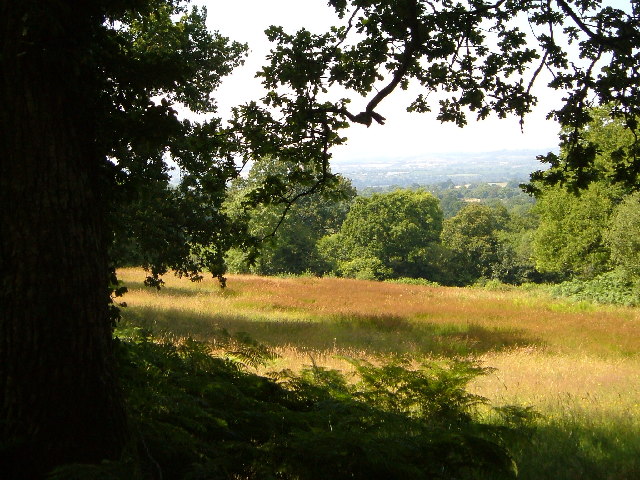
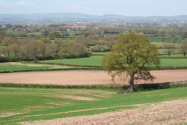
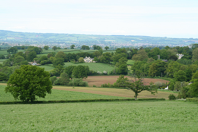
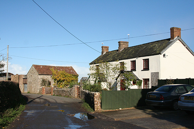
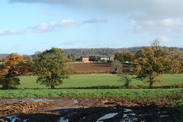
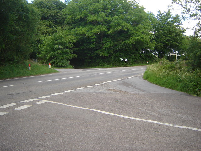
Coombe Plantation, located in Somerset, England, is a picturesque woodland forest that spans across a vast area of approximately 100 hectares. This enchanting plantation is nestled in the heart of the countryside, offering visitors a tranquil escape from the bustling city life.

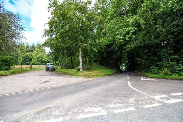
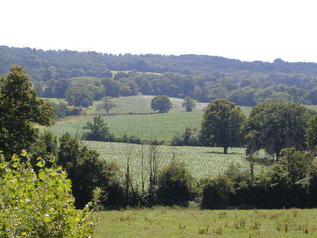
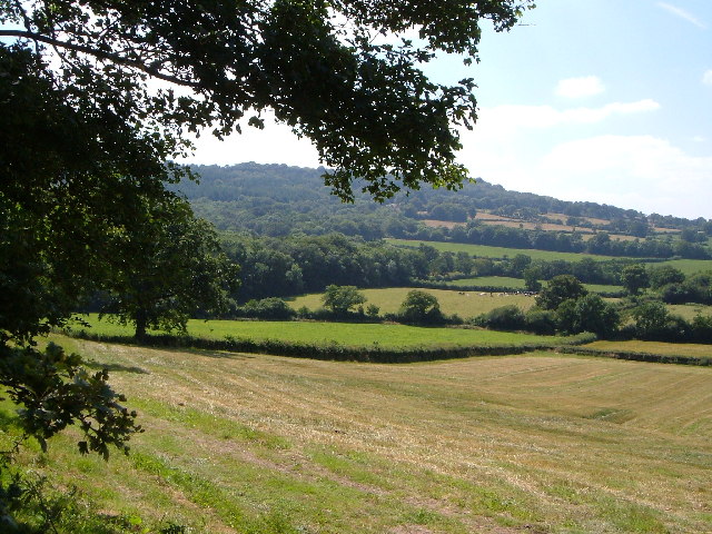
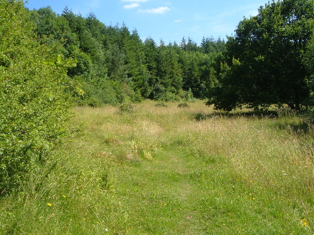
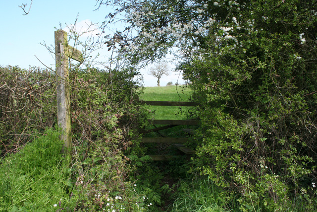
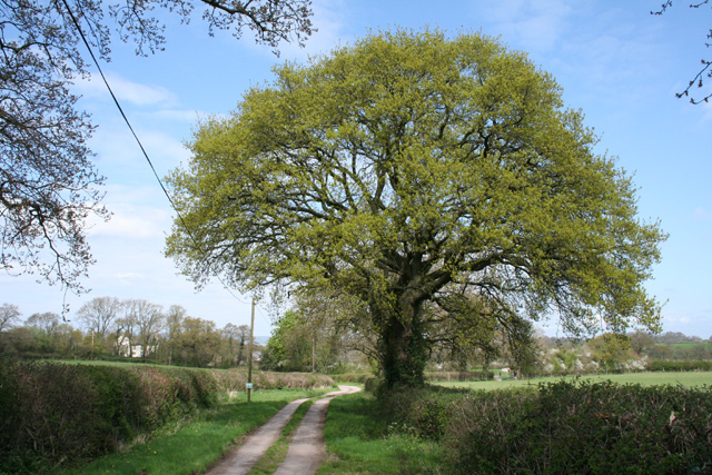
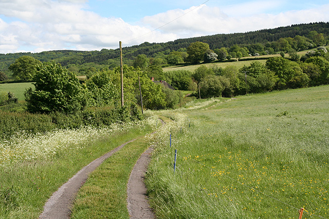
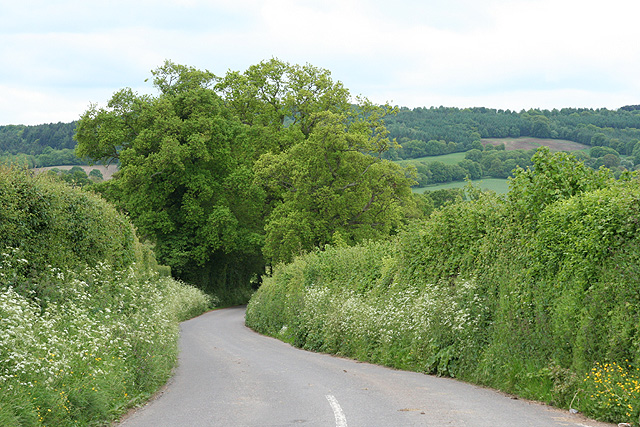
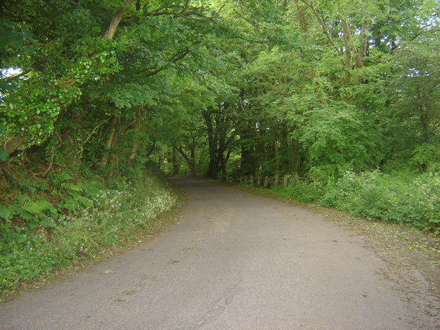
The plantation is a haven for nature enthusiasts, boasting a diverse range of flora and fauna. The dense woodland is primarily populated by towering oak, beech, and pine trees, creating a lush and verdant landscape. Visitors can stroll along the well-maintained paths that wind through the plantation, immersing themselves in the beauty of nature.

The forest is also home to a variety of wildlife species, making it a popular destination for birdwatchers and wildlife photographers. From the elusive red deer to the vibrant plumage of woodland birds, Coombe Plantation offers a unique opportunity to observe and appreciate the natural wonders of Somerset.

In addition to its natural beauty, Coombe Plantation also holds historical significance. The remains of an ancient Roman villa have been discovered within the forest, providing a glimpse into the region's rich past. These archaeological findings add an intriguing layer of depth to the plantation, captivating history enthusiasts and archaeology buffs.

With its serene ambiance, diverse ecosystem, and historical significance, Coombe Plantation is a must-visit destination for those seeking solace in nature or wanting to explore the captivating history of Somerset. Whether it is a leisurely walk, birdwatching, or a picnic amidst the awe-inspiring woodland, Coombe Plantation offers a truly captivating experience for all who venture within its enchanting embrace.

If you have any feedback on the listing, please let us know in the comments section below.

Coombe Plantation Images

Images are sourced within 2km of 50.963094/-3.155883 or Grid Reference ST1818. Thanks to Geograph Open Source API. All images are credited.

Pitminster : Lowton Road Lowton Road off Blackdown Hill.
Pitminster : Lowton Road
Lowton Road off Blackdown Hill.
Pitminster : Woodland Woodland seen off Blackdown Hill.
Pitminster : Woodland
Woodland seen off Blackdown Hill.
Northern slopes of Blackdown Hills from Angersleigh Looking SSW from near Angersleigh church across farmland towards Leigh Hill
Northern slopes of Blackdown Hills from Angersleigh
Looking SSW from near Angersleigh church across farmland towards Leigh Hill
Farmland SE of Ruggin Looking WSW across the northern slopes of the Blackdown Hills, with Buckland Wood and Hill behind
Farmland SE of Ruggin
Looking WSW across the northern slopes of the Blackdown Hills, with Buckland Wood and Hill behind
Quants Nature Reserve Hidden within steep woods on the north-facing slopes of the Blackdown Hills, this meadow forms part of Quants SSSI, rich in plants indicative of ancient woodland, butterflies and other fauna
Quants Nature Reserve
Hidden within steep woods on the north-facing slopes of the Blackdown Hills, this meadow forms part of Quants SSSI, rich in plants indicative of ancient woodland, butterflies and other fauna
Woodland meadow near Farm Wood Bungalow Here the lower north-facing slopes of the Blackdown Hills form a patchwork of woods (here oak) and fields. Looking northwards, with a view across the Vale of Taunton Deane in the background.
Woodland meadow near Farm Wood Bungalow
Here the lower north-facing slopes of the Blackdown Hills form a patchwork of woods (here oak) and fields. Looking northwards, with a view across the Vale of Taunton Deane in the background.
Blagdon Hill Entering the village from the Howleigh road.
Blagdon Hill
Entering the village from the Howleigh road.
West Buckland: footpath to Buckland Farm The path starts here, near Five Cross Way. Looking east-south-east
West Buckland: footpath to Buckland Farm
The path starts here, near Five Cross Way. Looking east-south-east
West Buckland: the way to Buckland Farm The notice on the post indicates that this is a private road. With the oak tree just coming into leaf
West Buckland: the way to Buckland Farm
The notice on the post indicates that this is a private road. With the oak tree just coming into leaf
Pitminster: near Chelmsine Looking west-north-west over farmland. Wellington, with its church tower, can be seen in mid distance
Pitminster: near Chelmsine
Looking west-north-west over farmland. Wellington, with its church tower, can be seen in mid distance
Pitminster: cemetery at Chelmsine chapel Looking east-south-east with the Blackdown Hills beyond.
Pitminster: cemetery at Chelmsine chapel
Looking east-south-east with the Blackdown Hills beyond.
West Buckland: track to Perry Meade The track also serves as a public footpath to Ruggin. The thatched roof of Perry Meade is just visible beyond trees. Looking south-south-east on the edge of the Blackdown Hills
West Buckland: track to Perry Meade
The track also serves as a public footpath to Ruggin. The thatched roof of Perry Meade is just visible beyond trees. Looking south-south-east on the edge of the Blackdown Hills
Pitminster: towards Angersleigh Looking north-north-east on the road from Forches Corner (The Marry Harriers). Ahead The Glebe House stands by the road to Taunton. To the right the church of St Michael and All Angels and Leigh Court are half hidden by trees. Taunton lies in the distance
Pitminster: towards Angersleigh
Looking north-north-east on the road from Forches Corner (The Marry Harriers). Ahead The Glebe House stands by the road to Taunton. To the right the church of St Michael and All Angels and Leigh Court are half hidden by trees. Taunton lies in the distance
Pitminster: approaching Angersleigh Looking south on the road from Taunton with Leigh Hill on the Blackdowns providing the backdrop
Pitminster: approaching Angersleigh
Looking south on the road from Taunton with Leigh Hill on the Blackdowns providing the backdrop
Pitminster: cottages at Howleigh Hillcrest and Hillcrest Cottage, looking north-north-east
Pitminster: cottages at Howleigh
Hillcrest and Hillcrest Cottage, looking north-north-east
Pitminster: towards Sellick’s Green Looking east near Howleigh Farm with Pickeridge Hill providing the backdrop
Pitminster: towards Sellick’s Green
Looking east near Howleigh Farm with Pickeridge Hill providing the backdrop
Looking back into Buckland Wood This was taken at an elbow bend in the road at which also is the edge of the Wood.
Looking back into Buckland Wood
This was taken at an elbow bend in the road at which also is the edge of the Wood.
Five-road cross roads at Forches Corner
Show me another place!

Coombe Plantation is located at Grid Ref: ST1818 (Lat: 50.963094, Lng: -3.155883)

Administrative County: Somerset

District: Somerset West and Taunton

Police Authority: Avon and Somerset

What 3 Words

///distorts.ordinary.failed. Near Taunton, Somerset

Related Wikis

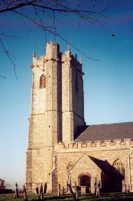
Church of St Michael, Angersleigh

The Anglican Church of St Michael in Angersleigh, Somerset, England was built in the 14th century. It is a Grade II* listed building. == History == The...

Quants Reserve

Quants Reserve is a nature reserve north west of Burnworthy in Somerset, England. It consists of a grassland clearing in a forestry plantation. It is well...

Leigh Reservoir

Leigh Reservoir, or Leigh Hill Reservoir, is a small reservoir in Somerset, England. It was built in 1893 to supply water to the town of Taunton, Somerset...

Taunton Deane services

Taunton Deane services is a double sided motorway service station on the M5 motorway near Taunton, England. It is owned by Roadchef. == Location == The...

Luxhay Reservoir

Luxhay Reservoir is an artificial reservoir near Angersleigh, Somerset, England. It is now owned by Wessex Water. It was built in 1905 by the town corporation...

West Buckland

West Buckland is a village and civil parish in Somerset, England, situated 5 miles (8.0 km) south west of Taunton. The parish has a population of 1,189...
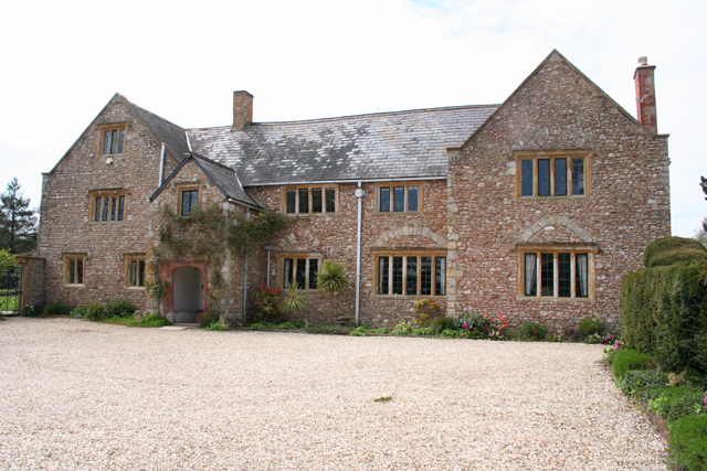
Gerbestone Manor

Gerbestone Manor in West Buckland, Somerset, England was largely rebuilt in the late 16th century, although some fabric from the 13th century house remains...

Ringdown SSSI, Somerset

Ringdown (grid reference ST178155) is a 4.0 hectare (9.9 acre) biological Site of Special Scientific Interest west of Burnworthy in the Blackdown Hills...

Nearby Amenities

Located within 500m of 50.963094,-3.155883
Chelmsine
Place: hamlet
Lat/Long: 50.9601383/-3.1554022
Knights Cross
Place: hamlet
Lat/Long: 50.9625569/-3.1553191
The data included in this document is from www.openstreetmap.org. The data is made available under ODbL.

Have you been to Coombe Plantation?

Leave your review of Coombe Plantation below (or comments, questions and feedback).