Glanville Copse

Wood, Forest in Devon East Devon

England

Glanville Copse

Offwell Brook valley below Colwell From the track that continues Rock Lane towards Slade Farm, a view across a tributary of the Offwell Brook.
Offwell Brook valley below Colwell Credit: Derek Harper

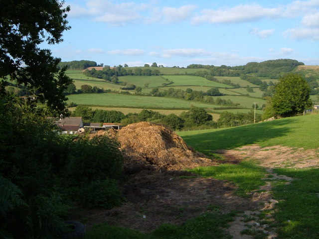
Glanville Copse is a picturesque woodland located in Devon, England. Covering an area of approximately 100 acres, this ancient forest is a haven for nature enthusiasts and offers a tranquil escape from the bustling city life. Situated in the heart of Devon, Glanville Copse is easily accessible and attracts visitors from all over the country.

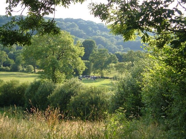
The copse is characterized by its dense vegetation, consisting mainly of native trees such as oak, beech, and ash. The towering trees create a canopy that filters sunlight, casting a dappled glow on the forest floor below. This creates an ideal habitat for a diverse range of flora and fauna.

As visitors explore the winding trails, they may come across various wildlife species that call Glanville Copse their home. These include deer, foxes, badgers, and a plethora of bird species, making it a popular spot for birdwatching. The peaceful atmosphere and abundance of wildlife make it a perfect place for nature photography or simply enjoying a peaceful walk in nature.

Aside from its natural beauty, Glanville Copse also holds historical significance. The forest has been preserved and protected for centuries, and remnants of ancient settlements and archaeological sites can be found within its boundaries. Exploring these historical sites offers visitors a glimpse into the forest's rich past and the people who once inhabited the area.

Overall, Glanville Copse in Devon is a remarkable woodland that showcases the natural beauty and historical significance of the region. Its lush vegetation, diverse wildlife, and tranquil ambiance make it a must-visit destination for nature lovers and history enthusiasts alike.

If you have any feedback on the listing, please let us know in the comments section below.

Glanville Copse Images

Images are sourced within 2km of 50.771985/-3.151633 or Grid Reference SY1897. Thanks to Geograph Open Source API. All images are credited.

Offwell Brook valley below Colwell From the track that continues Rock Lane towards Slade Farm, a view across a tributary of the Offwell Brook.
Offwell Brook valley below Colwell
From the track that continues Rock Lane towards Slade Farm, a view across a tributary of the Offwell Brook.
View near Smallicombe Farm The farm's buildings are on the left. Behind is the valley of the Offwell Brook. The wooded hill on the right is Suttonthorn Covert.
View near Smallicombe Farm
The farm's buildings are on the left. Behind is the valley of the Offwell Brook. The wooded hill on the right is Suttonthorn Covert.
At Baker's Gate A ridge lane twists and turns past Baker's Gate on its way from Honiton to Farwood Cross.
At Baker's Gate
A ridge lane twists and turns past Baker's Gate on its way from Honiton to Farwood Cross.
Baker's Gate A green lane from the Offwell Brook valley drops to meet the lane shown in <a href="https://www.geograph.org.uk/photo/422270">SY2096 : At Baker's Gate</a>. The village below is Northleigh.
Baker's Gate
A green lane from the Offwell Brook valley drops to meet the lane shown in SY2096 : At Baker's Gate. The village below is Northleigh.
Hillside near Baker's Gate Evening shadows stretch across a hillside above a green lane from Baker's Gate to Tricombe Farm.
Hillside near Baker's Gate
Evening shadows stretch across a hillside above a green lane from Baker's Gate to Tricombe Farm.
Bluebells near Baker's Gate The track from Baker's Gate to Blamphayne Farm curves around a steep hill; this is a scene on the slopes.
Bluebells near Baker's Gate
The track from Baker's Gate to Blamphayne Farm curves around a steep hill; this is a scene on the slopes.
Northleigh from Baker's Gate Looking over the main part of the village; the church (<a href="https://www.geograph.org.uk/gridref/SY1995">SY1995</a>) is above the square green field in the centre of the view, but not easy to make out. It has a white tower. This is a reverse view of <a href="https://www.geograph.org.uk/photo/808330">SY1794 : View from Ball Hill towards Northleigh</a> - the red fields in the foreground can be clearly made out on the other view, taken earlier on the same day. It was taken from the bare patch visible among the trees, just below the skyline, one-third of the way across from the right.
Northleigh from Baker's Gate
Looking over the main part of the village; the church (SY1995) is above the square green field in the centre of the view, but not easy to make out. It has a white tower. This is a reverse view of SY1794 : View from Ball Hill towards Northleigh - the red fields in the foreground can be clearly made out on the other view, taken earlier on the same day. It was taken from the bare patch visible among the trees, just below the skyline, one-third of the way across from the right.
West from Baker's Gate The farm standing alone on the right is Bucknole Farm (<a href="https://www.geograph.org.uk/gridref/SY1896">SY1896</a>), also visible in <a href="https://www.geograph.org.uk/photo/808331">SY1794 : Looking over Farway from Ball Hill</a>. In front of that are scattered houses along the road north from Northleigh, above Collin's Farm.
West from Baker's Gate
The farm standing alone on the right is Bucknole Farm (SY1896), also visible in SY1794 : Looking over Farway from Ball Hill. In front of that are scattered houses along the road north from Northleigh, above Collin's Farm.
Footpath, Baker's Gate Northleigh is in the background.
Footpath, Baker's Gate
Northleigh is in the background.
Farway: Communal parking area
Farway: Grassy area in front of St. Michael and All Angels Church
Farway, St. Michael and All Angels Church: The north aisle and Prideaux memorial
Farway, St. Michael and All Angels Church: Nave capital
Farway, St. Michael and All Angels Church: Prideaux monument; Sir Edmund on the top Peter (d. 1643) below
Farway, St. Michael and All Angels Church: Prideaux monument; Sir Edmund on the top Peter (d. 1643) below 2 Peter Prideaux.
Farway, St. Michael and All Angels Church: Prideaux monument; Sir Edmund on the top Peter (d. 1643) below 2
Peter Prideaux.
Farway, St. Michael and All Angels Church: Prideaux monument; Sir Edmund on the top Peter (d. 1643) below 3 Sir Edmund Prideaux.
Farway, St. Michael and All Angels Church: Prideaux monument; Sir Edmund on the top Peter (d. 1643) below 3
Sir Edmund Prideaux.
Farway, St. Michael and All Angels Church: Prideaux monument; Sir Edmund on the top Peter (d. 1643) below 4
Farway, St. Michael and All Angels Church: Sir Peter Prideaux memorial
Show me another place!

Glanville Copse is located at Grid Ref: SY1897 (Lat: 50.771985, Lng: -3.151633)

Administrative County: Devon

District: East Devon

Police Authority: Devon and Cornwall

What 3 Words

///winters.outhouse.stews. Near Honiton, Devon

Related Wikis

Nearby Amenities

Located within 500m of 50.771985,-3.151633
Generator Method: photovoltaic
Generator Output Electricity: yes
Generator Source: solar
Generator Type: solar_photovoltaic_panel
Location: roof
Power: generator
Source: Bing
Lat/Long: 50.7742356/-3.1557007
Generator Method: photovoltaic
Generator Output Electricity: yes
Generator Source: solar
Generator Type: solar_photovoltaic_panel
Location: roof
Power: generator
Source: Bing
Lat/Long: 50.7742585/-3.1556927
The data included in this document is from www.openstreetmap.org. The data is made available under ODbL.

Have you been to Glanville Copse?

Leave your review of Glanville Copse below (or comments, questions and feedback).