Cliff End

Settlement in Sussex Rother

England

Cliff End

Pett Level Road
Pett Level Road Credit: Oast House Archive

Cliff End is a picturesque coastal village located in Sussex, England. Situated on the southern coast, it is known for its stunning views of the English Channel and its charming atmosphere. With a population of around 500 residents, Cliff End is a small and tight-knit community.

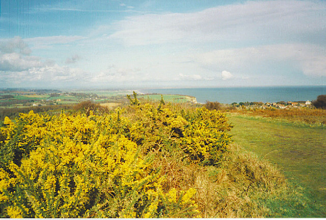
The village is surrounded by rolling hills and cliffs, providing residents and visitors with breathtaking scenery. The coastline offers a mix of sandy and rocky beaches, perfect for leisurely walks or relaxing picnics. Cliff End is also home to a small harbor, where local fishermen bring in their daily catch.

The architecture in Cliff End is predominantly traditional, with many charming cottages and houses that date back to the 18th and 19th centuries. These buildings add to the village's quaint and historic feel.

A notable landmark in Cliff End is the Cliff End Lighthouse, which has been guiding ships along the coast since the 19th century. It stands proudly on the cliffs, offering a striking silhouette against the backdrop of the sea.

In terms of amenities, Cliff End has a few local shops and a cozy village pub, where residents and visitors can gather for a drink or a meal. The village is well-connected to nearby towns and cities, making it convenient for those who work or study in the area.

Overall, Cliff End is a tranquil and scenic village that offers a peaceful escape from the hustle and bustle of city life. Its natural beauty and rich history make it a desirable destination for those seeking a tranquil coastal retreat.

If you have any feedback on the listing, please let us know in the comments section below.
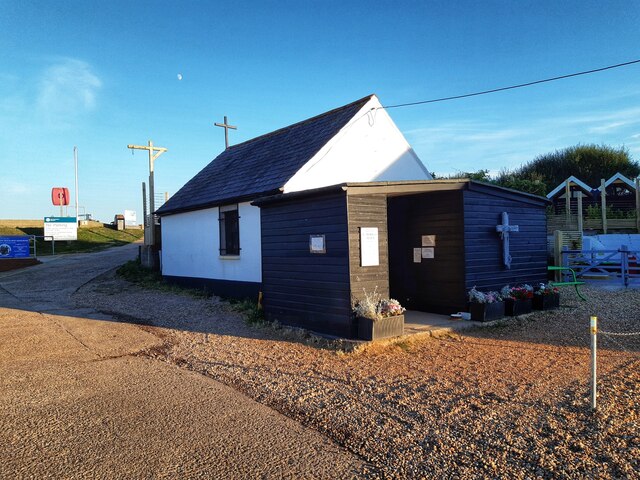
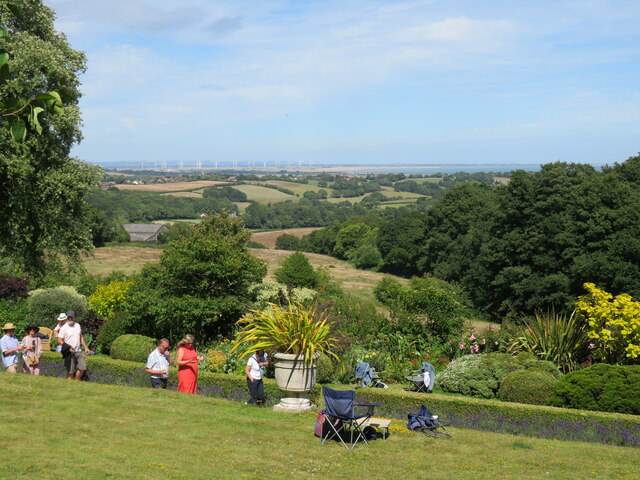
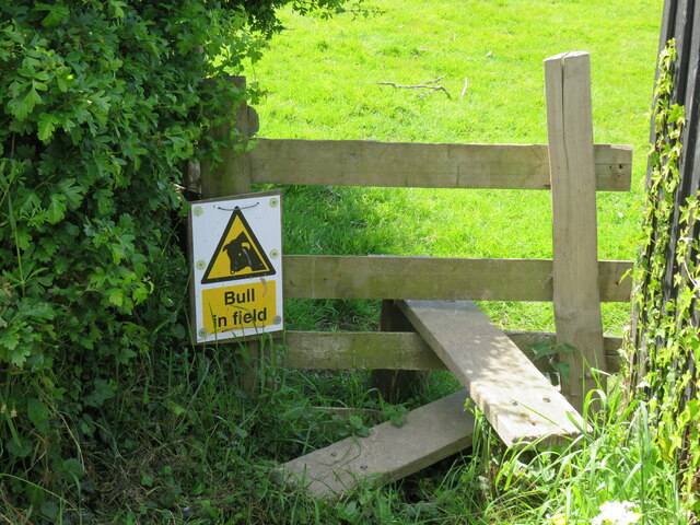
Cliff End Images

Images are sourced within 2km of 50.887409/0.680928 or Grid Reference TQ8813. Thanks to Geograph Open Source API. All images are credited.

Pett Level Road
Pett Level Road
Colonel Body Memorial Lakes
The Colonel Body Memorial Lakes A sign on one of the gates informs passers by (and anglers, presumably) that the lakes are closed due to Australian Stonecrop (Crasula helmsii) infestation. Also known as New Zealand Pygmyweed, this invasive, non-native plant grows in a wide range of conditions, and effectively swamps just about anything else in the area. Lovely. <span class="nowrap"><a title="http://www.weed-killer.net/australian-swamp-stonecrop.html" rel="nofollow ugc noopener" href="http://www.weed-killer.net/australian-swamp-stonecrop.html">Link</a><img style="margin-left:2px;" alt="External link" title="External link - shift click to open in new window" src="https://s1.geograph.org.uk/img/external.png" width="10" height="10"/></span>
The Colonel Body Memorial Lakes
A sign on one of the gates informs passers by (and anglers, presumably) that the lakes are closed due to Australian Stonecrop (Crasula helmsii) infestation. Also known as New Zealand Pygmyweed, this invasive, non-native plant grows in a wide range of conditions, and effectively swamps just about anything else in the area. Lovely. LinkExternal link
Wildlife lake on Pett Level The Colonel Body Memorial Lakes are named after Colonel John Body.  He was a First World War officer who won the Distinguished Service Order. He commanded the battalion that was the first to enter and occupy Baghdad in 1917. He was awarded the OBE and was Deputy Lord Lieutenant for Kent. The lakes are now an important wildlife reserve for waterfowl.
Wildlife lake on Pett Level
The Colonel Body Memorial Lakes are named after Colonel John Body. He was a First World War officer who won the Distinguished Service Order. He commanded the battalion that was the first to enter and occupy Baghdad in 1917. He was awarded the OBE and was Deputy Lord Lieutenant for Kent. The lakes are now an important wildlife reserve for waterfowl.
Winchelsea Beach and Cliff End Looking south-west towards Cliff End
Winchelsea Beach and Cliff End
Looking south-west towards Cliff End
Winchelsea Beach Winchelsea Beach at low tide
Winchelsea Beach
Winchelsea Beach at low tide
Gulls on sand bank, Winchelsea Beach In the far distance is Dungeness Power Station. The sand here could be reached fairly dry shod by looping west round the foreground water. This is about 30 minutes before expected low water at Hastings, and here it should be somewhat later than Hastings.
Gulls on sand bank, Winchelsea Beach
In the far distance is Dungeness Power Station. The sand here could be reached fairly dry shod by looping west round the foreground water. This is about 30 minutes before expected low water at Hastings, and here it should be somewhat later than Hastings.
Coastal defences, Pett Level As well as the usual groynes, this stretch of coast has a sort of groyne running along the beach. Whether it performed as hoped is doubtful - it has not been worth maintaining.
Coastal defences, Pett Level
As well as the usual groynes, this stretch of coast has a sort of groyne running along the beach. Whether it performed as hoped is doubtful - it has not been worth maintaining.
Colonel Body Memorial Lake
Lake on Pett Level One of a group of lakes, the Colonel Body Memorial Lakes, an important part of the Pett Level SSSI. These were probably formed by gravel extraction, but why they remember Colonel Body, a local man, I've yet to find out.
Lake on Pett Level
One of a group of lakes, the Colonel Body Memorial Lakes, an important part of the Pett Level SSSI. These were probably formed by gravel extraction, but why they remember Colonel Body, a local man, I've yet to find out.
Winchelsea Beach, low tide Looking towards the settlement of Winchelsea Beach.  This is about 30 minutes before expected low water at Hastings, and here it should be somewhat later than Hastings. This sand bank can be reached dry shod by looping to the west around the water seen to the left.
Winchelsea Beach, low tide
Looking towards the settlement of Winchelsea Beach. This is about 30 minutes before expected low water at Hastings, and here it should be somewhat later than Hastings. This sand bank can be reached dry shod by looping to the west around the water seen to the left.
Colonel Body Lakes
Colonel Body Lakes
Cliff End
Cliff End
St Nicholas Church, Pett Level
Rye Bay from Fairlight Hall Fairlight Hall's garden in foreground, distant views to Rye Bay and the Camber windfarm
Rye Bay from Fairlight Hall
Fairlight Hall's garden in foreground, distant views to Rye Bay and the Camber windfarm
Church Farm at Pett Interesting mixture of materials.
Church Farm at Pett
Interesting mixture of materials.
Gatehurst Cottage at Pett Built in local sandstone.
Gatehurst Cottage at Pett
Built in local sandstone.
Bull in field These standard signs seem more common than any bulls! This is on a public path across National Trust land.
Bull in field
These standard signs seem more common than any bulls! This is on a public path across National Trust land.
Show me another place!

Cliff End is located at Grid Ref: TQ8813 (Lat: 50.887409, Lng: 0.680928)

Administrative County: East Sussex

District: Rother

Police Authority: Sussex

What 3 Words

///rags.dance.watching. Near Fairlight, East Sussex

Nearby Locations

Cliff End Pett Level

Related Wikis

Pett

Pett is a village and civil parish in the Rother district of East Sussex, England. The village is located 5 miles (8.0 km) north-east of Hastings on the...

Fairlight, East Sussex

Fairlight is a village in East Sussex, England within Rother district, three miles (5 km) to the east of Hastings. Fairlight is also the name of the civil...

Hogg Hill Mill, Icklesham

Hogg Hill Mill is a post mill at Icklesham in East Sussex, England. == History == Hogg Hill Mill was built in Pett in 1781 and moved to Icklesham in 1790...

Hastings and Rye (UK Parliament constituency)

Hastings and Rye is a constituency in East Sussex represented in the House of Commons of the UK Parliament since 2019 by Sally-Ann Hart of the Conservative...

Nearby Amenities

Located within 500m of 50.887409,0.680928
Source: PGS
Lat/Long: 50.8835029/0.6809433
Source: PGS
Lat/Long: 50.8841793/0.6812392
Source: PGS
Lat/Long: 50.8849076/0.6816544
Source: PGS
Lat/Long: 50.8856053/0.68209
Source: PGS
Lat/Long: 50.8863982/0.6835437
Source: PGS
Lat/Long: 50.8868305/0.6840362
Source: PGS
Lat/Long: 50.8876986/0.6851026
Source: PGS
Lat/Long: 50.8886959/0.6866068
Cliff End
Place: village
Lat/Long: 50.8887635/0.6839212
Post Box
Brand: Royal Mail
Brand Wikidata: Q638098
Collection Times: Mo-Fr 16:45; Sa 11:00
Mapillary: 247784434668544
Operator: Royal Mail
Operator Wikidata: Q638098
Post Box Mounting: pier
Post Box Type: lamp
Ref: TN35 124
Royal Cypher: EIIR
Royal Cypher Wikidata: Q33102113
Source: survey
Survey Date: 2023-07-08
Lat/Long: 50.8886918/0.6836536
Waste Basket
Lat/Long: 50.8885693/0.6837471
Telephone
Booth: KX100
Covered: booth
Lat/Long: 50.8885514/0.6837721
Sunken forest
Natural: wood
Lat/Long: 50.8867052/0.6863934
Generator Method: photovoltaic
Generator Output Electricity: yes
Generator Source: solar
Generator Type: solar_photovoltaic_panel
Location: roof
Power: generator
Lat/Long: 50.8896444/0.6827429
Generator Method: photovoltaic
Generator Output Electricity: yes
Generator Source: solar
Generator Type: solar_photovoltaic_panel
Location: roof
Power: generator
Lat/Long: 50.8904667/0.6790535
Generator Method: photovoltaic
Generator Output Electricity: yes
Generator Source: solar
Generator Type: solar_photovoltaic_panel
Location: roof
Power: generator
Lat/Long: 50.8904726/0.6795202
The data included in this document is from www.openstreetmap.org. The data is made available under ODbL.

Have you been to Cliff End?

Leave your review of Cliff End below (or comments, questions and feedback).