Whippin's Copse

Wood, Forest in Devon East Devon

England

Whippin's Copse

Entering Rawridge in low afternoon light
Entering Rawridge in low afternoon light Credit: Rob Purvis

Whippin's Copse is a beautiful woodland area located in Devon, England. This ancient forest is known for its dense trees, vibrant flora, and diverse wildlife. The copse is home to a variety of tree species, including oak, beech, and ash, which provide a rich habitat for birds, insects, and small mammals.

Visitors to Whippin's Copse can enjoy peaceful walks along the well-maintained trails that wind through the forest. The sound of birds chirping and leaves rustling in the wind creates a serene atmosphere that is perfect for nature lovers looking to escape the hustle and bustle of everyday life.

In addition to its natural beauty, Whippin's Copse also holds historical significance. The forest has been a part of the Devon landscape for centuries and has played a role in local folklore and traditions.

Overall, Whippin's Copse is a tranquil and picturesque woodland area that offers visitors the opportunity to immerse themselves in nature and experience the beauty of the natural world. Whether you're looking for a peaceful retreat or a place to explore and discover the wonders of the forest, Whippin's Copse is a must-visit destination in Devon.

If you have any feedback on the listing, please let us know in the comments section below.

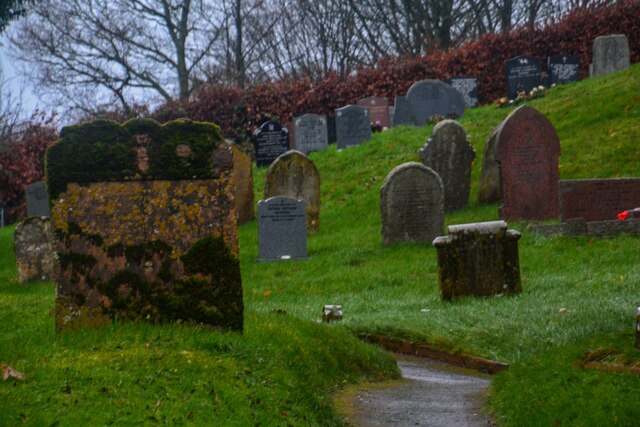
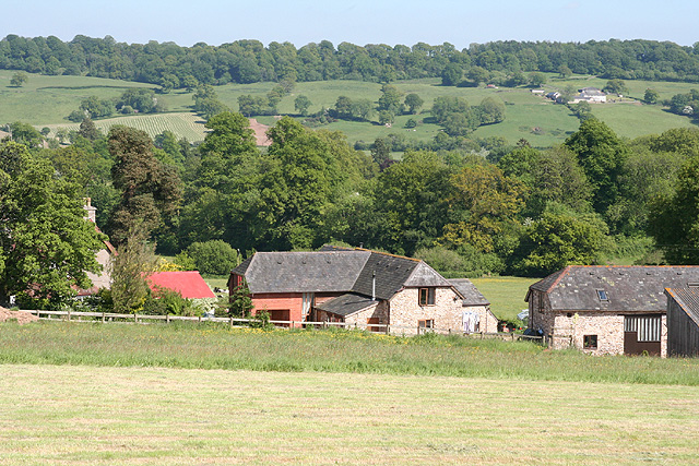
Whippin's Copse Images

Images are sourced within 2km of 50.850233/-3.157892 or Grid Reference ST1806. Thanks to Geograph Open Source API. All images are credited.

Entering Rawridge in low afternoon light
Glebe Farm buildings near Upottery
Luppitt : Village Hall Today the village hall is a polling station.
Luppitt : Village Hall
Today the village hall is a polling station.
Luppitt : Footbridge A footbridge over the stream.
Luppitt : Footbridge
A footbridge over the stream.
Luppitt : Footbridge A footbridge over the stream.
Luppitt : Footbridge
A footbridge over the stream.
Luppitt : Ford A ford in the road, and today, there seems to be a lot of water.
Luppitt : Ford
A ford in the road, and today, there seems to be a lot of water.
Luppitt : Ford A ford in the road.
Luppitt : Ford
A ford in the road.
Luppitt : St Mary's Church Grade I listed parish church. Norman origins and font, rebuilt in the late C13 - early C14, refurbished in the C15 with new tower (the top part rebuilt in 1905) and the south porch, the church was renovated 1885-90 and the chancel was rebuilt at the same time, renovated again in 1923.
Luppitt : St Mary's Church
Grade I listed parish church. Norman origins and font, rebuilt in the late C13 - early C14, refurbished in the C15 with new tower (the top part rebuilt in 1905) and the south porch, the church was renovated 1885-90 and the chancel was rebuilt at the same time, renovated again in 1923.
Luppitt : St Mary's Church Headstones in the churchyard.
Luppitt : St Mary's Church
Headstones in the churchyard.
Luppitt : Village Scenery Looking down and into Luppitt from St Mary's Church.
Luppitt : Village Scenery
Looking down and into Luppitt from St Mary's Church.
Luppitt : Village Scenery Looking down into the village of Luppitt.
Luppitt : Village Scenery
Looking down into the village of Luppitt.
Luppitt : St Mary's Church St Mary's Church and war memorial.
Luppitt : St Mary's Church
St Mary's Church and war memorial.
Old Bridge Marker near Upottery Bridge County Bridge Marker on the west side of the road and 97 metres northwest of Upottery Bridge, River Otter. Upottery parish. Inscribed C to mark the extent of roadway adjoining the bridge that the County was obliged to maintain.

Milestone Society National ID: DV_HNTA07br
Old Bridge Marker near Upottery Bridge
County Bridge Marker on the west side of the road and 97 metres northwest of Upottery Bridge, River Otter. Upottery parish. Inscribed C to mark the extent of roadway adjoining the bridge that the County was obliged to maintain. Milestone Society National ID: DV_HNTA07br
Otter Vale Close, Rawridge
Lane junction north of Rawridge
Luppitt: towards the Beacon The Beacon is a hamlet on the southern edge of Hartridge, ahead. The lane leads first to Luppitt Mill
Luppitt: towards the Beacon
The Beacon is a hamlet on the southern edge of Hartridge, ahead. The lane leads first to Luppitt Mill
Luppitt: Luppitt Mill Seen from the dry ford on the lane near the Beacon. The mill and mill house date from the 19th century; the mill last worked in 1939, it’s waterwheel by then needing extensive repair. The leat, now dry, is half a mile long and was difficult to maintain
Luppitt: Luppitt Mill
Seen from the dry ford on the lane near the Beacon. The mill and mill house date from the 19th century; the mill last worked in 1939, it’s waterwheel by then needing extensive repair. The leat, now dry, is half a mile long and was difficult to maintain
Upottery: overlooking Glebe Farm Barns converted to residences. Looking south east
Upottery: overlooking Glebe Farm
Barns converted to residences. Looking south east
Show me another place!

Whippin's Copse is located at Grid Ref: ST1806 (Lat: 50.850233, Lng: -3.157892)

Administrative County: Devon

District: East Devon

Police Authority: Devon and Cornwall

What 3 Words

///violinist.basis.consoled. Near Dunkeswell, Devon

Nearby Locations

Whippin's Copse

Related Wikis

Hartridge Hill

Hartridge Hill is an elongated, peat hill situated in the Luppitt catchment area of East Devon, England. Mostly privately owned and primarily used for...

Mohuns Ottery

Mohuns Ottery or Mohun's Ottery ( "moon's awtrey"), is a house and historic manor in the parish of Luppitt, 1 mile south-east of the village of Luppitt...
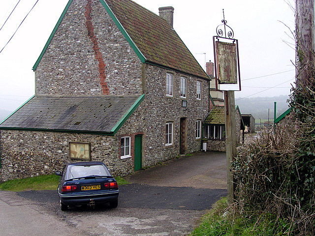
Luppitt Inn

The Luppitt Inn is the only public house at Luppitt, Devon. Located in the front rooms of a farmhouse, the building is constructed from stone, rendered...

Luppitt

Luppitt is a village and civil parish in East Devon situated about 6 kilometres (4 mi) due north of Honiton. The historian William Harris was preacher...

Nearby Amenities

Located within 500m of 50.850233,-3.157892
Power: pole
Source: bing
Transformer: distribution
Lat/Long: 50.8544989/-3.160066
Power: pole
Source: bing
Lat/Long: 50.8536878/-3.1595993
Power: pole
Source: bing
Lat/Long: 50.8537352/-3.1583038
Power: pole
Source: bing
Lat/Long: 50.8537674/-3.1573248
Power: pole
Source: bing
Lat/Long: 50.8538046/-3.1560212
Power: pole
Source: bing
Lat/Long: 50.8538605/-3.1545112
Power: pole
Source: bing
Lat/Long: 50.8538792/-3.153846
The data included in this document is from www.openstreetmap.org. The data is made available under ODbL.

Have you been to Whippin's Copse?

Leave your review of Whippin's Copse below (or comments, questions and feedback).