Craghall Wood

Wood, Forest in Cumberland Copeland

England

Craghall Wood

A595 at Buckman Brow
A595 at Buckman Brow Credit: Colin Pyle

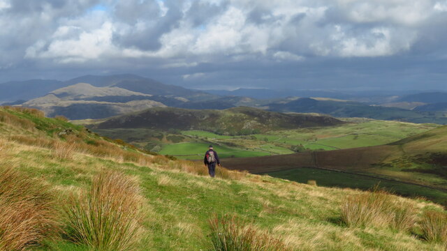
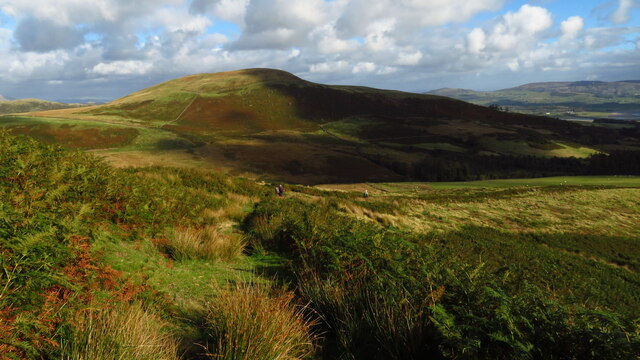
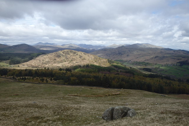
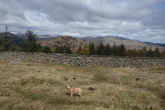
Craghall Wood is a picturesque woodland located in the county of Cumberland, England. Situated in the northern part of the Lake District National Park, it covers an area of approximately 100 acres. The wood is known for its diverse range of flora and fauna, making it a popular destination for nature enthusiasts and hikers alike.

The woodland is predominantly composed of native broadleaf trees such as oak, beech, and birch, which create a dense canopy that provides shade and shelter for a variety of woodland creatures. The forest floor is covered in a lush carpet of ferns, mosses, and wildflowers, adding to the natural beauty of the surroundings.

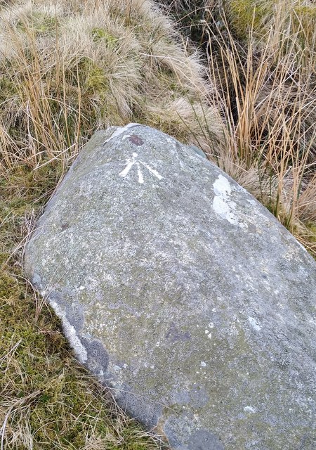
Several walking trails wind their way through the wood, allowing visitors to explore its hidden gems. One of the most prominent features is a small stream that meanders through the heart of the woodland, providing a tranquil setting for relaxation and contemplation.

Craghall Wood is home to a diverse range of wildlife, including deer, squirrels, and numerous species of birds. Birdwatchers will delight in the opportunity to spot woodpeckers, owls, and various migratory birds that frequent the area.

The wood has been carefully managed to maintain its natural balance and preserve its unique ecosystem. It is open to the public year-round and offers an excellent opportunity for visitors to connect with nature and experience the tranquility of a truly enchanting woodland setting.

If you have any feedback on the listing, please let us know in the comments section below.

Craghall Wood Images

Images are sourced within 2km of 54.279471/-3.2626602 or Grid Reference SD1787. Thanks to Geograph Open Source API. All images are credited.

A595 at Buckman Brow
Descending on path below Gray Stones, Black Combe
Descending on path below Grey Stones - view towards Knott Hill
Cattle Grid
Cattle Grid
Road Junction
Road Junction
Ordnance Survey Cut Mark This OS cut mark can be found adjacent to the letter box at Broadgate. It marks a point 107.274m above mean sea level.
Ordnance Survey Cut Mark
This OS cut mark can be found adjacent to the letter box at Broadgate. It marks a point 107.274m above mean sea level.
Ordnance Survey Cut Mark This OS cut mark can be found on a large rock to the west of the track.
Ordnance Survey Cut Mark
This OS cut mark can be found on a large rock to the west of the track.
Black Crag From Raven Crag
Black Crag
From Raven Crag
Bluebells, Furnace Wood In deepest Duddon
Bluebells, Furnace Wood
In deepest Duddon
Dry Tarn, Barrow The drought has dried up this tiny tarn. I suspect it is the same as <a href="https://www.geograph.org.uk/photo/3741119">SD1888 : Small tarn on Barrow</a>
Dry Tarn, Barrow
The drought has dried up this tiny tarn. I suspect it is the same as SD1888 : Small tarn on Barrow
Ascending Barrow Looking towards the Duddon estuary
Ascending Barrow
Looking towards the Duddon estuary
On Barrow A rarely frequented top
On Barrow
A rarely frequented top
On Barrow Looks like the top
On Barrow
Looks like the top
Descending Barrow Penn, our next objective in shot
Descending Barrow
Penn, our next objective in shot
Forest Edge Under Barrow
Forest Edge
Under Barrow
Duddon iron furnace (disused) A charcoal burning blast furnace dating from 1736. Isaac Wilkinson's cylinder bellows powered by water were first applied here. It is a Scheduled Ancient Monument but is temporarily closed to the public while structural issues are considered. There is a good view from the bridleway that goes past the site.
Duddon iron furnace (disused)
A charcoal burning blast furnace dating from 1736. Isaac Wilkinson's cylinder bellows powered by water were first applied here. It is a Scheduled Ancient Monument but is temporarily closed to the public while structural issues are considered. There is a good view from the bridleway that goes past the site.
Ordnance Survey Pivot This OS pivot can be found on a boulder NW side of the road. It marks a point 185.148m above mean sea level.
Ordnance Survey Pivot
This OS pivot can be found on a boulder NW side of the road. It marks a point 185.148m above mean sea level.
Ordnance Survey Pivot This OS pivot can be found on a rock north side of the road. It marks a point 204.868m above mean sea level.
Ordnance Survey Pivot
This OS pivot can be found on a rock north side of the road. It marks a point 204.868m above mean sea level.
Show me another place!

Craghall Wood is located at Grid Ref: SD1787 (Lat: 54.279471, Lng: -3.2626602)

Administrative County: Cumbria

District: Copeland

Police Authority: Cumbria

What 3 Words

///stars.squaring.strut. Near Millom, Cumbria

Related Wikis

Swinside

Swinside, which is also known as Sunkenkirk and Swineshead, is a stone circle lying beside Swinside Fell, part of Black Combe in southern Cumbria, North...

Duddon furnace

The Duddon furnace (Grid Reference SD 197883) is a surviving charcoal-fuelled blast furnace near Broughton-in-Furness in Cumbria. It is on the west side...

Duddon Bridge

Duddon Bridge is a hamlet in Cumbria, England. == References ==

Bank End

Bank End is a village in Cumbria, England. == External links == Media related to Bank End, South Lakeland at Wikimedia Commons

Nearby Amenities

Located within 500m of 54.279471,-3.2626602
Barrier: cattle_grid
Lat/Long: 54.2794017/-3.2667752
Knott Moor
Place: locality
Lat/Long: 54.2798027/-3.2694568
Power: pole
Lat/Long: 54.2766479/-3.2588694
Power: pole
Lat/Long: 54.2773361/-3.2589152
Power: pole
Lat/Long: 54.2781506/-3.2589556
Power: pole
Lat/Long: 54.2790832/-3.2589891
Power: pole
Lat/Long: 54.2797446/-3.2590154
Power: pole
Lat/Long: 54.2798873/-3.25999
Power: pole
Lat/Long: 54.2802129/-3.2619005
Power: pole
Lat/Long: 54.2805631/-3.2640255
Power: pole
Lat/Long: 54.280938/-3.2662632
Power: pole
Lat/Long: 54.2818767/-3.2670002
Power: pole
Lat/Long: 54.2811105/-3.2592072
Power: pole
Lat/Long: 54.2822782/-3.2584684
Power: pole
Lat/Long: 54.2827814/-3.2581394
The data included in this document is from www.openstreetmap.org. The data is made available under ODbL.

Have you been to Craghall Wood?

Leave your review of Craghall Wood below (or comments, questions and feedback).