Ghyll Wood

Wood, Forest in Cumberland Allerdale

England

Ghyll Wood

Buttermere Moss Looking across Buttermere Moss from the path that crosses the wet ground and ascends Robinson.
Buttermere Moss Credit: Graham Robson

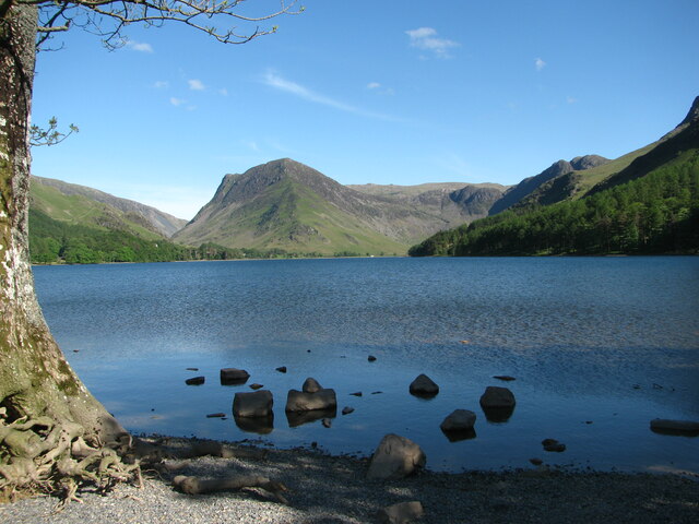
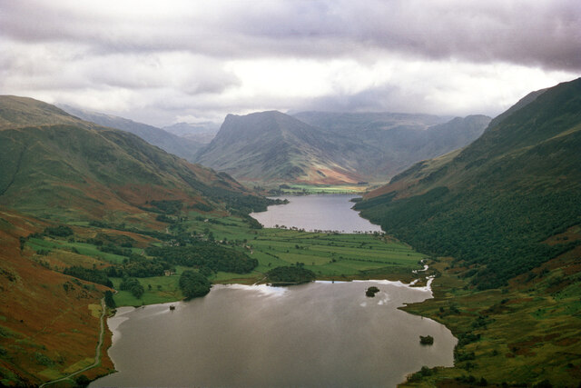
Ghyll Wood, located in Cumberland, England, is a beautiful and enchanting forest that covers a vast area of approximately 5 square kilometers. It is situated in the northern part of the Lake District National Park, making it an ideal destination for nature enthusiasts and hikers alike.

This woodland is renowned for its diverse ecosystem and rich biodiversity. It is home to a wide variety of flora and fauna, including ancient oak and beech trees that have stood tall for centuries. The forest floor is adorned with a carpet of wildflowers during the spring and summer months, creating a vibrant and picturesque scene.

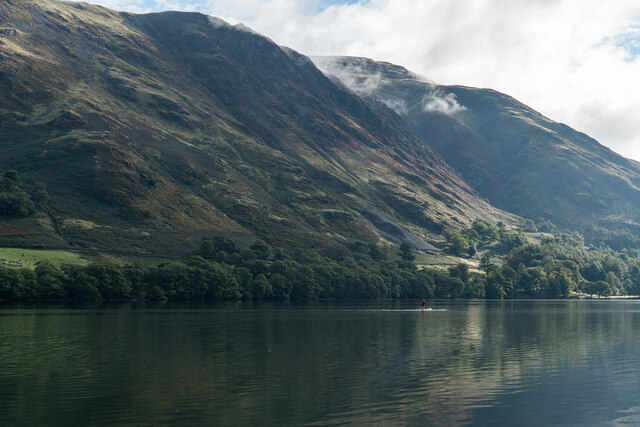
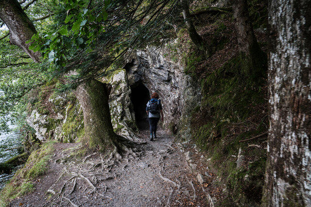
Ghyll Wood is crisscrossed with numerous well-marked trails, ranging from easy strolls to more challenging hikes. These trails provide visitors with the opportunity to explore the forest's hidden gems, such as cascading waterfalls, babbling brooks, and secluded picnic spots. The wood is also intersected by a meandering stream, which adds to its serene and tranquil atmosphere.

For those interested in wildlife, Ghyll Wood offers a chance to spot a range of creatures. Birdwatchers can observe various species, including woodpeckers, kingfishers, and owls. Squirrels, deer, and foxes are among the mammals that can be encountered within the forest.

Ghyll Wood is a popular destination for nature lovers, photographers, and families seeking a peaceful retreat. Its natural beauty, combined with its accessibility and well-maintained paths, make it an ideal location for a day trip or a longer stay.

If you have any feedback on the listing, please let us know in the comments section below.

Ghyll Wood Images

Images are sourced within 2km of 54.543479/-3.2735834 or Grid Reference NY1717. Thanks to Geograph Open Source API. All images are credited.

Buttermere Moss Looking across Buttermere Moss from the path that crosses the wet ground and ascends Robinson.
Buttermere Moss
Looking across Buttermere Moss from the path that crosses the wet ground and ascends Robinson.
Path to Newlands Hause from High Snockrigg The wet footpath connecting Newlands Hause and the high ground of High Snockrigg and Buttermere Moss.
Path to Newlands Hause from High Snockrigg
The wet footpath connecting Newlands Hause and the high ground of High Snockrigg and Buttermere Moss.
Newlands Hause Newlands Hause is the highest point on the pass between the valleys of Newlands and Buttermere. As such it is a starting point for walks up fells in the area and even on a wet October weekend there are several cars parked in the car park.
Newlands Hause
Newlands Hause is the highest point on the pass between the valleys of Newlands and Buttermere. As such it is a starting point for walks up fells in the area and even on a wet October weekend there are several cars parked in the car park.
Moss Beck Looking across from the slopes of Knott Rigg to stream of Moss Beck flowing steeply down from Buttermere Moss. The waterfall in the upper section is known as Moss Force, lots of water is flowing down the waterfall and stream after a period of persistant steady rain.
Moss Beck
Looking across from the slopes of Knott Rigg to stream of Moss Beck flowing steeply down from Buttermere Moss. The waterfall in the upper section is known as Moss Force, lots of water is flowing down the waterfall and stream after a period of persistant steady rain.
Buttermere
Buttermere
View looking from Rannerdale Knotts towards Buttermere This is an image of the view looking down towards Buttermere from the top of Rannerdale Knotts. 

It was part of our blog post below, so for more information and photos see the link.

<span class="nowrap"><a title="https://truefreedomseekers.com/rannerdale-knotts-walk/" rel="nofollow ugc noopener" href="https://truefreedomseekers.com/rannerdale-knotts-walk/">Link</a><img style="margin-left:2px;" alt="External link" title="External link - shift click to open in new window" src="https://s1.geograph.org.uk/img/external.png" width="10" height="10"/></span>
View looking from Rannerdale Knotts towards Buttermere
This is an image of the view looking down towards Buttermere from the top of Rannerdale Knotts. It was part of our blog post below, so for more information and photos see the link. LinkExternal link
Crummock Water One of the quieter parts of the National Park.
Crummock Water
One of the quieter parts of the National Park.
Buttermere and Fleetwith There's something compelling about the walk around Buttermere.
Buttermere and Fleetwith
There's something compelling about the walk around Buttermere.
Buttermere lake and village Delightful path around Buttermere lake.
Buttermere lake and village
Delightful path around Buttermere lake.
Buttermere House What a place to live
Buttermere House
What a place to live
Paddle Boarder, Buttermere
Crummock Water and Buttermere from Mellbreak A view straight to Fleetwith Pike and the Honister Pass over the lakes.
Crummock Water and Buttermere from Mellbreak
A view straight to Fleetwith Pike and the Honister Pass over the lakes.
The Head of Crummock Water A good path gives walkers a chance to enjoy the view up the valley off the main road. The small island is Wood Island and the peak is Fleetwith Pike at the brow of the Honister Pass.
The Head of Crummock Water
A good path gives walkers a chance to enjoy the view up the valley off the main road. The small island is Wood Island and the peak is Fleetwith Pike at the brow of the Honister Pass.
George VI Post Box (1936-1952), Buttermere
Bridge Hotel and Sheep, Buttermere
Footpath Tunnel, Buttermere
High Snockrigg Seen from the summit of Dodd. The B5289 runs beside Buttermere.
High Snockrigg
Seen from the summit of Dodd. The B5289 runs beside Buttermere.
Hills above Buttermere. Whiteless Breast is in the centre. The ridge leads up to Whiteless Pike.
Hills above Buttermere.
Whiteless Breast is in the centre. The ridge leads up to Whiteless Pike.
Show me another place!

Ghyll Wood is located at Grid Ref: NY1717 (Lat: 54.543479, Lng: -3.2735834)

Administrative County: Cumbria

District: Allerdale

Police Authority: Cumbria

What 3 Words

///doghouse.burst.overtones. Near Keswick, Cumbria

Related Wikis

Buttermere, Cumbria (village)

Buttermere is a village and civil parish in the county of Cumbria, England. == Village == The village of Buttermere lies between the Lake District lakes...
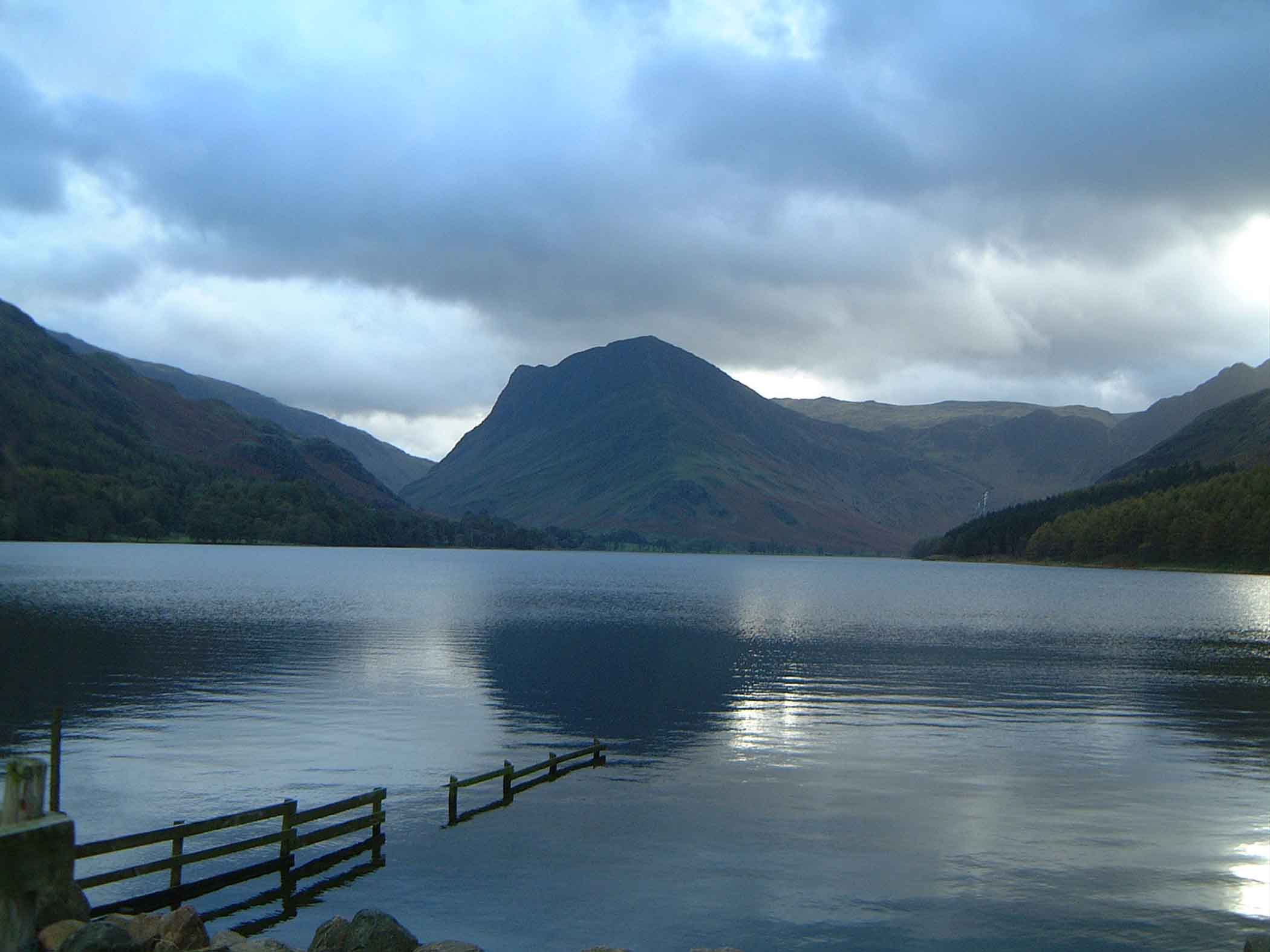
Buttermere

Buttermere is a lake in the Lake District in North West England. It has a length of approximately 2 kilometres (1.2 mi) and a maximum width of 0.54 kilometres...

Rannerdale Knotts

Rannerdale Knotts is a fell in the Lake District of Cumbria, England. Rising from the Buttermere valley, it is one of the smaller Cumbrian hills and is...
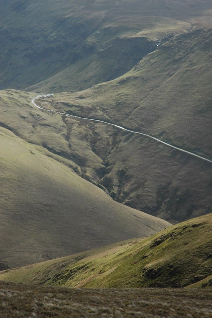
Newlands Pass

The Newlands Pass, also known as Newlands Hause, is a mountain pass in the Lake District in Cumbria, England. It is located on an unclassified road linking...
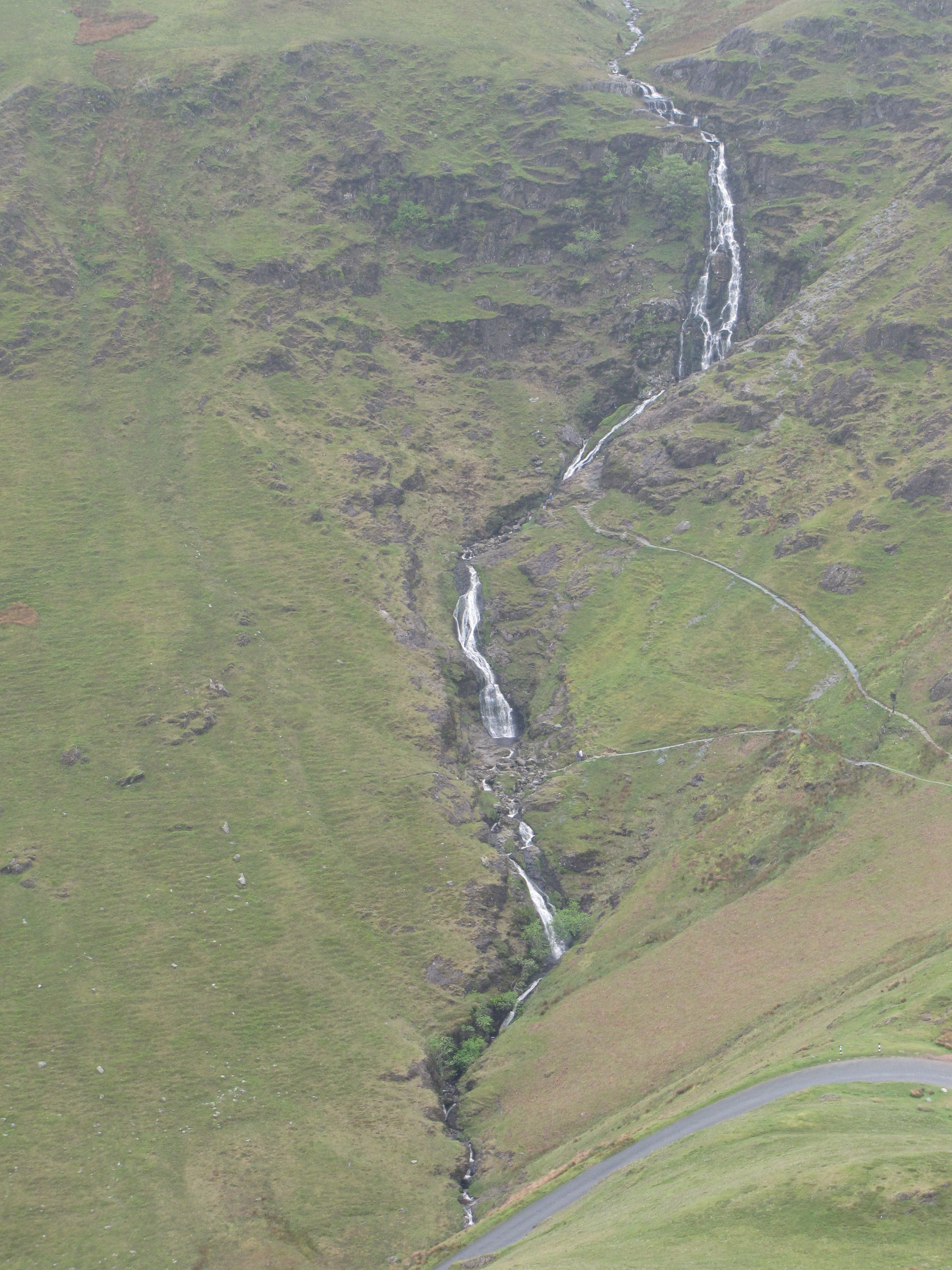
Moss Force

Moss Force is a waterfall situated within the Lake District National Park in the English county of Cumbria. It is located 10 km SW of the town of Keswick...
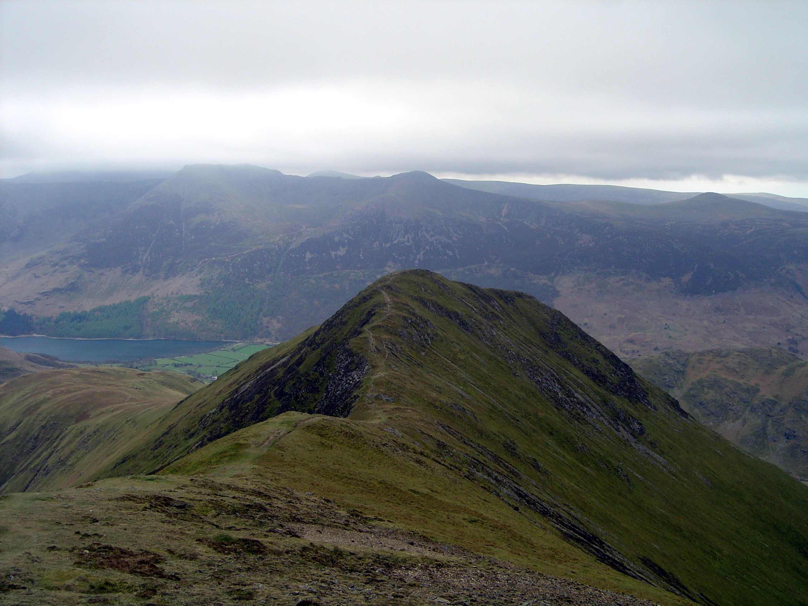
Whiteless Pike

Whiteless Pike, 660 metres (2,170 ft) high, is a fell in the north-western English Lake District. It stands immediately east of Crummock Water and forms...

Crummock Water

Crummock Water is a lake in the Lake District in North West England. It is 2.5 miles (4.0 km) long, 0.6 miles (0.97 km) wide, 140 feet (43 m) deep, and...

Bleaberry Tarn

Bleaberry Tarn is a small natural mountain tarn near Buttermere in the English Lake District. Located at NY165154 (OS Landranger 89), it lies in a corrie...

Nearby Amenities

Located within 500m of 54.543479,-3.2735834
Buttermere
Place: village
Source: npe
Wikidata: Q1018118
Wikipedia: en:Buttermere, Cumbria
Lat/Long: 54.5409307/-3.2762422
Post Box
Ref: CA13 39
Source: survey
Lat/Long: 54.5412988/-3.2765266
Telephone
Source: survey
Lat/Long: 54.540792/-3.2785058
Bus Stop
The Fish Hotel
Bench: no
Bus: yes
Covered: no
Naptan AtcoCode: 090002190083
Naptan Bearing: W
Naptan CommonName: The Fish Hotel
Naptan Indicator: o/s
Naptan Landmark: Fish Hotel
Naptan NaptanCode: cumadjta
Naptan Street: No name
Naptan Verified: no
Public Transport: platform
Shelter: no
Source: naptan_import
Lat/Long: 54.5409254/-3.2773023
Bus Stop
Mountain Road junction
Bench: no
Bus: yes
Covered: no
Local Ref: AT
Naptan AtcoCode: 090002190084
Naptan Bearing: E
Naptan BusStopType: CUS
Naptan CommonName: Mountain Road junction
Naptan Indicator: at
Naptan Landmark: B5289 Mountain Road Junction
Naptan NaptanCode: cumadjtd
Naptan Street: B5289
Naptan Verified: no
Public Transport: platform
Shelter: no
Source: naptan_import
Lat/Long: 54.5416726/-3.2744465
Bus Stop
Buttermere Youth Hostel (S bound)
Bus: yes
Naptan AtcoCode: 090002190447
Naptan Bearing: S
Naptan BusStopType: CUS
Naptan CommonName: Buttermere Youth Hostel (S bound)
Naptan Indicator: o/s
Naptan Landmark: Buttermere Youth Hostel
Naptan NaptanCode: cumadjtj
Naptan Street: B5289
Naptan Verified: no
Public Transport: platform
Source: naptan_import
Lat/Long: 54.5405118/-3.2720143
Bus Stop
Buttermere Youth Hostel (N bound)
Bus: yes
Naptan AtcoCode: 090002193747
Naptan Bearing: NW
Naptan BusStopType: CUS
Naptan CommonName: Buttermere Youth Hostel (N bound)
Naptan Indicator: near
Naptan Landmark: King George VI Memorial Hostel
Naptan NaptanCode: cumadjwd
Naptan Street: B5289
Naptan Verified: no
Public Transport: platform
Source: naptan_import
Lat/Long: 54.5404197/-3.2722279
Pub
The Buttermere Court Hotel
Addr City: Buttermere
Addr Housename: Buttermere Court Hotel
Addr Postcode: CA13 9XA
Lat/Long: 54.5408364/-3.2777264
Barrier: kissing_gate
Source: gps
Lat/Long: 54.5443099/-3.2802745
Crag Houses
Place: locality
Lat/Long: 54.5429891/-3.2791028
Give Way
Direction: forward
Lat/Long: 54.5418221/-3.2743477
Give Way
Direction: backward
Lat/Long: 54.5415754/-3.274216
Give Way
Direction: backward
Lat/Long: 54.5416677/-3.2747827
Give Way
Direction: forward
Lat/Long: 54.5413421/-3.2765981
Barrier: cattle_grid
Lat/Long: 54.5415198/-3.277402
Barrier: cattle_grid
Lat/Long: 54.5414228/-3.2771703
Bus Stop
Bridge Hotel
Bus: yes
Public Transport: platform
Lat/Long: 54.5413385/-3.2767291
Charging Station
Access: customers
Authentication App: yes
Capacity: 1
Fee: yes
Motorcar: yes
Network: Charge My Street
Operator: Bridge Hotel
Payment App: yes
Socket Type2: 1
Socket Type2 Output: 7 kW
Lat/Long: 54.5412373/-3.2773317
Charging Station
Access: customers
Authentication App: yes
Capacity: 1
Fee: yes
Motorcar: yes
Network: Charge My Street
Operator: Bridge Hotel
Payment App: yes
Socket Type2: 1
Socket Type2 Output: 7 kW
Lat/Long: 54.5412547/-3.2773155
Defibrillator
Defibrillator Location: Outside, on the wall of cafe. requires code to open
Emergency: defibrillator
Indoor: no
Lat/Long: 54.5410151/-3.2770585
The data included in this document is from www.openstreetmap.org. The data is made available under ODbL.

Have you been to Ghyll Wood?

Leave your review of Ghyll Wood below (or comments, questions and feedback).