Brocklebank Wood

Wood, Forest in Cumberland Copeland

England

Brocklebank Wood

A5093 at The Green village boundary
A5093 at The Green village boundary Credit: Colin Pyle

Brocklebank Wood is a picturesque forest located in the county of Cumberland, England. It covers an area of approximately 50 acres and is known for its stunning natural beauty and diverse range of flora and fauna.

The wood is predominantly made up of deciduous trees such as oak, beech, and birch, which create a vibrant display of colors during the autumn months. The forest floor is covered in a thick carpet of ferns, mosses, and wildflowers, adding to the enchanting atmosphere of the wood.

Brocklebank Wood is a haven for wildlife, providing a habitat for numerous species. Birdwatchers can spot a variety of birds, including tawny owls, woodpeckers, and song thrushes. It is also home to small mammals like squirrels, rabbits, and hedgehogs, as well as insects such as butterflies and bees.

The wood offers a peaceful and tranquil environment, making it a popular spot for nature enthusiasts, hikers, and photographers. There are several well-maintained walking trails that wind through the forest, allowing visitors to explore its natural wonders at their own pace. The trails are suitable for all ages and abilities, with options for both short leisurely walks and longer, more challenging hikes.

Brocklebank Wood is managed by the local council, who ensure its preservation and conservation. The wood is open to the public throughout the year, with no admission fees. Visitors are encouraged to respect the natural surroundings, follow designated paths, and take their litter with them to help maintain the wood's pristine condition.

Overall, Brocklebank Wood is a hidden gem in Cumberland, offering a tranquil escape into nature and an opportunity to appreciate the beauty of the English countryside.

If you have any feedback on the listing, please let us know in the comments section below.

Brocklebank Wood Images

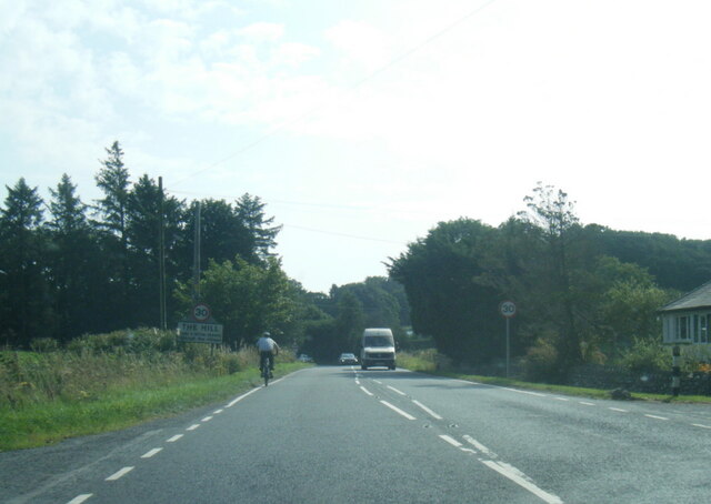
Images are sourced within 2km of 54.252974/-3.2763711 or Grid Reference SD1684. Thanks to Geograph Open Source API. All images are credited.

A5093 at The Green village boundary
A5093 at The Hill village boundary
The Punch Bowl Inn, The Green, Millom
Ordnance Survey Cut Mark This OS cut mark can be found on Old Hall Cottage. It marks a point 39.156m above mean sea level.
Ordnance Survey Cut Mark
This OS cut mark can be found on Old Hall Cottage. It marks a point 39.156m above mean sea level.
Ordnance Survey Cut Mark This OS cut mark can be found on Briar Dene. It marks a point 19.020m above mean sea level.
Ordnance Survey Cut Mark
This OS cut mark can be found on Briar Dene. It marks a point 19.020m above mean sea level.
Boundary Stone Toppled and damaged, over stream, south side of the A595.
Boundary Stone
Toppled and damaged, over stream, south side of the A595.
Ordnance Survey Cut Mark This OS cut mark can be found on the wall south side of the road. It marks a point 54.724m above mean sea level.
Ordnance Survey Cut Mark
This OS cut mark can be found on the wall south side of the road. It marks a point 54.724m above mean sea level.
Ordnance Survey Cut Mark This OS cut mark can be found on the rock face NE side of the road. It marks a point 56.565m above mean sea level.
Ordnance Survey Cut Mark
This OS cut mark can be found on the rock face NE side of the road. It marks a point 56.565m above mean sea level.
Ordnance Survey Cut Mark This OS cut mark can be found on the Village Hall SE side of the road. It marks a point 51.075m above mean sea level.
Ordnance Survey Cut Mark
This OS cut mark can be found on the Village Hall SE side of the road. It marks a point 51.075m above mean sea level.
Ordnance Survey Cut Mark This OS cut mark can be found on the gatepost south side of the road. It marks a point 59.576m above mean sea level.
Ordnance Survey Cut Mark
This OS cut mark can be found on the gatepost south side of the road. It marks a point 59.576m above mean sea level.
Ordnance Survey OSBM Bolt This OS Bolt can be found on the large boulder at the side of the barn at Low Broadgate. It marks a point 81.764m above mean sea level.
Ordnance Survey OSBM Bolt
This OS Bolt can be found on the large boulder at the side of the barn at Low Broadgate. It marks a point 81.764m above mean sea level.
Ordnance Survey Cut Mark This OS cut mark can be found on the wall NW side of the road. It marks a point 98.207m above mean sea level.
Ordnance Survey Cut Mark
This OS cut mark can be found on the wall NW side of the road. It marks a point 98.207m above mean sea level.
Ordnance Survey Flush Bracket (G3077) This OS Flush Bracket can be found on The Oaks. It marks a point 35.752m above mean sea level.
Ordnance Survey Flush Bracket (G3077)
This OS Flush Bracket can be found on The Oaks. It marks a point 35.752m above mean sea level.
Ordnance Survey Cut Mark This OS cut mark can be found on the gatepost NE side of the road. It marks a point 59.489m above mean sea level.
Ordnance Survey Cut Mark
This OS cut mark can be found on the gatepost NE side of the road. It marks a point 59.489m above mean sea level.
Dwelling in Hallthwaites Bridge at Hallthwaites, Cumbria.
Dwelling in Hallthwaites
Bridge at Hallthwaites, Cumbria.
Old Boundary Marker Parish Boundary Marker on the south side of Dubdale Brow, above a stream. This was the boundary of Thwaite and Whicham parishes but now the boundary of Millom Without and Whicham. Inscribed THWAITE and WHICHAM. See also <a title="https://www.geograph.org.uk/photo/6299741" href="https://www.geograph.org.uk/photo/6299741">Link</a>

Milestone Society National ID: CU_WHIMIW01pb
Old Boundary Marker
Parish Boundary Marker on the south side of Dubdale Brow, above a stream. This was the boundary of Thwaite and Whicham parishes but now the boundary of Millom Without and Whicham. Inscribed THWAITE and WHICHAM. See also Link Milestone Society National ID: CU_WHIMIW01pb
Whicham Mill in 1986 Whicham Mill in the valley of Whitecombe Beck from a hill road which itself enters the valley.
Whicham Mill in 1986
Whicham Mill in the valley of Whitecombe Beck from a hill road which itself enters the valley.
Sheep at Beckside Farm Swaledales confined in a small field between the farm buildings and the A595.
Sheep at Beckside Farm
Swaledales confined in a small field between the farm buildings and the A595.
Show me another place!

Brocklebank Wood is located at Grid Ref: SD1684 (Lat: 54.252974, Lng: -3.2763711)

Administrative County: Cumbria

District: Copeland

Police Authority: Cumbria

What 3 Words

///affords.estimated.restores. Near Millom, Cumbria

Related Wikis

St Anne's Church, Thwaites

St Anne's Church is in the village of Thwaites, Cumbria, England. It is an active Anglican parish church in the deanery of Millom, the archdeaconry of...

Thwaites, Cumbria

Thwaites is a small village near Duddon Valley and on the edge of the Duddon Estuary in the Lake District National Park in the Borough of Copeland, Cumbria...

Millom Without

Millom Without is a civil parish in the county of Cumbria, England. It had a population of 1,638 in 2001, decreasing to 859 at the 2011 Census. Millom...

Arnaby

Arnaby is a village in Cumbria, England.

Nearby Amenities

Located within 500m of 54.252974,-3.2763711
Power: pole
Lat/Long: 54.2499416/-3.2717002
Power: pole
Lat/Long: 54.2511559/-3.2760539
Power: pole
Lat/Long: 54.2504625/-3.2755271
Power: pole
Lat/Long: 54.2497729/-3.2748577
Power: pole
Lat/Long: 54.2493565/-3.2769339
Power: pole
Lat/Long: 54.2488326/-3.27881
Power: pole
Lat/Long: 54.2504682/-3.2820376
Power: pole
Lat/Long: 54.252054/-3.2826885
Power: pole
Lat/Long: 54.2498902/-3.2750965
Power: pole
Lat/Long: 54.2494938/-3.2729933
Barrier: stile
Lat/Long: 54.255165/-3.2814206
Barrier: stile
Lat/Long: 54.25562/-3.2798672
Barrier: stile
Lat/Long: 54.2501941/-3.2740916
Barrier: kissing_gate
Lat/Long: 54.2514428/-3.2782817
Barrier: kissing_gate
Lat/Long: 54.2515306/-3.278507
Barrier: stile
Lat/Long: 54.251938/-3.2809103
Information: guidepost
Tourism: information
Lat/Long: 54.2534089/-3.2822227
Power: pole
Lat/Long: 54.2539526/-3.2834641
Power: pole
Lat/Long: 54.2528612/-3.2830103
The data included in this document is from www.openstreetmap.org. The data is made available under ODbL.

Have you been to Brocklebank Wood?

Leave your review of Brocklebank Wood below (or comments, questions and feedback).