Prior Wood

Wood, Forest in Cumberland Allerdale

England

Prior Wood

Road Junction near Linskeldfield
Road Junction near Linskeldfield Credit: P Gaskell

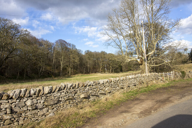
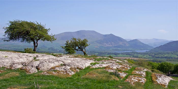
Prior Wood is a picturesque forest located in the county of Cumberland, England. Spanning across an area of approximately 100 acres, this woodland is known for its natural beauty and diverse wildlife. It is situated in close proximity to the small village of Prior Scales, adding to its charm and tranquility.

The woodland is predominantly made up of native broadleaf trees, such as oak, beech, and birch, creating a dense and lush canopy that offers a peaceful retreat for nature lovers and outdoor enthusiasts. The forest floor is adorned with a rich carpet of ferns, wildflowers, and mosses, adding to the enchanting atmosphere.

Prior Wood is home to a wide array of wildlife, making it a haven for nature enthusiasts and birdwatchers. Visitors may be able to spot various bird species, including woodpeckers, warblers, and owls, as well as mammals like deer, squirrels, and foxes. The woodland also provides a habitat for numerous insects, including butterflies and beetles.

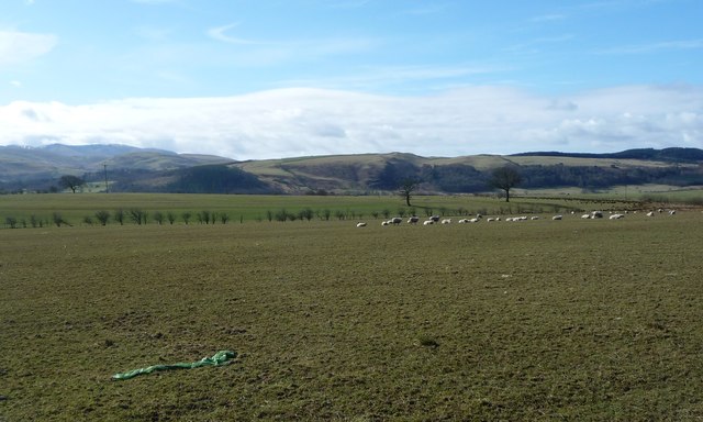
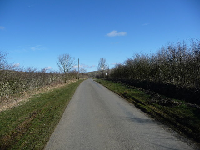
For those seeking outdoor activities, Prior Wood offers a network of walking trails, allowing visitors to explore the forest at their own pace. These trails lead to scenic viewpoints, offering breathtaking vistas of the surrounding countryside. The woodland is also a popular spot for picnicking and nature photography.

Overall, Prior Wood in Cumberland is a captivating forest that captivates visitors with its natural beauty, diverse wildlife, and tranquil ambiance.

If you have any feedback on the listing, please let us know in the comments section below.

Prior Wood Images

Images are sourced within 2km of 54.687536/-3.2907967 or Grid Reference NY1633. Thanks to Geograph Open Source API. All images are credited.

Road Junction near Linskeldfield
The lane from Blindcrake to Sunderland Bewsgill Wood
The lane from Blindcrake to Sunderland
Bewsgill Wood
New hedge planted
New hedge planted
Looking toward Park Wood
Ellers Wood Gateway to field by Ellers wood
Ellers Wood
Gateway to field by Ellers wood
Direction Sign - Signpost south of Isel Bridge, Setmurthy Located on the south side of the junction south of Isel Bridge in Setmurthy parish. 3 arms and pawn finial.

Milestone Society National ID: CU_NY1632
Direction Sign - Signpost south of Isel Bridge, Setmurthy
Located on the south side of the junction south of Isel Bridge in Setmurthy parish. 3 arms and pawn finial. Milestone Society National ID: CU_NY1632
Junction of two paths on Setmurthy Common Junction of two paths leading up Setmurthy Common, near Cockermouth.
Junction of two paths on Setmurthy Common
Junction of two paths leading up Setmurthy Common, near Cockermouth.
Lane near Setmurthy Common Lane running from Cockermouth to Isel, north of Setmurthy Common.
Lane near Setmurthy Common
Lane running from Cockermouth to Isel, north of Setmurthy Common.
Oval Plantation, Setmurthy Common The Oval Plantation at Setmurthy Common, near Cockermouth.
Oval Plantation, Setmurthy Common
The Oval Plantation at Setmurthy Common, near Cockermouth.
Sheep grazing, south of Crosshill Moss On the south side of the road to Isel, about 140 metres above sea level.
Sheep grazing, south of Crosshill Moss
On the south side of the road to Isel, about 140 metres above sea level.
The road to Sunderland (Allerdale, Cumbria) Heading north near Linskeldfield.
The road to Sunderland (Allerdale, Cumbria)
Heading north near Linskeldfield.
Sheep pasture near Linskeldfield On the west side of the road to Sunderland. About 120 metres above sea level.
Sheep pasture near Linskeldfield
On the west side of the road to Sunderland. About 120 metres above sea level.
Hedge strengthened with wire mesh, near Linskeldfield Otherwise the sheep would get through.
Hedge strengthened with wire mesh, near Linskeldfield
Otherwise the sheep would get through.
Pasture, Setmurthy Looking towards the edge of forestry on Setmurthy Common with the Skiddaw range in the background.
Pasture, Setmurthy
Looking towards the edge of forestry on Setmurthy Common with the Skiddaw range in the background.
Forestry, Setmurthy A path near the northern edge of the plantation.
Forestry, Setmurthy
A path near the northern edge of the plantation.
Pasture, Setmurthy Beside the footpath at Elva Plain.
Pasture, Setmurthy
Beside the footpath at Elva Plain.
Pasture, Setmurthy Fields descending gently to the River Derwent. In the background, left of picture, are the slopes of Binsey.
Pasture, Setmurthy
Fields descending gently to the River Derwent. In the background, left of picture, are the slopes of Binsey.
Pasture, Setmurthy Fields climbing gently then steeply from the road at Shepherd's Field.
Pasture, Setmurthy
Fields climbing gently then steeply from the road at Shepherd's Field.
Show me another place!

Prior Wood is located at Grid Ref: NY1633 (Lat: 54.687536, Lng: -3.2907967)

Administrative County: Cumbria

District: Allerdale

Police Authority: Cumbria

What 3 Words

///duties.resides.bookshop. Near Cockermouth, Cumbria

Related Wikis

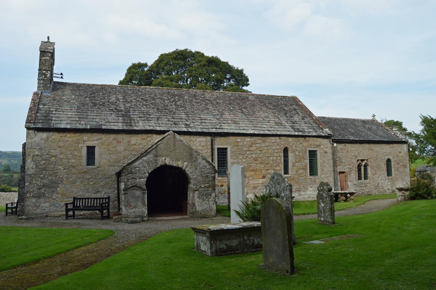
St Michael's Church, Isel

St Michael's Church is located by the side of the River Derwent in the dispersed settlement of Isel, in the civil parish of Blindcrake, Cumbria, England...

Isel, Cumbria

Isel is a dispersed settlement and area in the valley of the River Derwent within the Lake District National Park in Cumbria, England. It is an ecclesiastical...

Blindcrake

Blindcrake is a village and civil parish within the Isel Valley, in the Lake District National Park, in Cumbria, England, historically part of Cumberland...
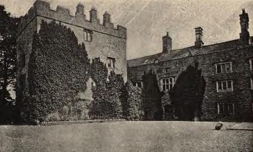
Isel Hall

Isel Hall is an ancient Cumbrian residence that sits on a steep rise on the northern banks of the River Derwent, two miles (3.2 km) south of Bassenthwaite...

Nearby Amenities

Located within 500m of 54.687536,-3.2907967
Post Box
Ref: CA13 150
Lat/Long: 54.6881023/-3.2983173
Barrier: stile
Lat/Long: 54.6896419/-3.2971778
Ford: yes
Lat/Long: 54.6902459/-3.2882318
Waste Basket
Lat/Long: 54.6872226/-3.2977123
Barrier: stile
Lat/Long: 54.6908061/-3.2945226
Barrier: stile
Lat/Long: 54.6908882/-3.294244
Information: guidepost
Tourism: information
Lat/Long: 54.6910143/-3.2936665
Power: pole
Lat/Long: 54.6891028/-3.2978024
Power: pole
Lat/Long: 54.6897731/-3.2967317
Power: pole
Lat/Long: 54.6892307/-3.295659
Power: pole
Lat/Long: 54.6887026/-3.2946648
Power: pole
Lat/Long: 54.6886787/-3.2932676
Power: pole
Lat/Long: 54.6886477/-3.291829
Power: pole
Lat/Long: 54.6886309/-3.2904153
Power: pole
Lat/Long: 54.6878137/-3.2904835
Power: pole
Lat/Long: 54.6856405/-3.2905289
Power: pole
Lat/Long: 54.6850251/-3.2898179
Power: pole
Lat/Long: 54.6842604/-3.2889478
Power: pole
Lat/Long: 54.683724/-3.2875981
The data included in this document is from www.openstreetmap.org. The data is made available under ODbL.

Have you been to Prior Wood?

Leave your review of Prior Wood below (or comments, questions and feedback).