Paccombe Plantation

Wood, Forest in Devon East Devon

England

Paccombe Plantation

Oakdown Touring Park Oakdown Touring Park. Taken outside the Shepherd's Huts.
Oakdown Touring Park Credit: Sofia

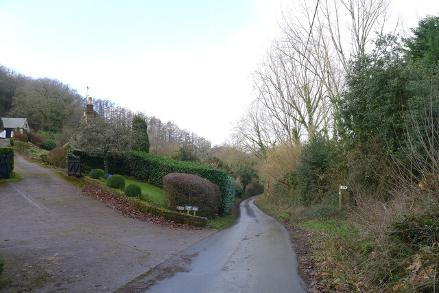
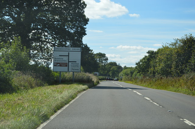
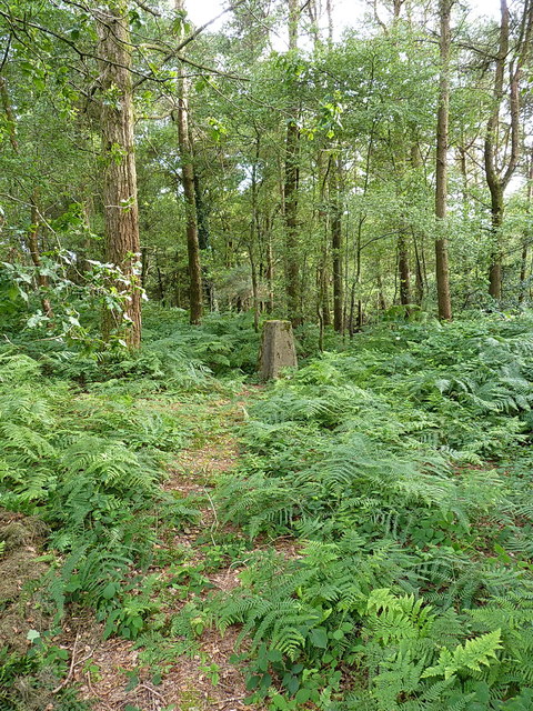
Paccombe Plantation is a picturesque woodland area located in the county of Devon, England. Situated near the village of Wood, this forested expanse spans approximately 200 acres, offering visitors a serene and enchanting natural retreat.

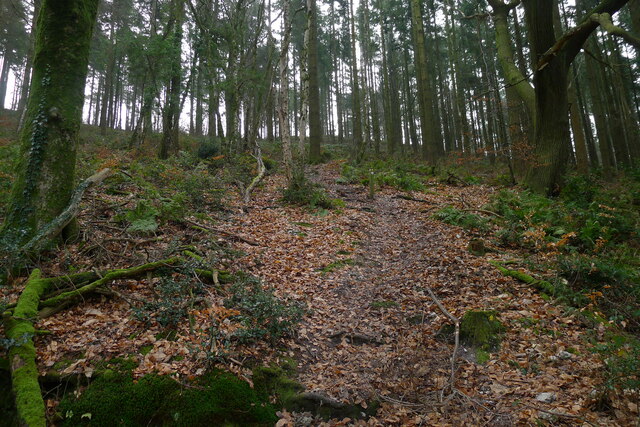
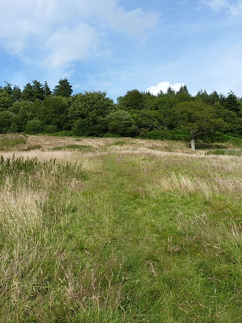
The plantation is characterized by its diverse range of tree species, including oak, beech, and ash, which create a beautiful and harmonious canopy. The dense foliage provides a haven for various wildlife, such as squirrels, rabbits, and an array of bird species, making it a popular destination for nature lovers and birdwatchers.

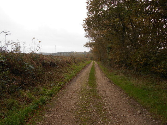
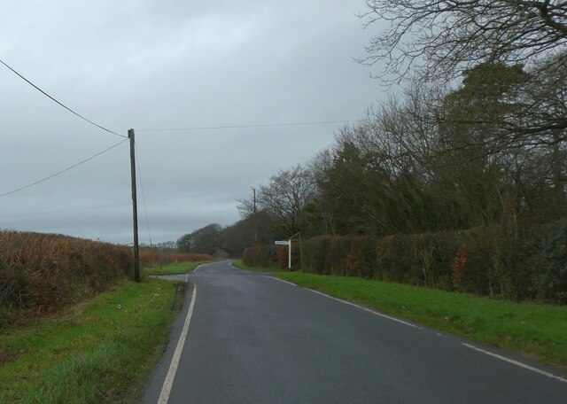
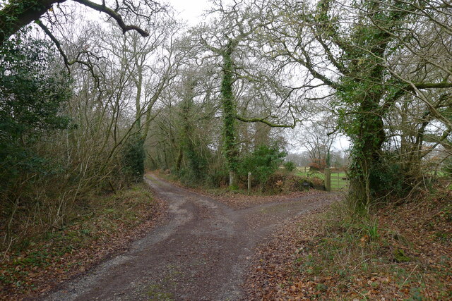
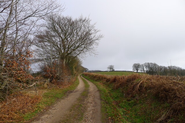
Paccombe Plantation boasts a network of well-maintained walking trails, allowing visitors to explore the enchanting woodland at their own pace. These trails wind through the forest, offering stunning views of the surrounding countryside and providing opportunities for peaceful contemplation and relaxation.

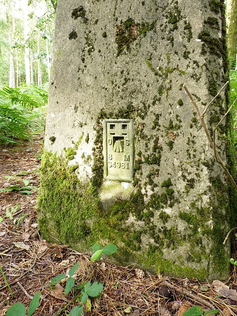
In addition to its natural beauty, Paccombe Plantation also holds historical significance. The site was once part of an ancient hunting ground, and remnants of old deer fences can still be found within the woodland. Furthermore, the plantation is home to a number of archaeological sites, including Bronze Age burial mounds, which provide insight into the area's rich cultural heritage.

Overall, Paccombe Plantation offers a tranquil and captivating outdoor experience for individuals seeking solace in nature. With its diverse flora and fauna, scenic walking trails, and historical significance, this Devon woodland is a must-visit destination for anyone looking to immerse themselves in the beauty of the natural world.

If you have any feedback on the listing, please let us know in the comments section below.

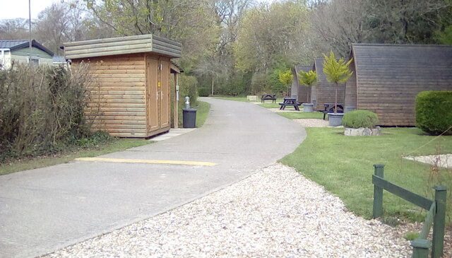
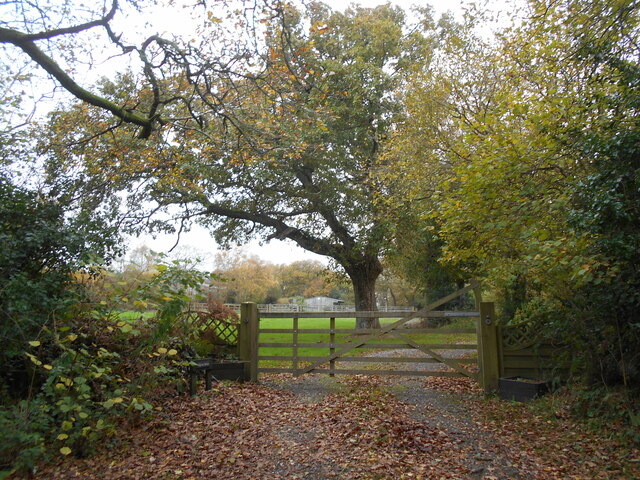
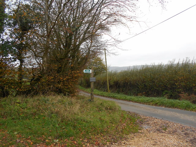
Paccombe Plantation Images

Images are sourced within 2km of 50.709958/-3.1877155 or Grid Reference SY1690. Thanks to Geograph Open Source API. All images are credited.

Oakdown Touring Park Oakdown Touring Park. Taken outside the Shepherd's Huts.
Oakdown Touring Park
Oakdown Touring Park. Taken outside the Shepherd's Huts.
Entrance to Hatway Stables An isolated block of stables at the top of Buckton  Hill.
Entrance to Hatway Stables
An isolated block of stables at the top of Buckton Hill.
Trackway on Buckton Hill Whilst now serving forestry workings . This may have been a prehistoric ridgeway. Similar to the nearby Farway plain site.
Trackway on Buckton Hill
Whilst now serving forestry workings . This may have been a prehistoric ridgeway. Similar to the nearby Farway plain site.
Trackway to Hatway stables Possibly following the course of a much older ridgeway route.
Trackway to Hatway stables
Possibly following the course of a much older ridgeway route.
Junction by the woodland at Long Chimney
Road north-west of Long Chimney
Sign for footpath to Chelson Farm
A steep climb through Buckley Plantation The East Devon Way on another Greensand escarpment
A steep climb through Buckley Plantation
The East Devon Way on another Greensand escarpment
The East Devon Way on Green Way Passing the entrance to Hatway Stables
The East Devon Way on Green Way
Passing the entrance to Hatway Stables
Green Lane, Hatway Hill The East Devon Way following a Greensand ridge north-east of Sidbury
Green Lane, Hatway Hill
The East Devon Way following a Greensand ridge north-east of Sidbury
Hatway Hill
Hatway Hill
A3052, Branscombe Cross The A3052 Road runs 27 miles from Charnmouth to Clyst St Mary. It runs parallel to the East Devon coastline, but inland.
<span class="nowrap"><a title="http://www.sabre-roads.org.uk/wiki/index.php?title=A3052" rel="nofollow ugc noopener" href="http://www.sabre-roads.org.uk/wiki/index.php?title=A3052">Link</a><img style="margin-left:2px;" alt="External link" title="External link - shift click to open in new window" src="https://s1.geograph.org.uk/img/external.png" width="10" height="10"/></span>
A3052, Branscombe Cross
The A3052 Road runs 27 miles from Charnmouth to Clyst St Mary. It runs parallel to the East Devon coastline, but inland. LinkExternal link
A3052 The A3052 Road runs 27 miles from Charnmouth to Clyst St Mary. It runs parallel to the East Devon coastline, but inland.
<span class="nowrap"><a title="http://www.sabre-roads.org.uk/wiki/index.php?title=A3052" rel="nofollow ugc noopener" href="http://www.sabre-roads.org.uk/wiki/index.php?title=A3052">Link</a><img style="margin-left:2px;" alt="External link" title="External link - shift click to open in new window" src="https://s1.geograph.org.uk/img/external.png" width="10" height="10"/></span>
A3052
The A3052 Road runs 27 miles from Charnmouth to Clyst St Mary. It runs parallel to the East Devon coastline, but inland. LinkExternal link
Boswell Farmhouse Dating in the most part from the 17th century, and given a Grade II listing <span class="nowrap"><a title="https://www.britishlistedbuildings.co.uk/101228395-boswell-farmhouse-sidmouth#.WYwBa1V96M8" rel="nofollow ugc noopener" href="https://www.britishlistedbuildings.co.uk/101228395-boswell-farmhouse-sidmouth#.WYwBa1V96M8">Link</a><img style="margin-left:2px;" alt="External link" title="External link - shift click to open in new window" src="https://s1.geograph.org.uk/img/external.png" width="10" height="10"/></span> in 1951. The farm also has an unusual listed barn <span class="nowrap"><a title="https://www.britishlistedbuildings.co.uk/101228689-bank-barn-to-north-west-of-boswell-farmhouse-sidmouth#.WYwBlVV96M8" rel="nofollow ugc noopener" href="https://www.britishlistedbuildings.co.uk/101228689-bank-barn-to-north-west-of-boswell-farmhouse-sidmouth#.WYwBlVV96M8">Link</a><img style="margin-left:2px;" alt="External link" title="External link - shift click to open in new window" src="https://s1.geograph.org.uk/img/external.png" width="10" height="10"/></span> just to the west, but this was inaccessible on the day I passed by.
Boswell Farmhouse
Dating in the most part from the 17th century, and given a Grade II listing LinkExternal link in 1951. The farm also has an unusual listed barn LinkExternal link just to the west, but this was inaccessible on the day I passed by.
The steep uphill bit An unsurfaced lane cutting the corner between Buckley Road and Buckton Lane. It's rideable on a bike, so long as you engage crawler gear.
The steep uphill bit
An unsurfaced lane cutting the corner between Buckley Road and Buckton Lane. It's rideable on a bike, so long as you engage crawler gear.
Bridleway onto Buckton Hill
Buckton Hill trig Lonely and somewhat unloved in the woods on Buckton Hill, the visit descriptions on <span class="nowrap"><a title="http://trigpointing.uk/trig/1751" rel="nofollow ugc noopener" href="http://trigpointing.uk/trig/1751">Link</a><img style="margin-left:2px;" alt="External link" title="External link - shift click to open in new window" src="https://s1.geograph.org.uk/img/external.png" width="10" height="10"/></span> don't exactly make you want to bother with this one! In fairness, it's not as overgrown as it once was, and provided the horseflies don't get you, the woods are quite pleasant.
Buckton Hill trig
Lonely and somewhat unloved in the woods on Buckton Hill, the visit descriptions on LinkExternal link don't exactly make you want to bother with this one! In fairness, it's not as overgrown as it once was, and provided the horseflies don't get you, the woods are quite pleasant.
OS Flush Bracket S4981 Fitted into Buckton Hill trig, the FB was levelled in 1948 at 180.203m above Ordnance Datum Newlyn.
OS Flush Bracket S4981
Fitted into Buckton Hill trig, the FB was levelled in 1948 at 180.203m above Ordnance Datum Newlyn.
Show me another place!

Paccombe Plantation is located at Grid Ref: SY1690 (Lat: 50.709958, Lng: -3.1877155)

Administrative County: Devon

District: East Devon

Police Authority: Devon and Cornwall

What 3 Words

///tropic.parsnips.grumbling. Near Sidmouth, Devon

Related Wikis

The Donkey Sanctuary

The Donkey Sanctuary is a British charitable organisation devoted to the welfare of donkeys. The charity, which is based near Sidmouth in Devon, England...

Weston, Devon

Weston is a small hamlet near Sidmouth in East Devon, England. It is near the Donkey Sanctuary and less than a mile from the beach at Branscombe; footpaths...

Salcombe Regis

Salcombe Regis is a coastal village and former civil parish, now in the parish of Sidmouth, in the East Devon district, in the county of Devon, England...

Sidbury

Sidbury is a large village and former civil parish north of Sidmouth, now in the parish of Sidmouth, in the East Devon district, in the county of Devon...

Weston Mouth

Weston Mouth is an isolated beach on the East Devon coast between Sidmouth and Seaton in England. It can be reached only by footpath, either along the...

Street, Devon

Street is a small village in the East Devon district of Devon, England. Its nearest town is Sidmouth, which lies approximately 4 miles (6.4 km) south-west...

Sidford

Sidford is a small village in the civil parish of and on the outskirts of the town of Sidmouth in the English county of Devon. It has a population of just...

Blackbury Camp

Blackbury Camp, also known as Blackbury Castle, is an Iron Age hill fort in Devon, England. It is managed by English Heritage. == Location == Blackbury...

Nearby Amenities

Located within 500m of 50.709958,-3.1877155
The data included in this document is from www.openstreetmap.org. The data is made available under ODbL.

Have you been to Paccombe Plantation?

Leave your review of Paccombe Plantation below (or comments, questions and feedback).