Alder Plot

Wood, Forest in Devon East Devon

England

Alder Plot

Sidford laundry Now derelict and closed down awaiting redevelopment.
this building was at one time used to dry sails from the local sailing club.
Sidford laundry Credit: Anthony Vosper

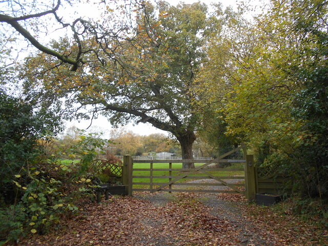
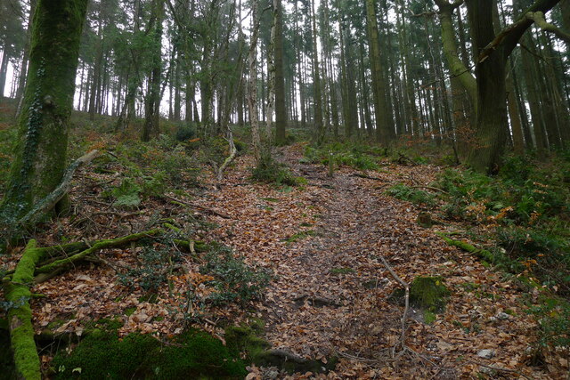
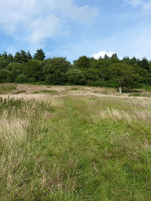
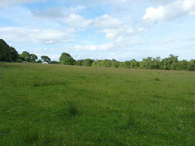
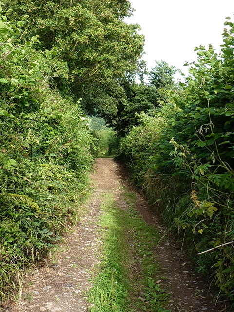
Alder Plot is a charming woodland area located in Devon, England. Nestled within the county's lush countryside, this beautiful forest is known for its dense population of alder trees, which give the plot its name. The forest covers a vast area, offering visitors a serene and peaceful environment to explore and immerse themselves in nature.

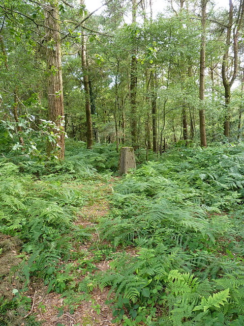
The alder trees that dominate the plot are tall and majestic, with their slender trunks and vibrant green foliage. They create a dense canopy that filters the sunlight, casting a dappled glow on the forest floor below. The ground is covered in a thick layer of moss, adding to the enchanting atmosphere of the woodland.

Alder Plot is rich in biodiversity, with a wide variety of plant and animal species calling it home. The forest floor is teeming with wildflowers, ferns, and mushrooms, while the trees provide a habitat for birds, squirrels, and a range of other woodland creatures. It is a haven for nature enthusiasts and birdwatchers, who can spot species such as woodpeckers, owls, and various songbirds.

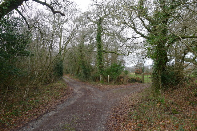
Visitors to Alder Plot can enjoy a leisurely stroll through the forest, following the well-marked trails that wind their way through the trees. The peaceful ambiance and the gentle rustling of leaves create a soothing soundtrack for those seeking solace in nature. The forest also offers picnic areas and designated spots for wildlife observation, providing opportunities for visitors to connect with the natural world.

Overall, Alder Plot in Devon is a picturesque and idyllic woodland that offers an escape from the hustle and bustle of everyday life. It is a place where visitors can reconnect with nature, breathe in the fresh forest air, and appreciate the beauty of the English countryside.

If you have any feedback on the listing, please let us know in the comments section below.
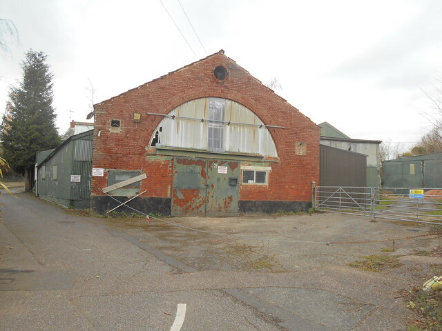
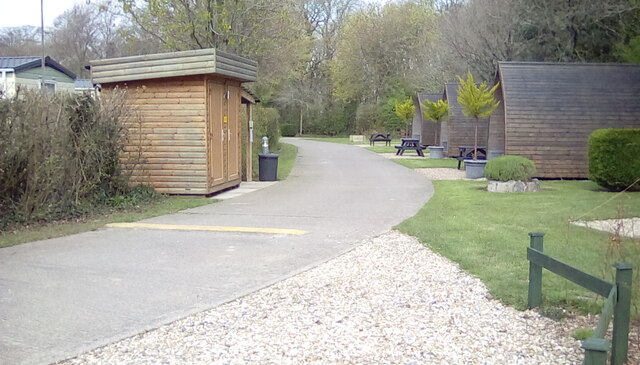
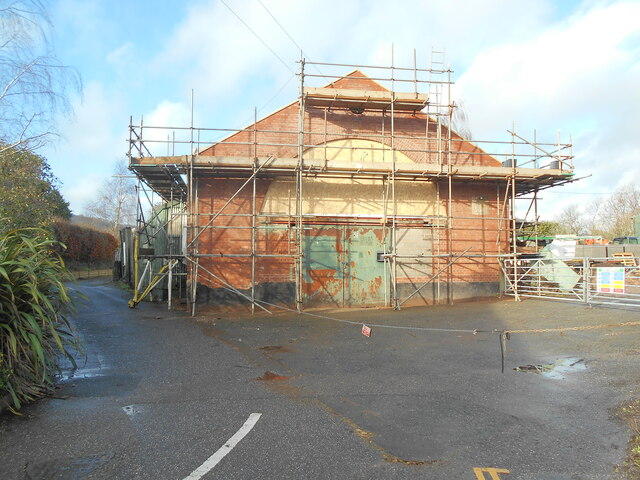
Alder Plot Images

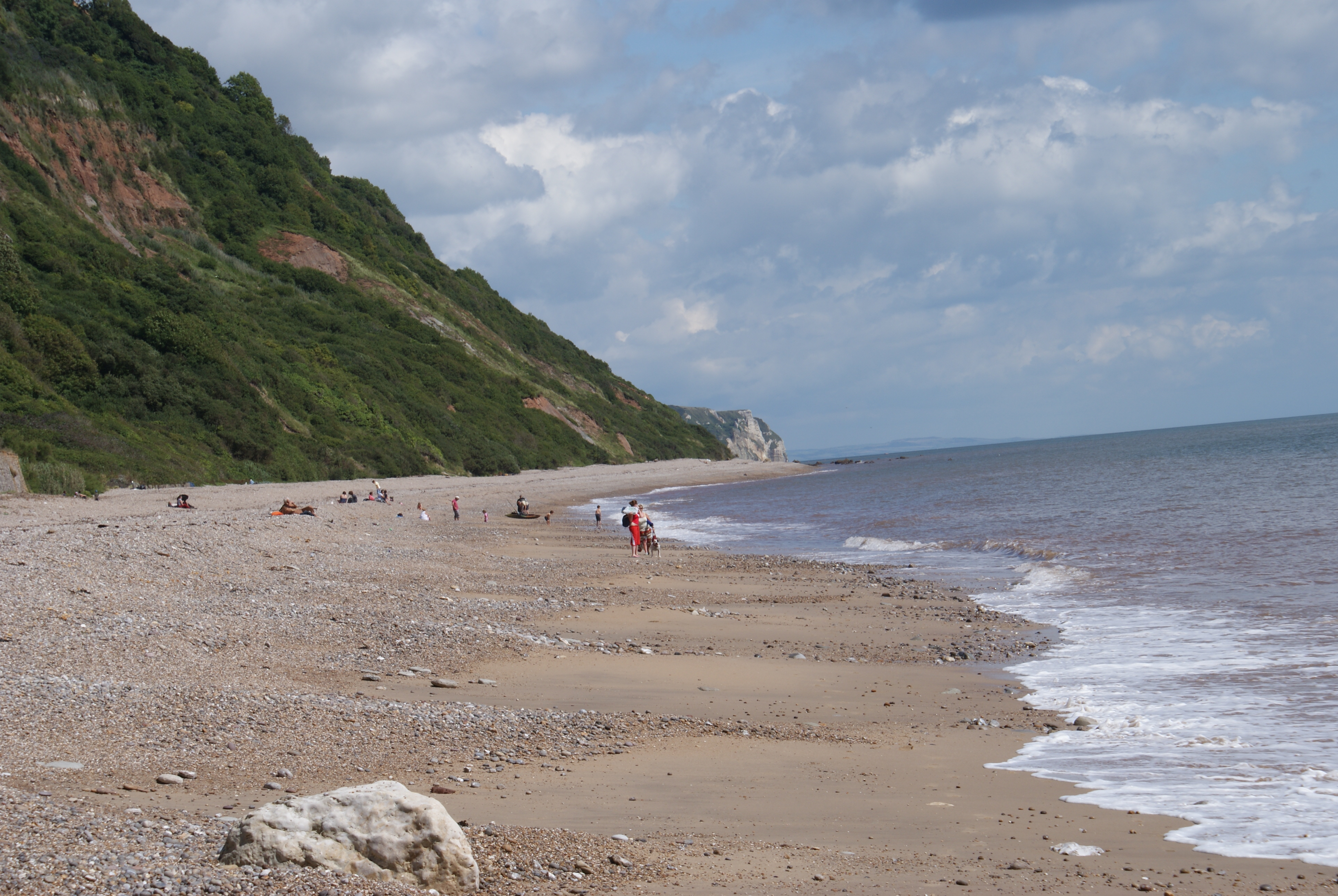
Images are sourced within 2km of 50.701891/-3.1973393 or Grid Reference SY1589. Thanks to Geograph Open Source API. All images are credited.

Sidford laundry Now derelict and closed down awaiting redevelopment.
this building was at one time used to dry sails from the local sailing club.
Sidford laundry
Now derelict and closed down awaiting redevelopment. this building was at one time used to dry sails from the local sailing club.
Oakdown Touring Park Oakdown Touring Park. Taken outside the Shepherd's Huts.
Oakdown Touring Park
Oakdown Touring Park. Taken outside the Shepherd's Huts.
Entrance to Hatway Stables An isolated block of stables at the top of Buckton  Hill.
Entrance to Hatway Stables
An isolated block of stables at the top of Buckton Hill.
10 Months on Rather than as many locals suspected, the old laundry building appears to be taking on a new lease of life.
10 Months on
Rather than as many locals suspected, the old laundry building appears to be taking on a new lease of life.
A steep climb through Buckley Plantation The East Devon Way on another Greensand escarpment
A steep climb through Buckley Plantation
The East Devon Way on another Greensand escarpment
The East Devon Way on Green Way Passing the entrance to Hatway Stables
The East Devon Way on Green Way
Passing the entrance to Hatway Stables
A3052 The A3052 Road runs 27 miles from Charnmouth to Clyst St Mary. It runs parallel to the East Devon coastline, but inland.
<span class="nowrap"><a title="http://www.sabre-roads.org.uk/wiki/index.php?title=A3052" rel="nofollow ugc noopener" href="http://www.sabre-roads.org.uk/wiki/index.php?title=A3052">Link</a><img style="margin-left:2px;" alt="External link" title="External link - shift click to open in new window" src="https://s1.geograph.org.uk/img/external.png" width="10" height="10"/></span>
A3052
The A3052 Road runs 27 miles from Charnmouth to Clyst St Mary. It runs parallel to the East Devon coastline, but inland. LinkExternal link
Laburnum Cottages, Church Street A pair of Grade II listed <span class="nowrap"><a title="https://www.britishlistedbuildings.co.uk/101097990-laburnumlaburnum-cottage-sidmouth#.WXtVpdQrLGh" rel="nofollow ugc noopener" href="https://www.britishlistedbuildings.co.uk/101097990-laburnumlaburnum-cottage-sidmouth#.WXtVpdQrLGh">Link</a><img style="margin-left:2px;" alt="External link" title="External link - shift click to open in new window" src="https://s1.geograph.org.uk/img/external.png" width="10" height="10"/></span> 18th Century cottages, set slightly back from the main road.
Laburnum Cottages, Church Street
A pair of Grade II listed LinkExternal link 18th Century cottages, set slightly back from the main road.
OS benchmark - Sidford - the old laundry building An OS cutmark on a derelict building at the end of England's Close; originally levelled, probably in 1948, at 37.286m above Ordnance Datum Newlyn.
OS benchmark - Sidford - the old laundry building
An OS cutmark on a derelict building at the end of England's Close; originally levelled, probably in 1948, at 37.286m above Ordnance Datum Newlyn.
Lane to Boswell Farm The lane is also a bridleway that heads off up to Harcombe.
Lane to Boswell Farm
The lane is also a bridleway that heads off up to Harcombe.
Boswell Farmhouse Dating in the most part from the 17th century, and given a Grade II listing <span class="nowrap"><a title="https://www.britishlistedbuildings.co.uk/101228395-boswell-farmhouse-sidmouth#.WYwBa1V96M8" rel="nofollow ugc noopener" href="https://www.britishlistedbuildings.co.uk/101228395-boswell-farmhouse-sidmouth#.WYwBa1V96M8">Link</a><img style="margin-left:2px;" alt="External link" title="External link - shift click to open in new window" src="https://s1.geograph.org.uk/img/external.png" width="10" height="10"/></span> in 1951. The farm also has an unusual listed barn <span class="nowrap"><a title="https://www.britishlistedbuildings.co.uk/101228689-bank-barn-to-north-west-of-boswell-farmhouse-sidmouth#.WYwBlVV96M8" rel="nofollow ugc noopener" href="https://www.britishlistedbuildings.co.uk/101228689-bank-barn-to-north-west-of-boswell-farmhouse-sidmouth#.WYwBlVV96M8">Link</a><img style="margin-left:2px;" alt="External link" title="External link - shift click to open in new window" src="https://s1.geograph.org.uk/img/external.png" width="10" height="10"/></span> just to the west, but this was inaccessible on the day I passed by.
Boswell Farmhouse
Dating in the most part from the 17th century, and given a Grade II listing LinkExternal link in 1951. The farm also has an unusual listed barn LinkExternal link just to the west, but this was inaccessible on the day I passed by.
The steep uphill bit An unsurfaced lane cutting the corner between Buckley Road and Buckton Lane. It's rideable on a bike, so long as you engage crawler gear.
The steep uphill bit
An unsurfaced lane cutting the corner between Buckley Road and Buckton Lane. It's rideable on a bike, so long as you engage crawler gear.
Bridleway onto Buckton Hill
Buckton Hill trig Lonely and somewhat unloved in the woods on Buckton Hill, the visit descriptions on <span class="nowrap"><a title="http://trigpointing.uk/trig/1751" rel="nofollow ugc noopener" href="http://trigpointing.uk/trig/1751">Link</a><img style="margin-left:2px;" alt="External link" title="External link - shift click to open in new window" src="https://s1.geograph.org.uk/img/external.png" width="10" height="10"/></span> don't exactly make you want to bother with this one! In fairness, it's not as overgrown as it once was, and provided the horseflies don't get you, the woods are quite pleasant.
Buckton Hill trig
Lonely and somewhat unloved in the woods on Buckton Hill, the visit descriptions on LinkExternal link don't exactly make you want to bother with this one! In fairness, it's not as overgrown as it once was, and provided the horseflies don't get you, the woods are quite pleasant.
OS Flush Bracket S4981 Fitted into Buckton Hill trig, the FB was levelled in 1948 at 180.203m above Ordnance Datum Newlyn.
OS Flush Bracket S4981
Fitted into Buckton Hill trig, the FB was levelled in 1948 at 180.203m above Ordnance Datum Newlyn.
Track on Buckley Plain There is a smallholding (just visible) at the far end of the field, and the track runs more or less along the length of Buckton Hill, past that and into the woods behind me.
Track on Buckley Plain
There is a smallholding (just visible) at the far end of the field, and the track runs more or less along the length of Buckton Hill, past that and into the woods behind me.
Open field on Buckley Plain Surrounded by woodland, with Buckley Plantation to the west and Buddle Wood to the east.
Open field on Buckley Plain
Surrounded by woodland, with Buckley Plantation to the west and Buddle Wood to the east.
Buckton Lane east of Buckton Farm Barely wide enough to get a horse or cycle along, this track is not marked as a dedicated right of way on the maps, but is used as a concessionary route between Buckton and Harecombe Farms.
Buckton Lane east of Buckton Farm
Barely wide enough to get a horse or cycle along, this track is not marked as a dedicated right of way on the maps, but is used as a concessionary route between Buckton and Harecombe Farms.
Show me another place!

Alder Plot is located at Grid Ref: SY1589 (Lat: 50.701891, Lng: -3.1973393)

Administrative County: Devon

District: East Devon

Police Authority: Devon and Cornwall

What 3 Words

///bleaching.capers.hoot. Near Sidmouth, Devon

Related Wikis

The Donkey Sanctuary

The Donkey Sanctuary is a British charitable organisation devoted to the welfare of donkeys. The charity, which is based near Sidmouth in Devon, England...

Salcombe Regis

Salcombe Regis is a coastal village and former civil parish, now in the parish of Sidmouth, in the East Devon district, in the county of Devon, England...
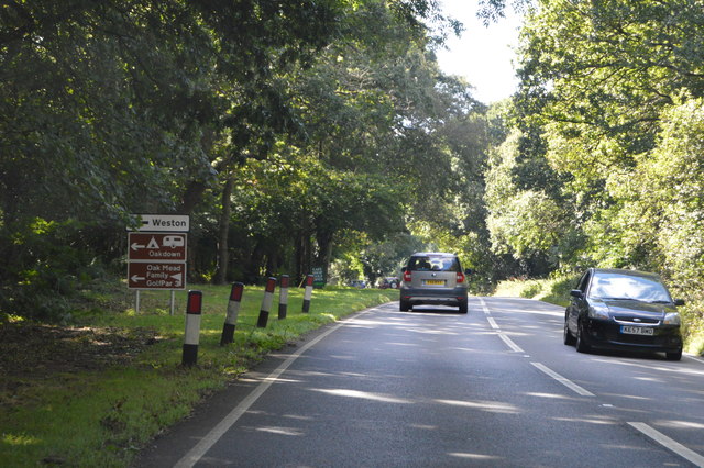
Weston, Devon

Weston is a small hamlet near Sidmouth in East Devon, England. It is near the Donkey Sanctuary and less than a mile from the beach at Branscombe; footpaths...

Weston Mouth

Weston Mouth is an isolated beach on the East Devon coast between Sidmouth and Seaton in England. It can be reached only by footpath, either along the...

Sidford

Sidford is a small village in the civil parish of and on the outskirts of the town of Sidmouth in the English county of Devon. It has a population of just...

Norman Lockyer Observatory

The Norman Lockyer Observatory, the Lockyer Technology Centre, and the Planetarium (jointly NLO), is a public access optical observatory 1 mile (1.6 km...

Sidmouth College

Sidmouth College is a coeducational secondary school and sixth form, located in Sidmouth in the English county of Devon. The school attracts pupils from...

Sidbury

Sidbury is a large village and former civil parish north of Sidmouth, now in the parish of Sidmouth, in the East Devon district, in the county of Devon...

Nearby Amenities

Located within 500m of 50.701891,-3.1973393
Barrier: stile
Lat/Long: 50.7010127/-3.2033161
Barrier: cattle_grid
Lat/Long: 50.7045842/-3.2029132
Barrier: stile
Lat/Long: 50.703246/-3.201221
Barrier: stile
Lat/Long: 50.7015283/-3.2025678
Barrier: stile
Lat/Long: 50.7011339/-3.200938
Trow Pump
Historic: archaeological_site
Lat/Long: 50.6978104/-3.1993361
Power: pole
Source: bing
Lat/Long: 50.7056713/-3.2007282
Power: pole
Source: bing
Lat/Long: 50.7052539/-3.2011273
Power: pole
Source: bing
Transformer: distribution
Lat/Long: 50.6979052/-3.1974694
Post Box
Collection Times: Mo-Fr 09:00; Sa 07:00
Location: Trow Hill
Operator: Royal Mail
Operator Wikidata: Q638098
Post Box Mounting: pier
Post Box Type: lamp
Ref: EX10 115D
Royal Cypher: EIIR
Royal Cypher Wikidata: Q33102113
Survey Date: 2023-04-07
Lat/Long: 50.6981471/-3.1969483
The data included in this document is from www.openstreetmap.org. The data is made available under ODbL.

Have you been to Alder Plot?

Leave your review of Alder Plot below (or comments, questions and feedback).