Low Wood

Wood, Forest in Cumberland Copeland

England

Low Wood

A camping field at Church Stile site
A camping field at Church Stile site Credit: David Medcalf

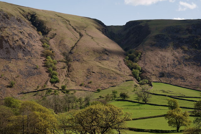
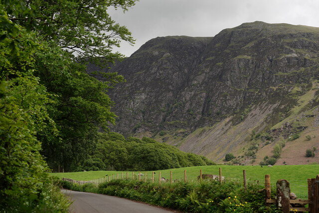
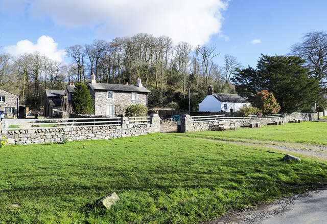
Low Wood is a small forested area located in Cumberland, a historic county in the northwest of England. Situated on the eastern edge of the Lake District National Park, it covers an area of approximately 100 acres. The woodland is known for its picturesque natural beauty and diverse ecosystem.

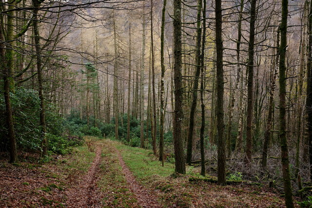
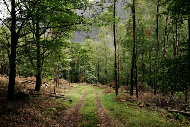
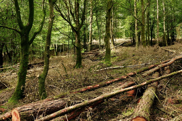
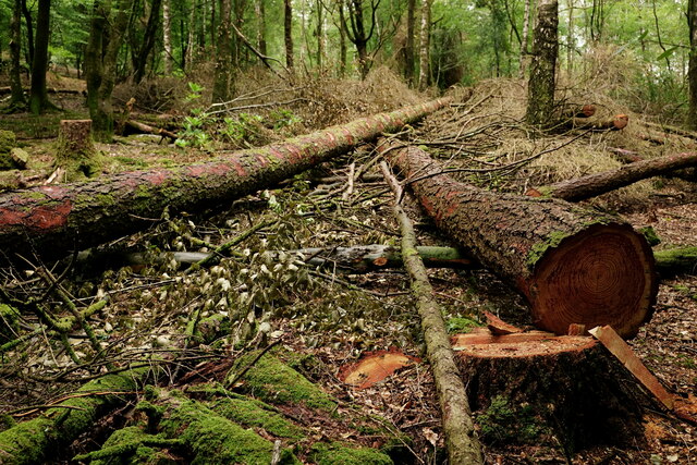
The forest is primarily composed of deciduous trees, including oak, birch, and beech, which create a dense canopy that provides shade and shelter for a variety of flora and fauna. The forest floor is covered in a thick layer of leaf litter, creating a rich habitat for mosses, ferns, and wildflowers.

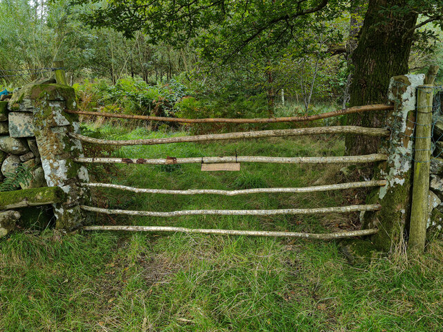
Low Wood is crisscrossed by a network of walking trails, allowing visitors to explore the forest and enjoy its tranquil ambiance. The trails vary in difficulty, catering to both casual strollers and more experienced hikers. As visitors wander through the forest, they may encounter wildlife such as deer, squirrels, and a wide array of bird species.

The forest is also home to a small lake, known as Low Wood Tarn, which adds to its natural charm. The tarn is a popular spot for fishing and offers a serene setting for picnics or simply enjoying the peaceful surroundings.

Low Wood is managed by the local forestry commission, which ensures its conservation and promotes sustainable woodland practices. The forest plays a vital role in preserving biodiversity and providing a valuable habitat for numerous species.

Overall, Low Wood in Cumberland is a cherished natural gem, offering a tranquil retreat for nature lovers and outdoor enthusiasts alike.

If you have any feedback on the listing, please let us know in the comments section below.
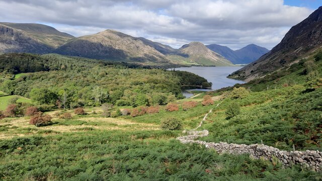
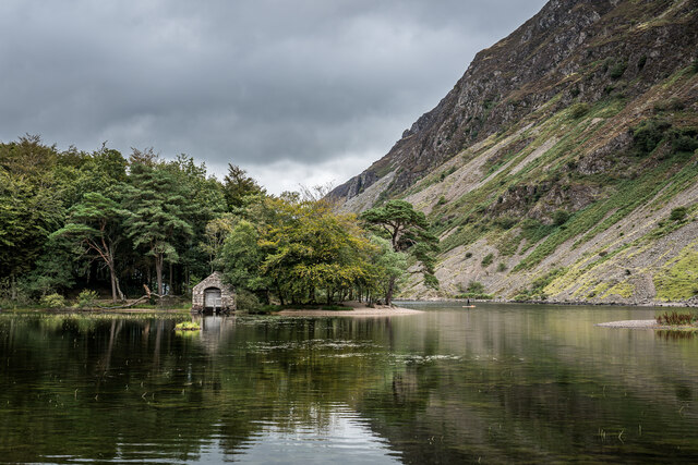
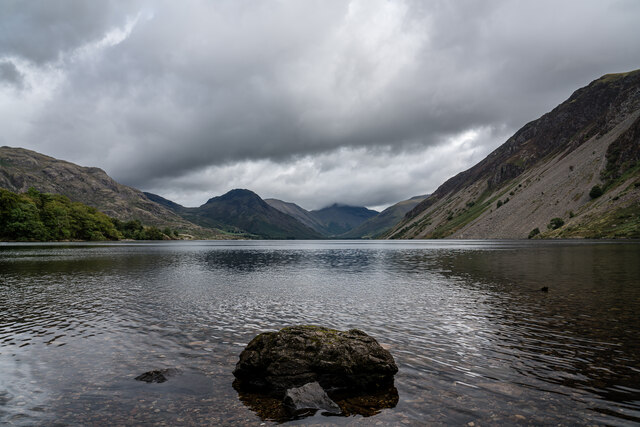
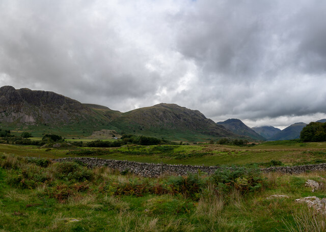
Low Wood Images

Images are sourced within 2km of 54.424481/-3.3205853 or Grid Reference NY1404. Thanks to Geograph Open Source API. All images are credited.

A camping field at Church Stile site
Wasdale Woodland Private woodland. Sadly, due to disease, all rhododendron, larch and sweet chestnut in the wood have to be felled by May 2022.
Wasdale Woodland
Private woodland. Sadly, due to disease, all rhododendron, larch and sweet chestnut in the wood have to be felled by May 2022.
View Towards Greathall Gill Seen from the road outside Woodhow Farm.
View Towards Greathall Gill
Seen from the road outside Woodhow Farm.
New Life in Wasdale Herdwick ewe with her lambs which had been born earlier in the day.
New Life in Wasdale
Herdwick ewe with her lambs which had been born earlier in the day.
Lambs in Nether Wasdale Seen from the road.
Lambs in Nether Wasdale
Seen from the road.
View Towards The Screes Sadly, several mature oak trees were lost to Storm Arwen along this stretch of road. The only positive is the opening up of a view, from the road, which has probably not been seen for more than a hundred years.
View Towards The Screes
Sadly, several mature oak trees were lost to Storm Arwen along this stretch of road. The only positive is the opening up of a view, from the road, which has probably not been seen for more than a hundred years.
Wasdale Woodland Private woodland. Due to disease, all rhododendron and larch has been felled, with sweet chestnut to follow.
Wasdale Woodland
Private woodland. Due to disease, all rhododendron and larch has been felled, with sweet chestnut to follow.
Wasdale Woodland Private woodland. Due to disease, all rhododendron and larch has been felled, with sweet chestnut to follow.
Wasdale Woodland
Private woodland. Due to disease, all rhododendron and larch has been felled, with sweet chestnut to follow.
Wasdale Woodland Private woodland. Due to disease, all rhododendron and larch has been felled, with sweet chestnut to follow.
Wasdale Woodland
Private woodland. Due to disease, all rhododendron and larch has been felled, with sweet chestnut to follow.
The view to Wastwater and Low Wood on descent from Whin Rigg
Wast Water Boathouse and Paddle Boarder, Nether Wasdale Lovely little boathouse on Wast Water
Wast Water Boathouse and Paddle Boarder, Nether Wasdale
Lovely little boathouse on Wast Water
Wast Water, Nether Wasdale The glacial lake is almost 3 miles long and is the deepest lake in England at 258 feet (79 m). The surface of the lake is about 200 feet (60 m) above sea level, while its bottom is over 50 feet (15 m) below sea level.  

<span class="nowrap"><a title="https://en.wikipedia.org/wiki/Wast_Water" rel="nofollow ugc noopener" href="https://en.wikipedia.org/wiki/Wast_Water">Link</a><img style="margin-left:2px;" alt="External link" title="External link - shift click to open in new window" src="https://s1.geograph.org.uk/img/external.png" width="10" height="10"/></span>
Wast Water, Nether Wasdale
The glacial lake is almost 3 miles long and is the deepest lake in England at 258 feet (79 m). The surface of the lake is about 200 feet (60 m) above sea level, while its bottom is over 50 feet (15 m) below sea level. LinkExternal link
Nether Wasdale Valley
How Gates Used To Be Done, Nether Wasdale Ok maybe not the cable tied sign.
How Gates Used To Be Done, Nether Wasdale
Ok maybe not the cable tied sign.
Wast Water with brooding cloud Perhaps not the day to climb the hills.
Wast Water with brooding cloud
Perhaps not the day to climb the hills.
The Screes - Wast Water c.1970
Gully on Whin Rigg Looking down to Wast Water from the head of a gully on the southwest end of the ridge of Wastwater screes. Wasdale Hall is in view above centre.
Gully on Whin Rigg
Looking down to Wast Water from the head of a gully on the southwest end of the ridge of Wastwater screes. Wasdale Hall is in view above centre.
Wide grass verge at Nether Wasdale The verge is on the north side of the minor road through the village; it has embedded rocks spaced along its edge for the obvious reason of preventing parking. The small, white-painted building is the church of St. Michael & All Angels.
Wide grass verge at Nether Wasdale
The verge is on the north side of the minor road through the village; it has embedded rocks spaced along its edge for the obvious reason of preventing parking. The small, white-painted building is the church of St. Michael & All Angels.
Show me another place!

Low Wood is located at Grid Ref: NY1404 (Lat: 54.424481, Lng: -3.3205853)

Administrative County: Cumbria

District: Copeland

Police Authority: Cumbria

What 3 Words

///fruitcake.stutter.probably. Near Seascale, Cumbria

Nearby Locations

High Scale Wood Low Wood

Related Wikis

Whin Rigg

Whin Rigg is a fell in the English Lake District, situated in the western segment of the national park, 22 kilometres (14 miles) south east of the town...

Wasdale, Eskdale and Duddon

Wasdale, Eskdale and Duddon is an area of protected countryside, now held as National Trust property: it is part of the Lake District, located in south...

Wasdale

Wasdale (; traditionally ) is a valley and civil parish in the western part of the Lake District National Park in Cumbria, England. The River Irt flows...

St Michael & All Angels, Nether Wasdale

St Michael & All Angels' Church in Nether Wasdale, Cumbria, England, is an active Anglican parish church in the deanery of Calder, and the diocese of Carlisle...

Nearby Amenities

Located within 500m of 54.424481,-3.3205853
Barrier: kissing_gate
Source: survey;bing;gps
Lat/Long: 54.4232762/-3.3242156
Woodhow
Place: locality
Lat/Long: 54.4262282/-3.3275496
Ford: yes
Lat/Long: 54.4207392/-3.323045
Bench
Lat/Long: 54.4262162/-3.3184574
Power: pole
Lat/Long: 54.4237411/-3.3278505
Power: pole
Lat/Long: 54.4242876/-3.326812
Power: pole
Lat/Long: 54.4247843/-3.3260402
Power: pole
Lat/Long: 54.4251933/-3.3263623
The data included in this document is from www.openstreetmap.org. The data is made available under ODbL.

Have you been to Low Wood?

Leave your review of Low Wood below (or comments, questions and feedback).