Burrows

Wood, Forest in Somerset Somerset West and Taunton

England

Burrows

Wellington: canal lift There were seven lifts on the Grand Western Canal and this one, known as the Nynehead Lift, is considered the best preserved. Here tub boats were introduced into caissons and raised or lowered nearly 20 feet. Looking south west
Wellington: canal lift Credit: Martin Bodman

Burrows, Somerset, also known as Wood or Forest, is a quaint village located in the county of Somerset, England. Situated amidst picturesque landscapes and surrounded by lush greenery, this village offers a serene and idyllic setting for residents and visitors alike.

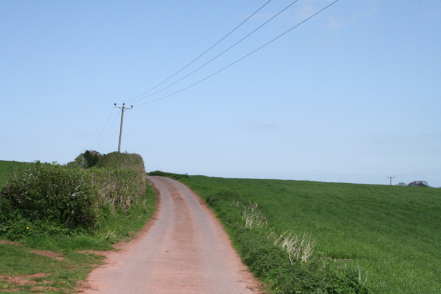
Burrows is known for its dense woodland, which covers a significant portion of the village and adds to its natural beauty. The forest is home to a wide variety of flora and fauna, making it a popular spot for nature enthusiasts and hikers. The tranquil atmosphere of the village, coupled with the enchanting forest, provides a perfect escape from the hustle and bustle of city life.

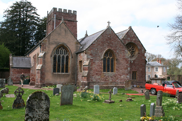
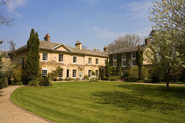
The village itself boasts a close-knit community, with friendly locals who take great pride in maintaining the village's charm and heritage. The architecture in Burrows reflects its rich history, with traditional cottages and buildings lining the streets. The village church, St. Mary's, is a notable landmark, dating back several centuries and showcasing stunning architectural features.

While Burrows may be small in size, it offers essential amenities to its residents, including a local pub, a post office, and a small convenience store. The village also hosts several community events throughout the year, fostering a sense of togetherness and camaraderie among its inhabitants.

Overall, Burrows, Somerset (Wood, Forest) is a hidden gem that provides a peaceful retreat for those seeking tranquility and a deep connection with nature. Its charming village atmosphere, coupled with its breathtaking woodland, make it a truly remarkable place to visit or call home.

If you have any feedback on the listing, please let us know in the comments section below.
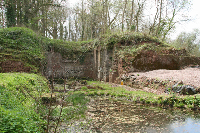
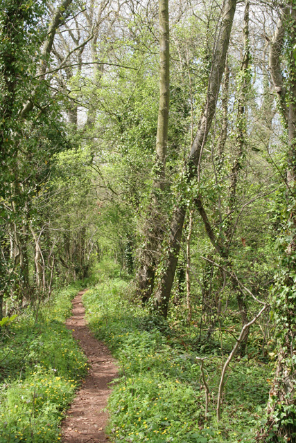
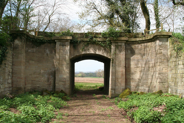
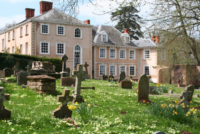
Burrows Images

Images are sourced within 2km of 50.998025/-3.2243852 or Grid Reference ST1422. Thanks to Geograph Open Source API. All images are credited.

Wellington: canal lift There were seven lifts on the Grand Western Canal and this one, known as the Nynehead Lift, is considered the best preserved. Here tub boats were introduced into caissons and raised or lowered nearly 20 feet. Looking south west
Wellington: canal lift
There were seven lifts on the Grand Western Canal and this one, known as the Nynehead Lift, is considered the best preserved. Here tub boats were introduced into caissons and raised or lowered nearly 20 feet. Looking south west
Wellington: footpath by canal bed Woods now cover the course of the Grand Western Canal west of the Nynehead Lift. Looking west north west
Wellington: footpath by canal bed
Woods now cover the course of the Grand Western Canal west of the Nynehead Lift. Looking west north west
Wellington: Nynehead Drive Aqueduct This was once a carriage drive to Nynehead Court. The bridge, or more correctly,  aqueduct carried the Grand Western Canal over the drive. Looking north west
Wellington: Nynehead Drive Aqueduct
This was once a carriage drive to Nynehead Court. The bridge, or more correctly, aqueduct carried the Grand Western Canal over the drive. Looking north west
Nynehead: Hornshay Weir On the river Tone. The weir once served a waterwheel; this was later replaced by a turbine which generated electricity for use at nearby Hornshay Farm
Nynehead: Hornshay Weir
On the river Tone. The weir once served a waterwheel; this was later replaced by a turbine which generated electricity for use at nearby Hornshay Farm
Nynehead: Nynehead Court Seen from the adjoining churchyard, looking north west. An Historic Landscape Restoration Award for the period 2001-2003 was given by Taunton Deane Borough Council
Nynehead: Nynehead Court
Seen from the adjoining churchyard, looking north west. An Historic Landscape Restoration Award for the period 2001-2003 was given by Taunton Deane Borough Council
Nynehead: church Adjoins Nynhead Court. Looking north west
Nynehead: church
Adjoins Nynhead Court. Looking north west
Nynehead: Heywood Farmhouse for Heywood farm, which is marked Haywood on the 1988 edition of the Ordnance Survey 1:25,000. Looking north-north-east
Nynehead: Heywood
Farmhouse for Heywood farm, which is marked Haywood on the 1988 edition of the Ordnance Survey 1:25,000. Looking north-north-east
Langford Budville: back lane Running between the B3187 Wellington-Milverton road and Heywood
Langford Budville: back lane
Running between the B3187 Wellington-Milverton road and Heywood
Wellington: Quantock Road Looking south east
Wellington: Quantock Road
Looking south east
Nynehead: Upcott Farmhouse and barns, looking north east
Nynehead: Upcott
Farmhouse and barns, looking north east
Nynehead: towards Blockhouse Farm Some of the buildings appear to have been converted to residential use. Note that the 1988 edition of the Ordnance Survey 1:25,000 has ‘Block House Farm’ rather than ‘Blockhouse Farm’. Looking east-north-east
Nynehead: towards Blockhouse Farm
Some of the buildings appear to have been converted to residential use. Note that the 1988 edition of the Ordnance Survey 1:25,000 has ‘Block House Farm’ rather than ‘Blockhouse Farm’. Looking east-north-east
Milverton: near Luckham Farm On the way to Houndsmoor and Milverton from Nynehead. Looking north west
Milverton: near Luckham Farm
On the way to Houndsmoor and Milverton from Nynehead. Looking north west
Oake: golf course Looking west
Oake: golf course
Looking west
Nynehead: footpath to Bradford-on-Tone Track at East Nynehead, looking south-south-east with the Blackdown Hills in the distance
Nynehead: footpath to Bradford-on-Tone
Track at East Nynehead, looking south-south-east with the Blackdown Hills in the distance
Nynehead: towards Wellington and the monument Looking south-south-east over farmland. The buildings with light roofs in mid-distance are at Poole, where there was formerly a brickworks. Wellington church tower is just visible, extreme right, in the distance
Nynehead: towards Wellington and the monument
Looking south-south-east over farmland. The buildings with light roofs in mid-distance are at Poole, where there was formerly a brickworks. Wellington church tower is just visible, extreme right, in the distance
Railway Foot Crossing
Milverton: track leading to Oake The track defines the border between Milverton and Oake parishes, suggesting that this was an old route. It also serves as a public footpath to the grounds of Oake Manor Golf Club
Milverton: track leading to Oake
The track defines the border between Milverton and Oake parishes, suggesting that this was an old route. It also serves as a public footpath to the grounds of Oake Manor Golf Club
Tonedale Mill Fox Bros woollen mill. Photographed from up the tower on the main multi-storey block. Has steam firepump, steam turbine and diesel engine for disposal as of 6-2007.
Tonedale Mill
Fox Bros woollen mill. Photographed from up the tower on the main multi-storey block. Has steam firepump, steam turbine and diesel engine for disposal as of 6-2007.
Show me another place!

Burrows is located at Grid Ref: ST1422 (Lat: 50.998025, Lng: -3.2243852)

Administrative County: Somerset

District: Somerset West and Taunton

Police Authority: Avon and Somerset

What 3 Words

///meant.simulations.pheasants. Near Milverton, Somerset

Related Wikis

Nynehead Court

Nynehead Court is a Grade II* listed building at Nynehead in Somerset, England. == History == The building dates back to the late 14th century with major...

Nynehead

Nynehead is a village and civil parish in Somerset, England, situated on the River Tone, 7 miles (11 km) south-west of Taunton and 1.5 miles (2 km) north...

Longforth Farm

Longforth Farm, on the outskirts of Wellington, Somerset, England, is the site of a Bronze Age landscape and an extensive medieval structure. The previously...

Tone Dale House

Tone Dale House (or Tonedale House) is a Grade II listed country house built in 1801 or 1807 by Thomas Fox in Wellington, Somerset, England. Wellington...

Nearby Amenities

Located within 500m of 50.998025,-3.2243852
Post Box
Operator: Royal Mail
Operator Wikidata: Q638098
Lat/Long: 51.0004787/-3.2184624
Nynehead
Is In: Somerset, England, UK
Place: village
Wikidata: Q2795489
Wikipedia: en:Nynehead
Lat/Long: 50.9982414/-3.2253663
Post Box
Drive Through: no
Operator: Royal Mail
Operator Wikidata: Q638098
Lat/Long: 50.9986069/-3.230177
Power: pole
Lat/Long: 51.0021991/-3.2246938
Power: pole
Lat/Long: 51.0017586/-3.2260564
Power: pole
Lat/Long: 51.0012421/-3.2275128
Power: pole
Lat/Long: 51.0007171/-3.2290283
Power: pole
Lat/Long: 51.0002124/-3.230592
The data included in this document is from www.openstreetmap.org. The data is made available under ODbL.

Have you been to Burrows?

Leave your review of Burrows below (or comments, questions and feedback).