Whicham Hall Wood

Wood, Forest in Cumberland Copeland

England

Whicham Hall Wood

The path to Fell Brow A pleasant track with a wonderful view of the south-west Cumbrian coastline.

This photograph was taken during the Coronavirus (COVID-19) pandemic of 2020/21.
The path to Fell Brow Credit: James T M Towill

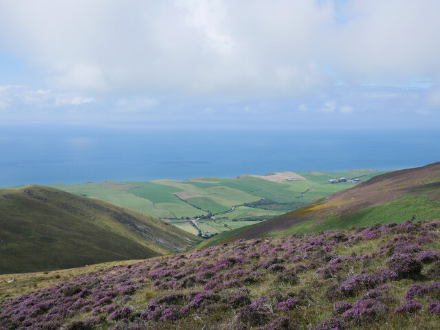
Whicham Hall Wood is a mesmerizing forest located in the county of Cumberland, England. Covering an area of approximately 100 hectares, it is nestled within the picturesque Whicham Valley, offering visitors a tranquil and enchanting experience.

The wood is predominantly composed of broadleaf trees, including oak, beech, and ash, which provide a lush and verdant canopy during the summer months. The diverse range of flora and fauna found within the wood creates a thriving ecosystem, attracting various species of birds, butterflies, and small mammals.

Traversing through Whicham Hall Wood, one can find a network of well-maintained footpaths, allowing visitors to explore the wood at their own pace. These paths wind through the dense foliage, providing glimpses of sun rays filtering through the leaves and casting a beautiful dappled light on the forest floor.

In addition to its natural beauty, Whicham Hall Wood holds historical significance. The wood is adjacent to the ruins of Whicham Hall, a 16th-century manor house, which adds an air of mystery and intrigue to the area. Exploring the wood, visitors may stumble upon remnants of the hall, such as stone walls or architectural fragments, further enhancing the sense of history and exploration.

Whether it's a leisurely stroll to enjoy the serenity of nature, birdwatching, or immersing oneself in the rich history of the area, Whicham Hall Wood offers a captivating experience for all who venture into its enchanting embrace.

If you have any feedback on the listing, please let us know in the comments section below.

Whicham Hall Wood Images

Images are sourced within 2km of 54.236685/-3.3182933 or Grid Reference SD1483. Thanks to Geograph Open Source API. All images are credited.

The path to Fell Brow A pleasant track with a wonderful view of the south-west Cumbrian coastline.

This photograph was taken during the Coronavirus (COVID-19) pandemic of 2020/21.
The path to Fell Brow
A pleasant track with a wonderful view of the south-west Cumbrian coastline. This photograph was taken during the Coronavirus (COVID-19) pandemic of 2020/21.
In Moor Gill A view back down to the fertile coastal farmland of this corner of Cumbria from the path leading to Black Combe.

This photograph was taken during the Coronavirus (COVID-19) pandemic of 2020/21.
In Moor Gill
A view back down to the fertile coastal farmland of this corner of Cumbria from the path leading to Black Combe. This photograph was taken during the Coronavirus (COVID-19) pandemic of 2020/21.
Bracken-lined Black Combe path In Moor Gill on the approach to Townend Knotts, time to look back and savour the view.  Walney Island can be noted in the centre distance of this shot.

This photograph was taken during the Coronavirus (COVID-19) pandemic of 2020/21.
Bracken-lined Black Combe path
In Moor Gill on the approach to Townend Knotts, time to look back and savour the view. Walney Island can be noted in the centre distance of this shot. This photograph was taken during the Coronavirus (COVID-19) pandemic of 2020/21.
Heather in bloom by the Black Combe path As well as being pleasing to the eye, a wonderful fragrance emanated from this expansive area of heather north of Townend Knotts.

This photograph was taken during the Coronavirus (COVID-19) pandemic of 2020/21.
Heather in bloom by the Black Combe path
As well as being pleasing to the eye, a wonderful fragrance emanated from this expansive area of heather north of Townend Knotts. This photograph was taken during the Coronavirus (COVID-19) pandemic of 2020/21.
Threatening clouds over Black Combe Alas, and rather predictably, they disappeared and blue skies prevailed later!

This photograph was taken during the Coronavirus (COVID-19) pandemic of 2020/21.
Threatening clouds over Black Combe
Alas, and rather predictably, they disappeared and blue skies prevailed later! This photograph was taken during the Coronavirus (COVID-19) pandemic of 2020/21.
A5093 north of Hellpool Bridge
A5093 passing under power lines near Silecroft
A595 at Wood House Farm
St Mary's church at Whicham Starting point for a walk up Black Combe.
St Mary's church at Whicham
Starting point for a walk up Black Combe.
The Moorgill  path Start of the climb to Black Combe.
The Moorgill path
Start of the climb to Black Combe.
The path to Black Combe
The path to Black Combe A steady climb.
The path to Black Combe
A steady climb.
Old Kirk A low stoney bank is all that is left of the early Medieval church that once stood upon this hillside above the village of Kirksanton.
Old Kirk
A low stoney bank is all that is left of the early Medieval church that once stood upon this hillside above the village of Kirksanton.
Path by Fell Brow
Path by Fell Brow
Track near Kirkbank
Track near Kirkbank
Path up Moorgill
Path up Moorgill
Ordnance Survey Cut Mark This OS cut mark can be found on the Signal Box. It marks a point 11.7226m above mean sea level.
Ordnance Survey Cut Mark
This OS cut mark can be found on the Signal Box. It marks a point 11.7226m above mean sea level.
Ordnance Survey Cut Mark This OS cut mark can be found on a gatepost at Cumpstones House. It marks a point 27.225m above mean sea level.
Ordnance Survey Cut Mark
This OS cut mark can be found on a gatepost at Cumpstones House. It marks a point 27.225m above mean sea level.
Show me another place!

Whicham Hall Wood is located at Grid Ref: SD1483 (Lat: 54.236685, Lng: -3.3182933)

Administrative County: Cumbria

District: Copeland

Police Authority: Cumbria

What 3 Words

///forgiving.brings.dusted. Near Millom, Cumbria

Related Wikis

St Mary's Church, Whicham

St Mary's Church is on the A595 road in Whicham, Cumbria, England. It is an active Anglican parish church in the deanery of Calder, the archdeaconry of...

Whicham

Whicham is a hamlet and civil parish in Copeland, Cumbria, England. At the 2011 census the parish had a population of 382. The parish includes the villages...

Silecroft railway station

Silecroft is a railway station on the Cumbrian Coast Line, which runs between Carlisle and Barrow-in-Furness. The station, situated 19 miles (31 km) north...

Silecroft

The village of Silecroft in Cumbria, England, is in the parish of Whicham. It is situated between the towns of Millom and Bootle, and also neighbours the...

Giant's Grave, Cumbria

Giant's Grave (grid reference SD135810) are two standing stones at the foot of Black Combe in Cumbria, England. The smaller stone has three cup and ring...

Black Combe

Black Combe is a fell in the south-west corner of the Lake District National Park, England, just 4 miles (6.4 km) from the Irish Sea. It lies near the...

Whitbeck, Cumbria

Whitbeck is a hamlet and former civil parish, now in the parish of Whicham, in the Copeland district, in the county of Cumbria, England. It was called...

Kirksanton

Kirksanton is a village on the A5093 road, in the Copeland district, in the county of Cumbria, England. Nearby settlements include the town of Millom,...

Nearby Amenities

Located within 500m of 54.236685,-3.3182933
Power: pole
Lat/Long: 54.2392942/-3.3131146
Power: pole
Lat/Long: 54.2383206/-3.3127012
Power: pole
Lat/Long: 54.2373892/-3.3123072
Power: pole
Lat/Long: 54.236395/-3.3118744
Power: pole
Lat/Long: 54.2356568/-3.3115631
Power: pole
Lat/Long: 54.2354594/-3.3132008
Power: pole
Lat/Long: 54.2349258/-3.3139749
Power: pole
Lat/Long: 54.2342246/-3.3150004
Power: pole
Lat/Long: 54.2333533/-3.3163019
Power: pole
Lat/Long: 54.2328478/-3.3170569
Power: pole
Lat/Long: 54.2328067/-3.3147612
The data included in this document is from www.openstreetmap.org. The data is made available under ODbL.

Have you been to Whicham Hall Wood?

Leave your review of Whicham Hall Wood below (or comments, questions and feedback).