East Wood

Wood, Forest in Somerset Somerset West and Taunton

England

East Wood

Farmland Ge-Mare Farmland west of the A39 looking towards Crooked Copse from the A39. This farmland is situated in the centre of the lower half of the grid square.
Farmland Credit: Pam Brophy

East Wood, Somerset, also known as Wood or Forest, is a picturesque village located in the county of Somerset, England. Nestled in the heart of the stunning Somerset countryside, East Wood is renowned for its natural beauty and tranquil atmosphere.

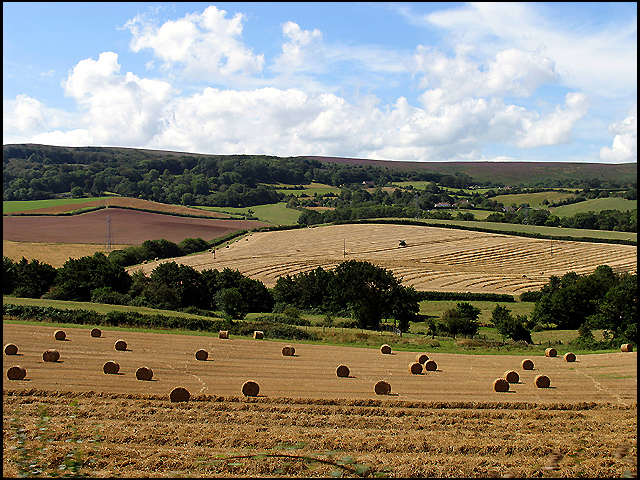
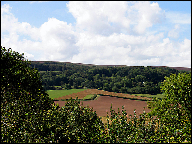
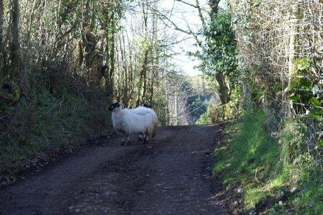
The village is surrounded by lush greenery, with dense woodlands and rolling hills that provide a haven for wildlife enthusiasts and nature lovers. The landscape is dotted with ancient trees, creating a sense of timeless charm and serenity. East Wood is particularly famous for its oak trees, which have been a prominent feature of the area for centuries.

The village itself is small yet welcoming, with a close-knit community that takes pride in its rural heritage. The local architecture is a mix of traditional cottages and more modern homes, blending seamlessly with the natural surroundings. The village center features a quaint church, a village hall, and a handful of local businesses, including a small grocery store and a cozy pub.

East Wood offers a range of outdoor activities for residents and visitors alike. The surrounding woodlands provide ample opportunities for hiking, cycling, and horseback riding, with numerous footpaths and bridleways to explore. The village also boasts a nearby lake, which is a popular spot for fishing and boating.

Overall, East Wood, Somerset, is a tranquil and idyllic village that offers a peaceful escape from the hustle and bustle of city life. Its natural beauty, friendly community, and abundance of outdoor activities make it a sought-after destination for those seeking a rural retreat in the heart of the English countryside.

If you have any feedback on the listing, please let us know in the comments section below.

East Wood Images

Images are sourced within 2km of 51.184567/-3.2294514 or Grid Reference ST1443. Thanks to Geograph Open Source API. All images are credited.

Farmland Ge-Mare Farmland west of the A39 looking towards Crooked Copse from the A39. This farmland is situated in the centre of the lower half of the grid square.
Farmland
Ge-Mare Farmland west of the A39 looking towards Crooked Copse from the A39. This farmland is situated in the centre of the lower half of the grid square.
Crooked Copse Crooked Copse, in the centre of the picture, is found in the south eastern section of the square and includes some farmland.
Crooked Copse
Crooked Copse, in the centre of the picture, is found in the south eastern section of the square and includes some farmland.
Kilve The village of Kilve lies in the south eastern section of the grid square. This view was taken from the A39 looking north west towards Kilve and East Wood.
Kilve
The village of Kilve lies in the south eastern section of the grid square. This view was taken from the A39 looking north west towards Kilve and East Wood.
East Quantoxhead Church from the SSW East Quantoxhead is an "Estate" village, hardly changed by modern development.  For more info see <span class="nowrap"><a title="www.quantockonline.co.uk/quantocks/villages/eastquantoxhead/eastquantoxhead1.html" rel="nofollow ugc noopener" href="http://www.quantockonline.co.uk/quantocks/villages/eastquantoxhead/eastquantoxhead1.html">Link</a><img style="margin-left:2px;" alt="External link" title="External link - shift click to open in new window" src="https://s1.geograph.org.uk/img/external.png" width="10" height="10"/></span>
East Quantoxhead Church from the SSW
East Quantoxhead is an "Estate" village, hardly changed by modern development. For more info see LinkExternal link
Beach at Quantock's Head The wave cut platform at low tide. The short 'cliff' shows the rock strata clearly.
Beach at Quantock's Head
The wave cut platform at low tide. The short 'cliff' shows the rock strata clearly.
Kilve Court This residential education centre is owned by Somerset County Council
Kilve Court
This residential education centre is owned by Somerset County Council
Old brick retort near Kilve beach This is the remains of an oil extractor built in the 1920's to process the oil rich shale in the cliffs. The ivy growing out of the stack has been shaped by the wind off the sea.
Old brick retort near Kilve beach
This is the remains of an oil extractor built in the 1920's to process the oil rich shale in the cliffs. The ivy growing out of the stack has been shaped by the wind off the sea.
The Chantry at Kilve The chantry was founded in 1329 by five monks but fell into disrepair before the dissolution of the monasteries.
The Chantry at Kilve
The chantry was founded in 1329 by five monks but fell into disrepair before the dissolution of the monasteries.
Cliff between Kilve and Lilstock The cliffs along this stretch of coastline are very unstable. The strata are clearly visible. Picture was taken at low tide.
Cliff between Kilve and Lilstock
The cliffs along this stretch of coastline are very unstable. The strata are clearly visible. Picture was taken at low tide.
Footpath to Lower Hill Farm. The grassy footpath runs straight ahead over the stile. The roof of Lower Hill Farm is just visible above the sheep.
Footpath to Lower Hill Farm.
The grassy footpath runs straight ahead over the stile. The roof of Lower Hill Farm is just visible above the sheep.
Wave cut platform at Kilve Beach Spectacular to look at, not so nice for beach holiday lovers...
Wave cut platform at Kilve Beach
Spectacular to look at, not so nice for beach holiday lovers...
St. Mary's Church - East Quantoxhead, Somerset
Post Box on a Tree Lane to Higher Street
Post Box on a Tree
Lane to Higher Street
Sheep on a Track on Pardlestone Hill
Kilve Beach Rock Formation Layered like a cake the rocks here alternate between dark bands of shale and lighter bands of limestone. The shale contains many fossils especially ammonites (see <a href="https://www.geograph.org.uk/photo/342219">ST1444 : Ammonite on Kilve Beach I</a>,<a href="https://www.geograph.org.uk/photo/342221">ST1444 : Ammonite on Kilve Beach II</a>)
Kilve Beach Rock Formation
Layered like a cake the rocks here alternate between dark bands of shale and lighter bands of limestone. The shale contains many fossils especially ammonites (see ST1444 : Ammonite on Kilve Beach I,ST1444 : Ammonite on Kilve Beach II)
Kilve Beach Limestone ridges form terraces on the beach at Kilve. The rock here alternates between limestone and shale, the latter yielding numerous fossils in particular ammonites (see <a href="https://www.geograph.org.uk/photo/342221">ST1444 : Ammonite on Kilve Beach II</a>)
Kilve Beach
Limestone ridges form terraces on the beach at Kilve. The rock here alternates between limestone and shale, the latter yielding numerous fossils in particular ammonites (see ST1444 : Ammonite on Kilve Beach II)
Kilve : The Old Chantry Beside the track that leads from Kilve church to the sea is this long-abandoned chantry which dates from the C14th (See also <a href="https://www.geograph.org.uk/photo/80361">ST1444 : The Chantry at Kilve</a>)
Chantries were founded by rich people who wished that prayers would be said for their souls after their death. They left an endowment that would pay for the upkeep of the buildings and pay for a number of monks to live there and do the required praying. This chantry at Kilve was founded by Sir Simon de Furneaux in 1329 and the endowment was sufficient to pay for five monks. Chantries were outlawed by Henry VIII as part of the Reformation, though most weren't actually closed until the reign of his son, Edward VI. This is probably the time (between 1547 & 1553) that this chantry was abandoned, and has been slowly crumbling ever since.
Kilve : The Old Chantry
Beside the track that leads from Kilve church to the sea is this long-abandoned chantry which dates from the C14th (See also ST1444 : The Chantry at Kilve) Chantries were founded by rich people who wished that prayers would be said for their souls after their death. They left an endowment that would pay for the upkeep of the buildings and pay for a number of monks to live there and do the required praying. This chantry at Kilve was founded by Sir Simon de Furneaux in 1329 and the endowment was sufficient to pay for five monks. Chantries were outlawed by Henry VIII as part of the Reformation, though most weren't actually closed until the reign of his son, Edward VI. This is probably the time (between 1547 & 1553) that this chantry was abandoned, and has been slowly crumbling ever since.
The track from Kilve Beach This is the view towards the Car Park and Kilve village from the track to the beach. The chimney in the middle of the picture is the top of the <a href="https://www.geograph.org.uk/photo/80352">ST1444 : Old brick retort near Kilve beach</a>.
The track from Kilve Beach
This is the view towards the Car Park and Kilve village from the track to the beach. The chimney in the middle of the picture is the top of the ST1444 : Old brick retort near Kilve beach.
Show me another place!

East Wood is located at Grid Ref: ST1443 (Lat: 51.184567, Lng: -3.2294514)

Administrative County: Somerset

District: Somerset West and Taunton

Police Authority: Avon and Somerset

What 3 Words

///vanilla.tolls.skinning. Near Nether Stowey, Somerset

Nearby Locations

East Wood Kilve

Related Wikis

Church of St Mary, East Quantoxhead

The Anglican Church of St Mary in East Quantoxhead, Somerset, England was built in the 14th century. It is a Grade II* listed building. == History == The...

Church of Saint Mary, Kilve

The Anglican Church of St Mary in Kilve, Somerset, England was built in the 14th century. It is a Grade II* listed building. == History == The first church...

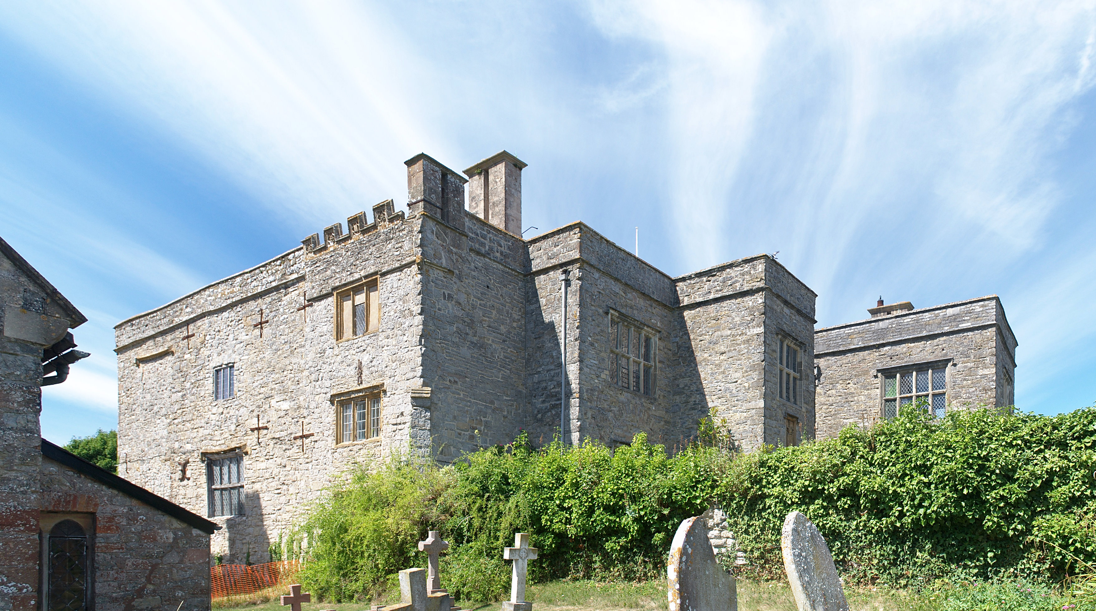
Court House, East Quantoxhead

The Court House in East Quantoxhead, Somerset, England has a medieval tower and other parts of the building which date from the 17th century. It has been...

Kilve Chantry

Kilve Chantry was a religious site in Kilve, Somerset, England. The Chantry was founded in 1329, when a brotherhood of five monks was employed to say Mass...

East Quantoxhead

East Quantoxhead is a village in the district of Somerset West and Taunton, 3 miles (5 km) from West Quantoxhead, 4 miles (6 km) east of Williton, and...

Oil Retort House

Oil Retort House is a Grade II listed building in Kilve, Somerset, United Kingdom. == History == In 1924, the Shalime Company was formed to exploit shale...
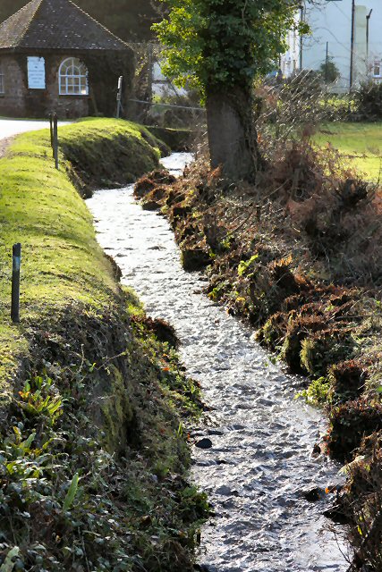
River Holford

The River Holford is located in the east Quantock Hills Area of Outstanding Natural Beauty in Somerset England. It is approximately 4.5 miles (7 km) long...

Kilve

Kilve is a village in the Somerset West and Taunton district of Somerset, England, within the Quantock Hills Area of Outstanding Natural Beauty, the first...

Nearby Amenities

Located within 500m of 51.184567,-3.2294514
East Quantoxhead
Place: village
Population: 112
Lat/Long: 51.1840398/-3.2353497
The data included in this document is from www.openstreetmap.org. The data is made available under ODbL.

Have you been to East Wood?

Leave your review of East Wood below (or comments, questions and feedback).