Two Acre Copse

Wood, Forest in Devon East Devon

England

Two Acre Copse

Hemyock: bluebell walk In the private grounds of Pikes Cottage at Madford where 19 acres of woods and 6 acres of cultivated garden are open to members of the public on certain summer weekends under The National Gardens Scheme - gardens open for charity. The Times featured the estate in 2004. Looking south
Hemyock: bluebell walk Credit: Martin Bodman

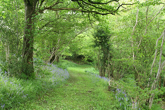
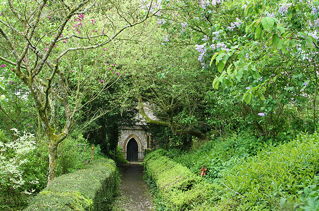
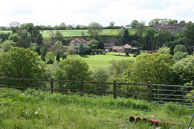
Two Acre Copse is a charming woodland located in Devon, England. Covering an area of approximately two acres, the copse is a delightful mix of ancient trees, dense undergrowth, and a variety of wildlife.

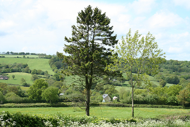
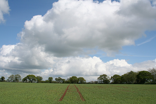
The copse is predominantly made up of native broadleaf trees such as oak, beech, and ash. These towering giants provide a dense canopy, creating a cool and tranquil atmosphere within the woods. The forest floor is covered in a thick carpet of moss, ferns, and wildflowers, adding to the enchanting beauty of the area.

Two Acre Copse is a haven for wildlife enthusiasts. The diverse ecosystem supports a range of animals, including deer, foxes, badgers, and numerous species of birds. Birdwatchers can spot woodland birds such as woodpeckers, owls, and thrushes, as well as raptors like buzzards and kestrels. The copse is also home to a variety of insects and small mammals, making it an ideal spot for nature lovers and photographers.

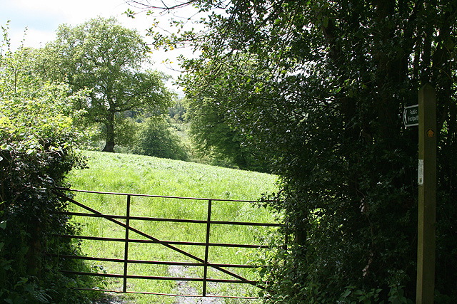
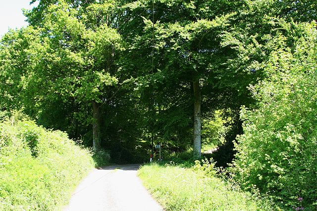
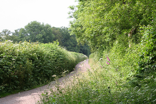
The copse is easily accessible, with a well-maintained footpath that winds through the woods. The path is lined with wooden benches, inviting visitors to sit and enjoy the peaceful surroundings. There are also informative signposts along the way, providing interesting facts about the flora and fauna found within the copse.

Whether it's a leisurely stroll, a picnic, or a nature walk, Two Acre Copse offers a tranquil escape from the hustle and bustle of everyday life. Its natural beauty and abundant wildlife make it a must-visit destination for those seeking a connection with nature in the heart of Devon.

If you have any feedback on the listing, please let us know in the comments section below.

Two Acre Copse Images

Images are sourced within 2km of 50.884693/-3.2265717 or Grid Reference ST1310. Thanks to Geograph Open Source API. All images are credited.
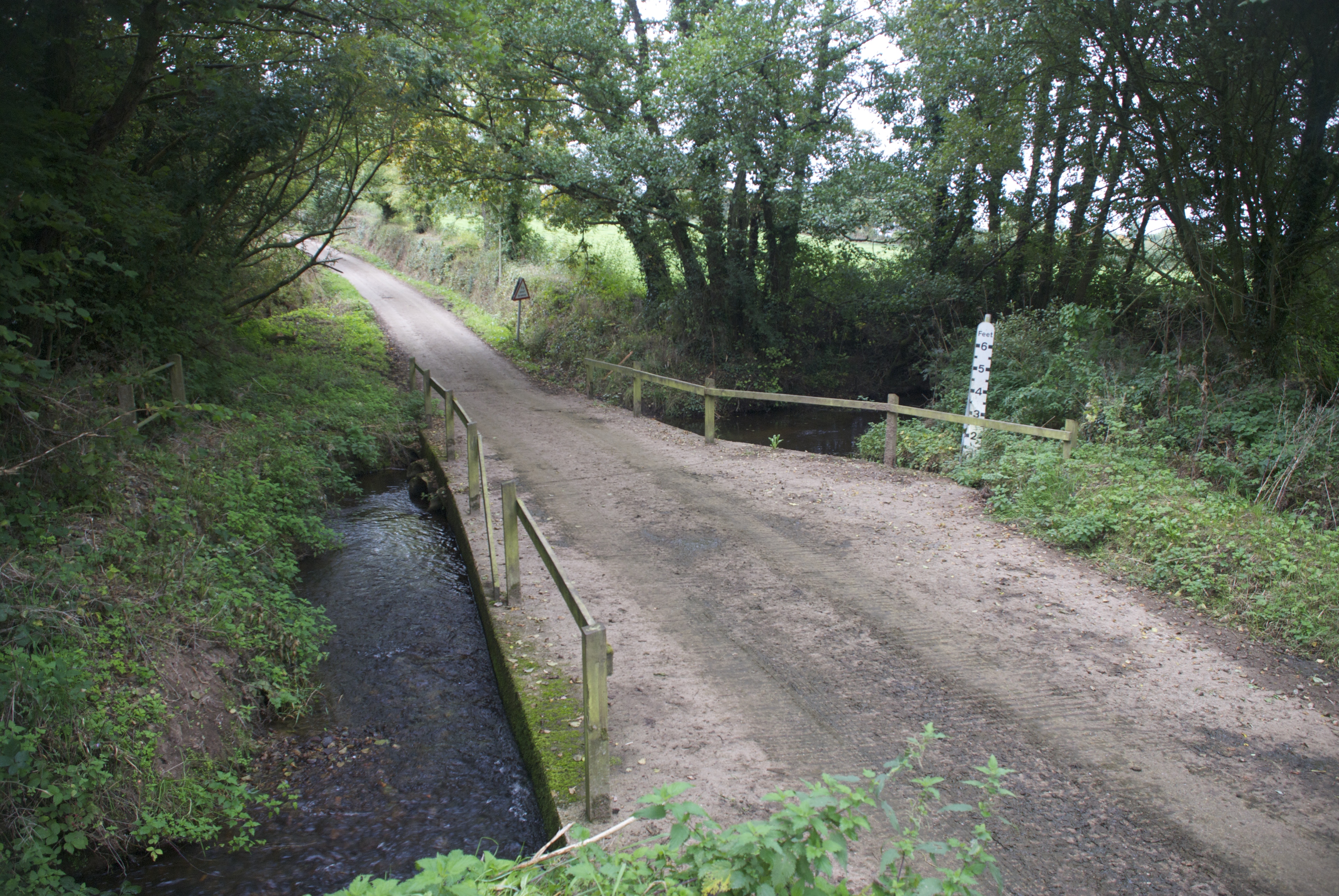
Hemyock: bluebell walk In the private grounds of Pikes Cottage at Madford where 19 acres of woods and 6 acres of cultivated garden are open to members of the public on certain summer weekends under The National Gardens Scheme - gardens open for charity. The Times featured the estate in 2004. Looking south
Hemyock: bluebell walk
In the private grounds of Pikes Cottage at Madford where 19 acres of woods and 6 acres of cultivated garden are open to members of the public on certain summer weekends under The National Gardens Scheme - gardens open for charity. The Times featured the estate in 2004. Looking south
Hemyock: Scaddings Prings and Scaddings was site of an 18th century tannery:
‘Devonshire. To be Let for a Term of 7 or 14 years, and entered upon immediately, all that Meffuage and Tenement called by the name of Prings and Scaddings, lately in the possession of Mr Clement Waldron, fituate at Madford, in the parifh of Hemiock .. comprifing of a Dwelling-houfe, Barn, and Outbuildings, and about twenty five acres of very good Orchard, Meadow and Pasture Land, well fituated for a Tannery, that Bufinefs having recently been carried on there ..’
[Exeter Flying Post 2 June 1796 p 2 col 3]. Situated by the Madford Water, a tributary of the Culm, and just downstream from Dunkeswell Abbey, it is very possible that there was originally a medieval tannery associated with the abbey here. Looking west-north-west
Hemyock: Scaddings
Prings and Scaddings was site of an 18th century tannery: ‘Devonshire. To be Let for a Term of 7 or 14 years, and entered upon immediately, all that Meffuage and Tenement called by the name of Prings and Scaddings, lately in the possession of Mr Clement Waldron, fituate at Madford, in the parifh of Hemiock .. comprifing of a Dwelling-houfe, Barn, and Outbuildings, and about twenty five acres of very good Orchard, Meadow and Pasture Land, well fituated for a Tannery, that Bufinefs having recently been carried on there ..’ [Exeter Flying Post 2 June 1796 p 2 col 3]. Situated by the Madford Water, a tributary of the Culm, and just downstream from Dunkeswell Abbey, it is very possible that there was originally a medieval tannery associated with the abbey here. Looking west-north-west
Dunkeswell: Madford valley Looking west-north-west from an entrance to Abbotsford Farm. The Dunkeswell Abbey site lies a little upstream to the left of shot
Dunkeswell: Madford valley
Looking west-north-west from an entrance to Abbotsford Farm. The Dunkeswell Abbey site lies a little upstream to the left of shot
Dunkeswell: on Madford Hill Looking south west. Typical landscape on the Blackdown Hills
Dunkeswell: on Madford Hill
Looking south west. Typical landscape on the Blackdown Hills
Dunkeswell: Abbey With remains of the Cistercian abbey beyond the MPV. Beyond the white gates a path leads to the church of the Holy Trinity
Dunkeswell: Abbey
With remains of the Cistercian abbey beyond the MPV. Beyond the white gates a path leads to the church of the Holy Trinity
Dunkeswell: church path By the site of Dunkeswell Abbey, the path leads to the church of the Holy Trinity. Looking east-north-east
Dunkeswell: church path
By the site of Dunkeswell Abbey, the path leads to the church of the Holy Trinity. Looking east-north-east
Dunkeswell: footpath to Stentwood Looking south west from the lane between Dunkeswell Abbey and Dunkeswell village
Dunkeswell: footpath to Stentwood
Looking south west from the lane between Dunkeswell Abbey and Dunkeswell village
Uffculme: by Ruggsmoor Under the trees, on the left of the lane, a footpath runs uphill to Trickey’s Farm. Looking east-north-east on the lane to Burnthouse Cross. Here the lane defines the boundary between Uffculme and Sheldon parishes
Uffculme: by Ruggsmoor
Under the trees, on the left of the lane, a footpath runs uphill to Trickey’s Farm. Looking east-north-east on the lane to Burnthouse Cross. Here the lane defines the boundary between Uffculme and Sheldon parishes
Dunkeswell: on Collard Hill Gathering hay for silage. The tractor is pulling a new trailer with its own feed device. Useful. But it means that the tractor needs to empty the trailer after no more than a lap of an average-sized field, which is fine if the silage storage facility is near at hand. Looking east-south-east with Abbey Hill – above Dunkeswell Abbey – on the skyline
Dunkeswell: on Collard Hill
Gathering hay for silage. The tractor is pulling a new trailer with its own feed device. Useful. But it means that the tractor needs to empty the trailer after no more than a lap of an average-sized field, which is fine if the silage storage facility is near at hand. Looking east-south-east with Abbey Hill – above Dunkeswell Abbey – on the skyline
Dunkeswell: towards Stentwood Seen from the lane by Higher Musgrove. Looking west across the upper Madford valley
Dunkeswell: towards Stentwood
Seen from the lane by Higher Musgrove. Looking west across the upper Madford valley
Dunkeswell: near Bowerhayes Looking east over typical upland Blackdown landscape
Dunkeswell: near Bowerhayes
Looking east over typical upland Blackdown landscape
Dunkeswell: near the airport By the road from Honiton to Wellington and close to the entrance for Dunkeswell Kart Racing Club. A light aircraft heads for the north-south runway. Dunkeswell was constructed as an airfield in 1941-2 and was initially used by the USAAF and US Navy on anti-submarine operations – from 1943
Dunkeswell: near the airport
By the road from Honiton to Wellington and close to the entrance for Dunkeswell Kart Racing Club. A light aircraft heads for the north-south runway. Dunkeswell was constructed as an airfield in 1941-2 and was initially used by the USAAF and US Navy on anti-submarine operations – from 1943
Dunkeswell: the lane to Dunkeswell Abbey Looking north in the direction of Park Farm
Dunkeswell: the lane to Dunkeswell Abbey
Looking north in the direction of Park Farm
Autumn on the road to Madford in Devon Beautiful colours of the hedgerow on the road to Madford in Devon
Autumn on the road to Madford in Devon
Beautiful colours of the hedgerow on the road to Madford in Devon
Beech and hedge, Hackpen Hill Uffculme Footpath 36 cuts briefly across the southwest corner of this square, passing this fine beech. The shadows on the right are cast by trees in the eastern tip of Bishop's Plot.
Beech and hedge, Hackpen Hill
Uffculme Footpath 36 cuts briefly across the southwest corner of this square, passing this fine beech. The shadows on the right are cast by trees in the eastern tip of Bishop's Plot.
Path to Hagdon Farm Uffculme Footpath 36 runs alongside this hedge at the top of the southwest slope of Hackpen / Collard Hill, here past a beech and an old gate.
Path to Hagdon Farm
Uffculme Footpath 36 runs alongside this hedge at the top of the southwest slope of Hackpen / Collard Hill, here past a beech and an old gate.
Beeches by the path A closer view of the further trees that appear in the background of <a href="https://www.geograph.org.uk/photo/2798189">ST1210 : Path to Hagdon Farm</a>, with Uffculme Footpath 36 continuing around the edge of the hill.
Beeches by the path
A closer view of the further trees that appear in the background of ST1210 : Path to Hagdon Farm, with Uffculme Footpath 36 continuing around the edge of the hill.
Field by Hagdon Farm Looking through the gateway ahead of the camera in <a href="https://www.geograph.org.uk/photo/2798189">ST1210 : Path to Hagdon Farm</a>. The farm buildings visible (to the left of the beeches shown in <a href="https://www.geograph.org.uk/photo/2798193">ST1210 : Beeches by the path</a>) are at Trickey's Farm rather than the nearer Hagdon Farm. Patches of snow lie in the field.
Field by Hagdon Farm
Looking through the gateway ahead of the camera in ST1210 : Path to Hagdon Farm. The farm buildings visible (to the left of the beeches shown in ST1210 : Beeches by the path) are at Trickey's Farm rather than the nearer Hagdon Farm. Patches of snow lie in the field.
Show me another place!

Two Acre Copse is located at Grid Ref: ST1310 (Lat: 50.884693, Lng: -3.2265717)

Administrative County: Devon

District: East Devon

Police Authority: Devon and Cornwall

What 3 Words

///mega.goodnight.yacht. Near Dunkeswell, Devon

Related Wikis

Abbey, Devon

Abbey is a hamlet in the English county of Devon. It is located in the Blackdown Hills, a group of hills that border both Devon and Somerset. Dunkeswell...

Goodleigh, Mid Devon

Goodleigh is a village about 1 km northeast of Bodmiscombe in the county of Devon, England. The origin of the place-name is from the Old English words...

Dunkeswell

Dunkeswell is a village and civil parish in East Devon, England, located about 5 miles (8.0 km) north of the town of Honiton. At the 2001 census, the...

Sheldon, Devon

Sheldon is a village and civil parish in the East Devon district of the county of Devon in England. It is located in the Blackdown Hills, 6.5 miles (10...

Nearby Amenities

Located within 500m of 50.884693,-3.2265717
Ford: yes
Lat/Long: 50.8884873/-3.2251278
Generator Method: photovoltaic
Generator Output Electricity: yes
Generator Source: solar
Generator Type: solar_photovoltaic_panel
Location: roof
Power: generator
Lat/Long: 50.8815552/-3.2251056
Power: pole
Source: bing
Lat/Long: 50.8888137/-3.2268637
Poles: bipole
Power: pole
Source: bing
Lat/Long: 50.8881284/-3.22679
Power: pole
Source: bing
Lat/Long: 50.8876301/-3.2259732
Power: pole
Source: bing
Lat/Long: 50.8868517/-3.2246871
Power: pole
Source: bing
Lat/Long: 50.8859185/-3.2227238
Power: pole
Source: bing
Lat/Long: 50.8861174/-3.2231516
Power: pole
Source: bing
Lat/Long: 50.8855073/-3.2221444
Power: pole
Source: bing
Lat/Long: 50.884767/-3.2217997
Power: pole
Source: bing
Lat/Long: 50.8840123/-3.2206866
Power: pole
Source: bing
Lat/Long: 50.8833998/-3.2199396
Power: pole
Source: bing
Lat/Long: 50.8854718/-3.2241681
Power: pole
Source: bing
Lat/Long: 50.8889634/-3.2271762
Power: pole
Source: bing
Transformer: distribution
Lat/Long: 50.8887384/-3.2261328
Power: pole
Source: bing
Lat/Long: 50.8884744/-3.2248655
Power: pole
Source: bing
Transformer: distribution
Lat/Long: 50.8882646/-3.2238986
Power: pole
Source: bing
Lat/Long: 50.8880336/-3.2228552
Power: pole
Source: bing
Lat/Long: 50.8874955/-3.2225601
Power: pole
Source: bing
Lat/Long: 50.8867925/-3.2230792
Power: pole
Source: bing
Lat/Long: 50.8859422/-3.2237161
Power: pole
Source: bing
Transformer: distribution
Lat/Long: 50.8815036/-3.2308173
The data included in this document is from www.openstreetmap.org. The data is made available under ODbL.

Have you been to Two Acre Copse?

Leave your review of Two Acre Copse below (or comments, questions and feedback).