Cliff Copse

Wood, Forest in Somerset Somerset West and Taunton

England

Cliff Copse

SCC fingerpost near the hamlet of Lawford, Crowcombe parish The photograph, taken in September 2021, shows the latest condition of this Somerset County Council fingerpost, located at the junctions of Stickle Hill and Heddon Wood Lane. Although it is part of the SCC Fingerpost Restoration project, and is awaiting restoration by 2 volunteers working on behalf of Crowcombe parish, it is currently cordoned off by the SCC Highways Team (for safety reasons possibly - the post is very close to the edge of a steep drop of 10/15 foot to a stream below).
Other Geographers have previously recorded the post condition; in April 2009 (when it still has its 'CROWCOMBE' arm) and again in June 2018.
SCC fingerpost near the hamlet of Lawford, Crowcombe parish Credit: Marika Reinholds

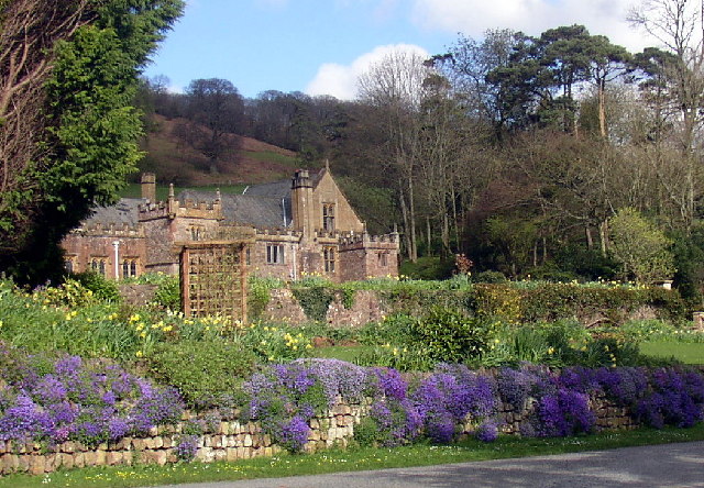
Cliff Copse, located in Somerset, England, is a picturesque wood or forest that spans over an area of approximately 500 acres. Nestled in the rolling hills of the county, it offers a serene and tranquil escape from the hustle and bustle of city life. The copse is characterized by its dense canopy of trees, which mainly consist of oak, beech, and ash, creating a rich and diverse ecosystem.

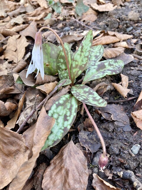
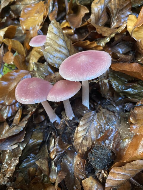
The forest floor is covered in a lush carpet of ferns, mosses, and wildflowers, adding to the natural beauty of the area. Walking through Cliff Copse, visitors can admire the vibrant colors of bluebells in the spring or witness the breathtaking sight of autumn leaves transforming the woodland into a kaleidoscope of reds, oranges, and yellows.

The wood is home to a variety of wildlife, including deer, badgers, foxes, and a wide range of bird species. Birdwatchers can spot woodpeckers, owls, and various songbirds while exploring the trails that wind through the forest.

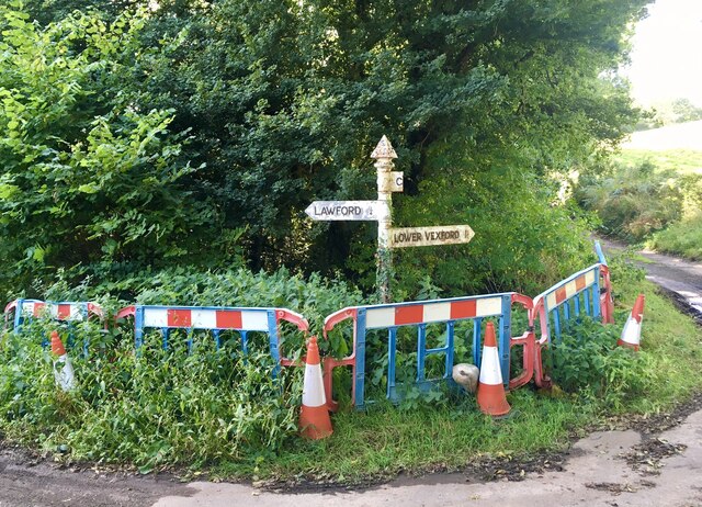
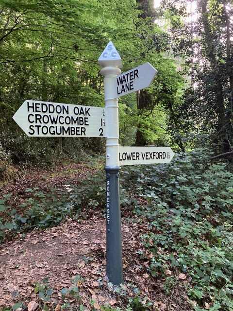
Cliff Copse is a popular destination for outdoor enthusiasts, offering a network of well-maintained footpaths and bridleways that cater to hikers, cyclists, and horse riders. These paths meander through the wood, providing opportunities to explore its hidden corners and discover its natural wonders.

Managed by a local conservation organization, Cliff Copse is dedicated to preserving the woodland and its biodiversity. The organization organizes educational programs and guided walks to raise awareness about the importance of protecting this precious natural resource.

Overall, Cliff Copse in Somerset is a haven for nature lovers and a place where visitors can immerse themselves in the beauty and tranquility of a woodland retreat.

If you have any feedback on the listing, please let us know in the comments section below.

Cliff Copse Images

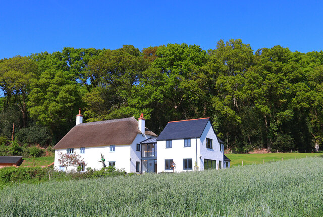
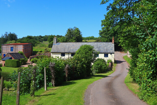
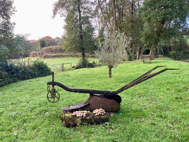
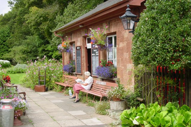
Images are sourced within 2km of 51.119938/-3.2455808 or Grid Reference ST1236. Thanks to Geograph Open Source API. All images are credited.

SCC fingerpost near the hamlet of Lawford, Crowcombe parish The photograph, taken in September 2021, shows the latest condition of this Somerset County Council fingerpost, located at the junctions of Stickle Hill and Heddon Wood Lane. Although it is part of the SCC Fingerpost Restoration project, and is awaiting restoration by 2 volunteers working on behalf of Crowcombe parish, it is currently cordoned off by the SCC Highways Team (for safety reasons possibly - the post is very close to the edge of a steep drop of 10/15 foot to a stream below).
Other Geographers have previously recorded the post condition; in April 2009 (when it still has its 'CROWCOMBE' arm) and again in June 2018.
SCC fingerpost near the hamlet of Lawford, Crowcombe parish
The photograph, taken in September 2021, shows the latest condition of this Somerset County Council fingerpost, located at the junctions of Stickle Hill and Heddon Wood Lane. Although it is part of the SCC Fingerpost Restoration project, and is awaiting restoration by 2 volunteers working on behalf of Crowcombe parish, it is currently cordoned off by the SCC Highways Team (for safety reasons possibly - the post is very close to the edge of a steep drop of 10/15 foot to a stream below). Other Geographers have previously recorded the post condition; in April 2009 (when it still has its 'CROWCOMBE' arm) and again in June 2018.
White trout lily Erythonium albidum. This unusual plant was spotted under trees in undisturbed roadside verge. It is native to North America. It may be a garden escapee. It is also known as fawn lily, white dogs toothed violet, serpent's tongue, adder's tongue, deer tongue.
White trout lily
Erythonium albidum. This unusual plant was spotted under trees in undisturbed roadside verge. It is native to North America. It may be a garden escapee. It is also known as fawn lily, white dogs toothed violet, serpent's tongue, adder's tongue, deer tongue.
Somerset County Council fingerpost - South of Heddon Oak-Water Lane junction A fingerpost was recently refurbished as part of the Somerset County Council fingerpost restoration project. Repainting was undertaken by 2 volunteers working on behalf of Crowcombe parish. A new 'Water Lane' arm was made and fitted to replace one that was snapped off years ago, probably by a large vehicle. The new arm, along with the paints and other materials needed was funded by Crowcombe parish council.

The post condition before refurbishment can be viewed on a previous Geographer's image, dating back to 5 June 2018.
Somerset County Council fingerpost - South of Heddon Oak-Water Lane junction
A fingerpost was recently refurbished as part of the Somerset County Council fingerpost restoration project. Repainting was undertaken by 2 volunteers working on behalf of Crowcombe parish. A new 'Water Lane' arm was made and fitted to replace one that was snapped off years ago, probably by a large vehicle. The new arm, along with the paints and other materials needed was funded by Crowcombe parish council. The post condition before refurbishment can be viewed on a previous Geographer's image, dating back to 5 June 2018.
Toadstool Mycena Rosea Not recommended for eating !
See link for more information about this pretty toadstool <span class="nowrap"><a title="https://www.first-nature.com/fungi/mycena-rosea.php" rel="nofollow ugc noopener" href="https://www.first-nature.com/fungi/mycena-rosea.php">Link</a><img style="margin-left:2px;" alt="External link" title="External link - shift click to open in new window" src="https://s1.geograph.org.uk/img/external.png" width="10" height="10"/></span>.
Toadstool Mycena Rosea
Not recommended for eating ! See link for more information about this pretty toadstool LinkExternal link.
New barriers in the hamlet of Lawford, Crowcombe parish Replacement barriers were installed at the Stickle Hill - Heddon Wood Lane junction in early 2022 - behind the safety barriers is a sharp drop into a sunken stream. An earlier photograph, loaded in September 2021, shows the poor barrier condition at that time.
New barriers in the hamlet of Lawford, Crowcombe parish
Replacement barriers were installed at the Stickle Hill - Heddon Wood Lane junction in early 2022 - behind the safety barriers is a sharp drop into a sunken stream. An earlier photograph, loaded in September 2021, shows the poor barrier condition at that time.
Somerset County Council fingerpost in the hamlet of Lawford, Crowcombe parish This fingerpost, at the junction of Stickle Hill and Heddon Wood Lane, was refurbished in August 2022 as part of the Somerset County Council fingerpost restoration project. Repainting was undertaken by 2 volunteers working on behalf of Crowcombe parish. A new 'Crowcombe' arm was made and fitted to replace one that was snapped off years ago, probably by a large farm vehicle. The new arm, along with the paints and materials needed for the refurbishment was funded by Crowcombe parish council. New safety barriers were also installed in 2022, by Somerset County Council.
Somerset County Council fingerpost in the hamlet of Lawford, Crowcombe parish
This fingerpost, at the junction of Stickle Hill and Heddon Wood Lane, was refurbished in August 2022 as part of the Somerset County Council fingerpost restoration project. Repainting was undertaken by 2 volunteers working on behalf of Crowcombe parish. A new 'Crowcombe' arm was made and fitted to replace one that was snapped off years ago, probably by a large farm vehicle. The new arm, along with the paints and materials needed for the refurbishment was funded by Crowcombe parish council. New safety barriers were also installed in 2022, by Somerset County Council.
'Lady of Legend' approaches Crowcombe Heathfield, from the west
Train for Minehead passes Roebuck Farm, West Somerset Railway 7820 'Dinmore Manor' passes Roebuck Farm with the 12.10 departure from Bishops Lydeard during the WSR's Autumn Gala.
Train for Minehead passes Roebuck Farm, West Somerset Railway
7820 'Dinmore Manor' passes Roebuck Farm with the 12.10 departure from Bishops Lydeard during the WSR's Autumn Gala.
Leigh Cottage Thatched cottage and modern extension.
Leigh Cottage
Thatched cottage and modern extension.
Townsend Crossroads Road junction north of Crowcombe.
Townsend Crossroads
Road junction north of Crowcombe.
Roebuck Gate Lane Farmhouse on Roebuck Gate Lane.
Roebuck Gate Lane
Farmhouse on Roebuck Gate Lane.
Old agricultural piece Possibly a hand plough.
Old agricultural piece
Possibly a hand plough.
Bridge over Doniford Stream A bridge crossing the Doniford Stream near Crowcombe Heathfield
Bridge over Doniford Stream
A bridge crossing the Doniford Stream near Crowcombe Heathfield
Stogumber Station A delightful little station on the Somerset Railway, manned by volunteers and beautifully kept.
Stogumber Station
A delightful little station on the Somerset Railway, manned by volunteers and beautifully kept.
Halsway Manor Halsway Manor is a grade II* listed building, with parts dating back to 15th century with later 19th century additions. Since 1965, Halsway Manor Society, a registered educational charity, has operated as a residential centre for traditional music, dance and song, from this historic building. The Wonderful Entrance Hall has a barrel ceiling with oak panelling round the walls. The Lounge is similarly panelled and the Kennedy-Grant Memorial library has a low decorated plaster ceiling mentioned in the listing statement. The ballroom called the Long Room, an excellent space for dancing, has 2 fireplaces and a great warmth of atmosphere is present in all the downstairs rooms. There are 18 bedrooms in the manor with a further 9 in the Mews, many offering en-suite facilities. 
<span class="nowrap"><a title="www.halswaymanor.org.uk" rel="nofollow ugc noopener" href="http://www.halswaymanor.org.uk">Link</a><img style="margin-left:2px;" alt="External link" title="External link - shift click to open in new window" src="https://s1.geograph.org.uk/img/external.png" width="10" height="10"/></span>
Halsway Manor
Halsway Manor is a grade II* listed building, with parts dating back to 15th century with later 19th century additions. Since 1965, Halsway Manor Society, a registered educational charity, has operated as a residential centre for traditional music, dance and song, from this historic building. The Wonderful Entrance Hall has a barrel ceiling with oak panelling round the walls. The Lounge is similarly panelled and the Kennedy-Grant Memorial library has a low decorated plaster ceiling mentioned in the listing statement. The ballroom called the Long Room, an excellent space for dancing, has 2 fireplaces and a great warmth of atmosphere is present in all the downstairs rooms. There are 18 bedrooms in the manor with a further 9 in the Mews, many offering en-suite facilities. LinkExternal link
Steam Train on the West Somerset Line This will have recently departed from Stogumber Station - see Geograph for ST1137
Steam Train on the West Somerset Line
This will have recently departed from Stogumber Station - see Geograph for ST1137
Crowcombe: Crowcombe church and cross View to the church house, beyond the yew tree, built in 1515 and the parish hall since 1977. The church, dedicated to the Holy Ghost, originally had a spire, felled by lightning in 1725
Crowcombe: Crowcombe church and cross
View to the church house, beyond the yew tree, built in 1515 and the parish hall since 1977. The church, dedicated to the Holy Ghost, originally had a spire, felled by lightning in 1725
Crowcombe: cross Market cross dating from the 14th century standing between Crowcombe church and the Carew Arms
Crowcombe: cross
Market cross dating from the 14th century standing between Crowcombe church and the Carew Arms
Show me another place!

Cliff Copse is located at Grid Ref: ST1236 (Lat: 51.119938, Lng: -3.2455808)

Administrative County: Somerset

District: Somerset West and Taunton

Police Authority: Avon and Somerset

What 3 Words

///unimpeded.chatted.grapevine. Near Williton, Somerset

Related Wikis

Roebuck Meadows

Roebuck Meadows (grid reference ST132354) is a 3.6 hectare (8.9 acre) biological Site of Special Scientific Interest south of Crowcombe in Somerset, notified...

Crowcombe Court

Crowcombe Court in Crowcombe, Somerset, England is a large country house dating from 1724 to 1739. It is Grade I listed. It was built, in English regional...

Crowcombe

Crowcombe is a village and civil parish under the Quantock Hills in Somerset, England, 5.5 miles (9 km) southeast of Watchet, and 8 miles (13 km) from...

Halsway Manor

Halsway Manor (also known as Halsway Court) is a manor house in Halsway, Somerset. It is owned by the Halsway Manor Society who operate the manor as a...

Nearby Amenities

Located within 500m of 51.119938,-3.2455808
Railway: crossing
Lat/Long: 51.1163059/-3.2458835
Addr Housename: Roebuck Farm
Lat/Long: 51.11706/-3.2435475
The data included in this document is from www.openstreetmap.org. The data is made available under ODbL.

Have you been to Cliff Copse?

Leave your review of Cliff Copse below (or comments, questions and feedback).