Bowerhouse Bank Wood

Wood, Forest in Cumberland Copeland

England

Bowerhouse Bank Wood

Signpost at Santon Bridge This signpost, which could do with some sprucing up, points the way at the junction just east of the bridge over the River Irt.
Signpost at Santon Bridge Credit: Stephen McKay

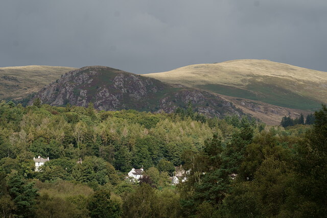
Bowerhouse Bank Wood is a beautiful woodland located in the county of Cumberland, England. Situated near the village of Bowerhouse Bank, the wood covers an area of approximately 100 acres and is a popular destination for nature enthusiasts and hikers alike.

The woodland is characterized by its diverse range of native trees, including oak, birch, and beech. Dense vegetation and a well-preserved canopy provide a haven for a variety of wildlife species, making it an important habitat for many birds, mammals, and insects. It is not uncommon to spot red squirrels, roe deer, and a plethora of bird species such as woodpeckers, thrushes, and owls within the wood.

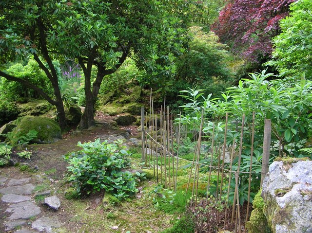
Trails wind through the wood, allowing visitors to explore its beauty and observe the natural surroundings. The paths are well-maintained, making it accessible for people of all ages and abilities. Along the trails, there are benches and picnic areas, providing a peaceful spot for visitors to rest and enjoy the tranquility of the woodland.

Bowerhouse Bank Wood is also renowned for its seasonal beauty. In spring, the forest floor is adorned with vibrant bluebells and wildflowers, creating a picturesque scene. During autumn, the foliage transforms into a symphony of warm hues, attracting many photographers and nature enthusiasts.

The wood is managed by a local conservation group, ensuring its preservation and protection for future generations. Regular conservation activities, such as tree planting and invasive species control, are carried out to maintain the ecological balance of the woodland.

Overall, Bowerhouse Bank Wood is a remarkable natural treasure, offering a serene escape and an opportunity to connect with nature in the heart of Cumberland.

If you have any feedback on the listing, please let us know in the comments section below.

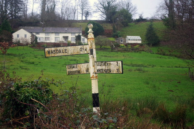
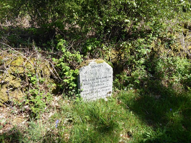
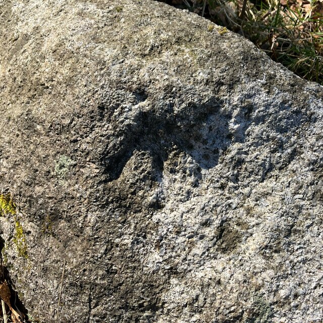
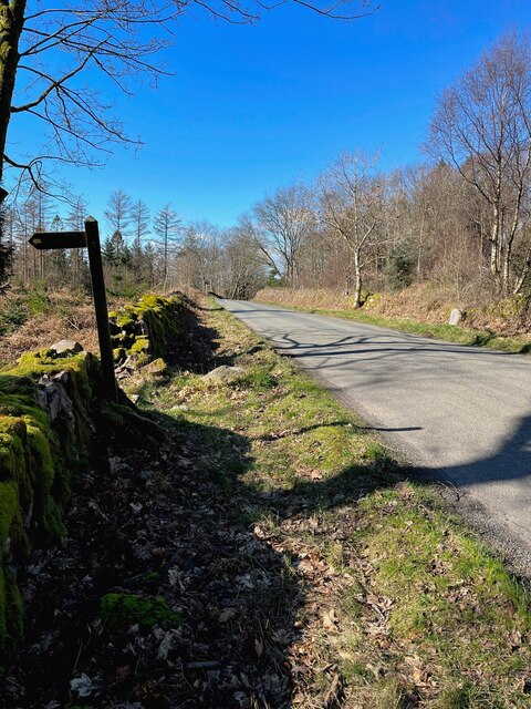
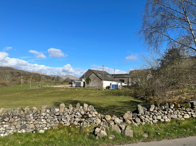
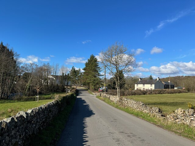
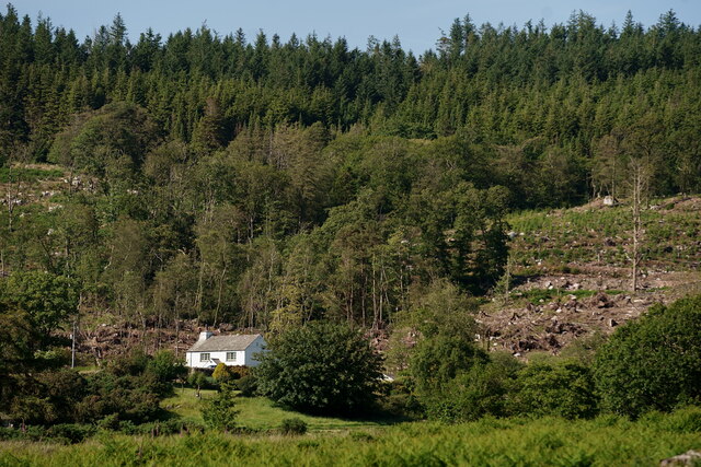
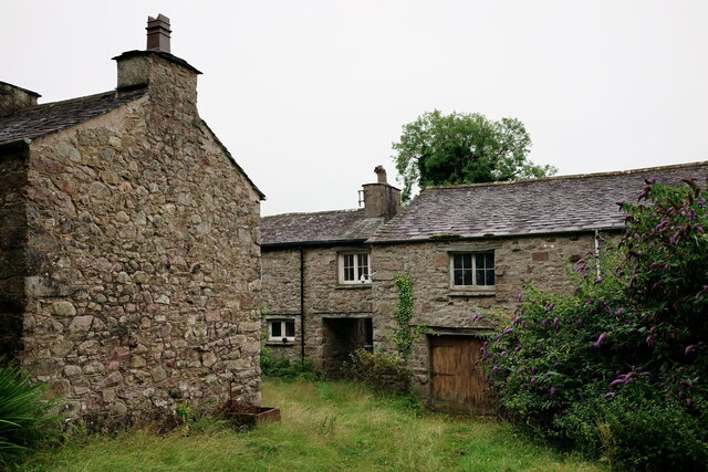
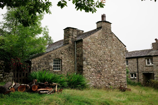
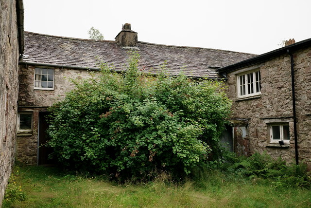
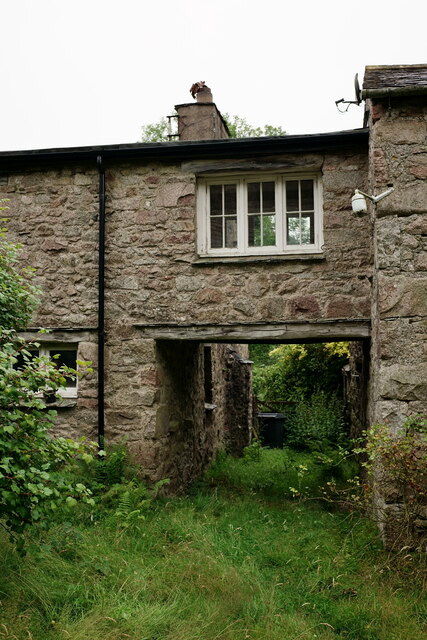
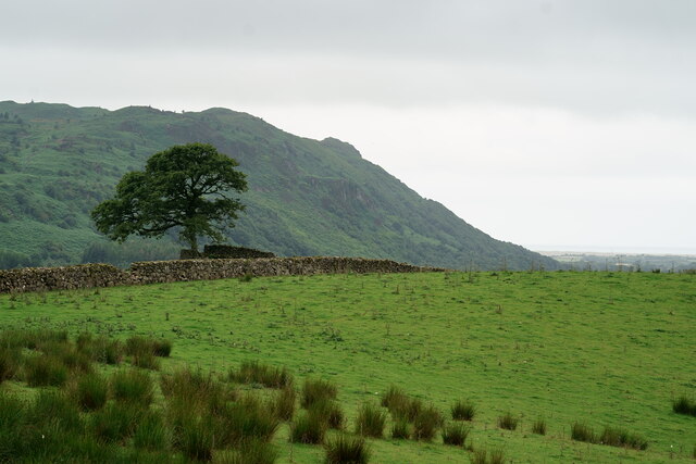
Bowerhouse Bank Wood Images

Images are sourced within 2km of 54.39283/-3.3454589 or Grid Reference NY1200. Thanks to Geograph Open Source API. All images are credited.

Signpost at Santon Bridge This signpost, which could do with some sprucing up, points the way at the junction just east of the bridge over the River Irt.
Signpost at Santon Bridge
This signpost, which could do with some sprucing up, points the way at the junction just east of the bridge over the River Irt.
The Malkinson Memorial Beside the road from Eskdale Green to Santon Bridge, this small stone memorial bears the following inscription:
'In memory of William Malkinson
Wesleyan Local Preacher
Died here suddenly Sunday Feb 21 1886
Be ye also ready'
The Malkinson Memorial
Beside the road from Eskdale Green to Santon Bridge, this small stone memorial bears the following inscription: 'In memory of William Malkinson Wesleyan Local Preacher Died here suddenly Sunday Feb 21 1886 Be ye also ready'
Benchmark, Irton Park Detail of the Ordnance Survey pivot benchmark on a granite rock on the verge of the road from Eskdale Green to Santon Bridge. The benchmark marks a height of 105.7473m above mean sea level (Ordnance Datum Newlyn) last verified in 1956 (location photograph <a href="https://www.geograph.org.uk/photo/7113106">NY1101 : The road from Eskdale Green to Santon Bridge</a>).
Benchmark, Irton Park
Detail of the Ordnance Survey pivot benchmark on a granite rock on the verge of the road from Eskdale Green to Santon Bridge. The benchmark marks a height of 105.7473m above mean sea level (Ordnance Datum Newlyn) last verified in 1956 (location photograph NY1101 : The road from Eskdale Green to Santon Bridge).
The road from Eskdale Green to Santon Bridge The footpath to the left leads to Plumgarth.  There is an Ordnance Survey pivot benchmark on the rock in the grass verge beyond the footpath sign (photograph <a href="https://www.geograph.org.uk/photo/7113067">NY1101 : Benchmark, Irton Park</a> and The Malkinson Memorial is on the opposite side of the road (photograph <a href="https://www.geograph.org.uk/photo/7086564">NY1101 : The Malkinson Memorial</a>).
The road from Eskdale Green to Santon Bridge
The footpath to the left leads to Plumgarth. There is an Ordnance Survey pivot benchmark on the rock in the grass verge beyond the footpath sign (photograph NY1101 : Benchmark, Irton Park and The Malkinson Memorial is on the opposite side of the road (photograph NY1101 : The Malkinson Memorial).
Broken wall near Bridge End Farm Damaged by winter storms, the roadside wall awaits repair.
Broken wall near Bridge End Farm
Damaged by winter storms, the roadside wall awaits repair.
Santon Bridge The road from Eskdale Green on the approach to the bridge at Santon Bridge.
Santon Bridge
The road from Eskdale Green on the approach to the bridge at Santon Bridge.
Bridge End Farm Built from granite, this building at Bridge End farm has an Ordnance Survey flush bracket benchmark set into the stonework just above the bottom quoin (photograph <a href="https://www.geograph.org.uk/photo/7116701">NY1101 : Benchmark, Santon Bridge, Bridge End Farm</a>).
Bridge End Farm
Built from granite, this building at Bridge End farm has an Ordnance Survey flush bracket benchmark set into the stonework just above the bottom quoin (photograph NY1101 : Benchmark, Santon Bridge, Bridge End Farm).
Benchmark, Santon Bridge, Bridge End Farm Detail of the Ordnance Survey flush bracket benchmark number G3097 on the corner of a farm building at Bridge End Farm. The benchmark marks a height of 29.5775m above mean sea level (Ordnance Datum Newlyn) last levelled and verified in 1954 (location photograph <a href="https://www.geograph.org.uk/photo/7116699">NY1101 : Bridge End Farm</a>).
Benchmark, Santon Bridge, Bridge End Farm
Detail of the Ordnance Survey flush bracket benchmark number G3097 on the corner of a farm building at Bridge End Farm. The benchmark marks a height of 29.5775m above mean sea level (Ordnance Datum Newlyn) last levelled and verified in 1954 (location photograph NY1101 : Bridge End Farm).
The Wasdale Fells from Irton Pike
Morning Visitor There are occasional squirrel visits to this location, which is maintained and monitored by one of the locals.
Morning Visitor
There are occasional squirrel visits to this location, which is maintained and monitored by one of the locals.
A Sad End I have walked this route, most months, for the past six years. About five years ago, this massive tree was felled.

In May, as I approached, a bird flew out of a nest in the hollow centre. The nest was made from moss and bracken, but I did not see the bird well enough, as it flashed past, to identify it. I did, however, think that it was not the best location in which to build a nest.

June saw me again walk past to find the remains of the nest and a pile of feathers on the ground. No doubt a sparrowhawk at work.

Amazingly, three eggs had survived intact. They were about 0.6 inch in length and white with some reddish brown speckles. From a photograph, a friend has identified these as robin eggs.

A sad end.
A Sad End
I have walked this route, most months, for the past six years. About five years ago, this massive tree was felled. In May, as I approached, a bird flew out of a nest in the hollow centre. The nest was made from moss and bracken, but I did not see the bird well enough, as it flashed past, to identify it. I did, however, think that it was not the best location in which to build a nest. June saw me again walk past to find the remains of the nest and a pile of feathers on the ground. No doubt a sparrowhawk at work. Amazingly, three eggs had survived intact. They were about 0.6 inch in length and white with some reddish brown speckles. From a photograph, a friend has identified these as robin eggs. A sad end.
Cubben View from the track leading into Keyhow Coppice. Recent felling, around the cottage, is obvious.
Cubben
View from the track leading into Keyhow Coppice. Recent felling, around the cottage, is obvious.
Low Holme Isolated farm, at the edge of Eskdale Green.
Low Holme
Isolated farm, at the edge of Eskdale Green.
Low Holme Isolated farm, at the edge of Eskdale Green.
Low Holme
Isolated farm, at the edge of Eskdale Green.
Low Holme Isolated farm, at the edge of Eskdale Green.
Low Holme
Isolated farm, at the edge of Eskdale Green.
Low Holme Isolated farm, at the edge of Eskdale Green.
Low Holme
Isolated farm, at the edge of Eskdale Green.
View Towards Muncaster Fell Seen from Smithybrow Lane. In the far distance, the coastline can be seen.
View Towards Muncaster Fell
Seen from Smithybrow Lane. In the far distance, the coastline can be seen.
Eskdale Green Great Bank is in the middle distance.
Eskdale Green
Great Bank is in the middle distance.
Show me another place!

Bowerhouse Bank Wood is located at Grid Ref: NY1200 (Lat: 54.39283, Lng: -3.3454589)

Administrative County: Cumbria

District: Copeland

Police Authority: Cumbria

What 3 Words

///jungle.blogs.everybody. Near Seascale, Cumbria

Related Wikis

Irton Road railway station

Irton Road railway station is a railway station on the 15 in gauge Ravenglass & Eskdale Railway in the Lake District National Park and the English county...

Irton Pike

Irton Pike is a hill in the west of the English Lake District, near Santon Bridge, Cumbria. It is the subject of a chapter of Alfred Wainwright's book...

Giggle Alley

Giggle Alley is a woodland in Eskdale Green, Cumbria, England. It was formerly part of the Gate House estate. The wood includes the ruins of a Japanese...

St Bega, Eskdale

St Bega is in Eskdale, Cumbria, England. It is an active Anglican parish church in the deanery of Calder, and the diocese of Carlisle. Its benefice is...

Nearby Amenities

Located within 500m of 54.39283,-3.3454589
Plumgarth Moss
Place: locality
Lat/Long: 54.3931316/-3.3500974
Bowerhouse Bank Wood
Natural: wood
Lat/Long: 54.3939709/-3.3440016
Ford: yes
Lat/Long: 54.3916625/-3.3517618
Power: pole
Lat/Long: 54.3900392/-3.3397144
The data included in this document is from www.openstreetmap.org. The data is made available under ODbL.

Have you been to Bowerhouse Bank Wood?

Leave your review of Bowerhouse Bank Wood below (or comments, questions and feedback).