Allergrove Copse

Wood, Forest in Devon East Devon

England

Allergrove Copse

Car Park in the Woods A woodland path with Witness Moor car park in the background just north of Hembury Hill Fort.
Car Park in the Woods Credit: John P Reeves

Allergrove Copse is a picturesque woodland located in the county of Devon, in the southwestern part of England. Situated in a rural area near the small village of Allergrove, this copse is renowned for its natural beauty and diverse ecosystem.

Covering an area of around 50 acres, Allergrove Copse is primarily composed of native deciduous trees, including oak, ash, beech, and birch. These trees provide a stunning canopy that changes colors with the seasons, creating a breathtaking display throughout the year. The forest floor is covered in a thick blanket of moss, ferns, and wildflowers, adding to its enchanting atmosphere.

The copse is crisscrossed with a network of footpaths and trails, allowing visitors to explore its natural wonders. These paths lead to hidden clearings, babbling brooks, and secluded ponds, offering tranquil spots for relaxation and contemplation. The copse is home to a wide variety of wildlife, including deer, foxes, rabbits, and a plethora of bird species, making it a popular destination for nature lovers and birdwatchers.

Allergrove Copse is also known for its historical importance, with remnants of ancient settlements and archaeological sites scattered throughout its grounds. These remnants provide insight into the rich history of the area, dating back to prehistoric times.

Overall, Allergrove Copse is a captivating woodland that offers visitors a chance to immerse themselves in nature, discover its hidden treasures, and appreciate the beauty of the Devon countryside.

If you have any feedback on the listing, please let us know in the comments section below.

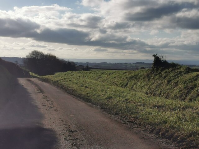
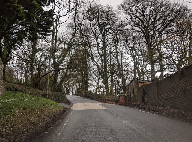
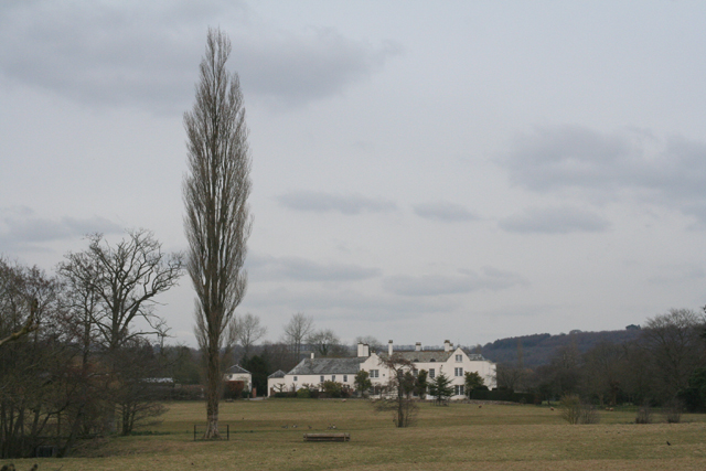
Allergrove Copse Images

Images are sourced within 2km of 50.817754/-3.2490776 or Grid Reference ST1202. Thanks to Geograph Open Source API. All images are credited.

Car Park in the Woods A woodland path with Witness Moor car park in the background just north of Hembury Hill Fort.
Car Park in the Woods
A woodland path with Witness Moor car park in the background just north of Hembury Hill Fort.
Iron Age Earth Works The impressive iron age earthworks of Hembury Hill Fort in Devon are becoming overgrown but still visible.
Iron Age Earth Works
The impressive iron age earthworks of Hembury Hill Fort in Devon are becoming overgrown but still visible.
Footpath on top of the Hill The public footpath through the gorse and bracken on top of Hembury Hill Fort in Devon.
Footpath on top of the Hill
The public footpath through the gorse and bracken on top of Hembury Hill Fort in Devon.
Public Footpath Signpost Public footpath sign post marking the crossroads of several footpaths on top of Hembury Hill Fort in Devon.
Public Footpath Signpost
Public footpath sign post marking the crossroads of several footpaths on top of Hembury Hill Fort in Devon.
Hill Summit The perceived summit of the iron age fort on Hembury Hill.
Hill Summit
The perceived summit of the iron age fort on Hembury Hill.
Hill Fort Noticeboard The noticeboard of the iron age Hembury Hill Fort in Devon situated on the approach to the first earthworks just south of the carpark.
Hill Fort Noticeboard
The noticeboard of the iron age Hembury Hill Fort in Devon situated on the approach to the first earthworks just south of the carpark.
Power for the people  Looking West from under the electricity pylons as they cross a footpath.
Power for the people
Looking West from under the electricity pylons as they cross a footpath.
Footbridge over the river Wolf The River Wolf feeds into the River Otter.
Footbridge over the river Wolf
The River Wolf feeds into the River Otter.
Awliscombe from Bushy Knap looking towards St Cyres hill in the distance.
Awliscombe from Bushy Knap
looking towards St Cyres hill in the distance.
Payhembury : Country Lane Looking along a small lane.
Payhembury : Country Lane
Looking along a small lane.
Passing Broadleaze on the A373, heading east
Steep up hill on the A373
Dangerous slippery road for 1 mile on the A373, heading east
Steep downhill and sharp bend on the A373, heading east
Staggered junction ahead on the A373, heading east
On the A373 heading east, sign for A. R. Boland Ltd
Houses next to the A373 near Awliscombe
Nap View joins the A373 in Awliscombe
Show me another place!

Allergrove Copse is located at Grid Ref: ST1202 (Lat: 50.817754, Lng: -3.2490776)

Administrative County: Devon

District: East Devon

Police Authority: Devon and Cornwall

What 3 Words

///porridge.jingles.stuffy. Near Honiton, Devon

Nearby Locations

Allergrove Copse

Related Wikis

Hembury

Hembury is a Neolithic causewayed enclosure and Iron Age hillfort near Honiton in Devon. Its history stretches from the late fifth and early fourth millennia...

Awliscombe

Awliscombe is a village and civil parish in the East Devon district of Devon, England. The village is about two miles west of Honiton. The 2011 census...

Buckerell

Buckerell is a small village and civil parish in the East Devon district of Devon, England. The village is about 2.5 miles west of the nearest town, Honiton...

Broadhembury

Broadhembury is a village and civil parish in the East Devon district of Devon, England, 5 miles (8 km) north-west of Honiton.The civil parish includes...

Deer Park Country House, Buckerell

Deer Park Country House near Honiton, Devon is a house of historical significance and is Grade II listed on the English Heritage Register. It was built...
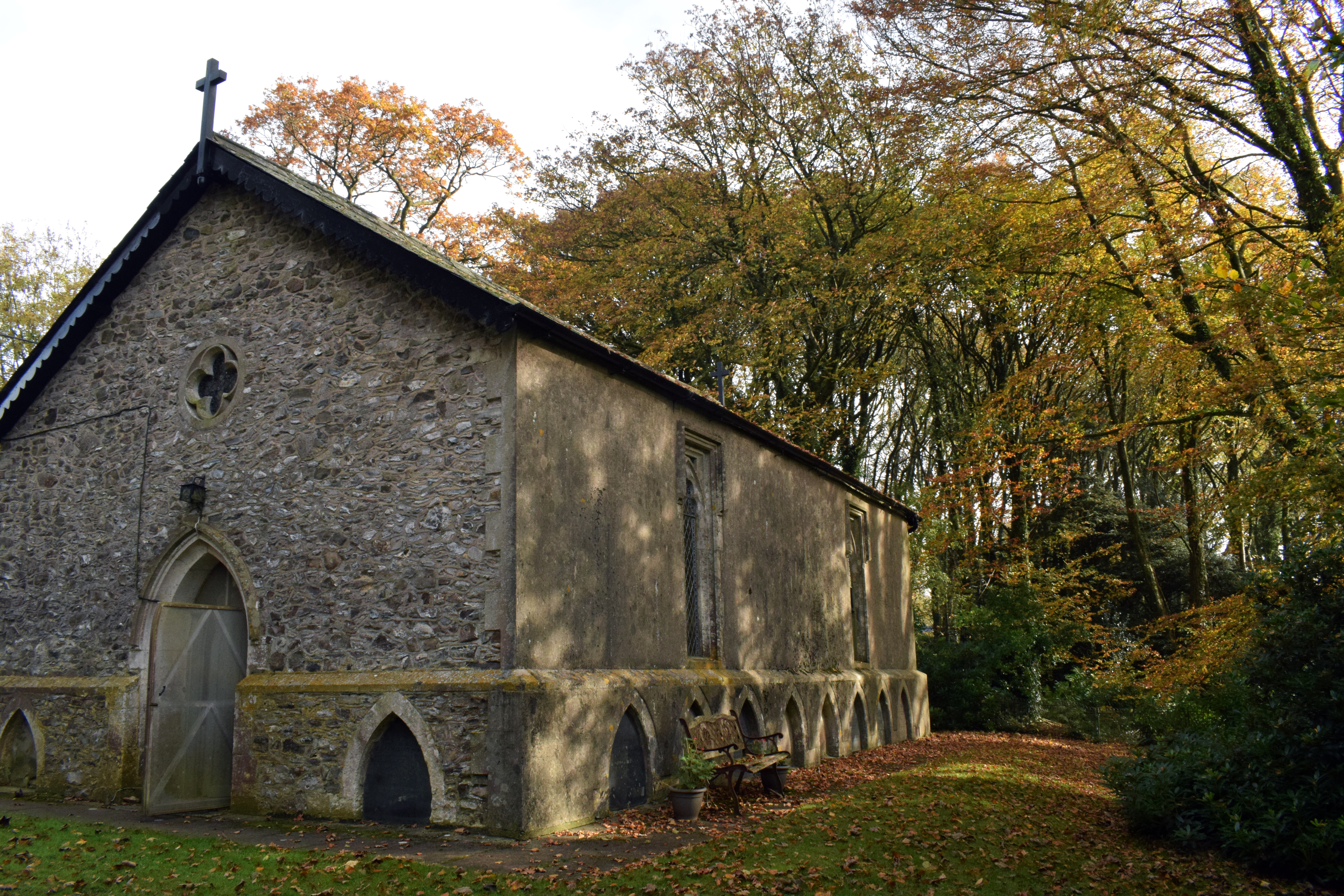
Wolford Chapel

Wolford Chapel in Devon, England, is the burial place of John Graves Simcoe, the first lieutenant governor of Upper Canada. It is the territory of the...

The Grange, Broadhembury

The Grange is a historic estate in the parish of Broadhembury in Devon, England. The surviving 16th-century mansion house (known as The Grange) is listed...

Payhembury

Payhembury is a village and civil parish in the East Devon district of Devon, England. The village is about six miles west of Honiton. At the time of...

Nearby Amenities

Located within 500m of 50.817754,-3.2490776
Buckerell Cross
Junction: yes
Place: locality
Lat/Long: 50.8147107/-3.2475175
Give Way
Direction: forward
Lat/Long: 50.8147796/-3.2475912
Give Way
Direction: forward
Lat/Long: 50.8145452/-3.2473734
Give Way
Direction: forward
Lat/Long: 50.8160902/-3.2525057
Power: pole
Source: bing
Lat/Long: 50.8156336/-3.2539296
Power: pole
Source: bing
Lat/Long: 50.8142968/-3.2489258
Power: pole
Source: bing
Lat/Long: 50.8138473/-3.2472264
Generator Method: photovoltaic
Generator Output Electricity: yes
Generator Source: solar
Generator Type: solar_photovoltaic_panel
Location: roof
Power: generator
Lat/Long: 50.8156877/-3.2495552
Generator Method: photovoltaic
Generator Output Electricity: yes
Generator Source: solar
Generator Type: solar_photovoltaic_panel
Location: roof
Power: generator
Lat/Long: 50.8156614/-3.2496156
Generator Method: photovoltaic
Generator Output Electricity: yes
Generator Source: solar
Generator Type: solar_photovoltaic_panel
Location: roof
Power: generator
Lat/Long: 50.8189083/-3.2471681
Power: pole
Source: bing
Lat/Long: 50.8171637/-3.2529402
Power: pole
Source: bing
Lat/Long: 50.8163974/-3.2534391
Power: pole
Source: bing
Lat/Long: 50.8162991/-3.2535025
Power: pole
Source: bing
Lat/Long: 50.8210053/-3.253195
Power: pole
Source: bing
Lat/Long: 50.820419/-3.2530327
Power: pole
Source: bing
Lat/Long: 50.8195277/-3.2528114
Power: pole
Source: bing
Lat/Long: 50.8179915/-3.2524118
Power: pole
Source: bing
Lat/Long: 50.8183948/-3.2525298
Power: pole
Source: bing
Lat/Long: 50.8186761/-3.2525875
Power: pole
Source: bing
Transformer: distribution
Lat/Long: 50.8189744/-3.2526585
Power: pole
Source: bing
Lat/Long: 50.8152615/-3.2450357
Power: pole
Source: bing
Lat/Long: 50.8163766/-3.2448158
Power: pole
Source: bing
Transformer: distribution
Lat/Long: 50.8177094/-3.244797
Power: pole
Source: bing
Lat/Long: 50.8191142/-3.2447722
Power: pole
Source: bing
Transformer: distribution
Lat/Long: 50.8204986/-3.2447447
Power: pole
Source: bing
Lat/Long: 50.8203385/-3.2433526
The data included in this document is from www.openstreetmap.org. The data is made available under ODbL.

Have you been to Allergrove Copse?

Leave your review of Allergrove Copse below (or comments, questions and feedback).