Ewecrag Wood

Wood, Forest in Cumberland Copeland

England

Ewecrag Wood

Muncaster castle A view of Muncaster castle looking in a NE direction
Muncaster castle Credit: neil hanson

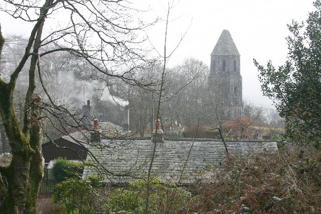
Ewecrag Wood is a picturesque woodland located in Cumberland, a county in the northwestern part of England. Covering an area of approximately 100 acres, it is a popular destination for nature enthusiasts and those seeking tranquility amidst the beautiful British countryside.

The woodland is characterized by its diverse range of tree species, including oak, ash, birch, and beech. These trees create a dense canopy that provides shade and shelter for a variety of wildlife, such as deer, squirrels, and numerous bird species. The forest floor is adorned with carpets of bluebells and other wildflowers during the spring, adding to the area's natural beauty.

A network of well-maintained trails winds through Ewecrag Wood, allowing visitors to explore its many delights. These paths offer opportunities for leisurely strolls or more challenging hikes, catering to a range of fitness levels. Along the way, visitors can discover charming clearings, babbling brooks, and ancient stone walls that showcase the area's rich history.

Ewecrag Wood is not only a haven for wildlife and recreational activities but also holds cultural significance. It is believed that the wood has been in existence for centuries and has witnessed various historical events. Local folklore and legends often intertwine with the woodland, adding an air of mystery and intrigue to the area.

Managed by a local conservation organization, Ewecrag Wood is dedicated to preserving the natural environment and promoting sustainable practices. It offers a serene retreat from the hustle and bustle of everyday life, providing a chance to reconnect with nature and appreciate the wonders of Cumberland's rural landscape.

If you have any feedback on the listing, please let us know in the comments section below.

Ewecrag Wood Images

Images are sourced within 2km of 54.357382/-3.3542718 or Grid Reference SD1296. Thanks to Geograph Open Source API. All images are credited.

Muncaster castle A view of Muncaster castle looking in a NE direction
Muncaster castle
A view of Muncaster castle looking in a NE direction
Trig Point on Hooker Crag This is the highest point on Muncaster Fell.
Scafell in the distance one way and a lovely view of a well known Nuclear Reprocessing Plant in the other.
Trig Point on Hooker Crag
This is the highest point on Muncaster Fell. Scafell in the distance one way and a lovely view of a well known Nuclear Reprocessing Plant in the other.
Muncaster Fell View of the summit, looking east.
Muncaster Fell
View of the summit, looking east.
Footpath alongside Chapel Wood This part of the wood is a relatively new extension of the original, which was more of an ornamental surround for the artificial tarn.
Footpath alongside Chapel Wood
This part of the wood is a relatively new extension of the original, which was more of an ornamental surround for the artificial tarn.
Muncaster Tarn Artificially enlarged by damming. The surrounding woods are currently being thinned and harvested.
Muncaster Tarn
Artificially enlarged by damming. The surrounding woods are currently being thinned and harvested.
Chapels and Monument, Muncaster Above Chapel Woods. A "private" sign, fencing and wire prevent legal access from the track above. Muncaster Castle has a website, for further information.
Chapels and Monument, Muncaster
Above Chapel Woods. A "private" sign, fencing and wire prevent legal access from the track above. Muncaster Castle has a website, for further information.
Rough Grazing Looking south-east
Rough Grazing
Looking south-east
Golf Course Looking south from the bridleway.
Golf Course
Looking south from the bridleway.
New Golf Course The house with mini pond and mini bridge is High Eskholme.
New Golf Course
The house with mini pond and mini bridge is High Eskholme.
Timber Harvesting, Muncaster Fell
Stock's Bridge An unusual design, using galvanised steel, wire and timber. Crosses the River Esk.
Stock's Bridge
An unusual design, using galvanised steel, wire and timber. Crosses the River Esk.
River Esk At Stock's Bridge. Now in the final run-out into the sea, the crystal clear river meanders gently.
River Esk
At Stock's Bridge. Now in the final run-out into the sea, the crystal clear river meanders gently.
River Esk Looking west
River Esk
Looking west
Nether Stainton and Tower A small hamlet, with Stainton Tower on the skyline
Nether Stainton and Tower
A small hamlet, with Stainton Tower on the skyline
Muncaster Field track leading to the Muncaster cottages and Monument
Muncaster
Field track leading to the Muncaster cottages and Monument
Muncaster Tarn An artificial lake created by damming both ends of an upland valley
Muncaster Tarn
An artificial lake created by damming both ends of an upland valley
Muncaster Castle
Muncaster Castle
Show me another place!

Ewecrag Wood is located at Grid Ref: SD1296 (Lat: 54.357382, Lng: -3.3542718)

Administrative County: Cumbria

District: Copeland

Police Authority: Cumbria

What 3 Words

///drape.monitors.nags. Near Seascale, Cumbria

Related Wikis

St Michael's Church, Muncaster

St Michael's Church is in the grounds of Muncaster Castle, near Ravenglass, Cumbria, England. It is an active Anglican parish church in the deanery of...

Muncaster

Muncaster is a civil parish in Cumbria, North West England. The parish is 41 miles (66 km) south west of the city of Carlisle, in the Copeland district...

Muncaster Castle

Muncaster Castle is a privately owned castle overlooking the River Esk, about a mile east of the west-coastal town of Ravenglass in Cumbria, England. It...

Muncaster Fell

Muncaster Fell is a fell at the far western edge of the Lake District National Park, in Cumbria, England. Muncaster Fell is a long, narrow ridge of land...

Broad Oak, Cumbria

Broad Oak is a hamlet in Cumbria, England. It is located along the A595 road, 14.4 miles (23.2 km) by road south of Egremont. == See also == List of places...

Miteside Halt railway station

Miteside Halt railway station is a railway station on the 15" gauge Ravenglass & Eskdale Railway in Cumbria, England. It is located where public footpath...

St John's Church, Waberthwaite

St John's Church is situated on the south bank of the River Esk in the hamlet of Hall Waberthwaite in the former civil parish of Waberthwaite (now part...

Murthwaite Halt railway station

Murthwaite Halt railway station is a small intermediate railway station on the 15" gauge Ravenglass & Eskdale Railway in Cumbria, England. It is named...

Nearby Amenities

Located within 500m of 54.357382,-3.3542718
Waste Wood
Natural: wood
Lat/Long: 54.3580397/-3.3482661
Ewe Crag
Place: locality
Lat/Long: 54.3564162/-3.3526419
Lease Knott
Place: locality
Lat/Long: 54.3549907/-3.3492301
Howbank
Place: locality
Lat/Long: 54.3569851/-3.3578454
Birkby
Place: locality
Lat/Long: 54.3543007/-3.3540391
Ewecrag Wood
Natural: wood
Lat/Long: 54.3580304/-3.3532241
Whins Wood
Natural: wood
Lat/Long: 54.3593337/-3.3529922
Hinninghouse Wood
Natural: wood
Lat/Long: 54.3606258/-3.3499326
Power: pole
Lat/Long: 54.3554721/-3.3603689
Power: pole
Lat/Long: 54.3562082/-3.3598377
Power: pole
Lat/Long: 54.3568417/-3.359375
Power: pole
Lat/Long: 54.357874/-3.3596196
Power: pole
Lat/Long: 54.3586756/-3.3598113
Power: pole
Lat/Long: 54.3590949/-3.3598869
Power: pole
Lat/Long: 54.3599928/-3.3600769
Power: pole
Lat/Long: 54.3570642/-3.3576722
Power: pole
Lat/Long: 54.3584188/-3.3584383
Power: pole
Lat/Long: 54.3587674/-3.3576502
Power: pole
Lat/Long: 54.3594603/-3.356118
Power: pole
Lat/Long: 54.3602158/-3.3546755
Power: pole
Lat/Long: 54.3606442/-3.3539067
Power: pole
Lat/Long: 54.3612326/-3.3532101
The data included in this document is from www.openstreetmap.org. The data is made available under ODbL.

Have you been to Ewecrag Wood?

Leave your review of Ewecrag Wood below (or comments, questions and feedback).