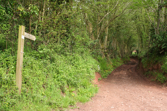
The Plantation

Wood, Forest in Somerset Somerset West and Taunton

England

The Plantation

Valley near Ford From the same spot as <a href="https://www.geograph.org.uk/photo/1716296">ST0928 : Valley at Ford</a>, looking directly across the valley between Castle Hill and Tipnoller Hill. The left side of the wood, in <a href="https://www.geograph.org.uk/gridref/ST0929">ST0929</a>, hides the disused Tipnoller Quarry and a couple of lime kilns. Visible is Tipnoller Cottage.
Valley near Ford Credit: Derek Harper

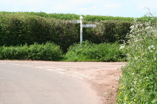
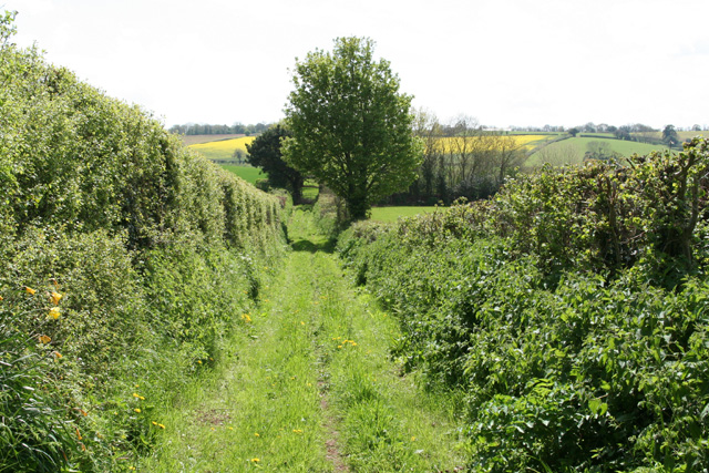
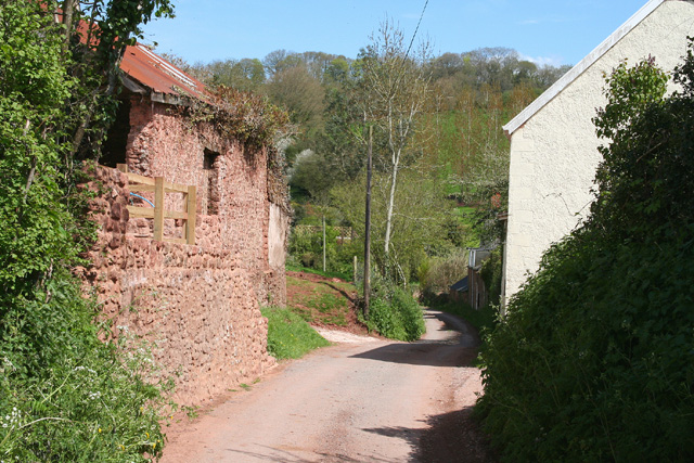
The Plantation, Somerset, also known as Wood or Forest Plantation, is a vast area of land located in Somerset, England. Covering approximately 500 acres, it is characterized by its dense woodland and diverse range of tree species.

The Plantation is a haven for nature enthusiasts and hikers, with its network of well-maintained trails that wind through the forest, offering breathtaking views and a chance to explore the rich biodiversity of the area. The woodland is predominantly made up of native trees such as oak, beech, and ash, creating a vibrant and lush environment.

Wildlife thrives in The Plantation, with various species of birds, mammals, and insects calling it home. Birdwatchers can spot a variety of species, including woodpeckers, owls, and warblers. The forest also provides a habitat for mammals like deer, foxes, and rabbits.

The Plantation is a popular destination for outdoor activities such as walking, cycling, and horseback riding. The well-marked trails cater to all levels of fitness and offer a chance to immerse oneself in the tranquility of the woodland.

Visitors can also enjoy picnicking and camping in designated areas, allowing for a peaceful retreat surrounded by nature. The Plantation is well-maintained, with regular upkeep and conservation efforts to preserve its natural beauty.

Overall, The Plantation, Somerset, provides a scenic and serene escape from the bustling city life, offering a chance to connect with nature and enjoy the peacefulness of a woodland setting.

If you have any feedback on the listing, please let us know in the comments section below.

The Plantation Images

Images are sourced within 2km of 51.05152/-3.2609503 or Grid Reference ST1128. Thanks to Geograph Open Source API. All images are credited.

Valley near Ford From the same spot as <a href="https://www.geograph.org.uk/photo/1716296">ST0928 : Valley at Ford</a>, looking directly across the valley between Castle Hill and Tipnoller Hill. The left side of the wood, in <a href="https://www.geograph.org.uk/gridref/ST0929">ST0929</a>, hides the disused Tipnoller Quarry and a couple of lime kilns. Visible is Tipnoller Cottage.
Valley near Ford
From the same spot as ST0928 : Valley at Ford, looking directly across the valley between Castle Hill and Tipnoller Hill. The left side of the wood, in ST0929, hides the disused Tipnoller Quarry and a couple of lime kilns. Visible is Tipnoller Cottage.
Fitzhead: by Road’s Barn Poultry farm with free-range hens. Eggs for sale here
Fitzhead: by Road’s Barn
Poultry farm with free-range hens. Eggs for sale here
Fitzhead: St James the Great In 1791 the church was dedicated to St Mary Magdalene. Until 1755 this was a daughter church or chapelry of Wiveliscombe; it was rebuilt in 1849. A new north aisle was added in 1887. The west tower survives from the earlier church and is 15th century
Fitzhead: St James the Great
In 1791 the church was dedicated to St Mary Magdalene. Until 1755 this was a daughter church or chapelry of Wiveliscombe; it was rebuilt in 1849. A new north aisle was added in 1887. The west tower survives from the earlier church and is 15th century
Fitzhead: St James the Great The 15th century west tower, the survivor from the medieval church
Fitzhead: St James the Great
The 15th century west tower, the survivor from the medieval church
Fitzhead: north west from the village Landscape with woods and fields. Looking north towards the Quantocks
Fitzhead: north west from the village
Landscape with woods and fields. Looking north towards the Quantocks
Wiveliscombe: barns at Hillacre Farm Now converted for residential use. Looking north from the A361 Trunk Road
Wiveliscombe: barns at Hillacre Farm
Now converted for residential use. Looking north from the A361 Trunk Road
Fitzhead: near Beech Tree Cross Looking over farmland with Fitzhead church in mid distance and the Quantocks beyond
Fitzhead: near Beech Tree Cross
Looking over farmland with Fitzhead church in mid distance and the Quantocks beyond
Halse: Combe Cross Looking north west
Halse: Combe Cross
Looking north west
Fitzhead: near Brownsells Footpath to Dean Farm. Looking south-south-west
Fitzhead: near Brownsells
Footpath to Dean Farm. Looking south-south-west
Lydeard St Lawrence: Chapel Leigh Chapel Leigh is a hamlet consisting of two farms and a number of cottages. Looking east-north-east
Lydeard St Lawrence: Chapel Leigh
Chapel Leigh is a hamlet consisting of two farms and a number of cottages. Looking east-north-east
Halse: barns at Northway Farm Looking north-north-west
Halse: barns at Northway Farm
Looking north-north-west
Fitzhead: limekiln near Burrow Hill Farm Looking south
Fitzhead: limekiln near Burrow Hill Farm
Looking south
Fitzhead: towards Pitsford Hill The field nearest the camera adjoins the lane from Fitzhead to Oakhampton Farm. In the distance is Willett Hill. Looking north-north-west
Fitzhead: towards Pitsford Hill
The field nearest the camera adjoins the lane from Fitzhead to Oakhampton Farm. In the distance is Willett Hill. Looking north-north-west
Fitzhead: view from above Wheatley’s Copse Looking south east by the public footpath to Fitzhead from Ford
Fitzhead: view from above Wheatley’s Copse
Looking south east by the public footpath to Fitzhead from Ford
Fitzhead: footpath to Ford The footpath follows the field edge. Looking north west
Fitzhead: footpath to Ford
The footpath follows the field edge. Looking north west
Fitzhead: near Brewers Farm Friendly horses by the footpath from Fitzhead to Ford
Fitzhead: near Brewers Farm
Friendly horses by the footpath from Fitzhead to Ford
Wiveliscombe: Croford Hill Bridleway to Cat’s Ash. Looking east
Wiveliscombe: Croford Hill
Bridleway to Cat’s Ash. Looking east
Hoccombe Farm Hoccombe Farm seen from the meadow behind it. Leat running in the foreground. Date: 22/04/2006.
Hoccombe Farm
Hoccombe Farm seen from the meadow behind it. Leat running in the foreground. Date: 22/04/2006.
Show me another place!

The Plantation is located at Grid Ref: ST1128 (Lat: 51.05152, Lng: -3.2609503)

Administrative County: Somerset

District: Somerset West and Taunton

Police Authority: Avon and Somerset

What 3 Words

///butlers.internal.keeps. Near Milverton, Somerset

Nearby Locations

Fitzhead The Plantation

Related Wikis

Fitzhead

Fitzhead is a village and civil parish in Somerset, England, situated approximately 6 miles (9.7 km) north west of Taunton. The village has an estimated...

Church of St James the Great, Fitzhead

The Anglican Church of St James the Great in Fitzhead, Somerset, England was built in the 15th century. It is a Grade II* listed building. == History... ==

Fitzhead Court and The Manor

Fitzhead Court and The Manor in Fitzhead, Somerset, England was built in the late 16th century and has now been split into two buildings. It is a Grade...

King's Castle, Wiveliscombe

King's Castle is an Iron Age Hillfort 1 kilometre (0.62 mi) east of Wiveliscombe in Somerset, England. It is surrounded by two banks with a ditch between...

Halse, Somerset

Halse is a village and civil parish in Somerset, England, situated 6 miles (9.7 km) north west of Taunton. The village has a population of 290. == History... ==

The Old House, Milverton

The Old House in Milverton in Somerset, England is a Grade II* listed building dating from the late 14th and early 15th century, although there may also...

Gaulden Manor

Gaulden Manor (also Gavelden or Gaveldene) is a Grade II* listed country house to the southeast of Tolland, Somerset, England. It is a double storied building...

Ruby Country

Ruby Country is the name given to the rural inland hinterland of north-west Devon, UK. It covers 45 parishes around the market towns of Holsworthy and...

Nearby Amenities

Located within 500m of 51.05152,-3.2609503
Fitzhead
Is In: Somerset, England, UK
Place: village
Wikidata: Q2798565
Wikipedia: en:Fitzhead
Lat/Long: 51.0487357/-3.2579363
The data included in this document is from www.openstreetmap.org. The data is made available under ODbL.

Have you been to The Plantation?

Leave your review of The Plantation below (or comments, questions and feedback).