Bellhanger's Copse

Wood, Forest in Somerset Somerset West and Taunton

England

Bellhanger's Copse

West Somerset : Willett Hill Willett Hill off of the B3224.
West Somerset : Willett Hill Credit: Lewis Clarke

Bellhanger's Copse is a picturesque woodland located in Somerset, England. Spanning approximately 50 acres, it is renowned for its natural beauty and diverse ecosystem. The copse is situated amidst rolling hills, providing a tranquil retreat for nature enthusiasts and outdoor adventurers alike.

The woodland is primarily composed of deciduous trees, including oak, beech, and ash, which create a dense canopy and provide ample shade during the summer months. These trees also offer a stunning display of colors during autumn, attracting visitors from far and wide. The forest floor is covered in a rich carpet of moss, ferns, and wildflowers, adding to the area's enchanting ambience.

Bellhanger's Copse is home to a variety of wildlife, making it a haven for nature lovers. Birdwatchers can spot species such as woodpeckers, owls, and thrushes, while small mammals like rabbits, squirrels, and badgers can be observed scurrying through the undergrowth. The copse also provides habitat for several rare and protected species, including the lesser horseshoe bat and the dormouse.

The woodland offers a network of well-maintained trails, allowing visitors to explore its beauty on foot. These paths wind through the forest, offering glimpses of babbling brooks and small ponds along the way. The copse is also a popular destination for recreational activities such as hiking, picnicking, and photography.

With its captivating scenery and abundant wildlife, Bellhanger's Copse is a must-visit destination for nature enthusiasts seeking a peaceful escape in the heart of Somerset.

If you have any feedback on the listing, please let us know in the comments section below.

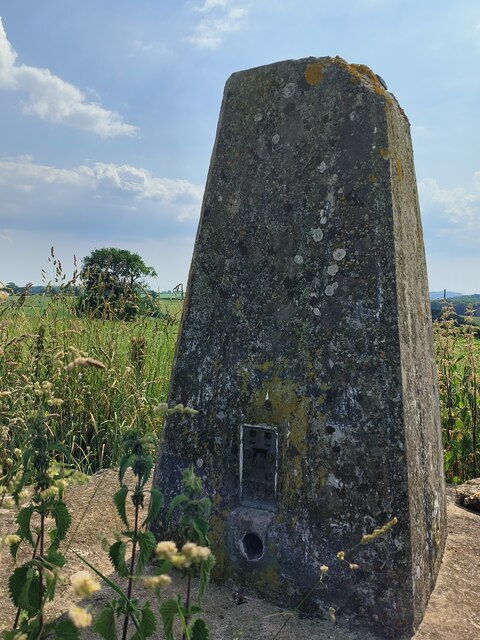
Bellhanger's Copse Images

Images are sourced within 2km of 51.090635/-3.2678543 or Grid Reference ST1133. Thanks to Geograph Open Source API. All images are credited.

West Somerset : Willett Hill Willett Hill off of the B3224.
West Somerset : Willett Hill
Willett Hill off of the B3224.
View from Willett Hill, West Somerset View from Willett Hill, looking towards Colwell Farmhouse in Brompton Ralph parish
View from Willett Hill, West Somerset
View from Willett Hill, looking towards Colwell Farmhouse in Brompton Ralph parish
Field, Willett Hill At 300m above sea level beside the Willett Hill Plantation in the Brendon Hills.
Field, Willett Hill
At 300m above sea level beside the Willett Hill Plantation in the Brendon Hills.
Willett Hill Plantation Forestry Commission sign.  A relief to see that "shooting let" does not mean an attempt to keep folk out for once.
Willett Hill Plantation
Forestry Commission sign. A relief to see that "shooting let" does not mean an attempt to keep folk out for once.
Turning for Tolland
Turning for Tolland
Channel to Channel (454) This is the folly known as Willett Tower - see <span class="nowrap"><a title="http://webapp1.somerset.gov.uk/her/details.asp?prn=30710" rel="nofollow ugc noopener" href="http://webapp1.somerset.gov.uk/her/details.asp?prn=30710">Link</a><img style="margin-left:2px;" alt="External link" title="External link - shift click to open in new window" src="https://s1.geograph.org.uk/img/external.png" width="10" height="10"/></span>.
For a close view see <a title="https://www.geograph.org.uk/photo/79885" href="https://www.geograph.org.uk/photo/79885">Link</a>.
Channel to Channel (454)
This is the folly known as Willett Tower - see LinkExternal link. For a close view see Link.
Tower on Willett Hill. I think this was built as a folly and at one time did have a roof. Through the arch is a glimpse of the Quantocks. There are stunning views to the South and East. Willett Hill is "open access" land.
Tower on Willett Hill.
I think this was built as a folly and at one time did have a roof. Through the arch is a glimpse of the Quantocks. There are stunning views to the South and East. Willett Hill is "open access" land.
Sign entering Tolland The sign announcing the village, on the lane from Brompton Ralph as it passes trees and approaches modern houses at the west end of the village. The West Deane Way follows the lane.
Sign entering Tolland
The sign announcing the village, on the lane from Brompton Ralph as it passes trees and approaches modern houses at the west end of the village. The West Deane Way follows the lane.
Parks Cottage Another view of the cottage shown in <a href="https://www.geograph.org.uk/photo/152268">ST0932 : Brompton Ralph: Parks Cottage</a>, this time from the lane from Tolland. The West Deane Way follows the lane and then turns up the B3188 past the cottage.
Parks Cottage
Another view of the cottage shown in ST0932 : Brompton Ralph: Parks Cottage, this time from the lane from Tolland. The West Deane Way follows the lane and then turns up the B3188 past the cottage.
Tolland Down Barn A view from the same gateway as <a href="https://www.geograph.org.uk/photo/1843519">ST0932 : Parks Cottage</a> looking across the Halse Water valley and up towards Willett Hill. The barn is the site of a development of new farm buildings, hence what I think must be temporary buildings nearby.
Tolland Down Barn
A view from the same gateway as ST0932 : Parks Cottage looking across the Halse Water valley and up towards Willett Hill. The barn is the site of a development of new farm buildings, hence what I think must be temporary buildings nearby.
B3188 at Parks Cottage This is similar to <a href="https://www.geograph.org.uk/photo/152268">ST0932 : Brompton Ralph: Parks Cottage</a>, but taken across the road at the Tolland junction. Beyond Parks Cottage is the Old School House, at the junction with the lane to Brompton Ralph. Looks like a new building has gone up in between.
B3188 at Parks Cottage
This is similar to ST0932 : Brompton Ralph: Parks Cottage, but taken across the road at the Tolland junction. Beyond Parks Cottage is the Old School House, at the junction with the lane to Brompton Ralph. Looks like a new building has gone up in between.
Willett Hill Plantation A junction of rides on the north side of the plantation, southeast of the car park by the B3224.
Willett Hill Plantation
A junction of rides on the north side of the plantation, southeast of the car park by the B3224.
Willett Hill Cross The B3224 passes a crossroads, with a lane on the right leading to Sheepsteading Lane and Cats' Castle Hill, and Truckwell Lane, restricted byway WL 9/2, on the left.
Willett Hill Cross
The B3224 passes a crossroads, with a lane on the right leading to Sheepsteading Lane and Cats' Castle Hill, and Truckwell Lane, restricted byway WL 9/2, on the left.
Signpost, Willett Hill Cross A close-up of the signpost seen in <a href="https://www.geograph.org.uk/photo/1902379">ST0934 : Willett Hill Cross</a>. The byway to the left is naturally ignored.
Signpost, Willett Hill Cross
A close-up of the signpost seen in ST0934 : Willett Hill Cross. The byway to the left is naturally ignored.
Taunton Turnpike Trust terminus stone The photograph shows the condition of the metal plate on the terminus stone on 25 August 2021. The stone is in Elworthy parish (just), near to Bridgets Farm on the B3224. The text reads 'HERE ENDS THE TAUNTON TRUST'. The Taunton Trust was in operation from 1752 to 1875.
Taunton Turnpike Trust terminus stone
The photograph shows the condition of the metal plate on the terminus stone on 25 August 2021. The stone is in Elworthy parish (just), near to Bridgets Farm on the B3224. The text reads 'HERE ENDS THE TAUNTON TRUST'. The Taunton Trust was in operation from 1752 to 1875.
Taunton Turnpike Trust terminus stone The photograph shows the condition of the metal plate on the terminus stone after refurbishment in September 2021. Works were undertaken by a volunteer working on behalf of The South West Heritage Trust, which supplied the paint and materials. The stone is in Elworthy parish (just), near to Bridgets Farm on the B3224. The Taunton Trust was in operation from 1752 until 1875.
Taunton Turnpike Trust terminus stone
The photograph shows the condition of the metal plate on the terminus stone after refurbishment in September 2021. Works were undertaken by a volunteer working on behalf of The South West Heritage Trust, which supplied the paint and materials. The stone is in Elworthy parish (just), near to Bridgets Farm on the B3224. The Taunton Trust was in operation from 1752 until 1875.
Direction Sign – Signpost near Gaulden Manor Located on the northeast side of a T junction southeast of Gaulden Manor and west of Handy Cross in Lydeard St Lawrence parish. 4 arms, 1 missing, and pyramid finial. See also <a title="https://www.geograph.org.uk/photo/4099886" href="https://www.geograph.org.uk/photo/4099886">Link</a>.

Milestone Society National ID: SO_ST1131
Direction Sign – Signpost near Gaulden Manor
Located on the northeast side of a T junction southeast of Gaulden Manor and west of Handy Cross in Lydeard St Lawrence parish. 4 arms, 1 missing, and pyramid finial. See also Link. Milestone Society National ID: SO_ST1131
Dene's Cross Trig Point
Show me another place!

Bellhanger's Copse is located at Grid Ref: ST1133 (Lat: 51.090635, Lng: -3.2678543)

Administrative County: Somerset

District: Somerset West and Taunton

Police Authority: Avon and Somerset

What 3 Words

///photo.chop.isolating. Near Wiveliscombe, Somerset

Related Wikis

Tolland, Somerset

Tolland is a village and civil parish in Somerset, England, situated 9 miles (14.5 km) north west of Taunton, between the Brendon Hills and Quantock Hills...

Lydeard St Lawrence

Lydeard St Lawrence or St Lawrence Lydiard is a village and civil parish in Somerset, England, situated 7 miles (11.3 km) north west of Taunton. The village...

Gaulden Manor

Gaulden Manor (also Gavelden or Gaveldene) is a Grade II* listed country house to the southeast of Tolland, Somerset, England. It is a double storied building...

Ruby Country

Ruby Country is the name given to the rural inland hinterland of north-west Devon, UK. It covers 45 parishes around the market towns of Holsworthy and...

Crowcombe Heathfield railway station

Crowcombe Heathfield railway station is a station on the West Somerset Railway, a heritage railway in Somerset, England. It is situated 2 miles (3.2 km...

Brompton Ralph

Brompton Ralph is a village and civil parish in the Somerset West and Taunton district of Somerset, England, about 11 miles (18 km) west of Taunton, and...

Church of St Mary, Brompton Ralph

The Anglican Church of St Mary in Brompton Ralph, Somerset, England was built in the 15th century. It is a Grade II* listed building. == History == Parts...

Roebuck Meadows

Roebuck Meadows (grid reference ST132354) is a 3.6 hectare (8.9 acre) biological Site of Special Scientific Interest south of Crowcombe in Somerset, notified...

Related Videos

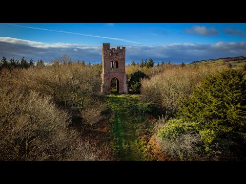
Photography walk at Willett Tower in Exmoor.

Join me as I discover a slightly disappointing Willett tower, the day after storm Arwen, a short walk up to the tower where I prove ...

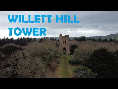
Willett Hill Tower, Somerset - DJI Mini 2 Drone

A small, rough collection of clips from the forest plantation and the Tower of Willett Hill near Taunton in Somerset. #drone ...

Nearby Amenities

Located within 500m of 51.090635,-3.2678543
Ford: yes
Lat/Long: 51.0912055/-3.2644361
Brand: National Grid
Brand Wikidata: Q1465461
Material: wood
Operator: National Grid Electricity Distribution Plc
Operator Old: Western Power Distribution
Operator Wikidata: Q7988183
Owner: National Grid Electricity Distribution (South West) Plc
Owner Wikidata: Q114397866
Power: pole
Lat/Long: 51.0907854/-3.2611644
Watering Place
Access: private
Lat/Long: 51.0919366/-3.269657
Watering Place
Access: private
Lat/Long: 51.0920629/-3.27121
Watering Place
Access: private
Lat/Long: 51.0910045/-3.2749658
Watering Place
Access: private
Lat/Long: 51.089856/-3.272818
Watering Place
Access: private
Lat/Long: 51.0895216/-3.2694914
Watering Place
Access: private
Lat/Long: 51.0902515/-3.2627859
Watering Place
Access: private
Lat/Long: 51.0912914/-3.2660884
Watering Place
Access: private
Lat/Long: 51.0924672/-3.2651174
Watering Place
Access: private
Lat/Long: 51.0878899/-3.2720912
Watering Place
Access: private
Lat/Long: 51.0865884/-3.2697013
Watering Place
Access: private
Lat/Long: 51.088885/-3.2639044
Watering Place
Access: private
Lat/Long: 51.0938107/-3.2643872
Watering Place
Access: private
Lat/Long: 51.0931057/-3.2630521
Watering Place
Access: private
Lat/Long: 51.090529/-3.2619651
Brand: National Grid
Brand Wikidata: Q1465461
Layer: 1
Operator: National Grid Electricity Distribution Plc
Operator Old: Western Power Distribution
Operator Wikidata: Q7988183
Owner: National Grid Electricity Distribution (South West) Plc
Owner Wikidata: Q114397866
Power: terminal
Lat/Long: 51.0948585/-3.2659367
Brand: National Grid
Brand Wikidata: Q1465461
Devices: 1
Frequency: 50
Location Transition: yes
Material: wood
Operator: National Grid Electricity Distribution Plc
Operator Old: Western Power Distribution
Operator Wikidata: Q7988183
Owner: National Grid Electricity Distribution (South West) Plc
Owner Wikidata: Q114397866
Phases: 1
Power: pole
Transformer: distribution
Lat/Long: 51.0872939/-3.2665557
Brand: National Grid
Brand Wikidata: Q1465461
Material: wood
Operator: National Grid Electricity Distribution Plc
Operator Old: Western Power Distribution
Operator Wikidata: Q7988183
Owner: National Grid Electricity Distribution (South West) Plc
Owner Wikidata: Q114397866
Power: pole
Lat/Long: 51.0875176/-3.2657585
Brand: National Grid
Brand Wikidata: Q1465461
Material: wood
Operator: National Grid Electricity Distribution Plc
Operator Old: Western Power Distribution
Operator Wikidata: Q7988183
Owner: National Grid Electricity Distribution (South West) Plc
Owner Wikidata: Q114397866
Power: pole
Lat/Long: 51.0877695/-3.2648586
Brand: National Grid
Brand Wikidata: Q1465461
Material: wood
Operator: National Grid Electricity Distribution Plc
Operator Old: Western Power Distribution
Operator Wikidata: Q7988183
Owner: National Grid Electricity Distribution (South West) Plc
Owner Wikidata: Q114397866
Power: pole
Lat/Long: 51.0889092/-3.263889
Brand: National Grid
Brand Wikidata: Q1465461
Material: wood
Operator: National Grid Electricity Distribution Plc
Operator Old: Western Power Distribution
Operator Wikidata: Q7988183
Owner: National Grid Electricity Distribution (South West) Plc
Owner Wikidata: Q114397866
Power: pole
Lat/Long: 51.0883364/-3.2643771
Brand: National Grid
Brand Wikidata: Q1465461
Material: wood
Operator: National Grid Electricity Distribution Plc
Operator Old: Western Power Distribution
Operator Wikidata: Q7988183
Owner: National Grid Electricity Distribution (South West) Plc
Owner Wikidata: Q114397866
Power: pole
Lat/Long: 51.0895881/-3.2633069
Brand: National Grid
Brand Wikidata: Q1465461
Devices: 1
Frequency: 50
Line Management: split
Location Transition: yes
Material: wood
Operator: National Grid Electricity Distribution Plc
Operator Old: Western Power Distribution
Operator Wikidata: Q7988183
Owner: National Grid Electricity Distribution (South West) Plc
Owner Wikidata: Q114397866
Phases: 3
Power: pole
Transformer: distribution
Lat/Long: 51.090262/-3.2627463
Brand: National Grid
Brand Wikidata: Q1465461
Material: wood
Operator: National Grid Electricity Distribution Plc
Operator Old: Western Power Distribution
Operator Wikidata: Q7988183
Owner: National Grid Electricity Distribution (South West) Plc
Owner Wikidata: Q114397866
Power: pole
Lat/Long: 51.0905316/-3.2619953
The data included in this document is from www.openstreetmap.org. The data is made available under ODbL.

Have you been to Bellhanger's Copse?

Leave your review of Bellhanger's Copse below (or comments, questions and feedback).