Brimmet's Wood

Wood, Forest in Somerset Somerset West and Taunton

England

Brimmet's Wood

Path up Beacon Hill near Staple Plain Car Park
Path up Beacon Hill near Staple Plain Car Park Credit: David Martin

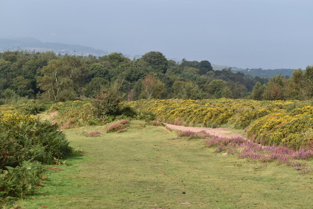
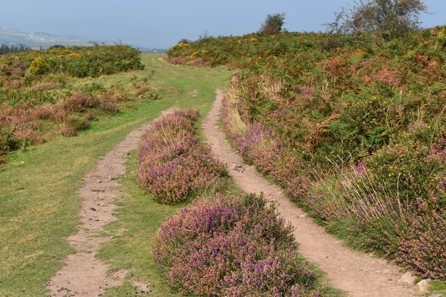
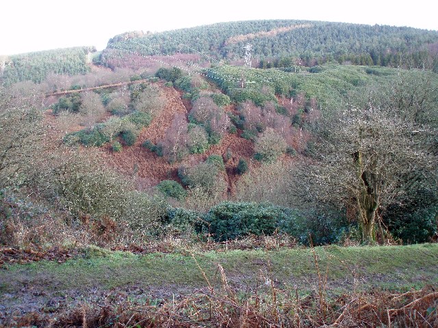
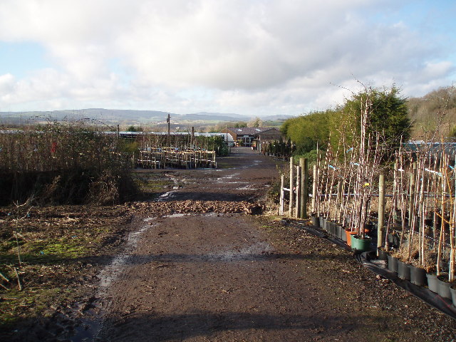
Brimmet's Wood, located in Somerset, England, is a picturesque woodland that covers an area of approximately 25 acres. It is nestled within the rolling hills of the beautiful Somerset countryside, making it a popular destination for nature lovers and outdoor enthusiasts.

This ancient woodland boasts a diverse range of tree species, including oak, beech, ash, and birch, which create a rich and vibrant canopy overhead. The forest floor is adorned with a variety of wildflowers, ferns, and mosses, adding to the enchanting atmosphere of the wood.

Brimmet's Wood is home to a plethora of wildlife, making it a haven for nature enthusiasts. Visitors may spot various bird species, such as woodpeckers, owls, and thrushes, as well as small mammals like squirrels, rabbits, and foxes. The wood is also known for its diverse insect population, including butterflies and dragonflies.

The wood offers a network of well-maintained footpaths, allowing visitors to explore its beauty while enjoying leisurely walks or invigorating hikes. There are also designated picnic areas, providing a perfect spot to relax and enjoy the serene surroundings.

Brimmet's Wood is steeped in history and folklore, with tales of ancient rituals and mythical creatures associated with the area. It is a place that captures the imagination and offers a glimpse into the past.

Overall, Brimmet's Wood is a captivating natural wonder that offers a tranquil escape from the hustle and bustle of everyday life. Its lush vegetation, abundant wildlife, and rich history make it a must-visit destination for those seeking a genuine connection with nature.

If you have any feedback on the listing, please let us know in the comments section below.

Brimmet's Wood Images

Images are sourced within 2km of 51.174308/-3.2730095 or Grid Reference ST1142. Thanks to Geograph Open Source API. All images are credited.

Path up Beacon Hill near Staple Plain Car Park
Path on Beacon Hill
Path on Beacon Hill
Bank of gorse on Beacon Hill
Path on Beacon Hill
Path on Beacon Hill
Sheep on the path on Round Hill
Heather on northern flank of Beacon Hill
St Etheldreda's Church
The Orangery at St Audries Park
The Northern Flank of Beacon Hill (Quantocks) In late summer the northern Quantocks are ablaze with Heather and Gorse.  Minehead can be seen in the distance
The Northern Flank of Beacon Hill (Quantocks)
In late summer the northern Quantocks are ablaze with Heather and Gorse. Minehead can be seen in the distance
St. Audries Church A charming little church, next to the A39 in West Quantoxhead
St. Audries Church
A charming little church, next to the A39 in West Quantoxhead
The Orangery, St Audries Park At one time St. Audries Park was a posh girls'-school, or is that posh-girls' school?  Anyway it is now a business that specialises in weddings.  The service takes place in the Orangery and the rest of the festivities take place in the house, behind us.
The Orangery, St Audries Park
At one time St. Audries Park was a posh girls'-school, or is that posh-girls' school? Anyway it is now a business that specialises in weddings. The service takes place in the Orangery and the rest of the festivities take place in the house, behind us.
St Audries Park The house was once a girl's school, but is now used for weddings.
St Audries Park
The house was once a girl's school, but is now used for weddings.
Waterfall between Doniford and St. Audries Bay This waterfall plunges straight down onto the beach and can only be reached on foot at low tide. There will soon be some more falls of vegetation and rock from the top. The horizontal strata are very well defined.
Waterfall between Doniford and St. Audries Bay
This waterfall plunges straight down onto the beach and can only be reached on foot at low tide. There will soon be some more falls of vegetation and rock from the top. The horizontal strata are very well defined.
Eastwards from Doniford. The waterfall in the other photograph for this square plunges from the striped cliff face on the extreme left of the picture.
Eastwards from Doniford.
The waterfall in the other photograph for this square plunges from the striped cliff face on the extreme left of the picture.
Changing face of the Quantocks. The photograph shows how the rhododendron bushes are encroaching into areas that were previously bracken, even on very steep slopes. Some efforts are being made to cut them down but are probably doomed to failure. They do look stunning in the spring though!
Changing face of the Quantocks.
The photograph shows how the rhododendron bushes are encroaching into areas that were previously bracken, even on very steep slopes. Some efforts are being made to cut them down but are probably doomed to failure. They do look stunning in the spring though!
Wibble Farm Nurseries. This is a traditional working family nursery where plants are grown on from cuttings until ready for sale. The emphasis is on hardy perennials, shrubs and trees. Being in the South West and very near the coast lots of plants can be grown that wouldn't be hardy in other areas of the country.
Wibble Farm Nurseries.
This is a traditional working family nursery where plants are grown on from cuttings until ready for sale. The emphasis is on hardy perennials, shrubs and trees. Being in the South West and very near the coast lots of plants can be grown that wouldn't be hardy in other areas of the country.
Caravan Park St Audrie's Bay Holiday Club
Caravan Park
St Audrie's Bay Holiday Club
Field on a Hillside
Field on a Hillside
Show me another place!

Brimmet's Wood is located at Grid Ref: ST1142 (Lat: 51.174308, Lng: -3.2730095)

Administrative County: Somerset

District: Somerset West and Taunton

Police Authority: Avon and Somerset

What 3 Words

///driven.scariest.deeper. Near Williton, Somerset

Nearby Locations

Brimmet's Wood

Related Wikis

St Audries Park

St Audries Park Manor house at West Quantoxhead in the Quantock Hills of Somerset, England, was the manor house of the Acland family. It was rebuilt on...

West Quantoxhead

West Quantoxhead is a small village and civil parish in the Somerset West and Taunton district of Somerset, England. It lies on the route of the Coleridge...

Church of St Etheldreda, West Quantoxhead

The Church of St Etheldreda, also known as the Church of St Audries, is a Church of England parish church in West Quantoxhead, Somerset, England. Designed...

East Quantoxhead

East Quantoxhead is a village in the district of Somerset West and Taunton, 3 miles (5 km) from West Quantoxhead, 4 miles (6 km) east of Williton, and...

Williton railway station

Williton railway station in Williton, Somerset, England, was opened by the West Somerset Railway in 1862 and closed by British Rail in 1971. It was reopened...

Doniford Halt railway station

Doniford Halt railway station, sometimes known as Doniford Beach Halt, is a request stop situated on the West Somerset Railway, a heritage railway in...

Williton

Williton is a large village and civil parish in Somerset, England, at the junction of the A39, A358 and B3191 roads, on the coast 2 miles (3.2 km) south...

Williton Rural District

Williton was a rural district in Somerset, England, from 1894 to 1974. It was created in 1894 under the Local Government Act 1894. In 1974 it was abolished...

Nearby Amenities

Located within 500m of 51.174308,-3.2730095
St Audries Park
Addr City: Taunton
Addr Country: GB
Addr County: Somerset
Addr Postcode: TA4 4DS
Addr Street: Church Road
Addr Village: West Quantoxhead
Fhrs Authority: West Somerset
Fhrs Id: 160560
Fhrs Local Authority Id: PI/000000261
Tourism: hotel
Website: https://www.audries-park.co.uk/
Wikidata: Q7592527
Wikipedia: en:St Audries Park
Lat/Long: 51.1732626/-3.2736886
Entrance: yes
Lat/Long: 51.1731465/-3.2740423
Entrance: yes
Lat/Long: 51.1732675/-3.2733463
Barrier: entrance
Bicycle: yes
Foot: yes
Motorcar: yes
Lat/Long: 51.1733761/-3.2731628
Bench
Backrest: yes
Material: wood
Seats: 4
Lat/Long: 51.1725317/-3.2702766
Turning Circle
Lat/Long: 51.1776498/-3.2772382
Turning Circle
Lat/Long: 51.1777815/-3.2743849
Turning Circle
Lat/Long: 51.1784007/-3.2754123
The data included in this document is from www.openstreetmap.org. The data is made available under ODbL.

Have you been to Brimmet's Wood?

Leave your review of Brimmet's Wood below (or comments, questions and feedback).