Cleasby

Settlement in Yorkshire Richmondshire

England

Cleasby

Woodland near the A66(M)
Woodland near the A66(M) Credit: Anthony Parkes

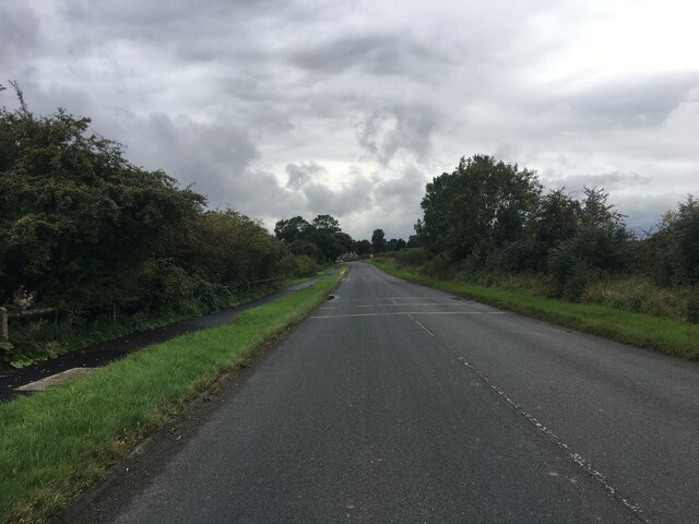
Cleasby is a small village located in the Richmondshire district of North Yorkshire, England. Situated on the banks of the River Tees, it lies approximately 3 miles northwest of the historic market town of Darlington.

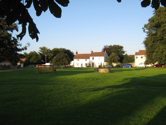
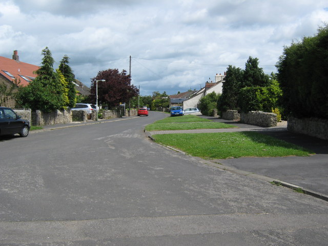
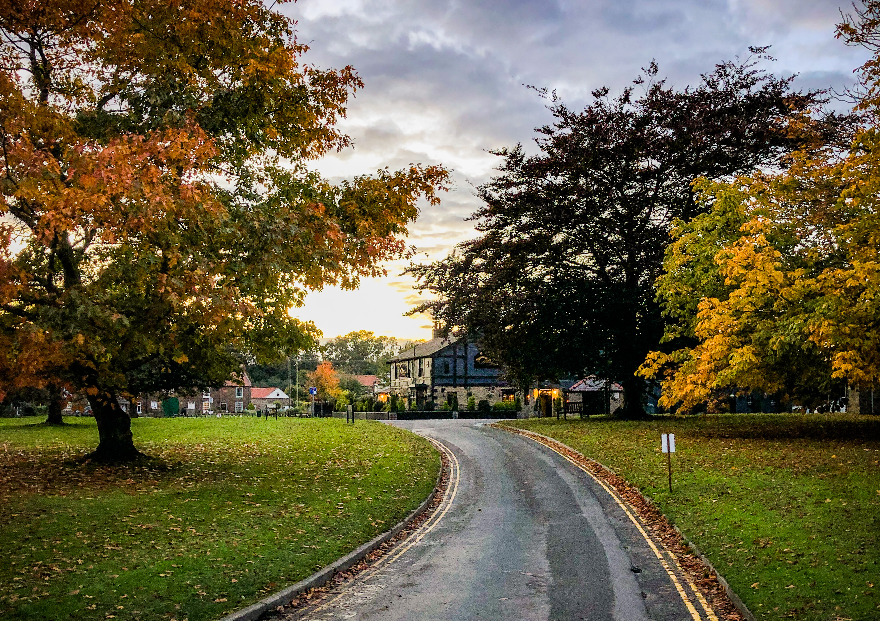
With a population of around 200 people, Cleasby is known for its picturesque rural setting, surrounded by rolling hills and farmland. The village is characterized by its charming stone cottages and a quaint, close-knit community atmosphere.

Cleasby has a rich history, dating back to Roman times when it was an important settlement along the Roman road leading to Piercebridge. The village was mentioned in the Domesday Book of 1086 as "Clesbi," indicating its long-standing presence in the region.

Despite its small size, Cleasby offers several amenities to its residents, including a local pub, the Shoulder of Mutton, which serves as a social hub for the community. The village also has a beautiful Norman church, St. Peter's, which dates back to the 12th century and features stunning stained glass windows.

The surrounding countryside provides ample opportunities for outdoor activities, such as hiking, cycling, and fishing, with the River Tees offering a popular spot for anglers. Additionally, Cleasby is within close proximity to the Yorkshire Dales National Park, providing further access to stunning natural landscapes.

Overall, Cleasby offers a tranquil and idyllic setting for those seeking a peaceful rural lifestyle, while still providing easy access to nearby towns and amenities.

If you have any feedback on the listing, please let us know in the comments section below.

Cleasby Images

Images are sourced within 2km of 54.511625/-1.614986 or Grid Reference NZ2512. Thanks to Geograph Open Source API. All images are credited.
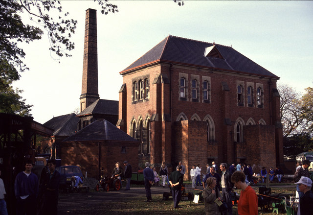
Woodland near the A66(M)
Old Milestone by A67, Conniscliffe Road, Broken Brae carpark, near pumping station The Milestone is located on grass verge on the South of the road.  Parish of Low Coniscliffe And Merrybent (Darlington District). Carved stone post, BC/D stone design, erected by the Stockton & Barnard Castle turnpike trust in the 18th Century, part buried underground. An earlier photograph can be found here: <a title="https://www.geograph.org.uk/photo/5624048" href="https://www.geograph.org.uk/photo/5624048">Link</a> 

Inscription reads:-  
BC / (14)  : : D / (2)  

Milestone Society National ID: DU_DABC02
Old Milestone by A67, Conniscliffe Road, Broken Brae carpark, near pumping station
The Milestone is located on grass verge on the South of the road.  Parish of Low Coniscliffe And Merrybent (Darlington District). Carved stone post, BC/D stone design, erected by the Stockton & Barnard Castle turnpike trust in the 18th Century, part buried underground. An earlier photograph can be found here: Link  Inscription reads:- BC / (14) : : D / (2) Milestone Society National ID: DU_DABC02
Old Milepost by A67, Merrybent, by No.12, "Cedar Ridge" The Milepost is located back of footpath on the SouthWest of the road.  Parish of Low Coniscliffe And Merrybent (Darlington District). Cast iron post, Durham county iron casting design, erected by the County Council in the 19/20th Century. An earlier photograph can be found here: <a title="https://www.geograph.org.uk/photo/5624049" href="https://www.geograph.org.uk/photo/5624049">Link</a> 

Inscription reads:-  
{hand} / BARNARD / CASTLE / 13 / MILES  : : {hand} / DARLINGTON / 3 / MILES : : DURHAM COUNTY 

Grade II listed. List Entry Number: 1322970 <span class="nowrap"><a title="https://historicengland.org.uk/listing/the-list/list-entry/1322970" rel="nofollow ugc noopener" href="https://historicengland.org.uk/listing/the-list/list-entry/1322970">Link</a><img style="margin-left:2px;" alt="External link" title="External link - shift click to open in new window" src="https://s1.geograph.org.uk/img/external.png" width="10" height="10"/></span> 

Milestone Society National ID: DU_DABC03
Old Milepost by A67, Merrybent, by No.12, "Cedar Ridge"
The Milepost is located back of footpath on the SouthWest of the road.  Parish of Low Coniscliffe And Merrybent (Darlington District). Cast iron post, Durham county iron casting design, erected by the County Council in the 19/20th Century. An earlier photograph can be found here: Link  Inscription reads:- {hand} / BARNARD / CASTLE / 13 / MILES : : {hand} / DARLINGTON / 3 / MILES : : DURHAM COUNTY Grade II listed. List Entry Number: 1322970 LinkExternal link Milestone Society National ID: DU_DABC03
Old Milestone, Stapleton Bank, Barton Road The milestone is located opposite the northern end of the drive to Cleasby Grange, on the verge on the east side of the road. Parish of Stapleton (Richmondshire District). Cast iron post, Bedale HD iron casting design, erected by the Local Highways Board in the 19th/20th century. 

Inscription reads:-
{pointing hand} / RICHMOND / 9 / MILES : : RICHMOND / H.D : : {pointing hand} / DARLINGTON / 3 / MILES : : F MATTISON & Co / BEDALE

Grade II Listed, List Entry Number: 1179817 <span class="nowrap"><a title="https://historicengland.org.uk/listing/the-list/list-entry/1179817" rel="nofollow ugc noopener" href="https://historicengland.org.uk/listing/the-list/list-entry/1179817">Link</a><img style="margin-left:2px;" alt="External link" title="External link - shift click to open in new window" src="https://s1.geograph.org.uk/img/external.png" width="10" height="10"/></span>

Milestone Society National ID: YN_RCDL09
Old Milestone, Stapleton Bank, Barton Road
The milestone is located opposite the northern end of the drive to Cleasby Grange, on the verge on the east side of the road. Parish of Stapleton (Richmondshire District). Cast iron post, Bedale HD iron casting design, erected by the Local Highways Board in the 19th/20th century. Inscription reads:- {pointing hand} / RICHMOND / 9 / MILES : : RICHMOND / H.D : : {pointing hand} / DARLINGTON / 3 / MILES : : F MATTISON & Co / BEDALE Grade II Listed, List Entry Number: 1179817 LinkExternal link Milestone Society National ID: YN_RCDL09
Tees Cottage Pumping Station, Darlington [1] The 1852 filter bed and the 1852 engine house. The pumping station was built on the north bank of the River Tees in 1849 to provide clean drinking water to Darlington and other parts of Teesside. It became a museum in 1980. The engine house now houses a gas engine, installed in 1914. Water is pumped up from the River Tees by the gas engine and then filtered through sand in this pond.
Tees Cottage Pumping Station, Darlington [1]
The 1852 filter bed and the 1852 engine house. The pumping station was built on the north bank of the River Tees in 1849 to provide clean drinking water to Darlington and other parts of Teesside. It became a museum in 1980. The engine house now houses a gas engine, installed in 1914. Water is pumped up from the River Tees by the gas engine and then filtered through sand in this pond.
Tees Cottage Pumping Station, Darlington [2] The 1849 filter beds and the 1904 beam engine house. The pumping station was built on the north bank of the River Tees in 1849 to provide clean drinking water to Darlington and other parts of Teesside. It became a museum in 1980. The beam engine pumps up water from river water into the filter beds, where it filters slowly through sand.
Tees Cottage Pumping Station, Darlington [2]
The 1849 filter beds and the 1904 beam engine house. The pumping station was built on the north bank of the River Tees in 1849 to provide clean drinking water to Darlington and other parts of Teesside. It became a museum in 1980. The beam engine pumps up water from river water into the filter beds, where it filters slowly through sand.
Tees Cottage Pumping Station, Darlington [3] Pumped river water entering both 1849 filter beds. The pumping station was built on the north bank of the River Tees in 1849 to provide clean drinking water to Darlington and other parts of Teesside. It became a museum in 1980.
Tees Cottage Pumping Station, Darlington [3]
Pumped river water entering both 1849 filter beds. The pumping station was built on the north bank of the River Tees in 1849 to provide clean drinking water to Darlington and other parts of Teesside. It became a museum in 1980.
Stockton and Darlington Model Engineers [1] Based at Tees Cottage pumping station.
Stockton and Darlington Model Engineers [1]
Based at Tees Cottage pumping station.
Tees Cottage Pumping Station, Darlington [4] The 1852 clear water tank. Filtered water was stored here before being pumped to a service reservoir. The pumping station was built on the north bank of the River Tees in 1849 to provide clean drinking water to Darlington and other parts of Teesside. It became a museum in 1980.
Tees Cottage Pumping Station, Darlington [4]
The 1852 clear water tank. Filtered water was stored here before being pumped to a service reservoir. The pumping station was built on the north bank of the River Tees in 1849 to provide clean drinking water to Darlington and other parts of Teesside. It became a museum in 1980.
Stockton and Darlington Model Engineers [2] Their railway track runs inside the southern boundary of the Tees Cottage pumping station [now a museum].
Stockton and Darlington Model Engineers [2]
Their railway track runs inside the southern boundary of the Tees Cottage pumping station [now a museum].
Tees Cottage Pumping Station, Darlington [5] The red cylinders outside the 1904 beam engine house were used to help smooth out differences in water pressure. Similar cylinders are outside the 1852 engine house.  The pumping station was built on the north bank of the River Tees in 1849 to provide clean drinking water to Darlington and other parts of Teesside. It became a museum in 1980.
Tees Cottage Pumping Station, Darlington [5]
The red cylinders outside the 1904 beam engine house were used to help smooth out differences in water pressure. Similar cylinders are outside the 1852 engine house. The pumping station was built on the north bank of the River Tees in 1849 to provide clean drinking water to Darlington and other parts of Teesside. It became a museum in 1980.
Stockton and Darlington Model Engineers [3] Four tracks heading east from the western turntable.
Stockton and Darlington Model Engineers [3]
Four tracks heading east from the western turntable.
Broken Scar Pumping and Filtration Works [1] Northumbrian Water's successor to Tees Cottage pumping station. Seen through a security fence.
Broken Scar Pumping and Filtration Works [1]
Northumbrian Water's successor to Tees Cottage pumping station. Seen through a security fence.
Broken Scar Pumping and Filtration Works [2] Northumbrian Water's successor to Tees Cottage pumping station. Seen through a security fence.
Broken Scar Pumping and Filtration Works [2]
Northumbrian Water's successor to Tees Cottage pumping station. Seen through a security fence.
Road towards Stapleton
Road towards Cleasby
Junction 57, A1(M) The A66(M) turnoff.
Junction 57, A1(M)
The A66(M) turnoff.
Footbridge ovr the A1(M) near High House The A1 is the longest numbered road in the UK at 410 miles long. It connects London with Edinburgh, via the east of England. 
For much of its path it follows the Great North Road the old coaching route between London and Edinburgh. Several sections of the route are classified as motorway A1(M). The modern A1 bypasses the towns the Great North Road passed through and is dual carriageway for most of its route through England.
Footbridge ovr the A1(M) near High House
The A1 is the longest numbered road in the UK at 410 miles long. It connects London with Edinburgh, via the east of England. For much of its path it follows the Great North Road the old coaching route between London and Edinburgh. Several sections of the route are classified as motorway A1(M). The modern A1 bypasses the towns the Great North Road passed through and is dual carriageway for most of its route through England.
Show me another place!

Cleasby is located at Grid Ref: NZ2512 (Lat: 54.511625, Lng: -1.614986)

Division: North Riding

Administrative County: North Yorkshire

District: Richmondshire

Police Authority: North Yorkshire

What 3 Words

///finishing.pardon.glitz. Near High Coniscliffe, Co. Durham

Nearby Locations

Cleasby Cleasby

Related Wikis

Cleasby

Cleasby is a village and civil parish in the North Yorkshire district of North Yorkshire, England. It is close to the River Tees and Darlington and the...

Low Coniscliffe

Low Coniscliffe is a village in the civil parish of Low Coniscliffe and Merrybent, in County Durham, England. The population of the civil parish taken...

Tees Cottage Pumping Station

Tees Cottage Pumping Station is a Victorian pumping station complex at Broken Scar on the A67 near Low Coniscliffe just west of Darlington. The site dates...

Stapleton-on-Tees

Stapleton (locally [stepəltən], ˈsteɪpltən), is a small village and civil parish on the River Tees, North Yorkshire, England. Historically, the settlement...

Nearby Amenities

Located within 500m of 54.511625,-1.614986
Power: pole
Lat/Long: 54.5153013/-1.6117425
Power: pole
Lat/Long: 54.508703/-1.6129268
Power: pole
Lat/Long: 54.5095215/-1.6124738
Power: pole
Lat/Long: 54.5099316/-1.6122425
Power: pole
Lat/Long: 54.5115944/-1.6113018
Power: pole
Lat/Long: 54.513011/-1.6127126
Power: pole
Lat/Long: 54.5138097/-1.6123791
Post Box
Lat/Long: 54.5118678/-1.6153508
Phone
Check Date: 2021-08-13
Emergency: phone
Ref: 9063A
Lat/Long: 54.5115608/-1.6203444
Power: pole
Lat/Long: 54.5128895/-1.6221568
Power: pole
Lat/Long: 54.5114307/-1.622517
Cleasby
Place: hamlet
Source: NLS-OS-1st_Series
Lat/Long: 54.5123357/-1.6139111
Power: pole
Lat/Long: 54.5100122/-1.6185321
Power: pole
Lat/Long: 54.5100535/-1.6184932
Power: pole
Lat/Long: 54.5105876/-1.617934
Power: pole
Lat/Long: 54.5110913/-1.6173962
Power: pole
Transformer: distribution
Lat/Long: 54.5116363/-1.6168208
Phone
Emergency: phone
Lat/Long: 54.5115904/-1.6199242
Power: pole
Lat/Long: 54.5106537/-1.6218621
Power: pole
Lat/Long: 54.5104614/-1.6206792
Power: pole
Lat/Long: 54.5102458/-1.6195326
Power: pole
Lat/Long: 54.5082284/-1.6193944
Power: pole
Lat/Long: 54.5091799/-1.6189438
The data included in this document is from www.openstreetmap.org. The data is made available under ODbL.

Have you been to Cleasby?

Leave your review of Cleasby below (or comments, questions and feedback).