Furze Hill Copse

Wood, Forest in Somerset Somerset West and Taunton

England

Furze Hill Copse

Wiveliscombe : Country Road A road heads through the countryside.
Wiveliscombe : Country Road Credit: Lewis Clarke

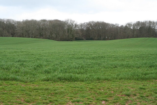
Furze Hill Copse is a picturesque woodland located in Somerset, England. Spanning approximately 20 acres, it is a captivating natural landscape that offers visitors a tranquil and serene environment to explore. The copse is situated on the outskirts of a small village, surrounded by rolling hills and meadows, adding to its charm.

The woodland primarily consists of deciduous trees, such as oak, beech, and ash, which create a dense canopy overhead, providing shade and shelter for various wildlife. The forest floor is adorned with a carpet of wildflowers, including bluebells, primroses, and wood anemones, which bloom in vibrant colors during the spring months.

Furze Hill Copse is home to a diverse range of fauna, making it a haven for nature enthusiasts. Visitors may spot various woodland birds, including woodpeckers, thrushes, and finches, as well as mammals such as squirrels, foxes, and badgers. The copse is also known for its rich insect population, with butterflies, bees, and beetles adding to the vibrant ecosystem.

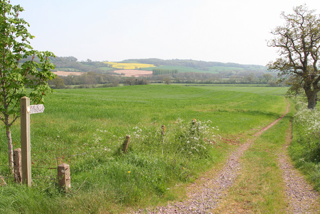
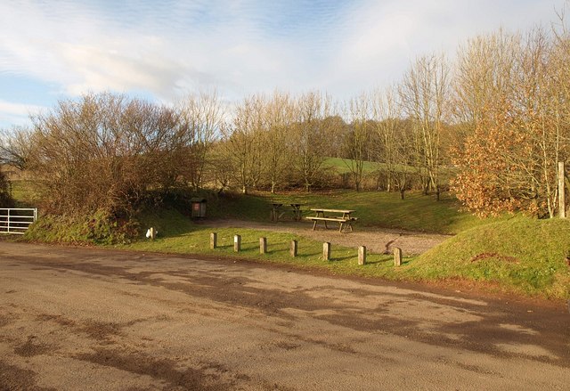
The copse offers several walking trails, allowing visitors to explore its beauty at their own pace. These well-marked paths wind through the woodland, offering breathtaking views and opportunities for wildlife spotting. Along the trails, there are strategically placed benches and picnic areas, providing perfect spots for visitors to rest and soak in the peaceful ambiance.

Furze Hill Copse is a true gem of Somerset, offering a delightful escape for nature lovers and a chance to immerse oneself in the pristine beauty of a traditional English woodland.

If you have any feedback on the listing, please let us know in the comments section below.

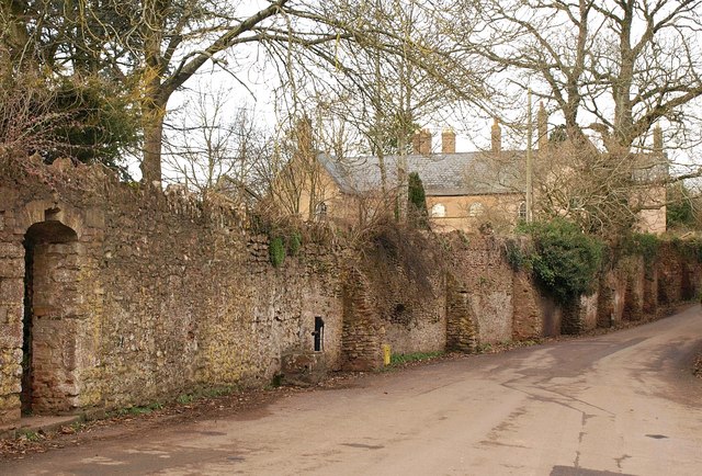
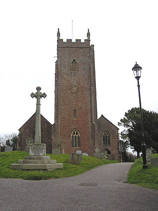
Furze Hill Copse Images

Images are sourced within 2km of 51.034085/-3.2748815 or Grid Reference ST1026. Thanks to Geograph Open Source API. All images are credited.

Wiveliscombe : Country Road A road heads through the countryside.
Wiveliscombe : Country Road
A road heads through the countryside.
Wiveliscombe : Fernicaps Park Looking towards the farm.
Wiveliscombe : Fernicaps Park
Looking towards the farm.
Wiveliscombe : Country Road Passing Lower Park Farm. The flag of Ukraine flies outside the house.
Wiveliscombe : Country Road
Passing Lower Park Farm. The flag of Ukraine flies outside the house.
Wiveliscombe : Country Road A tractor heads along the road.
Wiveliscombe : Country Road
A tractor heads along the road.
Wiveliscombe : Higher Park Farm A barn at the farm.
Wiveliscombe : Higher Park Farm
A barn at the farm.
Wiveliscombe : Higher Park Farm The house at the farm.
Wiveliscombe : Higher Park Farm
The house at the farm.
Bathealton : Countryside Scenery Looking to Screedy Barn.
Bathealton : Countryside Scenery
Looking to Screedy Barn.
Bathealton : Country Road A road heading through the countryside.
Bathealton : Country Road
A road heading through the countryside.
Milverton: Milverton Heath Seen from Screedy. Looking south
Milverton: Milverton Heath
Seen from Screedy. Looking south
Milverton: Milverton Heath Looking south
Milverton: Milverton Heath
Looking south
Wiveliscombe: footpath to Slape Moor The path runs on to Quakinghouse Lane, so named because of the early Quaker burial ground there. Looking south-south-west
Wiveliscombe: footpath to Slape Moor
The path runs on to Quakinghouse Lane, so named because of the early Quaker burial ground there. Looking south-south-west
Wiveliscombe: tractor and mower Trimming a meadow near Fernicaps Park and Lower Park Farm. Seen from the footpath to Farthings Farm. Looking north east
Wiveliscombe: tractor and mower
Trimming a meadow near Fernicaps Park and Lower Park Farm. Seen from the footpath to Farthings Farm. Looking north east
Beeches near Spring Grove Cross A fine row of beeches towers above the road from Spring Grove Cross towards Milverton Heath.
Beeches near Spring Grove Cross
A fine row of beeches towers above the road from Spring Grove Cross towards Milverton Heath.
Fields near Slape Moor Seen from the B3227, a field boundary cuts across the northern slopes of the valley of the Hillfarrance Brook. The brook runs along the diagonal line of woodland in the distance (and in <a href="https://www.geograph.org.uk/gridref/ST0926">ST0926</a>), beneath the hills crowned by Milverton Heath.
Fields near Slape Moor
Seen from the B3227, a field boundary cuts across the northern slopes of the valley of the Hillfarrance Brook. The brook runs along the diagonal line of woodland in the distance (and in ST0926), beneath the hills crowned by Milverton Heath.
Miscanthus, Fry's Farm Miscanthus is a significant crop in West Somerset and East Devon - see <a href="https://www.geograph.org.uk/photo/130581">ST0711 : Uffculme: miscanthus crop</a>. This field, which quickly crosses into <a href="https://www.geograph.org.uk/gridref/ST1026">ST1026</a>, climbs the hill towards Quaking House.
Miscanthus, Fry's Farm
Miscanthus is a significant crop in West Somerset and East Devon - see ST0711 : Uffculme: miscanthus crop. This field, which quickly crosses into ST1026, climbs the hill towards Quaking House.
Woodland track, Quarry Plantation A track leaving, though not really accessible from, the lane shown in <a href="https://www.geograph.org.uk/photo/1700447">ST0925 : Beeches near Spring Grove Cross</a>, and leading though woodland on Milverton Heath.
Woodland track, Quarry Plantation
A track leaving, though not really accessible from, the lane shown in ST0925 : Beeches near Spring Grove Cross, and leading though woodland on Milverton Heath.
Layby by the B3227 On the left is the B3227 between Milverton and Wiveliscombe, which can be glimpsed in the distance. Behind the camera, it runs along the course of the Devon and Somerset Railway; here it begins to diverge to the left (south) from that line.
Layby by the B3227
On the left is the B3227 between Milverton and Wiveliscombe, which can be glimpsed in the distance. Behind the camera, it runs along the course of the Devon and Somerset Railway; here it begins to diverge to the left (south) from that line.
Picnic table by the B3227 From the same spot as <a href="https://www.geograph.org.uk/photo/1716218">ST0927 : Layby by the B3227</a>, looking across the layby. The picnic table is on the course of the former railway line, its cutting behind.
Picnic table by the B3227
From the same spot as ST0927 : Layby by the B3227, looking across the layby. The picnic table is on the course of the former railway line, its cutting behind.
Show me another place!

Furze Hill Copse is located at Grid Ref: ST1026 (Lat: 51.034085, Lng: -3.2748815)

Administrative County: Somerset

District: Somerset West and Taunton

Police Authority: Avon and Somerset

What 3 Words

///stitch.hers.reclined. Near Milverton, Somerset

Related Wikis

Holme Moor & Clean Moor

Holme Moor & Clean Moor (grid reference ST095260) is a 10.8 hectare (26.7 acre) biological Site of Special Scientific Interest south of Wiveliscombe in...

King's Castle, Wiveliscombe

King's Castle is an Iron Age Hillfort 1 kilometre (0.62 mi) east of Wiveliscombe in Somerset, England. It is surrounded by two banks with a ditch between...

The Old House, Milverton

The Old House in Milverton in Somerset, England is a Grade II* listed building dating from the late 14th and early 15th century, although there may also...

Fitzhead

Fitzhead is a village and civil parish in Somerset, England, situated approximately 6 miles (9.7 km) north west of Taunton. The village has an estimated...

Church of St James the Great, Fitzhead

The Anglican Church of St James the Great in Fitzhead, Somerset, England was built in the 15th century. It is a Grade II* listed building. == History... ==

Fitzhead Court and The Manor

Fitzhead Court and The Manor in Fitzhead, Somerset, England was built in the late 16th century and has now been split into two buildings. It is a Grade...

Milverton, Somerset

Milverton is a village and civil parish in Somerset, England, situated in the valley of the River Tone 5 miles (8.0 km) west of Taunton. The village has...

Kingsmead School, Wiveliscombe

Kingsmead School (KS) is a coeducational state school in Wiveliscombe, Somerset, England, serving the north-west of Taunton Deane district. It had 804...

Nearby Amenities

Located within 500m of 51.034085,-3.2748815
Give Way
Direction: backward
Lat/Long: 51.0355014/-3.2690371
The data included in this document is from www.openstreetmap.org. The data is made available under ODbL.

Have you been to Furze Hill Copse?

Leave your review of Furze Hill Copse below (or comments, questions and feedback).