Callendown Wood
Wood, Forest in Somerset Somerset West and Taunton
England
Callendown Wood

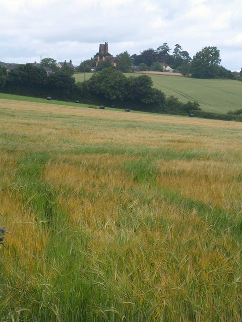
Callendown Wood is a picturesque woodland located in Somerset, England. Nestled in the rolling hills of the county, this enchanting forest covers an area of approximately 50 acres and is a popular destination for nature enthusiasts and walkers alike.
The wood is home to a rich variety of flora and fauna, with ancient oak and beech trees dominating the landscape. The dense canopy of leaves creates a tranquil and shaded atmosphere, perfect for escaping the hustle and bustle of everyday life. Bluebells carpet the forest floor in spring, creating a stunning display of vibrant colors, and birdsong fills the air throughout the year.
A network of well-maintained footpaths and trails wind their way through Callendown Wood, offering visitors the opportunity to explore its hidden corners and discover its hidden treasures. These paths lead to secluded clearings, babbling brooks, and small ponds, providing a haven for wildlife such as deer, badgers, and foxes.
Callendown Wood also holds historical significance, with remnants of an old Roman road running through its heart. This adds an additional layer of intrigue and charm to the woodland, as visitors can imagine the footsteps of ancient travelers who once traversed this very path.
Whether you're seeking solitude, a family outing, or a chance to reconnect with nature, Callendown Wood offers a magical experience. So, lace up your walking boots and immerse yourself in the natural beauty and tranquility of this beloved Somerset forest.
If you have any feedback on the listing, please let us know in the comments section below.
Callendown Wood Images
Images are sourced within 2km of 51.014533/-3.2897986 or Grid Reference ST0924. Thanks to Geograph Open Source API. All images are credited.


Callendown Wood is located at Grid Ref: ST0924 (Lat: 51.014533, Lng: -3.2897986)
Administrative County: Somerset
District: Somerset West and Taunton
Police Authority: Avon and Somerset
What 3 Words
///subsystem.life.variances. Near Milverton, Somerset
Nearby Locations
Related Wikis

Langford Heathfield
Langford Heathfield (grid reference ST100235) is a 95.4 hectare (235.7 acre) biological Site of Special Scientific Interest at Langford Budville, 3 km...

Holme Moor & Clean Moor
Holme Moor & Clean Moor (grid reference ST095260) is a 10.8 hectare (26.7 acre) biological Site of Special Scientific Interest south of Wiveliscombe in...

St Bartholomew's Church, Bathealton
St Bartholomew's Church is a Church of England parish church in Bathealton, Somerset, England. It was built in 1854 to the designs of C. E. Giles and is...

Bathealton
Bathealton is a village and civil parish in Somerset, England, situated 3 miles (4.8 km) west of Wellington and 8 miles (12.9 km) west of Taunton. The...
Bathealton Court
Bathealton Court is a Grade II listed country house in Bathealton, Somerset, England. It was built in around 1766 and underwent significant alteration...
Langford Budville
Langford Budville is a village and civil parish in Somerset, England, situated near the River Tone 2 miles (3.2 km) north-west of Wellington, 4.5 miles...
The Old House, Milverton
The Old House in Milverton in Somerset, England is a Grade II* listed building dating from the late 14th and early 15th century, although there may also...

Church of St Nicholas, Kittisford
The Anglican Church of St Nicholas in Kittisford, Somerset, England was built around 1500. It is a Grade II* listed building. == History == The church...
Have you been to Callendown Wood?
Leave your review of Callendown Wood below (or comments, questions and feedback).