Coram's Wood

Wood, Forest in Somerset Somerset West and Taunton

England

Coram's Wood

Langford Budville: Grand Western Canal at Higher Wellisford Here the canal ran in cutting, above and to the south of the river Tone. It was active from 1838 to 1867. A footpath now runs its course. Looking east
Langford Budville: Grand Western Canal at Higher Wellisford Credit: Martin Bodman

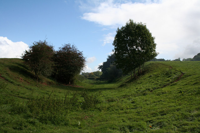
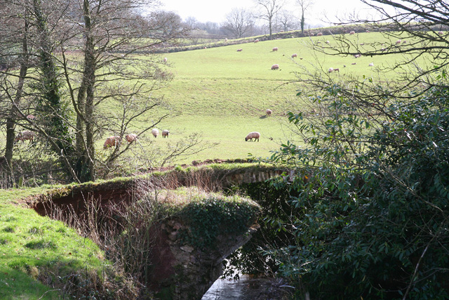
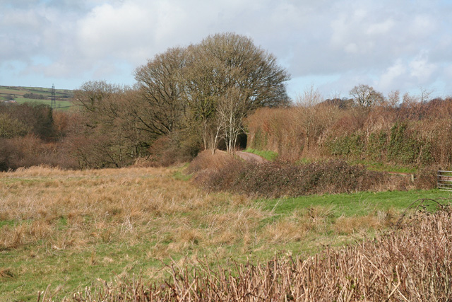
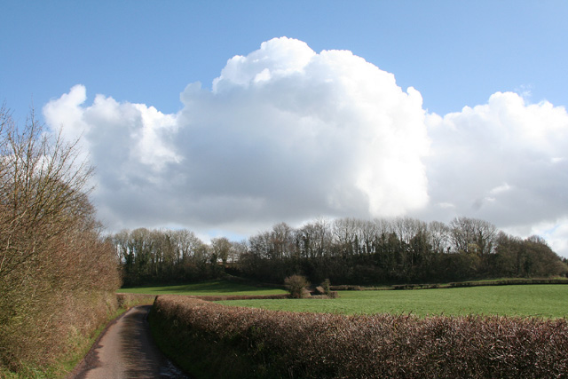
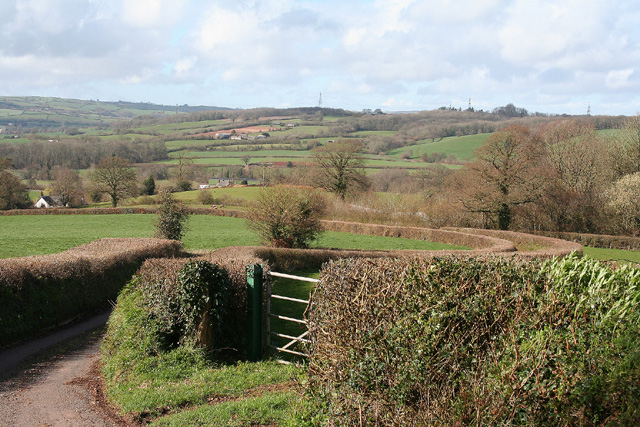
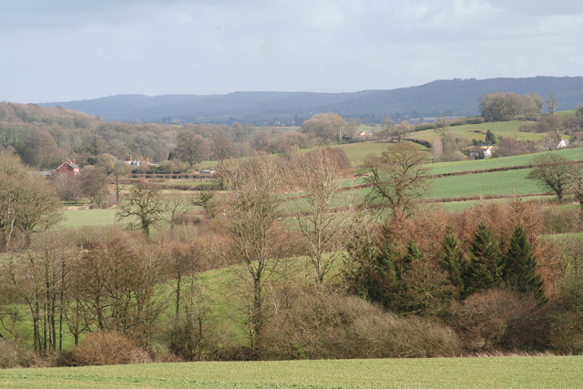
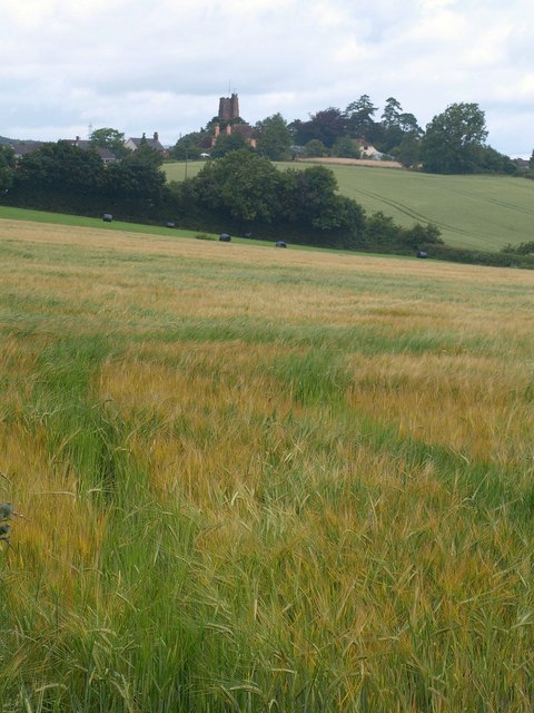
Coram's Wood is a picturesque woodland located in Somerset, England. Covering an area of approximately 100 acres, it is a popular destination for nature enthusiasts and hikers alike. The wood is nestled within the stunning Mendip Hills, offering visitors breathtaking views of the surrounding countryside.

The forest is primarily composed of broadleaf trees such as oak, beech, and ash, creating a diverse and vibrant ecosystem. The dense canopy provides shelter for various bird species, including woodpeckers and owls, making it a haven for birdwatchers. The forest floor is adorned with a rich carpet of wildflowers, adding bursts of color to the landscape during the spring and summer months.

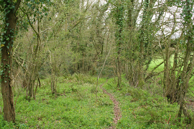
Coram's Wood boasts a network of well-maintained trails, allowing visitors to explore the area at their own pace. Whether it's a leisurely stroll or a more challenging hike, there is something for everyone. Along the trails, visitors may encounter wildlife such as deer, foxes, and badgers, adding to the allure of the woodland experience.

For those seeking solitude and tranquility, Coram's Wood offers secluded picnic spots and benches strategically placed to enjoy the serenity of nature. The wood also features a small stream that meanders through the forest, adding to its charm.

Managed by a local conservation organization, Coram's Wood is committed to preserving its natural beauty and protecting its wildlife. It is a place where visitors can escape the hustle and bustle of everyday life and immerse themselves in the wonders of nature.

If you have any feedback on the listing, please let us know in the comments section below.
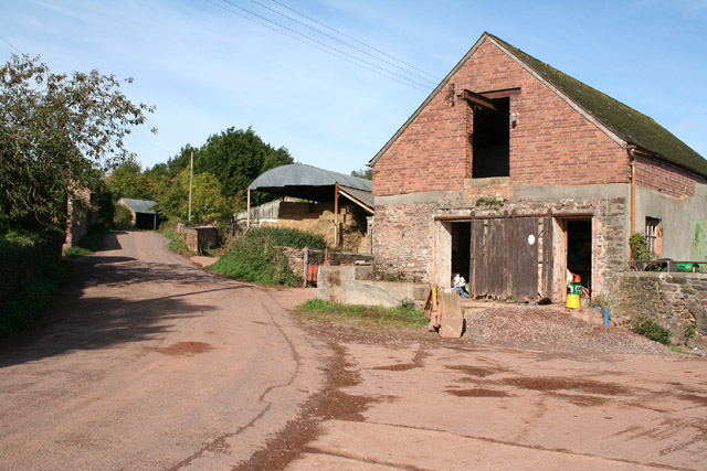
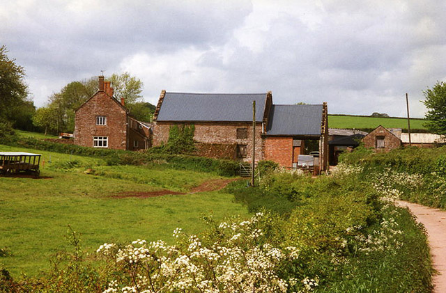
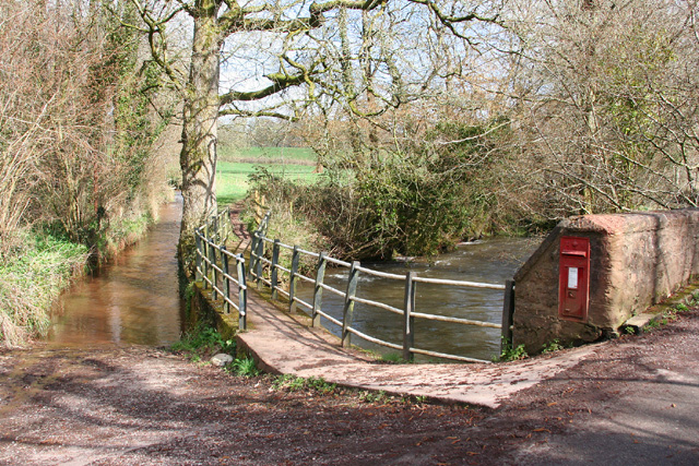
Coram's Wood Images

Images are sourced within 2km of 51.00156/-3.2918758 or Grid Reference ST0923. Thanks to Geograph Open Source API. All images are credited.

Langford Budville: Grand Western Canal at Higher Wellisford Here the canal ran in cutting, above and to the south of the river Tone. It was active from 1838 to 1867. A footpath now runs its course. Looking east
Langford Budville: Grand Western Canal at Higher Wellisford
Here the canal ran in cutting, above and to the south of the river Tone. It was active from 1838 to 1867. A footpath now runs its course. Looking east
Stawley: barns at Kittisford Barton On the lane known as Cockland Hill
Stawley: barns at Kittisford Barton
On the lane known as Cockland Hill
Bathealton: raised churchyard The church, dedicated to St Bartholomew, is a 19th century rebuilding
Bathealton: raised churchyard
The church, dedicated to St Bartholomew, is a 19th century rebuilding
Bathealton: Leigh Farm A pond to the south west of the farm fed a leat which powered a waterwheel here. A public footpath passes both pond and farm – at this point using the lane leading to the farm – but the wheel and machinery it drove have long gone
Bathealton: Leigh Farm
A pond to the south west of the farm fed a leat which powered a waterwheel here. A public footpath passes both pond and farm – at this point using the lane leading to the farm – but the wheel and machinery it drove have long gone
Stawley: by Lutley Bridge On the left of this shot is a long ford: it leads to Poleshill, and brings water from Bathealton. In the centre a footbridge also leads to Poleshill and to the right is a post box built into the parapet of Lutley Bridge. The Tone, on the right, having run north from Greenham, swings sharply here to run south east towards Wellisford and Harpford Bridge. Looking east
Stawley: by Lutley Bridge
On the left of this shot is a long ford: it leads to Poleshill, and brings water from Bathealton. In the centre a footbridge also leads to Poleshill and to the right is a post box built into the parapet of Lutley Bridge. The Tone, on the right, having run north from Greenham, swings sharply here to run south east towards Wellisford and Harpford Bridge. Looking east
Langford Budville: old bridge at Lower Wellisford Part of the arch survives on what was presumably an old crossing of the River Tone. Looking south from a point a little to the east of Wellisford Manor
Langford Budville: old bridge at Lower Wellisford
Part of the arch survives on what was presumably an old crossing of the River Tone. Looking south from a point a little to the east of Wellisford Manor
Stawley: Tone valley near Kittisford Mill North of Cothay Manor: the Tone flows north towards Lutley Bridge where it turns sharply to the south east
Stawley: Tone valley near Kittisford Mill
North of Cothay Manor: the Tone flows north towards Lutley Bridge where it turns sharply to the south east
Stawley: house at Kittisford Mill This was in all probability the mill proprietor’s house at one time. Looking north west. Only a remnant of the mill remains, out of shot, to the left. It was powered by a leat from a weir on the river Tone
Stawley: house at Kittisford Mill
This was in all probability the mill proprietor’s house at one time. Looking north west. Only a remnant of the mill remains, out of shot, to the left. It was powered by a leat from a weir on the river Tone
Thorne St Margaret: lane from Wellisford Looking south east
Thorne St Margaret: lane from Wellisford
Looking south east
Langford Budville: view north to Wellisford and Poleshill Seen from the lane to Thorne St Margaret
Langford Budville: view north to Wellisford and Poleshill
Seen from the lane to Thorne St Margaret
Stawley: the Tone valley near Kittisford Looking south east from a point above Kittisford Mill. Beyond the first field the Tone flows north - to the left - before running south east for Wellisford. The roofs and chimneys of buildings at Wellisford – the further one is Wellisford Manor – can be seen on the left. In the distance stand the Blackdowns
Stawley: the Tone valley near Kittisford
Looking south east from a point above Kittisford Mill. Beyond the first field the Tone flows north - to the left - before running south east for Wellisford. The roofs and chimneys of buildings at Wellisford – the further one is Wellisford Manor – can be seen on the left. In the distance stand the Blackdowns
Langford Budville: edge of Coram’s Wood On a possible deer track as the path seemingly leads nowhere and is not shown on the Ordnance Survey 1: 25,000. On the edge of Langford Heathfield, now largely a nature reserve
Langford Budville: edge of Coram’s Wood
On a possible deer track as the path seemingly leads nowhere and is not shown on the Ordnance Survey 1: 25,000. On the edge of Langford Heathfield, now largely a nature reserve
Bathealton: Lower Poleshill House at the junction of Watery Lane and Carrier’s Lane. Looking west-south-west
Bathealton: Lower Poleshill
House at the junction of Watery Lane and Carrier’s Lane. Looking west-south-west
Bathealton: Pooles & Burgess Farmhouse on the eastern edge of the village. Looking north west
Bathealton: Pooles & Burgess
Farmhouse on the eastern edge of the village. Looking north west
Stawley: footpath at Kittisford The path leads to Rectory Farm. Looking north east
Stawley: footpath at Kittisford
The path leads to Rectory Farm. Looking north east
Country lane in Somerset
Towards Cobhay Farm From the footpath described in <a href="https://www.geograph.org.uk/photo/1521611">ST0825 : Field boundary by Cobhay Moor Plantation</a>, looking along a field boundary eastwards, with Cobhay Moor Plantation across the field on the left. Conhay Farm in the distance straddles an easting gridline.
Towards Cobhay Farm
From the footpath described in ST0825 : Field boundary by Cobhay Moor Plantation, looking along a field boundary eastwards, with Cobhay Moor Plantation across the field on the left. Conhay Farm in the distance straddles an easting gridline.
Cobhay Farm Similar to <a href="https://www.geograph.org.uk/photo/1521680">ST0824 : Towards Cobhay Farm</a>, but taken with more zoom from the other side of the hedge. Pond Close Plantation on the right, is in <a href="https://www.geograph.org.uk/gridref/ST0924">ST0924</a>, as are the houses on the hill around Spring Grove Cross.
Cobhay Farm
Similar to ST0824 : Towards Cobhay Farm, but taken with more zoom from the other side of the hedge. Pond Close Plantation on the right, is in ST0924, as are the houses on the hill around Spring Grove Cross.
Show me another place!

Coram's Wood is located at Grid Ref: ST0923 (Lat: 51.00156, Lng: -3.2918758)

Administrative County: Somerset

District: Somerset West and Taunton

Police Authority: Avon and Somerset

What 3 Words

///boat.buckling.camp. Near Milverton, Somerset

Related Wikis

Langford Heathfield

Langford Heathfield (grid reference ST100235) is a 95.4 hectare (235.7 acre) biological Site of Special Scientific Interest at Langford Budville, 3 km...

St Bartholomew's Church, Bathealton

St Bartholomew's Church is a Church of England parish church in Bathealton, Somerset, England. It was built in 1854 to the designs of C. E. Giles and is...

Bathealton

Bathealton is a village and civil parish in Somerset, England, situated 3 miles (4.8 km) west of Wellington and 8 miles (12.9 km) west of Taunton. The...

Langford Budville

Langford Budville is a village and civil parish in Somerset, England, situated near the River Tone 2 miles (3.2 km) north-west of Wellington, 4.5 miles...

Church of St Nicholas, Kittisford

The Anglican Church of St Nicholas in Kittisford, Somerset, England was built around 1500. It is a Grade II* listed building. == History == The church...

Bathealton Court

Bathealton Court is a Grade II listed country house in Bathealton, Somerset, England. It was built in around 1766 and underwent significant alteration...

Kittisford

Kittisford is a village and former civil parish and manor, now in the parish of Stawley in the Somerset district, in the ceremonial county of Somerset...

Cothay Manor

Cothay Manor is a grade one listed medieval house and gardens, in Stawley, near Wellington, Somerset. The manor grounds consist of almost 40 acres and...

Have you been to Coram's Wood?

Leave your review of Coram's Wood below (or comments, questions and feedback).