The Grove

Wood, Forest in Devon Mid Devon

England

The Grove

Steep downhill from the Blackdowns
Steep downhill from the Blackdowns Credit: Rob Purvis

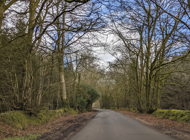
The Grove, located in Devon, England, is a sprawling and picturesque wood known for its lush forests and natural beauty. Covering an area of approximately 500 acres, it is a haven for nature enthusiasts and those seeking tranquility away from the bustling city.

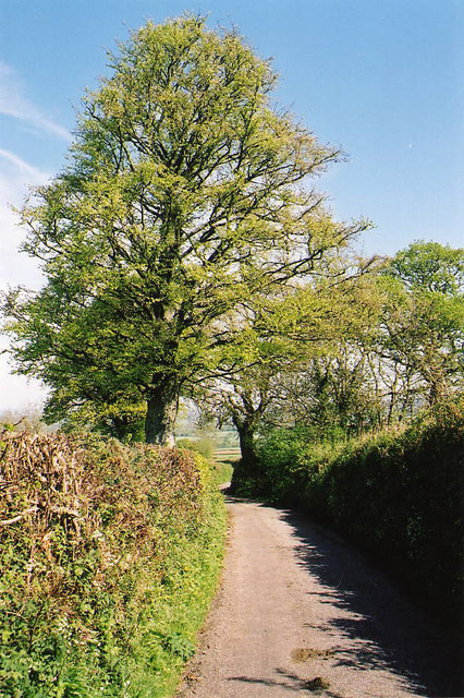
The Grove is characterized by its dense and diverse woodland, which is home to a wide variety of flora and fauna. Towering oak, beech, and ash trees dominate the landscape, providing a dramatic canopy that filters the sunlight and creates a peaceful atmosphere. The forest floor is adorned with a colorful tapestry of wildflowers, mosses, and ferns, adding to the enchanting ambiance.

Nature enthusiasts visiting The Grove can explore its numerous walking trails and immerse themselves in the natural surroundings. The woodland is crisscrossed by a network of paths, ranging from easy strolls to more challenging hikes, catering to all levels of fitness and ability. These trails offer opportunities for visitors to observe the local wildlife, including deer, foxes, and a wide variety of bird species.

The Grove is not only a sanctuary for wildlife but also a place of historical significance. The wood has been preserved for centuries and was once part of an ancient hunting ground. Remnants of old stone walls and boundary markers can still be found, serving as a reminder of its past.

Overall, The Grove in Devon is a captivating and enchanting wood, offering visitors a chance to reconnect with nature and explore its diverse ecosystems. Its beauty and tranquility make it a popular destination for nature lovers and those seeking a peaceful retreat.

If you have any feedback on the listing, please let us know in the comments section below.

The Grove Images

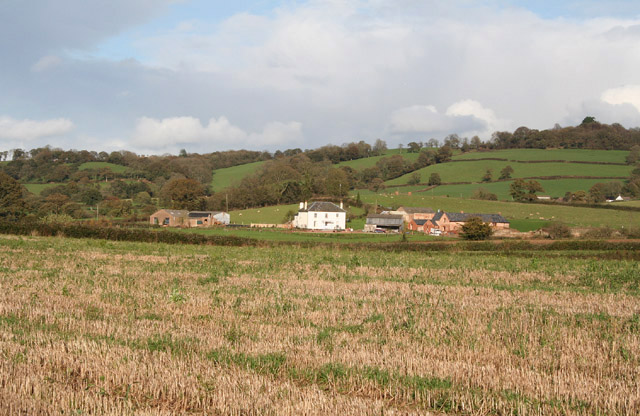
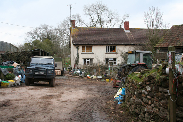
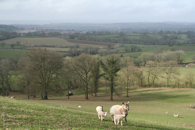
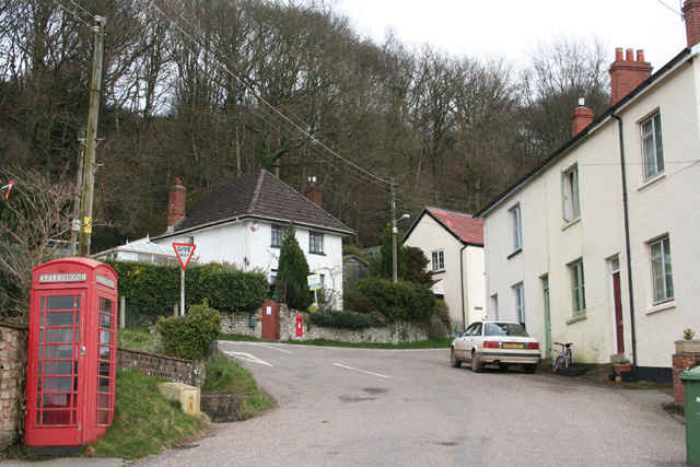
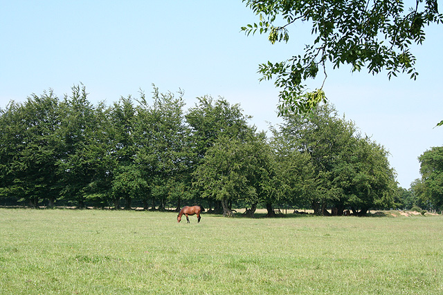
Images are sourced within 2km of 50.868174/-3.289108 or Grid Reference ST0908. Thanks to Geograph Open Source API. All images are credited.

Steep downhill from the Blackdowns
Baptist Church at Sainthill This is the Baptist Church at Sainthill as viewed from the back of the churchyard.
Stainthill is east of Kentisbeare in Devon.
Baptist Church at Sainthill
This is the Baptist Church at Sainthill as viewed from the back of the churchyard. Stainthill is east of Kentisbeare in Devon.
Lane in woodland at Black Down
Lane junction for the turning to Sheldon
A view across the countryside from North Devon towards Dartmoor The hills in the centre of the horizon are on Dartmoor, the highest being Yes Tor. The centre of the image is near the village of Dolton.
A view across the countryside from North Devon towards Dartmoor
The hills in the centre of the horizon are on Dartmoor, the highest being Yes Tor. The centre of the image is near the village of Dolton.
Deep Lane An ancient lane to a farm mentioned in the Domesday Book.
Deep Lane
An ancient lane to a farm mentioned in the Domesday Book.
Bridlepath to North Hill This path skirts the summit of the Blackdown Hills plateau.
Bridlepath to North Hill
This path skirts the summit of the Blackdown Hills plateau.
Woodland above Saint Hill Managed woodlands.
Woodland above Saint Hill
Managed woodlands.
Kentisbeare: north from Blackborough Looking north on the lane to Ashill
Kentisbeare: north from Blackborough
Looking north on the lane to Ashill
Kentisbeare: Hollis Farm At Hollis Green; seen from the south west
Kentisbeare: Hollis Farm
At Hollis Green; seen from the south west
Kentisbeare: Blackborough House This mansion has seen better days. It was built in the Italianate style for the fourth and last Earl of Egremont, a member of the Wyndham family, in 1838-40, but was never entirely finished. The Grade II Listed house was on the market for £1,000,000 in 2003, with sixty rooms. The fourth earl also had a large mansion built at Silverton which has since been demolished. For some years now Blackborough House has been surrounded by a scrapyard, presently run by Blackborough Motor Salvage
Kentisbeare: Blackborough House
This mansion has seen better days. It was built in the Italianate style for the fourth and last Earl of Egremont, a member of the Wyndham family, in 1838-40, but was never entirely finished. The Grade II Listed house was on the market for £1,000,000 in 2003, with sixty rooms. The fourth earl also had a large mansion built at Silverton which has since been demolished. For some years now Blackborough House has been surrounded by a scrapyard, presently run by Blackborough Motor Salvage
Kentisbeare: Sandfield Farm A public footpath starts here and runs north through the yard to Ashill Moor
Kentisbeare: Sandfield Farm
A public footpath starts here and runs north through the yard to Ashill Moor
Kentisbeare: Allhallows Farm Looking north east to farm barns from the lane to Allercombe
Kentisbeare: Allhallows Farm
Looking north east to farm barns from the lane to Allercombe
Kentisbeare: near Blackborough House Looking west from a public footpath
Kentisbeare: near Blackborough House
Looking west from a public footpath
Kentisbeare: Blackborough The village centre. Behind the camera is Ponchydown House, at one time the Ponchydown Inn. Just out of shot to the left is the village hall. Looking east-south-east
Kentisbeare: Blackborough
The village centre. Behind the camera is Ponchydown House, at one time the Ponchydown Inn. Just out of shot to the left is the village hall. Looking east-south-east
Kentisbeare: Forestry Commission, Blackborough Looking north at the entrance to the Blackborough woodland. The public footpath through to Blackborough Common here defines the parish boundary with Uffculme
Kentisbeare: Forestry Commission, Blackborough
Looking north at the entrance to the Blackborough woodland. The public footpath through to Blackborough Common here defines the parish boundary with Uffculme
Uffculme: above Bodmiscombe Wood Farm Looking north-north-east to Hackpen Hill with Culmstock Beacon beyond
Uffculme: above Bodmiscombe Wood Farm
Looking north-north-east to Hackpen Hill with Culmstock Beacon beyond
Sheldon: at Woodlands Farm Looking north by the farm entrance
Sheldon: at Woodlands Farm
Looking north by the farm entrance
Show me another place!

The Grove is located at Grid Ref: ST0908 (Lat: 50.868174, Lng: -3.289108)

Administrative County: Devon

District: Mid Devon

Police Authority: Devon and Cornwall

What 3 Words

///firebird.carefully.regulator. Near Dunkeswell, Devon

Related Wikis

Blackborough, Devon

Blackborough is a hamlet and former manor in the parish of Kentisbeare, Devon, England. It is situated within the Mid Devon district. The nearest substantial...

Bodmiscombe

Bodmiscombe is a village in Devon, England. == External links == Media related to Bodmiscombe at Wikimedia Commons
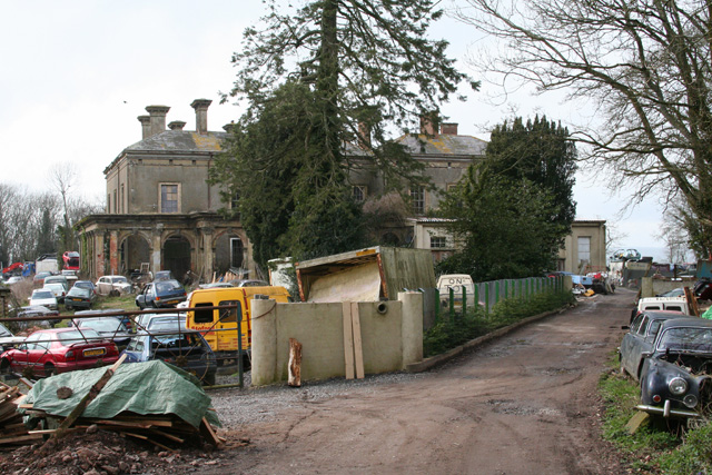
Blackborough House

Blackborough House is a grade II listed privately owned country house in Blackborough, Devon, three miles (5 km) east of Cullompton. It was built in 1838...

Orway

Orway is a small hamlet, approximately 1.5 miles squared, situated just on the edge of the Blackdown Hills in Devon, United Kingdom. It is located in the...

Nearby Amenities

Located within 500m of 50.868174,-3.289108
Place Of Worship
Saint Hill Church
Denomination: baptist
Religion: christian
Lat/Long: 50.865899/-3.2927616
Post Box
Post Box Type: wall
Lat/Long: 50.871737/-3.2848557
Telephone
Defibrillator
Booth: K6
Covered: booth
Defibrillator Location: inside old red phone box in front of Blackborough Village Hall
Emergency: defibrillator
Man Made: telephone_box
Lat/Long: 50.8717439/-3.2851974
Information: guidepost
Tourism: information
Lat/Long: 50.8660198/-3.2829367
Power: pole
Source: bing
Lat/Long: 50.8670481/-3.2957499
Power: pole
Source: bing
Lat/Long: 50.8655084/-3.2940175
Power: pole
Source: bing
Lat/Long: 50.8647596/-3.2920994
Power: pole
Source: bing
Lat/Long: 50.8644523/-3.2912984
Power: pole
Source: bing
Lat/Long: 50.8716609/-3.2861189
Power: pole
Source: bing
Lat/Long: 50.8712206/-3.2863009
Power: pole
Source: bing
Lat/Long: 50.8704254/-3.2865841
Power: pole
Source: bing
Lat/Long: 50.8704881/-3.2948993
Power: pole
Source: bing
Lat/Long: 50.8706438/-3.2936065
Generator Method: photovoltaic
Generator Output Electricity: yes
Generator Source: solar
Generator Type: solar_photovoltaic_panel
Location: roof
Power: generator
Lat/Long: 50.8717601/-3.2861568
Generator Method: photovoltaic
Generator Output Electricity: yes
Generator Source: solar
Generator Type: solar_photovoltaic_panel
Location: roof
Power: generator
Lat/Long: 50.8654242/-3.2925926
Generator Method: photovoltaic
Generator Output Electricity: yes
Generator Source: solar
Generator Type: solar_photovoltaic_panel
Location: roof
Power: generator
Lat/Long: 50.8654682/-3.2925537
Generator Method: photovoltaic
Generator Output Electricity: yes
Generator Source: solar
Generator Type: solar_photovoltaic_panel
Location: roof
Power: generator
Lat/Long: 50.8655249/-3.2924961
Generator Method: photovoltaic
Generator Output Electricity: yes
Generator Source: solar
Generator Type: solar_photovoltaic_panel
Location: roof
Power: generator
Lat/Long: 50.871169/-3.2924471
Generator Method: photovoltaic
Generator Output Electricity: yes
Generator Source: solar
Generator Type: solar_photovoltaic_panel
Location: roof
Power: generator
Lat/Long: 50.8711677/-3.2925504
Generator Method: photovoltaic
Generator Output Electricity: yes
Generator Source: solar
Generator Type: solar_photovoltaic_panel
Location: roof
Power: generator
Lat/Long: 50.8709324/-3.2841946
Power: pole
Source: bing
Lat/Long: 50.871447/-3.2872711
Power: pole
Source: bing
Lat/Long: 50.8712354/-3.2884499
Power: pole
Source: bing
Lat/Long: 50.8710137/-3.2896395
Power: pole
Source: bing
Lat/Long: 50.8708013/-3.2908036
Power: pole
Source: bing
Lat/Long: 50.8705812/-3.2919864
Power: pole
Source: bing
Lat/Long: 50.8650086/-3.292724
Power: pole
Source: bing
Lat/Long: 50.8660057/-3.2952963
The data included in this document is from www.openstreetmap.org. The data is made available under ODbL.

Have you been to The Grove?

Leave your review of The Grove below (or comments, questions and feedback).