Aller Grove
Wood, Forest in Devon Mid Devon
England
Aller Grove

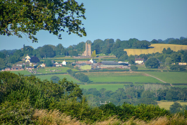
Aller Grove, located in Devon, England, is a picturesque woodland area known for its natural beauty and tranquil atmosphere. Situated near the village of Aller, the grove is nestled within the stunning landscape of the Dartmoor National Park. Spanning across a vast area, Aller Grove is characterized by its dense forest, with a rich variety of trees, including oak, beech, and ash.
The grove offers a peaceful retreat for nature enthusiasts and outdoor lovers alike. It is a popular destination for hiking, walking, and birdwatching, attracting visitors from all around. The well-maintained trails wind through the woodland, allowing visitors to explore and admire the diverse flora and fauna that call Aller Grove their home.
The grove is particularly renowned for its bluebell displays in the spring, transforming the forest floor into a vibrant carpet of blue. This annual natural spectacle draws photographers and nature enthusiasts who come to witness the breathtaking sight.
Aller Grove is also home to a variety of wildlife, including deer, foxes, and various bird species. Birdwatchers can spot woodpeckers, owls, and other woodland birds in their natural habitat. The peaceful environment and abundance of wildlife make Aller Grove a haven for nature lovers seeking a connection with the great outdoors.
Overall, Aller Grove in Devon is a charming woodland area offering an idyllic escape from the hustle and bustle of everyday life. Its natural beauty, diverse wildlife, and peaceful ambiance make it a must-visit destination for those seeking a serene connection with nature.
If you have any feedback on the listing, please let us know in the comments section below.
Aller Grove Images
Images are sourced within 2km of 50.936661/-3.3126911 or Grid Reference ST0716. Thanks to Geograph Open Source API. All images are credited.


Aller Grove is located at Grid Ref: ST0716 (Lat: 50.936661, Lng: -3.3126911)
Administrative County: Devon
District: Mid Devon
Police Authority: Devon and Cornwall
What 3 Words
///knees.stops.abstracts. Near Uffculme, Devon
Nearby Locations
Related Wikis

Burlescombe
Burlescombe (, bur-LES-kəm) is a village and civil parish in the Mid Devon district of Devon, England. The parish is surrounded, clockwise from the north, by the parishes of Holcombe Rogus, Culmstock, Uffculme, Halberton and Sampford Peverell. According to the 2001 census it had a population of 911.

Canonsleigh Abbey
Canonsleigh Abbey was an Augustinian priory in the parish of Burlescombe, Devon. == History == It was founded in about 1170 by Walter de Claville, lord of the manor of Burlescombe, for the Augustinian canons regular as the Priory of the Blessed Virgin Mary and Saint John the Evangelist. He appears to have been a descendant of Walter I de Claville (floruit 1086), one of the 52 Devon Domesday Book tenants-in-chief of King William the Conqueror, who had 32 landholdings in Devon.

Culmstock
Culmstock is a village and civil parish in Mid Devon, England, centred 10 miles from Tiverton and 6 NE of Cullompton. It is laid out on both sides of the River Culm; the village is joined by a single old narrow stone bridge across the river. The population of the parish at the 2011 Census was 554.

Appledore, Mid Devon
Appledore is a small village near Uffculme in Devon, England, about 7 miles (11 kilometres) east of Tiverton.Appledore was listed in the Domesday Book of 1086.

Ayshford Chapel
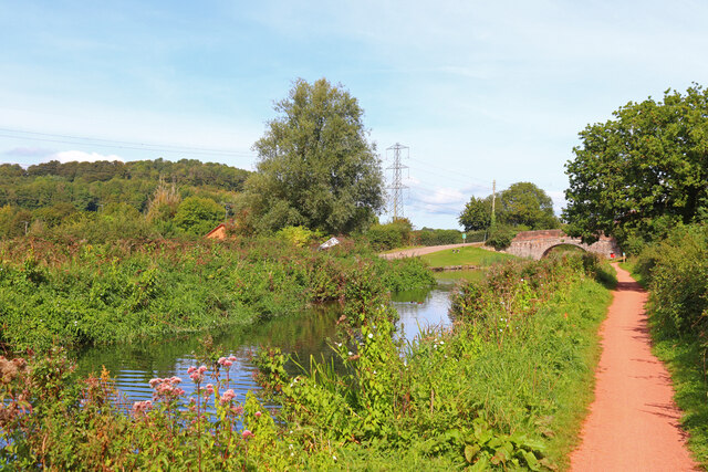
Ayshford Chapel is a former private chapel in the village of Ayshford, in the parish of Burlescombe, Devon, England. It is recorded in the National Heritage List for England as a designated Grade I listed building, and is under the care of the Friends of Friendless Churches. It is situated immediately to the south of the manor house of Ayshford Court, and to the north of the Grand Western Canal.
Wellington Bank, Somerset
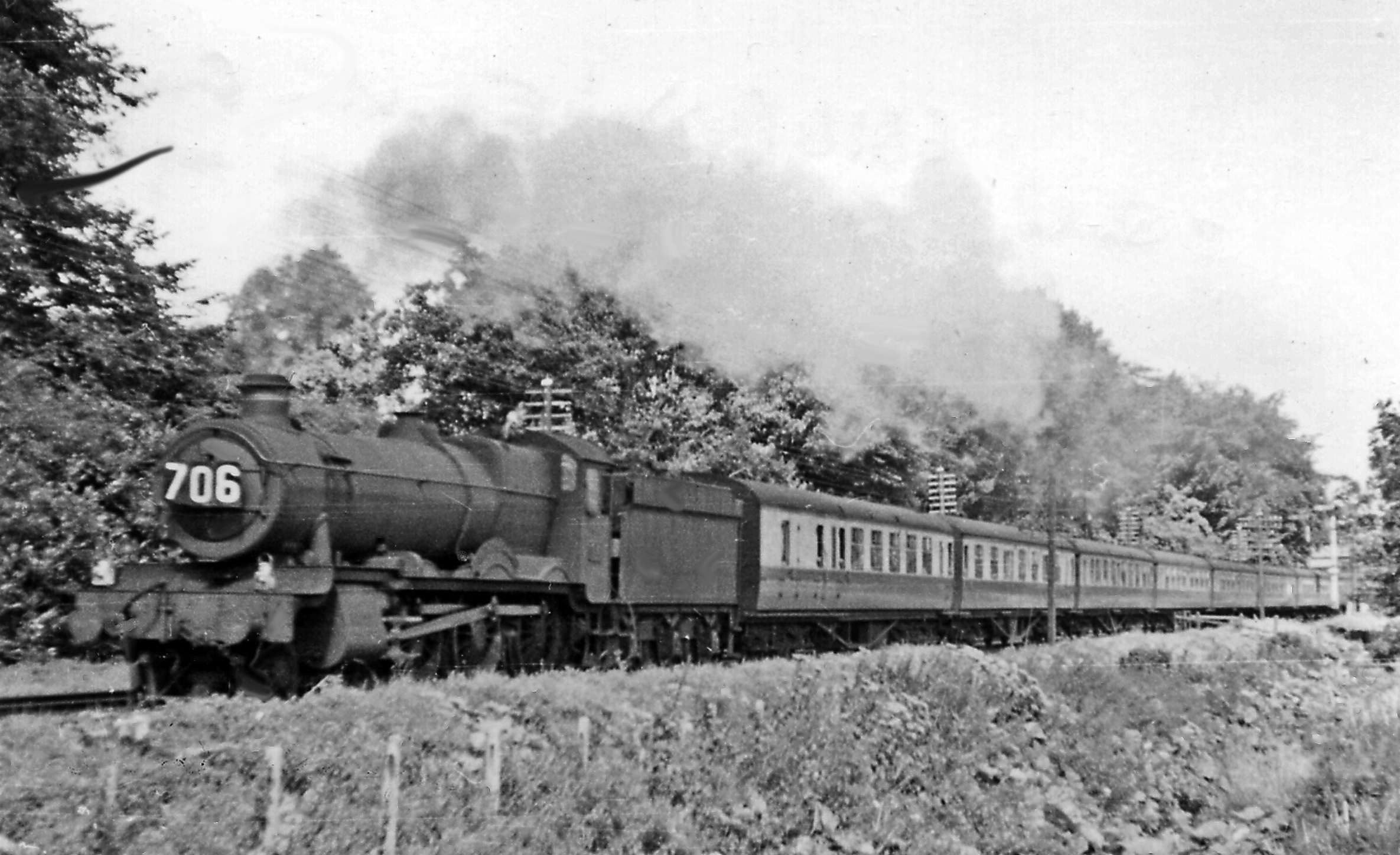
Wellington Bank is a steep railway embankment and associated climb located on the Bristol to Exeter line, that climbs from just northeast of Wellington, Somerset, until its peak at Sampford Arundel, where it enters Whiteball tunnel and travels under the Whiteball Hill. == Background == The Bristol & Exeter Railway was authorised by act of Parliament in 1836, following quickly on the 1835 act for construction of the Great Western Railway. Bristol merchants were anxious to secure a railway route to Exeter, which was an important commercial centre, and which had a harbour on the south coast, in the English Channel.

Culmstock Halt railway station
Culmstock Halt railway station served the village of Culmstock, Devon, England, from 1876 to 1963 on the Culm Valley Light Railway. == History == The station was opened on 29 May 1876 by the Culm Valley Light Railway. It was situated on the east side of the B3391.

Holcombe Rogus
Holcombe Rogus is a village, civil parish and ecclesiastical parish in the English county of Devon. In 2001 the population of the parish was 503. == Name == The first element of the place-name is derived from Old English for a deep or hollow coomb (valley) and the second element refers to the holder of the land – at the time of the Domesday Book (1086) the tenant was Rogo or Rogus.
Nearby Amenities
Located within 500m of 50.936661,-3.3126911Have you been to Aller Grove?
Leave your review of Aller Grove below (or comments, questions and feedback).