Egypt Copse

Wood, Forest in Somerset Somerset West and Taunton

England

Egypt Copse

Brompton Ralph, Blessed Virgin Mary
Brompton Ralph, Blessed Virgin Mary Credit: Dave Kelly

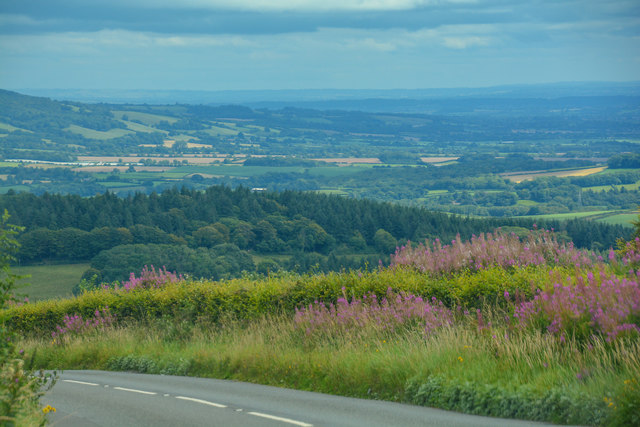
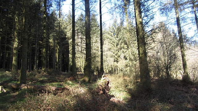
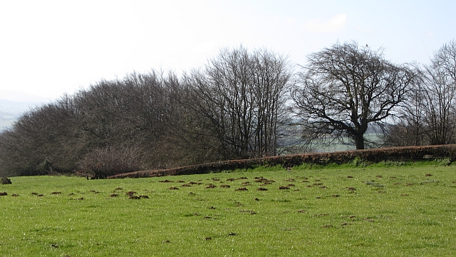
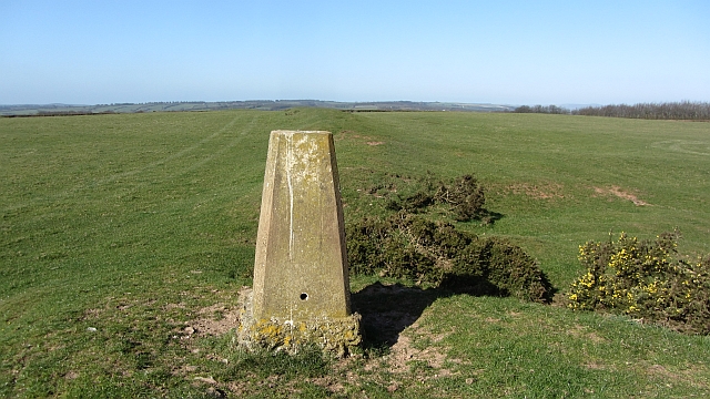
Egypt Copse is a small wooded area located in Somerset, England. It covers an approximate area of 5 acres and is situated near the village of Egypt, hence its name. The copse is predominantly made up of mixed deciduous trees, including oak, ash, and beech, which provide a diverse and picturesque landscape.

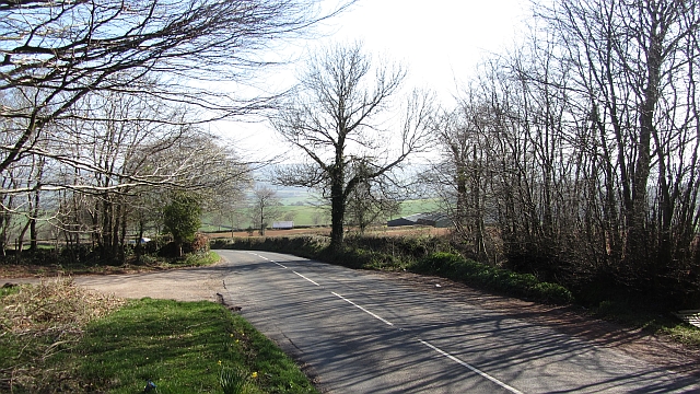
The copse is a popular destination for nature lovers and outdoor enthusiasts. It offers numerous walking trails that meander through the woodland, allowing visitors to explore and immerse themselves in the natural beauty of the area. These trails are well-marked and maintained, making them accessible for people of all ages and abilities.

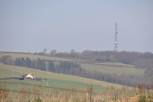
Egypt Copse is also home to a variety of wildlife. Birdwatchers will delight in spotting species such as woodpeckers, thrushes, and owls, while small mammals like rabbits and squirrels can often be seen darting between the trees. The copse is particularly beautiful during the spring and summer months when the trees are in full bloom and the forest floor is carpeted with wildflowers.

In addition to its natural attractions, Egypt Copse also has historical significance. It is believed that the area was once part of an ancient woodland that covered much of the surrounding landscape. Remnants of this ancient woodland can still be found within the copse, adding to its charm and allure.

Overall, Egypt Copse is a tranquil and enchanting woodland that offers visitors a chance to escape the hustle and bustle of everyday life and connect with nature. Whether it's for a leisurely walk, birdwatching, or simply enjoying the serenity of the forest, Egypt Copse is a hidden gem in the heart of Somerset.

If you have any feedback on the listing, please let us know in the comments section below.
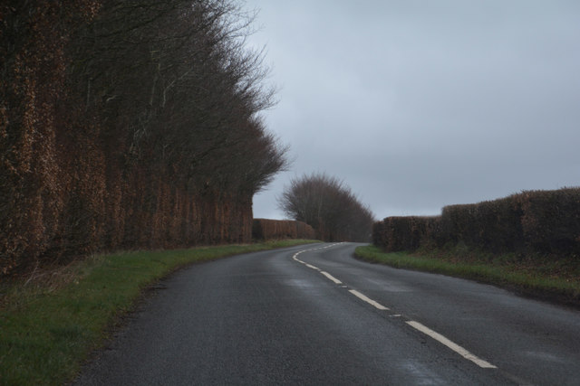
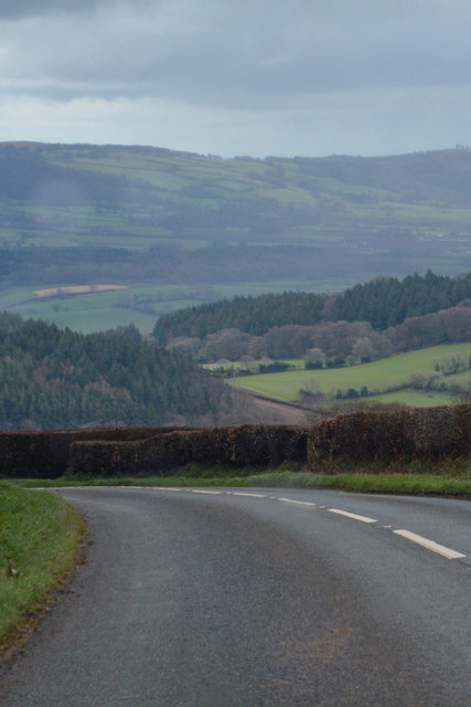
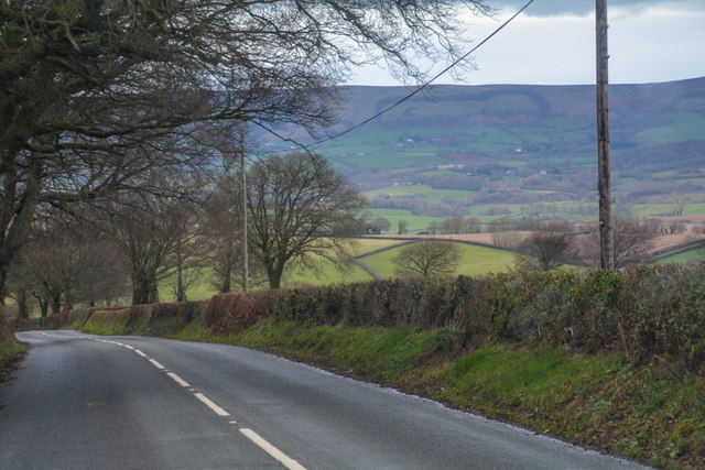
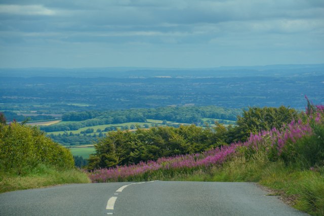
Egypt Copse Images

Images are sourced within 2km of 51.081206/-3.3202053 or Grid Reference ST0732. Thanks to Geograph Open Source API. All images are credited.

Brompton Ralph, Blessed Virgin Mary
The B3224 descending to Elworthy
Combe Bottom from the air Several different woods comprises the woodland along the valley and its side valleys; the main one is Ollery Wood. To the right is the scattered village of Whitefield. This is at the east end of the Brendon Hills.
Combe Bottom from the air
Several different woods comprises the woodland along the valley and its side valleys; the main one is Ollery Wood. To the right is the scattered village of Whitefield. This is at the east end of the Brendon Hills.
SCC Finger Post at Forche's Cross 5 fingered SCC Post.
SCC Finger Post at Forche's Cross
5 fingered SCC Post.
West Somerset : The B3224 Heading along the B3224.
West Somerset : The B3224
Heading along the B3224.
West Somerset : The B3224 Heading along the B3224.
West Somerset : The B3224
Heading along the B3224.
West Somerset : The B3224 Heading along the B3224.
West Somerset : The B3224
Heading along the B3224.
Elworthy : B3224 Looking along the B3224.
Elworthy : B3224
Looking along the B3224.
Elworthy : B3224 You can see for miles from here on the B3224.
Elworthy : B3224
You can see for miles from here on the B3224.
West Somerset : Mast & Countryside Looking towards a mast on the hillside.
West Somerset : Mast & Countryside
Looking towards a mast on the hillside.
Woodland, Elworthy Coombe Maturing conifer wood.
Woodland, Elworthy Coombe
Maturing conifer wood.
B3224, Elsworthy The road, climbing steeply, passes an entrance to Elsworthy Combe.
B3224, Elsworthy
The road, climbing steeply, passes an entrance to Elsworthy Combe.
Elsworthy Barrows Triangulation pillar, mast and Bronze Age earthworks on the Brendon Hills. The name is confusing as these are the ramparts of a hill fort as opposed to burial mounds.
Elsworthy Barrows
Triangulation pillar, mast and Bronze Age earthworks on the Brendon Hills. The name is confusing as these are the ramparts of a hill fort as opposed to burial mounds.
Molehills Molehills in hill pasture near Elsworthy.
Molehills
Molehills in hill pasture near Elsworthy.
Marl pit, Elsworthy Barrows A pool in an excavation just below the triangulation pillar.
Marl pit, Elsworthy Barrows
A pool in an excavation just below the triangulation pillar.
Elsworthy Barrows triangulation pillar The pillar, on the ramparts of an hill fort, is named Brompton Ralph on the Ordnance Survey database.
Elsworthy Barrows triangulation pillar
The pillar, on the ramparts of an hill fort, is named Brompton Ralph on the Ordnance Survey database.
Brompton Ralph trig point The triangulation pillar on Elsworthy Barrows. This shows clearly the nature of the Brendon Hills - not a place for the prominence list bagger! It is a big climb to get here though.
Brompton Ralph trig point
The triangulation pillar on Elsworthy Barrows. This shows clearly the nature of the Brendon Hills - not a place for the prominence list bagger! It is a big climb to get here though.
St Mary's Church, Brompton Ralph
Show me another place!

Egypt Copse is located at Grid Ref: ST0732 (Lat: 51.081206, Lng: -3.3202053)

Administrative County: Somerset

District: Somerset West and Taunton

Police Authority: Avon and Somerset
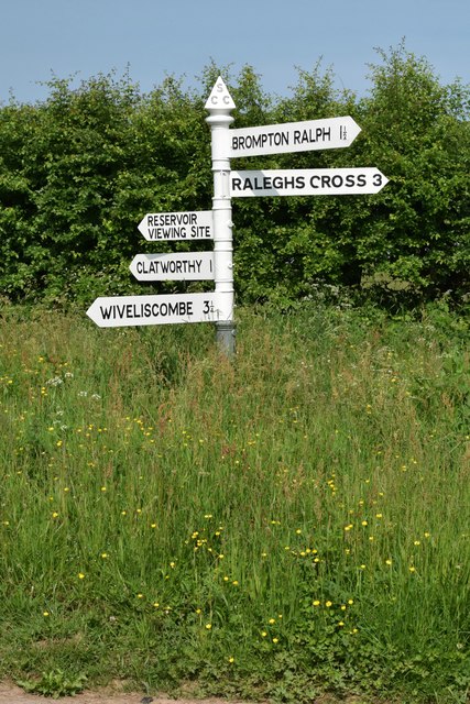
What 3 Words

///contained.tadpoles.normal. Near Wiveliscombe, Somerset

Nearby Locations

Ashland Brake Egypt Copse

Related Wikis

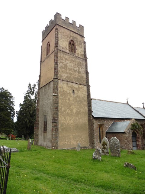
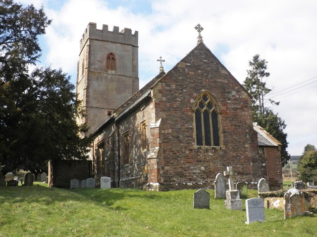
Church of St Mary, Brompton Ralph

The Anglican Church of St Mary in Brompton Ralph, Somerset, England was built in the 15th century. It is a Grade II* listed building. == History == Parts...
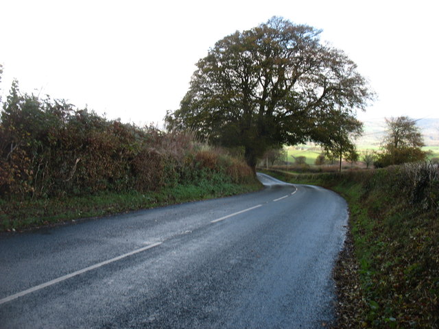
Brompton Ralph

Brompton Ralph is a village and civil parish in the Somerset West and Taunton district of Somerset, England, about 11 miles (18 km) west of Taunton, and...
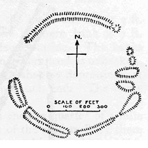
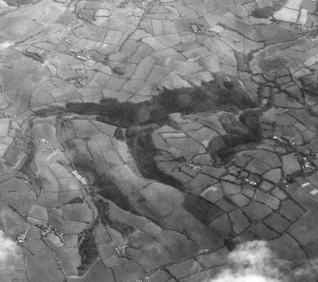
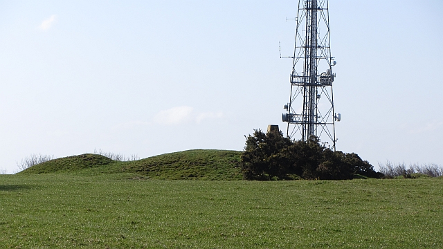
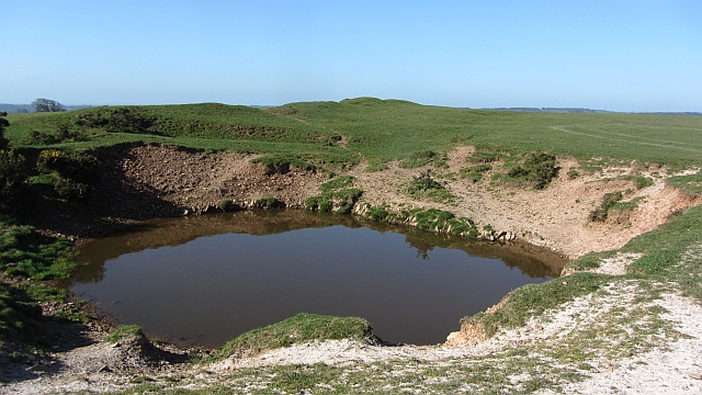
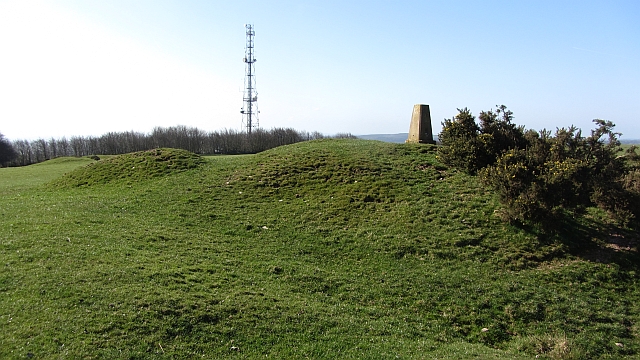
Elworthy Barrows

Elworthy Barrows is an unfinished Iron Age hill fort, rather than Bronze Age barrows, which is designated a scheduled ancient monument (No:188401). It...

Ruby Country

Ruby Country is the name given to the rural inland hinterland of north-west Devon, UK. It covers 45 parishes around the market towns of Holsworthy and...

Clatworthy

Clatworthy is a village and civil parish in the Somerset West and Taunton district of Somerset, England. It is situated 10 miles (16 km) from Wellington...

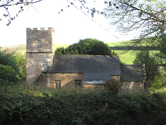
Church of St Mary Magdalene, Clatworthy

The Anglican Church of Mary Magdalene in Clatworthy, Somerset, England was built in the 12th century. It is a Grade II* listed building. == History... ==

Elworthy

Elworthy is a small village and civil parish in the Brendon Hills 5 miles (8 km) south-east of Watchet, and 12 miles (19 km) west of Taunton, in the Somerset...

Church of St Martin, Elworthy

The Church of St Martin in Elworthy, Somerset, England, is dedicated to St Martin of Tours. It dates from the 13th century and is recorded in the National...

Nearby Amenities

Located within 500m of 51.081206,-3.3202053
Barrier: cattle_grid
Foot: private
Horse: no
Vehicle: private
Lat/Long: 51.0789823/-3.3198466
Ford: yes
Lat/Long: 51.0804502/-3.3184357
Ford: yes
Lat/Long: 51.0821391/-3.3192524
Ford: yes
Lat/Long: 51.0804797/-3.3177383
Barrier: cattle_grid
Foot: private
Horse: no
Vehicle: private
Lat/Long: 51.0781947/-3.3195475
Brand: National Grid
Brand Wikidata: Q1465461
Material: wood
Operator: National Grid Electricity Distribution Plc
Operator Old: Western Power Distribution
Operator Wikidata: Q7988183
Owner: National Grid Electricity Distribution (South West) Plc
Owner Wikidata: Q114397866
Power: pole
Lat/Long: 51.0782537/-3.315677
Brand: National Grid
Brand Wikidata: Q1465461
Material: wood
Operator: National Grid Electricity Distribution Plc
Operator Old: Western Power Distribution
Operator Wikidata: Q7988183
Owner: National Grid Electricity Distribution (South West) Plc
Owner Wikidata: Q114397866
Power: pole
Lat/Long: 51.0783751/-3.3172153
Brand: National Grid
Brand Wikidata: Q1465461
Material: wood
Operator: National Grid Electricity Distribution Plc
Operator Old: Western Power Distribution
Operator Wikidata: Q7988183
Owner: National Grid Electricity Distribution (South West) Plc
Owner Wikidata: Q114397866
Power: pole
Lat/Long: 51.0784955/-3.3187348
Brand: National Grid
Brand Wikidata: Q1465461
Material: wood
Operator: National Grid Electricity Distribution Plc
Operator Old: Western Power Distribution
Operator Wikidata: Q7988183
Owner: National Grid Electricity Distribution (South West) Plc
Owner Wikidata: Q114397866
Power: pole
Lat/Long: 51.0781265/-3.3200102
Brand: National Grid
Brand Wikidata: Q1465461
Material: wood
Operator: National Grid Electricity Distribution Plc
Operator Old: Western Power Distribution
Operator Wikidata: Q7988183
Owner: National Grid Electricity Distribution (South West) Plc
Owner Wikidata: Q114397866
Power: pole
Lat/Long: 51.0780675/-3.3247013
Brand: National Grid
Brand Wikidata: Q1465461
Material: wood
Operator: National Grid Electricity Distribution Plc
Operator Old: Western Power Distribution
Operator Wikidata: Q7988183
Owner: National Grid Electricity Distribution (South West) Plc
Owner Wikidata: Q114397866
Power: pole
Lat/Long: 51.0779858/-3.3235426
Brand: National Grid
Brand Wikidata: Q1465461
Material: wood
Operator: National Grid Electricity Distribution Plc
Operator Old: Western Power Distribution
Operator Wikidata: Q7988183
Owner: National Grid Electricity Distribution (South West) Plc
Owner Wikidata: Q114397866
Power: pole
Lat/Long: 51.0778105/-3.321138
Brand: National Grid
Brand Wikidata: Q1465461
Material: wood
Operator: National Grid Electricity Distribution Plc
Operator Old: Western Power Distribution
Operator Wikidata: Q7988183
Owner: National Grid Electricity Distribution (South West) Plc
Owner Wikidata: Q114397866
Power: pole
Lat/Long: 51.0778716/-3.3220164
Brand: National Grid
Brand Wikidata: Q1465461
Layer: 1
Operator: National Grid Electricity Distribution Plc
Operator Old: Western Power Distribution
Operator Wikidata: Q7988183
Owner: National Grid Electricity Distribution (South West) Plc
Owner Wikidata: Q114397866
Power: terminal
Lat/Long: 51.0786673/-3.3148188
Brand: National Grid
Brand Wikidata: Q1465461
Devices: 1
Frequency: 50
Line Management: split
Material: wood
Operator: National Grid Electricity Distribution Plc
Operator Old: Western Power Distribution
Operator Wikidata: Q7988183
Owner: National Grid Electricity Distribution (South West) Plc
Owner Wikidata: Q114397866
Phases: 1
Power: pole
Transformer: distribution
Lat/Long: 51.0783077/-3.3148858
Brand: National Grid
Brand Wikidata: Q1465461
Material: wood
Operator: National Grid Electricity Distribution Plc
Operator Old: Western Power Distribution
Operator Wikidata: Q7988183
Owner: National Grid Electricity Distribution (South West) Plc
Owner Wikidata: Q114397866
Power: pole
Lat/Long: 51.0786615/-3.3149274
Access: private
Door: overhead
Entrance: yes
Motorcar: private
Lat/Long: 51.078652/-3.3148865
The data included in this document is from www.openstreetmap.org. The data is made available under ODbL.

Have you been to Egypt Copse?

Leave your review of Egypt Copse below (or comments, questions and feedback).