Knowle Copse

Wood, Forest in Devon Mid Devon

England

Knowle Copse

Ordnance Survey Cut Mark This OS cut mark can be found on the porch of All Saints Church. It marks a point 139.513m above mean sea level.
Ordnance Survey Cut Mark Credit: Adrian Dust

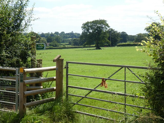
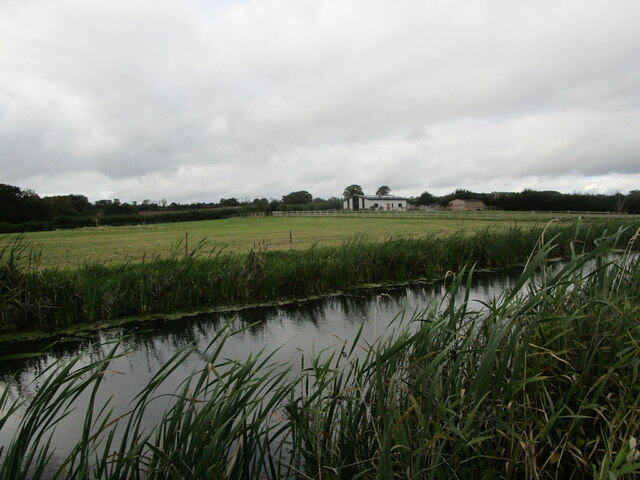
Knowle Copse is a picturesque woodland located in the county of Devon, England. This small but enchanting forest covers an area of approximately 20 acres and is known for its natural beauty and diverse wildlife.

The copse is situated in a rural area, surrounded by rolling hills and farmland, providing a peaceful and serene environment for visitors to enjoy. The woodland is primarily composed of native broadleaf trees, including oak, ash, and beech, which create a dense canopy that filters sunlight and creates a cool and shaded atmosphere.

As visitors explore Knowle Copse, they will discover a network of meandering footpaths that wind their way through the forest. These paths are well-maintained and offer an immersive experience, allowing visitors to fully appreciate the sights, sounds, and scents of the woodland. The forest floor is covered in a thick carpet of moss, ferns, and wildflowers, adding to the enchanting atmosphere.

Knowle Copse is also home to a rich variety of wildlife. Birds such as woodpeckers, owls, and songbirds can be heard singing their melodious tunes throughout the day, while small mammals like squirrels and hedgehogs can be spotted scurrying amongst the undergrowth. The copse is also a haven for insects, with butterflies, bees, and beetles flitting between the flowers and plants.

Whether it's for a leisurely stroll, a nature walk, or simply to escape the hustle and bustle of everyday life, Knowle Copse offers a tranquil retreat for visitors of all ages. Its natural beauty and abundant wildlife make it a must-visit destination for nature enthusiasts and those seeking a peaceful connection with the great outdoors.

If you have any feedback on the listing, please let us know in the comments section below.

Knowle Copse Images

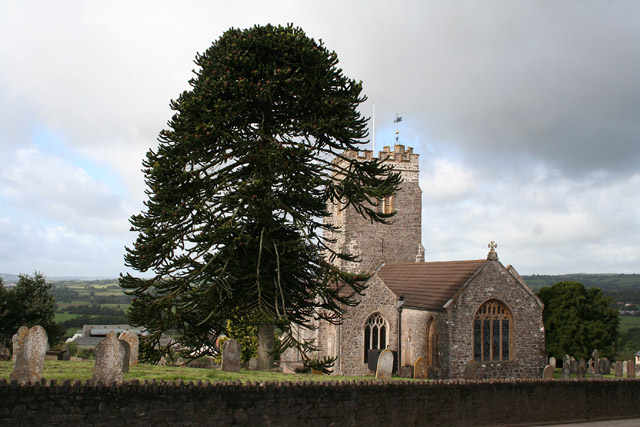
Images are sourced within 2km of 50.950638/-3.34338 or Grid Reference ST0517. Thanks to Geograph Open Source API. All images are credited.

Ordnance Survey Cut Mark This OS cut mark can be found on the porch of All Saints Church. It marks a point 139.513m above mean sea level.
Ordnance Survey Cut Mark
This OS cut mark can be found on the porch of All Saints Church. It marks a point 139.513m above mean sea level.
Ordnance Survey Cut Mark This OS cut mark can be found on the wall SE side of the road. It marks a point 127.349m above mean sea level.
Ordnance Survey Cut Mark
This OS cut mark can be found on the wall SE side of the road. It marks a point 127.349m above mean sea level.
Ordnance Survey Cut Mark This looks like an uncompleted OS cut mark about 5m NE of a completed mark. <a title="https://www.geograph.org.uk/photo/7687952" href="https://www.geograph.org.uk/photo/7687952">Link</a>
Ordnance Survey Cut Mark
This looks like an uncompleted OS cut mark about 5m NE of a completed mark. Link
Ordnance Survey Cut Mark This OS cut mark can be found on the wall NE side of the road. It marks a point 116.830m above mean sea level. <a title="https://www.geograph.org.uk/photo/7687951" href="https://www.geograph.org.uk/photo/7687951">Link</a>
Ordnance Survey Cut Mark
This OS cut mark can be found on the wall NE side of the road. It marks a point 116.830m above mean sea level. Link
Ordnance Survey Cut Mark This OS cut mark can be found on the east parapet of the bridge. It marks a point 119.247m above mean sea level.
Ordnance Survey Cut Mark
This OS cut mark can be found on the east parapet of the bridge. It marks a point 119.247m above mean sea level.
Ordnance Survey Rivet This OS rivet can be found on the NE parapet of the bridge. It marks a point 102.904m above mean sea level.
Ordnance Survey Rivet
This OS rivet can be found on the NE parapet of the bridge. It marks a point 102.904m above mean sea level.
Stile between Ford and Holcombe Rogus
Minor road to Holcombe Rogus
Footpath to Black Lane, Holcombe Rogus
Gate at start of two footpaths, near Holcombe Rogus
Part of Holcombe Rogus primary school Above the window, the carved inscription reads "Holcombe Rogus Charity School"
Part of Holcombe Rogus primary school
Above the window, the carved inscription reads "Holcombe Rogus Charity School"
Westcott Bridge, Grand Western Canal
Grand Western Canal and Ley Barn
Black Bridge Carried a mineral railway serving Westleigh Quarry. Now carries a footpath.
The railway replaced a tramway in 1892.
Black Bridge
Carried a mineral railway serving Westleigh Quarry. Now carries a footpath. The railway replaced a tramway in 1892.
The Grand Western Canal at Great Fossend
Towpath alongside the Grand Western Canal
Burlescombe : Grand Western Canal The canal heading through the countryside.
Burlescombe : Grand Western Canal
The canal heading through the countryside.
Burlescombe : Grand Western Canal Underneath a bridge.
Burlescombe : Grand Western Canal
Underneath a bridge.
Show me another place!

Knowle Copse is located at Grid Ref: ST0517 (Lat: 50.950638, Lng: -3.34338)

Administrative County: Devon

District: Mid Devon

Police Authority: Devon and Cornwall

What 3 Words

///crucially.sulky.delusions. Near Sampford Peverell, Devon

Related Wikis

Canonsleigh Abbey

Canonsleigh Abbey was an Augustinian priory in the parish of Burlescombe, Devon. == History == It was founded in about 1170 by Walter de Claville, lord...

Holcombe Rogus

Holcombe Rogus is a village, civil parish and ecclesiastical parish in the English county of Devon. In 2001 the population of the parish was 503. ��2...

Manor of Holcombe Rogus

Holcombe Rogus is a historic manor in the parish of Holcombe Rogus in Devon, England. The present grade I listed Tudor manor house known as Holcombe Court...

Burlescombe

Burlescombe (, bur-LES-kəm) is a village and civil parish in the Mid Devon district of Devon, England. The parish is surrounded, clockwise from the north...

Nearby Amenities

Located within 500m of 50.950638,-3.34338
The data included in this document is from www.openstreetmap.org. The data is made available under ODbL.

Have you been to Knowle Copse?

Leave your review of Knowle Copse below (or comments, questions and feedback).