Holcombe Wood

Wood, Forest in Devon Mid Devon

England

Holcombe Wood

Ordnance Survey Cut Mark This OS cut mark can be found on the porch of All Saints Church. It marks a point 139.513m above mean sea level.
Ordnance Survey Cut Mark Credit: Adrian Dust

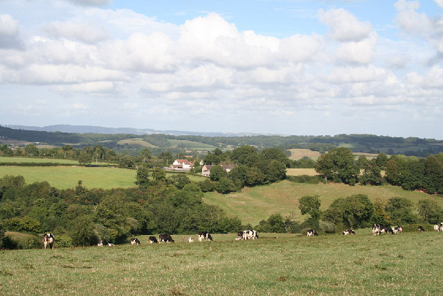
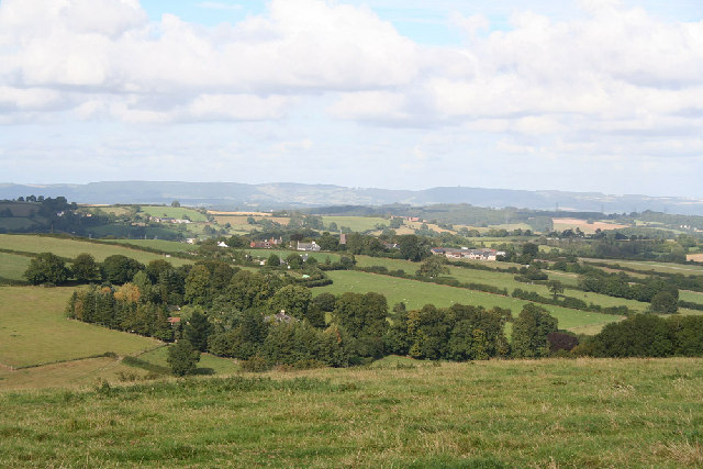
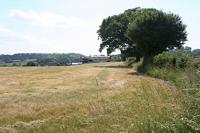
Holcombe Wood is a picturesque woodland located in the county of Devon, England. Spanning an area of approximately 150 acres, it is renowned for its natural beauty and tranquil atmosphere. The wood is situated in the eastern part of Devon, near the village of Holcombe Rogus.

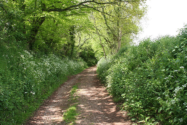
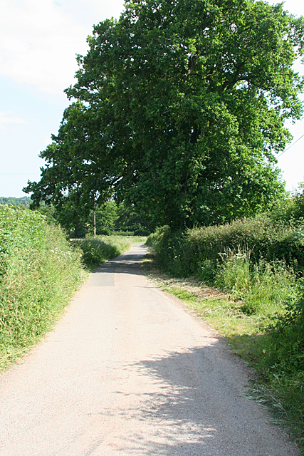
Holcombe Wood is predominantly composed of deciduous trees, including oak, beech, and ash, which create a diverse and thriving ecosystem. The trees provide a dense canopy that offers shade during the summer months and displays a stunning array of colors in the autumn. The forest floor is covered in a blanket of lush green vegetation, including ferns and wildflowers, adding to the wood's enchanting ambiance.

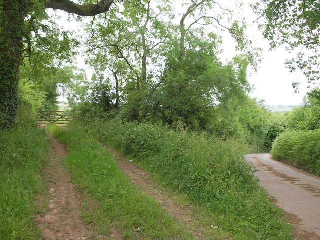
The wood is intersected by a network of footpaths and trails, allowing visitors to explore its natural wonders at their own pace. These paths lead to various points of interest, such as a small pond inhabited by ducks and other waterfowl. Additionally, there are several picnic areas scattered throughout the wood, providing a perfect spot for visitors to relax and enjoy a meal amidst the serene surroundings.

Holcombe Wood is not only a haven for nature enthusiasts but also home to a diverse range of wildlife. Birdwatchers can spot a variety of species, including woodpeckers, nuthatches, and owls. The wood is also home to mammals like deer, squirrels, and foxes, making it a popular destination for wildlife enthusiasts.

Overall, Holcombe Wood offers visitors a chance to immerse themselves in the beauty of nature. With its idyllic scenery, well-maintained trails, and abundant wildlife, it is a must-visit destination for anyone seeking a peaceful retreat in the heart of Devon.

If you have any feedback on the listing, please let us know in the comments section below.

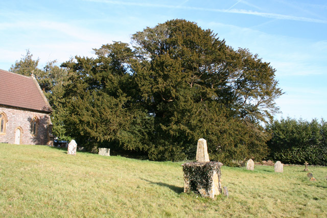
Holcombe Wood Images

Images are sourced within 2km of 50.96612/-3.3483412 or Grid Reference ST0519. Thanks to Geograph Open Source API. All images are credited.

Ordnance Survey Cut Mark This OS cut mark can be found on the porch of All Saints Church. It marks a point 139.513m above mean sea level.
Ordnance Survey Cut Mark
This OS cut mark can be found on the porch of All Saints Church. It marks a point 139.513m above mean sea level.
Ordnance Survey Cut Mark This OS cut mark can be found on the wall SE side of the road. It marks a point 127.349m above mean sea level.
Ordnance Survey Cut Mark
This OS cut mark can be found on the wall SE side of the road. It marks a point 127.349m above mean sea level.
Ordnance Survey Cut Mark This looks like an uncompleted OS cut mark about 5m NE of a completed mark. <a title="https://www.geograph.org.uk/photo/7687952" href="https://www.geograph.org.uk/photo/7687952">Link</a>
Ordnance Survey Cut Mark
This looks like an uncompleted OS cut mark about 5m NE of a completed mark. Link
Ordnance Survey Cut Mark This OS cut mark can be found on the wall NE side of the road. It marks a point 116.830m above mean sea level. <a title="https://www.geograph.org.uk/photo/7687951" href="https://www.geograph.org.uk/photo/7687951">Link</a>
Ordnance Survey Cut Mark
This OS cut mark can be found on the wall NE side of the road. It marks a point 116.830m above mean sea level. Link
Ordnance Survey Cut Mark This OS cut mark can be found on the south face of St Simon & St Jude's Church. It marks a point 202.241m above mean sea level.
Ordnance Survey Cut Mark
This OS cut mark can be found on the south face of St Simon & St Jude's Church. It marks a point 202.241m above mean sea level.
Ordnance Survey Cut Mark This OS cut mark can be found on the east parapet of the bridge. It marks a point 119.247m above mean sea level.
Ordnance Survey Cut Mark
This OS cut mark can be found on the east parapet of the bridge. It marks a point 119.247m above mean sea level.
Ordnance Survey Rivet This OS rivet can be found on the NE parapet of the bridge. It marks a point 102.904m above mean sea level.
Ordnance Survey Rivet
This OS rivet can be found on the NE parapet of the bridge. It marks a point 102.904m above mean sea level.
Ordnance Survey Cut Mark This OS cut mark can be found on the south angle of St John the Baptist's Church. It marks a point 182.786m above mean sea level.
Ordnance Survey Cut Mark
This OS cut mark can be found on the south angle of St John the Baptist's Church. It marks a point 182.786m above mean sea level.
Ordnance Survey Cut Mark This OS cut mark can be found on the west angle of the roadside building at Whipples Farm. It marks a point 123.522m above mean sea level.
Ordnance Survey Cut Mark
This OS cut mark can be found on the west angle of the roadside building at Whipples Farm. It marks a point 123.522m above mean sea level.
Holcombe Rogus: east to Bishop's Barton Bishop's Barton is in the parish of Stawley, across the river Tone
Holcombe Rogus: east to Bishop's Barton
Bishop's Barton is in the parish of Stawley, across the river Tone
Hockworthy: north east to Ashbrittle On the border of Devon and Somerset: Ashbrittle church, in Somerset, centre of image. The Quantocks are on the horizon. Viewed from the Lea Barton - Staple Cross lane in Devon
Hockworthy: north east to Ashbrittle
On the border of Devon and Somerset: Ashbrittle church, in Somerset, centre of image. The Quantocks are on the horizon. Viewed from the Lea Barton - Staple Cross lane in Devon
Ashbrittle: the Ashbrittle Yew Reputed to be 3000 years old, this tree was standing when Stonehenge was in use. Clearly it predates the adjoining church by millennia and it may mark a holy place or commemorate a battle site. Whatever its origins, it is thought to be one of the oldest living things in Britain. Looking east
Ashbrittle: the Ashbrittle Yew
Reputed to be 3000 years old, this tree was standing when Stonehenge was in use. Clearly it predates the adjoining church by millennia and it may mark a holy place or commemorate a battle site. Whatever its origins, it is thought to be one of the oldest living things in Britain. Looking east
Holcombe Rogus: track near Kytton Barton Looking north west. A little further along a public footpath veers off through a gate on the right and leads to Ashbrittle village
Holcombe Rogus: track near Kytton Barton
Looking north west. A little further along a public footpath veers off through a gate on the right and leads to Ashbrittle village
Holcombe Rogus: towards Wardmoor Taken about a field's length away from Freathingcott Farm. The lane eventually leads to Holcombe Rogus village
Holcombe Rogus: towards Wardmoor
Taken about a field's length away from Freathingcott Farm. The lane eventually leads to Holcombe Rogus village
Holcombe Rogus: towards Freathingcott Farm Typical country near the Devon-Somerset border and rather off the beaten track
Holcombe Rogus: towards Freathingcott Farm
Typical country near the Devon-Somerset border and rather off the beaten track
St John the Baptist, Ashbrittle The attractive interior of the church, seen to the left of <a href="https://www.geograph.org.uk/photo/119778">ST0521 : Ashbrittle: the Ashbrittle Yew</a>. The pulpit was painted when <span class="nowrap"><a title="http://www.britishlistedbuildings.co.uk/en-270076-church-of-st-john-the-baptist-ashbrittle" rel="nofollow ugc noopener" href="http://www.britishlistedbuildings.co.uk/en-270076-church-of-st-john-the-baptist-ashbrittle">Link</a><img style="margin-left:2px;" alt="External link" title="External link - shift click to open in new window" src="https://s1.geograph.org.uk/img/external.png" width="10" height="10"/></span> was written.
St John the Baptist, Ashbrittle
The attractive interior of the church, seen to the left of ST0521 : Ashbrittle: the Ashbrittle Yew. The pulpit was painted when LinkExternal link was written.
Church of St John the Baptist, Ashbrittle The sandstone of this church is quite dark reddish-purple. The C15 church (the east end of which can be glimpsed in <a href="https://www.geograph.org.uk/photo/119778">ST0521 : Ashbrittle: the Ashbrittle Yew</a>) was restored in the C19.
Church of St John the Baptist, Ashbrittle
The sandstone of this church is quite dark reddish-purple. The C15 church (the east end of which can be glimpsed in ST0521 : Ashbrittle: the Ashbrittle Yew) was restored in the C19.
Track by the lane near Tracebridge A track leads into a field on the slopes of the Marcombe Lake valley. The lane drops down to Tracebridge, where Marcombe Lake meets the Tone.
Track by the lane near Tracebridge
A track leads into a field on the slopes of the Marcombe Lake valley. The lane drops down to Tracebridge, where Marcombe Lake meets the Tone.
Show me another place!

Holcombe Wood is located at Grid Ref: ST0519 (Lat: 50.96612, Lng: -3.3483412)

Administrative County: Devon

District: Mid Devon

Police Authority: Devon and Cornwall

What 3 Words

///tablet.essential.torso. Near Sampford Peverell, Devon

Related Wikis

Manor of Holcombe Rogus

Holcombe Rogus is a historic manor in the parish of Holcombe Rogus in Devon, England. The present grade I listed Tudor manor house known as Holcombe Court...

Holcombe Rogus

Holcombe Rogus is a village, civil parish and ecclesiastical parish in the English county of Devon. In 2001 the population of the parish was 503. ��2...

Hockworthy

Hockworthy is a village and civil parish in Devon, England. Its name is Old English and means "Hocca's enclosure". It has a church dedicated to St. Simon...

Church of St John the Baptist, Ashbrittle

The Church of St John the Baptist is a Church of England parish church in Ashbrittle, Somerset. It was built in the 15th century, and is a Grade II* listed...

Nearby Amenities

Located within 500m of 50.96612,-3.3483412
The data included in this document is from www.openstreetmap.org. The data is made available under ODbL.

Have you been to Holcombe Wood?

Leave your review of Holcombe Wood below (or comments, questions and feedback).