Clay Hill
Settlement in Middlesex
England
Clay Hill

Clay Hill is a small residential area located in the London Borough of Enfield in Middlesex, England. It is situated in the northern part of the borough, close to the borders with Hertfordshire and Barnet. The area is known for its quiet and peaceful atmosphere, making it an ideal place for families and professionals looking for a suburban lifestyle.
Clay Hill is primarily made up of residential streets lined with a mix of detached and semi-detached houses, as well as some apartment buildings. The area also has a number of green spaces and parks, providing residents with opportunities for outdoor activities and relaxation.
Despite its tranquil setting, Clay Hill is well-connected to the rest of London and beyond. The area is served by several bus routes, providing easy access to nearby towns and the city center. In addition, Oakwood Underground station is located nearby, offering direct connections to central London via the Piccadilly line.
Overall, Clay Hill offers a peaceful and convenient living environment for its residents, with a good balance of green spaces and urban amenities.
If you have any feedback on the listing, please let us know in the comments section below.
Clay Hill Images
Images are sourced within 2km of 51.670612/-0.091823 or Grid Reference TQ3298. Thanks to Geograph Open Source API. All images are credited.


Clay Hill is located at Grid Ref: TQ3298 (Lat: 51.670612, Lng: -0.091823)
Unitary Authority: Enfield
Police Authority: Metropolitan
What 3 Words
///wrong.part.branch. Near Enfield Town, London
Nearby Locations
Related Wikis

Municipal Borough of Enfield
Enfield was a local government district in Middlesex, England from 1850 to 1965. == History == The parish of Enfield adopted the Public Health Act 1848...

Fallow Buck Inn
The Fallow Buck Inn is a public house in Clay Hill, Enfield, and a grade II listed building with Historic England. == References == == External links ==
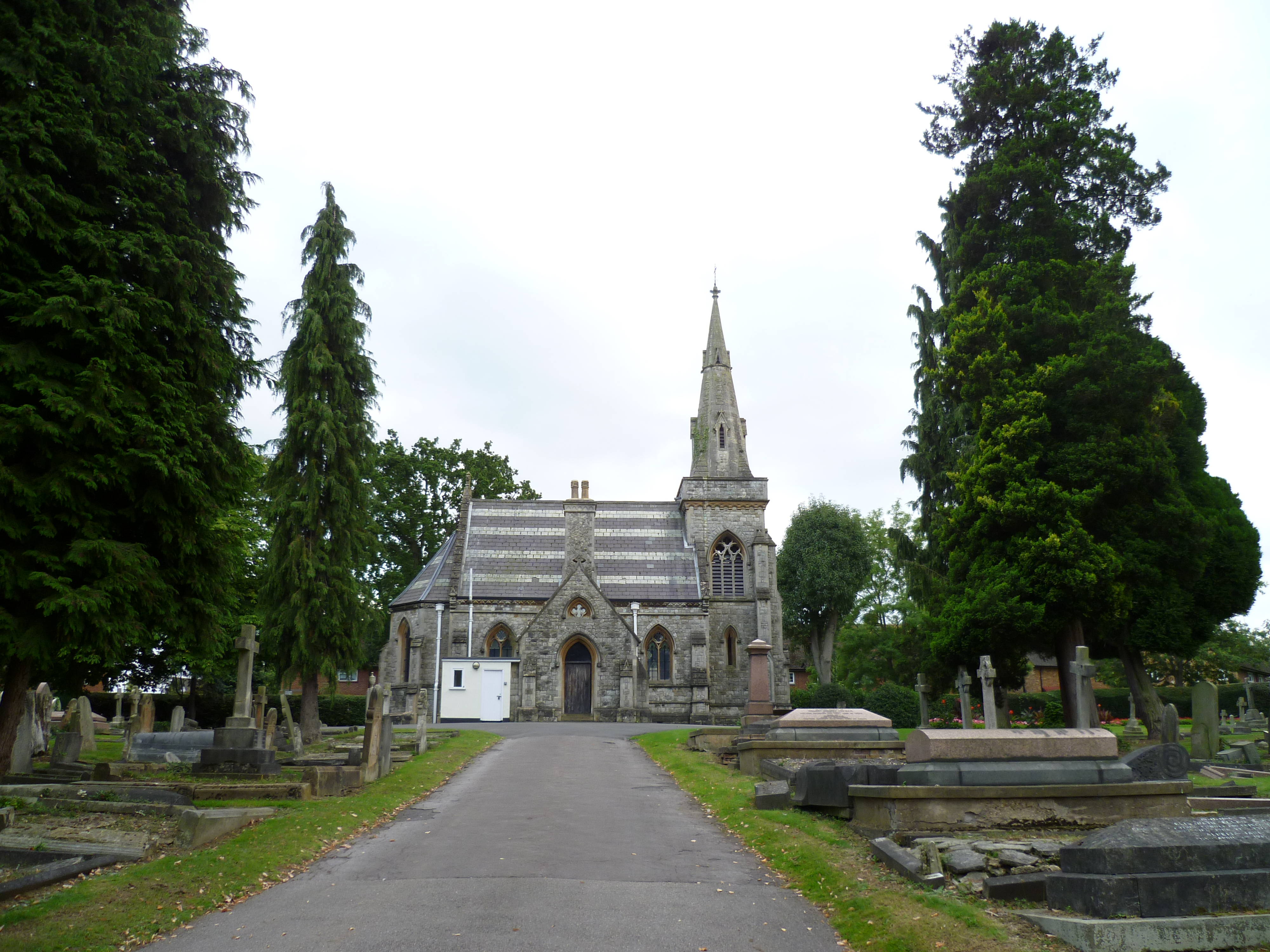
Lavender Hill Cemetery
Lavender Hill Cemetery is a cemetery in Cedar Road, Enfield, London, administered by the London Borough of Enfield. The cemetery opened in 1872 and has...
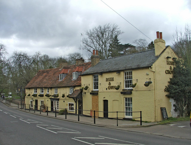
The Rose and Crown, Clay Hill
The Rose and Crown is a grade II listed public house in Clay Hill, Enfield. == References == == External links ==
Nearby Amenities
Located within 500m of 51.670612,-0.091823Have you been to Clay Hill?
Leave your review of Clay Hill below (or comments, questions and feedback).