Gaitskell's Wood

Wood, Forest in Cumberland Copeland

England

Gaitskell's Wood

Triangulation Pillar, Seascale The Ordnance Survey triangulation pillar adjacent to Seascale Golf Course was constructed in 1949. The flush bracket benchmark number S5760 on the west face of the pillar marks a height of 41.3431m above sea level (Ordnance Datum Newlyn) last verified in 1965 (photograph <a href="https://www.geograph.org.uk/photo/7219327">NY0301 : Flush Bracket Benchmark, Seascale</a>).
Triangulation Pillar, Seascale Credit: Adrian Taylor

Gaitskell's Wood is a picturesque forest located in the county of Cumberland, England. Spread across a sprawling area of approximately 100 acres, it is a prime example of the region's natural beauty and biodiversity. The wood is named after Hugh Gaitskell, a prominent British politician who had a strong connection to the area.

The forest is characterized by its dense canopy of ancient oak and ash trees, which provide a lush green cover throughout the year. The towering trees create a serene and tranquil atmosphere, making it a popular destination for nature enthusiasts and hikers. The forest floor is adorned with a diverse range of wildflowers, adding vibrant pops of color to the landscape.

Gaitskell's Wood is home to a rich variety of wildlife, including deer, foxes, badgers, and numerous bird species. The forest provides an ideal habitat for these creatures, offering ample food and shelter. Birdwatchers often flock to the area to catch glimpses of rare and migratory birds.

Walking trails meander through the wood, allowing visitors to explore its hidden treasures at their own pace. These well-maintained paths offer breathtaking views of the surrounding countryside and provide opportunities for photography and picnicking. Additionally, there are designated areas where visitors can camp and enjoy the forest's peaceful ambiance overnight.

Gaitskell's Wood is not only a haven for nature lovers but also an important site for ecological research and conservation. Efforts are continually made to protect and preserve the forest's natural habitat and wildlife, ensuring its beauty and significance for future generations to enjoy.

If you have any feedback on the listing, please let us know in the comments section below.

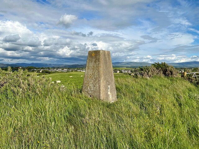
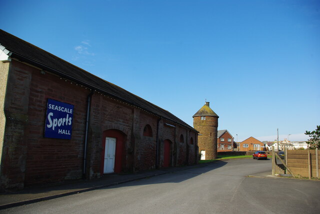
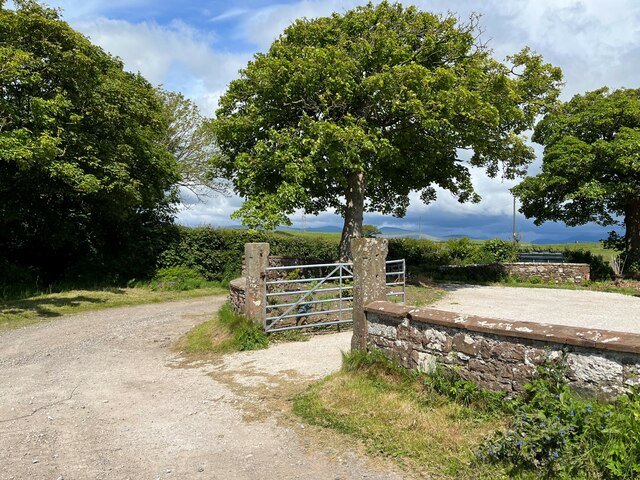
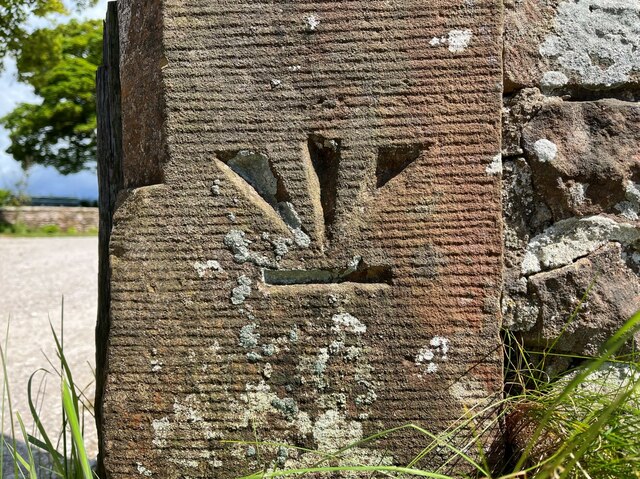
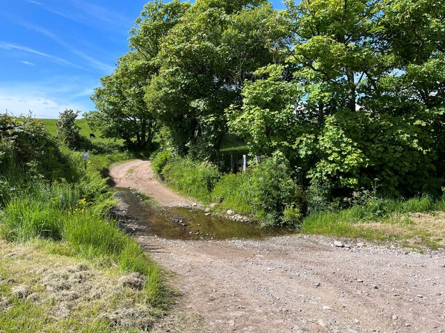
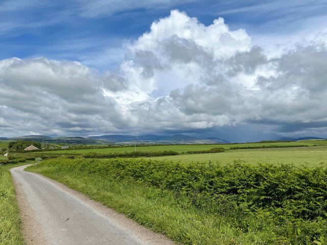
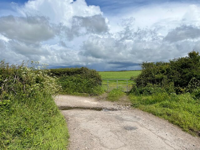
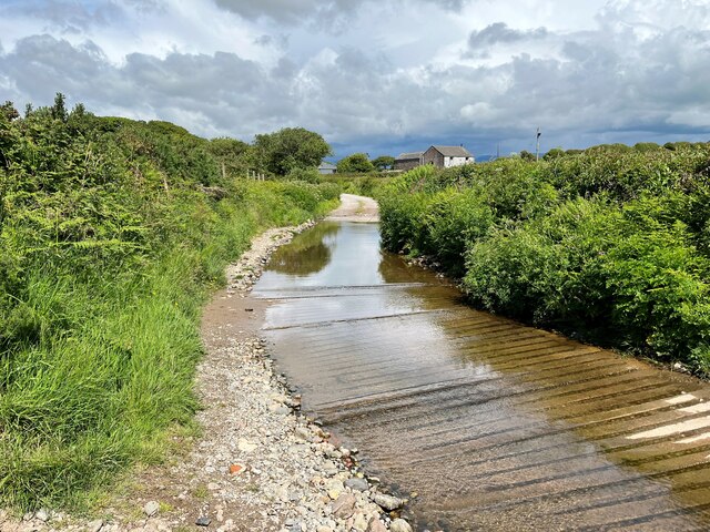
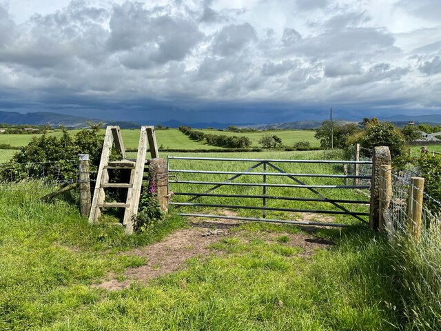
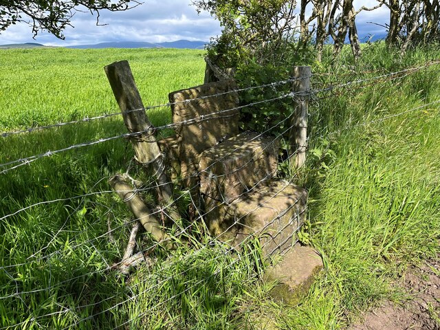
Gaitskell's Wood Images

Images are sourced within 2km of 54.404361/-3.4666685 or Grid Reference NY0401. Thanks to Geograph Open Source API. All images are credited.

Triangulation Pillar, Seascale The Ordnance Survey triangulation pillar adjacent to Seascale Golf Course was constructed in 1949. The flush bracket benchmark number S5760 on the west face of the pillar marks a height of 41.3431m above sea level (Ordnance Datum Newlyn) last verified in 1965 (photograph <a href="https://www.geograph.org.uk/photo/7219327">NY0301 : Flush Bracket Benchmark, Seascale</a>).
Triangulation Pillar, Seascale
The Ordnance Survey triangulation pillar adjacent to Seascale Golf Course was constructed in 1949. The flush bracket benchmark number S5760 on the west face of the pillar marks a height of 41.3431m above sea level (Ordnance Datum Newlyn) last verified in 1965 (photograph NY0301 : Flush Bracket Benchmark, Seascale).
Flush Bracket Benchmark, Seascale Detail of the flush bracket benchmark on the Ordnance Survey triangulation pillar at Seascale (photograph <a href="https://www.geograph.org.uk/photo/7219324">NY0301 : Triangulation Pillar, Seascale</a>). The flush bracket, benchmark number S5760, is on the west face of the pillar and marks a height of 41.3431m above sea level (Ordnance Datum Newlyn), last verified in 1965.
Flush Bracket Benchmark, Seascale
Detail of the flush bracket benchmark on the Ordnance Survey triangulation pillar at Seascale (photograph NY0301 : Triangulation Pillar, Seascale). The flush bracket, benchmark number S5760, is on the west face of the pillar and marks a height of 41.3431m above sea level (Ordnance Datum Newlyn), last verified in 1965.
Former Goods Yard With the Furness Railway water tower and goods shed
Former Goods Yard
With the Furness Railway water tower and goods shed
Postlethwaite Garage, Seascale
The B5344 in Seascale
Muddy tracks near Fleming Hall farm
England Coast Path near Seascale Almost lost in the vegetation, the narrow sandy path that forms the England Coast Path approaches Seascale.
This section of the England Coast Path was formerly the Cumbria Coastal Way.
England Coast Path near Seascale
Almost lost in the vegetation, the narrow sandy path that forms the England Coast Path approaches Seascale. This section of the England Coast Path was formerly the Cumbria Coastal Way.
Gateway at Panope The gateway to the house at Panope. The track leading past the gateway is a public bridleway to Hallsenna.
There is an inverted Ordnance Survey cut benchmark on the right hand gatepost (detail photograph <a href="https://www.geograph.org.uk/photo/7376084">NY0501 : Benchmark, Panope</a>).
Gateway at Panope
The gateway to the house at Panope. The track leading past the gateway is a public bridleway to Hallsenna. There is an inverted Ordnance Survey cut benchmark on the right hand gatepost (detail photograph NY0501 : Benchmark, Panope).
Benchmark, Panope Detail of the inverted Ordnance Survey cut benchmark on a gatepost at Panope (location photograph <a href="https://www.geograph.org.uk/photo/7376070">NY0501 : Gateway at Panope</a>).  The benchmark is possibly that indicated on the 1898 revision of the Ordnance Survey map as marking a height of 69.8 feet above mean sea level (Ordnance Datum Newlyn).
Benchmark, Panope
Detail of the inverted Ordnance Survey cut benchmark on a gatepost at Panope (location photograph NY0501 : Gateway at Panope). The benchmark is possibly that indicated on the 1898 revision of the Ordnance Survey map as marking a height of 69.8 feet above mean sea level (Ordnance Datum Newlyn).
Panope Ford The ford on Whitriggs Beck at Panope.  The track is the public bridleway from Panope to Cross Lanes at Seascale, joined almost in the ford (through the gate on the right) by a bridleway from Silver How and Blea Wath.
The beck follows the track for a few metres before leaving it to the left under a small footbridge hidden by vegetation in front of the sign.  The sign reads ‘NO SATNAV ROUTE FOR HGVS’ although the location is far from a metalled road.
Panope Ford
The ford on Whitriggs Beck at Panope. The track is the public bridleway from Panope to Cross Lanes at Seascale, joined almost in the ford (through the gate on the right) by a bridleway from Silver How and Blea Wath. The beck follows the track for a few metres before leaving it to the left under a small footbridge hidden by vegetation in front of the sign. The sign reads ‘NO SATNAV ROUTE FOR HGVS’ although the location is far from a metalled road.
Minor road near Stony How This minor road leads from the B5344 between Drigg and Seascale to Panope, Broom and Hallsenna.
There is heavy rain over the Lake District fells around Wasdale.
Minor road near Stony How
This minor road leads from the B5344 between Drigg and Seascale to Panope, Broom and Hallsenna. There is heavy rain over the Lake District fells around Wasdale.
Ford near Stony How In spite of rain clouds in the background, dry weather has reduced this small ford near Stony How to no more than a trickle.
The metalled public highway from the B5344 ends at the ford, continuing only as an unsurfaced access track and public bridleway to Panope and Hallsenna.
Ford near Stony How
In spite of rain clouds in the background, dry weather has reduced this small ford near Stony How to no more than a trickle. The metalled public highway from the B5344 ends at the ford, continuing only as an unsurfaced access track and public bridleway to Panope and Hallsenna.
Burnt Moor Ford This long paved ford at Burnt Moor is unusual insofar as Whitriggs Beck does not cross the track but merely flows along it for 25m (30yds), joining and leaving it again on the northwest side.
The track is a public bridleway from near Stony How to Panope.
Burnt Moor Ford
This long paved ford at Burnt Moor is unusual insofar as Whitriggs Beck does not cross the track but merely flows along it for 25m (30yds), joining and leaving it again on the northwest side. The track is a public bridleway from near Stony How to Panope.
Stile and Gate near Crossleys The stile is provided for a public footpath leading to the public bridleway at Crossleys, just visible in the right background.
There is a storm over the Lake District fells.
Stile and Gate near Crossleys
The stile is provided for a public footpath leading to the public bridleway at Crossleys, just visible in the right background. There is a storm over the Lake District fells.
Blocked Stile Near The Warren, this stile on the public footpath from Crossleys to Moss Side and Tarn How has been illegally blocked by fencing and barbed wire.
Blocked Stile
Near The Warren, this stile on the public footpath from Crossleys to Moss Side and Tarn How has been illegally blocked by fencing and barbed wire.
Track beside Seascale Golf Course The track runs along the edge of Seascale Golf Course from the village to How Farm and it is a public footpath.
The southernmost of the Lake District fells are in the background with the rounded bulk of Black Combe prominent.
Track beside Seascale Golf Course
The track runs along the edge of Seascale Golf Course from the village to How Farm and it is a public footpath. The southernmost of the Lake District fells are in the background with the rounded bulk of Black Combe prominent.
Lane near Fleming Hall The lane is a public bridleway and runs from Seascale Hall to Gosforth.
Lane near Fleming Hall
The lane is a public bridleway and runs from Seascale Hall to Gosforth.
Stored construction materials Stored construction materials beside the access track to Seascale Hall Farm.
Stored construction materials
Stored construction materials beside the access track to Seascale Hall Farm.
Show me another place!

Gaitskell's Wood is located at Grid Ref: NY0401 (Lat: 54.404361, Lng: -3.4666685)

Administrative County: Cumbria

District: Copeland

Police Authority: Cumbria

What 3 Words

///potential.enjoys.pints. Near Seascale, Cumbria

Related Wikis

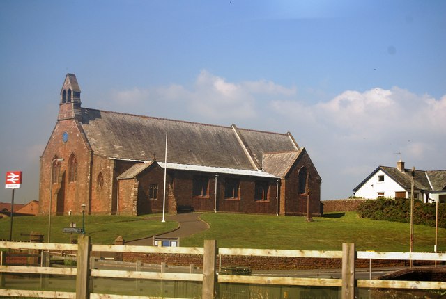
St Cuthbert, Seascale

St Cuthbert's is in Seascale, Cumbria, England. It is an active Anglican parish church in the deanery of Calder, and the diocese of Carlisle. Its benefice...

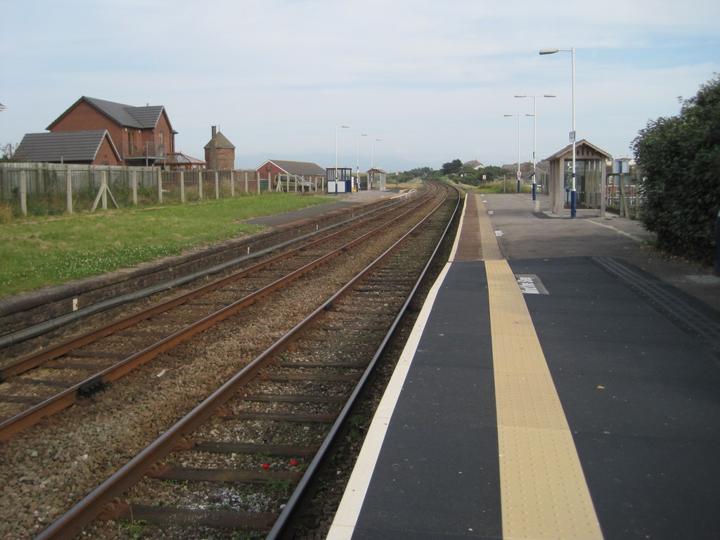
Seascale railway station

Seascale is a railway station on the Cumbrian Coast Line, which runs between Carlisle and Barrow-in-Furness. The station, situated 33+1⁄4 miles (54 km...

Seascale

Seascale is a village and civil parish on the Irish Sea coast of Cumbria, England, historically within Cumberland. The parish had a population of 1,747...

Grey Croft stone circle

Grey Croft stone circle is a restored stone circle near Seascale in Cumbria, England (grid reference NY03340238). It is situated near the site of the former...

Nearby Amenities

Located within 500m of 54.404361,-3.4666685
Bus Stop
Seascale Park (N bound)
Naptan AtcoCode: 090050221683
Naptan Bearing: N
Naptan CommonName: Seascale Park (N bound)
Naptan Indicator: near
Naptan Landmark: BNFL Calder Gate
Naptan NaptanCode: cumawdtp
Naptan Street: B5344
Naptan Verified: no
Source: naptan_import
Lat/Long: 54.4034196/-3.472842
Bus Stop
Seascale Park (S bound)
Naptan AtcoCode: 090050222305
Naptan Bearing: S
Naptan CommonName: Seascale Park (S bound)
Naptan Indicator: o/s
Naptan Landmark: Green Willow
Naptan NaptanCode: cumawdwd
Naptan Street: B5344
Naptan Verified: no
Source: naptan_import
Lat/Long: 54.4033036/-3.4727763
Crossing
Crossing: unmarked
Crossing Island: no
Tactile Paving: no
Lat/Long: 54.404213/-3.4722357
Turning Circle
Source: Bing
Lat/Long: 54.4022932/-3.4703174
Turning Circle
Source: Bing
Lat/Long: 54.4012814/-3.4699472
Power: tower
Lat/Long: 54.4065362/-3.4604306
Post Box
Ref: CA20 91
Lat/Long: 54.4028836/-3.4732242
Power: pole
Lat/Long: 54.4047303/-3.4722505
Power: pole
Lat/Long: 54.4046448/-3.472395
Power: pole
Lat/Long: 54.4054297/-3.4727759
Power: pole
Lat/Long: 54.4054663/-3.4726174
Power: pole
Lat/Long: 54.4063215/-3.4732384
Power: pole
Lat/Long: 54.4063187/-3.4730559
Power: pole
Lat/Long: 54.4007279/-3.4629102
Power: pole
Lat/Long: 54.4010519/-3.4640394
Power: pole
Lat/Long: 54.401372/-3.46517
Power: pole
Lat/Long: 54.4019372/-3.4664387
Power: pole
Lat/Long: 54.4008505/-3.4628016
Power: pole
Lat/Long: 54.4014375/-3.4632736
Power: pole
Lat/Long: 54.4022424/-3.4646483
Power: pole
Lat/Long: 54.4061579/-3.4686796
Power: pole
Lat/Long: 54.4055998/-3.4697056
Power: pole
Lat/Long: 54.4050721/-3.4706792
Power: pole
Lat/Long: 54.4045413/-3.4716153
Power: pole
Lat/Long: 54.4032908/-3.4664896
Power: pole
Lat/Long: 54.4039512/-3.4676456
Power: pole
Lat/Long: 54.4041713/-3.4696157
Power: pole
Lat/Long: 54.4044149/-3.4716502
Power: pole
Lat/Long: 54.402493/-3.4676564
Power: pole
Lat/Long: 54.4031175/-3.4690484
Power: pole
Lat/Long: 54.4037357/-3.4704593
Power: pole
Lat/Long: 54.4041807/-3.4714785
Power: pole
Lat/Long: 54.4046436/-3.4720659
Power: pole
Lat/Long: 54.4053204/-3.4717199
Power: pole
Lat/Long: 54.4068956/-3.4709743
Power: pole
Lat/Long: 54.4078369/-3.4705102
Generator Method: photovoltaic
Generator Source: solar
Generator Type: solar_photovoltaic_panel
Power: generator
Lat/Long: 54.4033532/-3.470749
Generator Method: photovoltaic
Generator Output Electricity: yes
Generator Source: solar
Generator Type: solar_photovoltaic_panel
Location: roof
Power: generator
Lat/Long: 54.4009223/-3.4709263
Generator Method: photovoltaic
Generator Output Electricity: yes
Generator Source: solar
Generator Type: solar_photovoltaic_panel
Location: roof
Power: generator
Lat/Long: 54.4016731/-3.4706699
Generator Method: photovoltaic
Generator Output Electricity: yes
Generator Source: solar
Generator Type: solar_photovoltaic_panel
Location: roof
Power: generator
Lat/Long: 54.4015939/-3.4716798
Generator Method: photovoltaic
Generator Output Electricity: yes
Generator Source: solar
Generator Type: solar_photovoltaic_panel
Location: roof
Power: generator
Lat/Long: 54.4028502/-3.4704136
Generator Method: photovoltaic
Generator Output Electricity: yes
Generator Source: solar
Generator Type: solar_photovoltaic_panel
Location: roof
Power: generator
Lat/Long: 54.4035964/-3.4716902
Power: pole
Lat/Long: 54.4065916/-3.4615649
Power: pole
Lat/Long: 54.406463/-3.462935
Power: pole
Lat/Long: 54.4063388/-3.4642269
Power: pole
Lat/Long: 54.4062134/-3.4655132
Power: pole
Lat/Long: 54.4060515/-3.4670929
Power: pole
Lat/Long: 54.4061181/-3.4679199
The data included in this document is from www.openstreetmap.org. The data is made available under ODbL.

Have you been to Gaitskell's Wood?

Leave your review of Gaitskell's Wood below (or comments, questions and feedback).