Seascale

Civil Parish in Cumberland Copeland

England

Seascale

Information, direction and warnings This array of signs is beside the England Coast Path near Carl Crag.
Information, direction and warnings Credit: Adrian Taylor

Seascale is a civil parish located in the district of Copeland, in the county of Cumbria, England. Situated on the coast of the Irish Sea, it is approximately 12 miles southwest of Whitehaven and 20 miles northwest of the Lake District National Park.

The village of Seascale itself is small, with a population of around 1,700 people. It is known for its picturesque views of the sea and the nearby fells, making it a popular destination for tourists and nature enthusiasts. The area is surrounded by beautiful countryside, offering ample opportunities for outdoor activities such as walking, hiking, and birdwatching.

The village has a rich history, with evidence of settlements dating back to the Bronze Age. It was traditionally a farming community, but in the late 19th century, it became a popular seaside resort due to the construction of the railway line, attracting visitors from across the country.

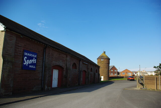
Today, Seascale is a thriving community with a range of amenities including shops, pubs, and restaurants. It is also home to the Sellafield nuclear reprocessing site, which has been a significant employer in the area since the 1950s.

Overall, Seascale offers a peaceful and scenic setting for both residents and visitors, with its proximity to the coast, stunning natural landscapes, and a strong sense of community.

If you have any feedback on the listing, please let us know in the comments section below.

Seascale Images

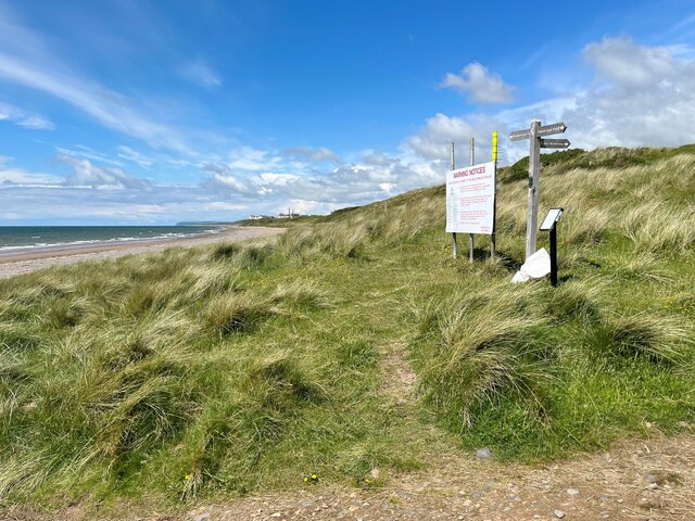
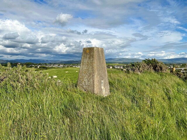
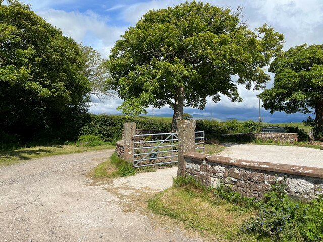
Images are sourced within 2km of 54.399315/-3.476932 or Grid Reference NY0401. Thanks to Geograph Open Source API. All images are credited.

Information, direction and warnings This array of signs is beside the England Coast Path near Carl Crag.
Information, direction and warnings
This array of signs is beside the England Coast Path near Carl Crag.
Footbridge on the Coast Path The footbridge crosses a small sike on the England Coast Path south of Seascale.
Footbridge on the Coast Path
The footbridge crosses a small sike on the England Coast Path south of Seascale.
Bridleway near Low Moor The public bridleway runs from the beach near Carl Crag to Low Moor passing beside the Drigg Low Level Waste Repository, Britain’s ‘central’ dump for radioactive nuclear waste. The high fence topped with razor wire forms the boundary of the 110 hectare site.
The Lake District fells can be glimpsed in the background.
Bridleway near Low Moor
The public bridleway runs from the beach near Carl Crag to Low Moor passing beside the Drigg Low Level Waste Repository, Britain’s ‘central’ dump for radioactive nuclear waste. The high fence topped with razor wire forms the boundary of the 110 hectare site. The Lake District fells can be glimpsed in the background.
England Coast Path near Carl Crag The warning sign relates to the MOD Eskmeals Range and is located beside the England Coast Path (formerly the Cumbria Coastal Way) at the end of the public bridleway from Low Moor.
England Coast Path near Carl Crag
The warning sign relates to the MOD Eskmeals Range and is located beside the England Coast Path (formerly the Cumbria Coastal Way) at the end of the public bridleway from Low Moor.
Triangulation Pillar, Seascale The Ordnance Survey triangulation pillar adjacent to Seascale Golf Course was constructed in 1949. The flush bracket benchmark number S5760 on the west face of the pillar marks a height of 41.3431m above sea level (Ordnance Datum Newlyn) last verified in 1965 (photograph <a href="https://www.geograph.org.uk/photo/7219327">NY0301 : Flush Bracket Benchmark, Seascale</a>).
Triangulation Pillar, Seascale
The Ordnance Survey triangulation pillar adjacent to Seascale Golf Course was constructed in 1949. The flush bracket benchmark number S5760 on the west face of the pillar marks a height of 41.3431m above sea level (Ordnance Datum Newlyn) last verified in 1965 (photograph NY0301 : Flush Bracket Benchmark, Seascale).
Flush Bracket Benchmark, Seascale Detail of the flush bracket benchmark on the Ordnance Survey triangulation pillar at Seascale (photograph <a href="https://www.geograph.org.uk/photo/7219324">NY0301 : Triangulation Pillar, Seascale</a>). The flush bracket, benchmark number S5760, is on the west face of the pillar and marks a height of 41.3431m above sea level (Ordnance Datum Newlyn), last verified in 1965.
Flush Bracket Benchmark, Seascale
Detail of the flush bracket benchmark on the Ordnance Survey triangulation pillar at Seascale (photograph NY0301 : Triangulation Pillar, Seascale). The flush bracket, benchmark number S5760, is on the west face of the pillar and marks a height of 41.3431m above sea level (Ordnance Datum Newlyn), last verified in 1965.
Former Goods Yard With the Furness Railway water tower and goods shed
Former Goods Yard
With the Furness Railway water tower and goods shed
The England Coast Path near Sellafield
Golf course and high security The multiple security fences of Sellafield are visible beyond the fairway. No searching for lost balls over there.
Golf course and high security
The multiple security fences of Sellafield are visible beyond the fairway. No searching for lost balls over there.
Postlethwaite Garage, Seascale
The B5344 in Seascale
Muddy tracks near Fleming Hall farm
England Coast Path near Seascale Almost lost in the vegetation, the narrow sandy path that forms the England Coast Path approaches Seascale.
This section of the England Coast Path was formerly the Cumbria Coastal Way.
England Coast Path near Seascale
Almost lost in the vegetation, the narrow sandy path that forms the England Coast Path approaches Seascale. This section of the England Coast Path was formerly the Cumbria Coastal Way.
Gateway at Panope The gateway to the house at Panope. The track leading past the gateway is a public bridleway to Hallsenna.
There is an inverted Ordnance Survey cut benchmark on the right hand gatepost (detail photograph <a href="https://www.geograph.org.uk/photo/7376084">NY0501 : Benchmark, Panope</a>).
Gateway at Panope
The gateway to the house at Panope. The track leading past the gateway is a public bridleway to Hallsenna. There is an inverted Ordnance Survey cut benchmark on the right hand gatepost (detail photograph NY0501 : Benchmark, Panope).
Benchmark, Panope Detail of the inverted Ordnance Survey cut benchmark on a gatepost at Panope (location photograph <a href="https://www.geograph.org.uk/photo/7376070">NY0501 : Gateway at Panope</a>).  The benchmark is possibly that indicated on the 1898 revision of the Ordnance Survey map as marking a height of 69.8 feet above mean sea level (Ordnance Datum Newlyn).
Benchmark, Panope
Detail of the inverted Ordnance Survey cut benchmark on a gatepost at Panope (location photograph NY0501 : Gateway at Panope). The benchmark is possibly that indicated on the 1898 revision of the Ordnance Survey map as marking a height of 69.8 feet above mean sea level (Ordnance Datum Newlyn).
Panope Ford The ford on Whitriggs Beck at Panope.  The track is the public bridleway from Panope to Cross Lanes at Seascale, joined almost in the ford (through the gate on the right) by a bridleway from Silver How and Blea Wath.
The beck follows the track for a few metres before leaving it to the left under a small footbridge hidden by vegetation in front of the sign.  The sign reads ‘NO SATNAV ROUTE FOR HGVS’ although the location is far from a metalled road.
Panope Ford
The ford on Whitriggs Beck at Panope. The track is the public bridleway from Panope to Cross Lanes at Seascale, joined almost in the ford (through the gate on the right) by a bridleway from Silver How and Blea Wath. The beck follows the track for a few metres before leaving it to the left under a small footbridge hidden by vegetation in front of the sign. The sign reads ‘NO SATNAV ROUTE FOR HGVS’ although the location is far from a metalled road.
Minor road near Stony How This minor road leads from the B5344 between Drigg and Seascale to Panope, Broom and Hallsenna.
There is heavy rain over the Lake District fells around Wasdale.
Minor road near Stony How
This minor road leads from the B5344 between Drigg and Seascale to Panope, Broom and Hallsenna. There is heavy rain over the Lake District fells around Wasdale.
Ford near Stony How In spite of rain clouds in the background, dry weather has reduced this small ford near Stony How to no more than a trickle.
The metalled public highway from the B5344 ends at the ford, continuing only as an unsurfaced access track and public bridleway to Panope and Hallsenna.
Ford near Stony How
In spite of rain clouds in the background, dry weather has reduced this small ford near Stony How to no more than a trickle. The metalled public highway from the B5344 ends at the ford, continuing only as an unsurfaced access track and public bridleway to Panope and Hallsenna.
Show me another place!

Seascale is located at Grid Ref: NY0401 (Lat: 54.399315, Lng: -3.476932)

Administrative County: Cumbria

District: Copeland

Police Authority: Cumbria

What 3 Words

///moment.sprinting.curated. Near Seascale, Cumbria

Related Wikis

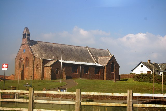
St Cuthbert, Seascale

St Cuthbert's is in Seascale, Cumbria, England. It is an active Anglican parish church in the deanery of Calder, and the diocese of Carlisle. Its benefice...

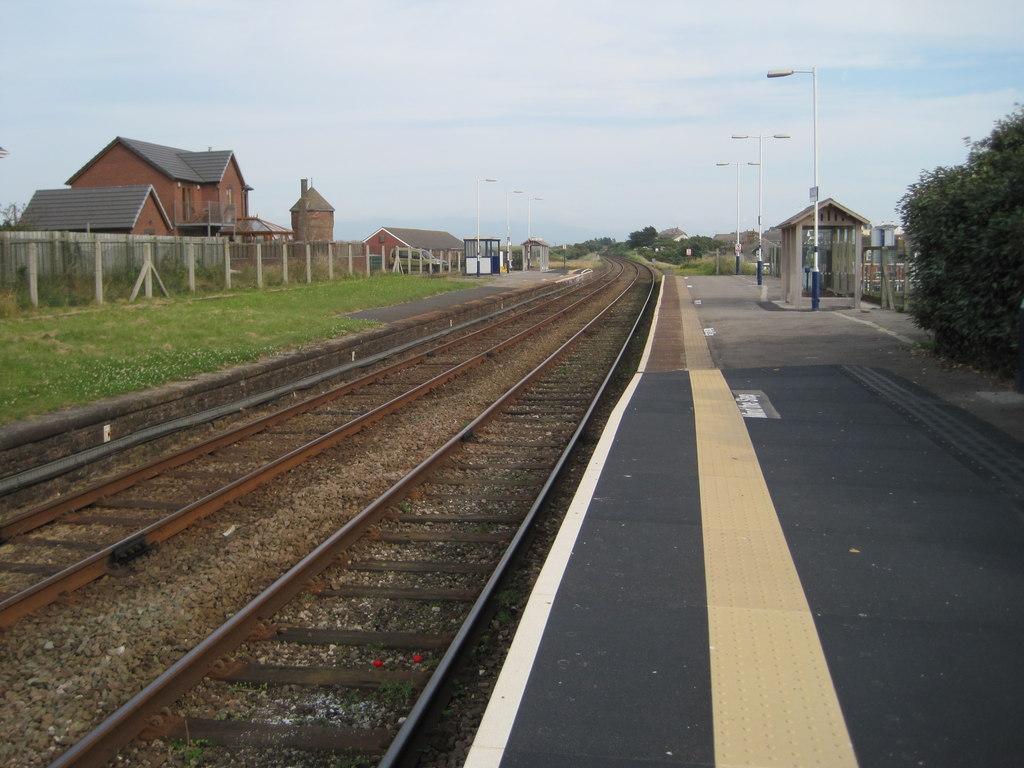
Seascale railway station

Seascale is a railway station on the Cumbrian Coast Line, which runs between Carlisle and Barrow-in-Furness. The station, situated 33+1⁄4 miles (54 km...

Seascale

Seascale is a village and civil parish on the Irish Sea coast of Cumbria, England, historically within Cumberland. The parish had a population of 1,747...

Grey Croft stone circle

Grey Croft stone circle is a restored stone circle near Seascale in Cumbria, England (grid reference NY03340238). It is situated near the site of the former...

Nearby Amenities

Located within 500m of 54.399315,-3.476932
Seascale
Place: village
Source: npe
Lat/Long: 54.3987161/-3.4779802
Bus Stop
Post office (S bound)
Naptan AtcoCode: 090050221774
Naptan Bearing: S
Naptan BusStopType: CUS
Naptan CommonName: Post office (S bound)
Naptan Indicator: near
Naptan Landmark: no. 48 The Stance
Naptan NaptanCode: cumawdtw
Naptan Street: B5344
Naptan Verified: no
Source: naptan_import
Lat/Long: 54.3973962/-3.4780948
Bus Stop
Post Office (N bound)
Naptan AtcoCode: 090050221815
Naptan Bearing: N
Naptan CommonName: Post Office (N bound)
Naptan Indicator: near
Naptan Landmark: Whole House Junction
Naptan NaptanCode: cumawdwa
Naptan Street: B5344
Naptan Verified: no
Source: naptan_import
Lat/Long: 54.3979425/-3.477529
Bus Stop
Primary School
Naptan AtcoCode: 090050222769
Naptan Bearing: N
Naptan CommonName: Primary School
Naptan Indicator: o/s
Naptan Landmark: Seascale County Primary School
Naptan NaptanCode: cumawdwj
Naptan Street: B5344
Naptan Verified: no
Source: naptan_import
Lat/Long: 54.4008939/-3.4757864
Telephone
Booth: K6
Covered: booth
Source: survey
Lat/Long: 54.4017351/-3.4745848
Post Box
Ref: CA20 54
Source: survey
Lat/Long: 54.3978308/-3.4777047
Post Box
Ref: CA20 24
Lat/Long: 54.4004085/-3.4707744
Post Box
Ref: CA20 91
Lat/Long: 54.4028836/-3.4732242
Post Office
Seascale Post Office
Addr City: Seascale
Addr Country: GB
Addr Postcode: CA20 1PR
Addr Street: Gosforth Road
Brand: Post Office
Brand Wikidata: Q1783168
Check Date: 2022-05-27
Check Date Opening Hours: 2022-05-27
Contact Website: https://www.postoffice.co.uk/branch-finder/4234103/seascale
Opening Hours: Mo-Fr 09:00-18:00; Sa 09:00-13:00
Ref Pol Id: 134636
Lat/Long: 54.396368/-3.4804611
Give Way
Direction: backward
Lat/Long: 54.4010895/-3.4768406
Give Way
Direction: backward
Lat/Long: 54.400633/-3.4760543
Generator Method: photovoltaic
Generator Source: solar
Generator Type: solar_photovoltaic_panel
Power: generator
Lat/Long: 54.3981055/-3.4825654
Generator Method: photovoltaic
Generator Source: solar
Generator Type: solar_photovoltaic_panel
Power: generator
Lat/Long: 54.3984225/-3.4720069
Generator Method: photovoltaic
Generator Source: solar
Generator Type: solar_photovoltaic_panel
Power: generator
Lat/Long: 54.3984132/-3.4721652
Generator Method: photovoltaic
Generator Source: solar
Generator Type: solar_photovoltaic_panel
Power: generator
Lat/Long: 54.3984405/-3.4723127
Generator Method: photovoltaic
Generator Source: solar
Generator Type: solar_photovoltaic_panel
Power: generator
Lat/Long: 54.3984904/-3.4724817
Generator Method: photovoltaic
Generator Source: solar
Generator Type: solar_photovoltaic_panel
Power: generator
Lat/Long: 54.3985006/-3.4725635
Generator Method: photovoltaic
Generator Source: solar
Generator Type: solar_photovoltaic_panel
Power: generator
Lat/Long: 54.3985232/-3.4726627
Generator Method: photovoltaic
Generator Source: solar
Generator Type: solar_photovoltaic_panel
Power: generator
Lat/Long: 54.3991408/-3.4738711
Power: pole
Lat/Long: 54.3996434/-3.4810027
Power: pole
Lat/Long: 54.4003238/-3.4801694
Power: pole
Lat/Long: 54.4008608/-3.4795199
Generator Method: photovoltaic
Generator Output Electricity: yes
Generator Source: solar
Generator Type: solar_photovoltaic_panel
Location: roof
Power: generator
Lat/Long: 54.3992421/-3.4795605
Generator Method: photovoltaic
Generator Output Electricity: yes
Generator Source: solar
Generator Type: solar_photovoltaic_panel
Location: roof
Power: generator
Lat/Long: 54.3992493/-3.4796676
Give Way
Direction: forward
Lat/Long: 54.3993921/-3.4791361
Generator Method: photovoltaic
Generator Output Electricity: yes
Generator Source: solar
Generator Type: solar_photovoltaic_panel
Location: roof
Power: generator
Lat/Long: 54.401542/-3.4794808
Generator Method: photovoltaic
Generator Output Electricity: yes
Generator Source: solar
Generator Type: solar_photovoltaic_panel
Location: roof
Power: generator
Lat/Long: 54.4013384/-3.4788759
Generator Method: photovoltaic
Generator Output Electricity: yes
Generator Source: solar
Generator Type: solar_photovoltaic_panel
Location: roof
Power: generator
Lat/Long: 54.4001324/-3.4787131
Generator Method: photovoltaic
Generator Output Electricity: yes
Generator Source: solar
Generator Type: solar_photovoltaic_panel
Location: roof
Power: generator
Lat/Long: 54.4001309/-3.478755
Generator Method: photovoltaic
Generator Output Electricity: yes
Generator Source: solar
Generator Type: solar_photovoltaic_panel
Location: roof
Power: generator
Lat/Long: 54.4001507/-3.4794587
Generator Method: photovoltaic
Generator Output Electricity: yes
Generator Source: solar
Generator Type: solar_photovoltaic_panel
Location: roof
Power: generator
Lat/Long: 54.3998842/-3.4794744
Generator Method: photovoltaic
Generator Output Electricity: yes
Generator Source: solar
Generator Type: solar_photovoltaic_panel
Location: roof
Power: generator
Lat/Long: 54.4003517/-3.4780826
Generator Method: photovoltaic
Generator Output Electricity: yes
Generator Source: solar
Generator Type: solar_photovoltaic_panel
Location: roof
Power: generator
Lat/Long: 54.40037/-3.4780277
Generator Method: photovoltaic
Generator Output Electricity: yes
Generator Source: solar
Generator Type: solar_photovoltaic_panel
Location: roof
Power: generator
Lat/Long: 54.3995872/-3.4783992
Generator Method: photovoltaic
Generator Output Electricity: yes
Generator Source: solar
Generator Type: solar_photovoltaic_panel
Location: roof
Power: generator
Lat/Long: 54.399144/-3.4782344
Generator Method: photovoltaic
Generator Output Electricity: yes
Generator Source: solar
Generator Type: solar_photovoltaic_panel
Location: roof
Power: generator
Lat/Long: 54.3992842/-3.4780643
Generator Method: photovoltaic
Generator Output Electricity: yes
Generator Source: solar
Generator Type: solar_photovoltaic_panel
Location: roof
Power: generator
Lat/Long: 54.3976988/-3.4782788
Generator Method: photovoltaic
Generator Output Electricity: yes
Generator Source: solar
Generator Type: solar_photovoltaic_panel
Location: roof
Power: generator
Lat/Long: 54.3969464/-3.4777295
Generator Method: photovoltaic
Generator Output Electricity: yes
Generator Source: solar
Generator Type: solar_photovoltaic_panel
Location: roof
Power: generator
Lat/Long: 54.3966007/-3.4820565
Generator Method: photovoltaic
Generator Output Electricity: yes
Generator Source: solar
Generator Type: solar_photovoltaic_panel
Location: roof
Power: generator
Lat/Long: 54.3973805/-3.4824332
Generator Method: photovoltaic
Generator Output Electricity: yes
Generator Source: solar
Generator Type: solar_photovoltaic_panel
Location: roof
Power: generator
Lat/Long: 54.3971642/-3.4833933
Generator Method: photovoltaic
Generator Output Electricity: yes
Generator Source: solar
Generator Type: solar_photovoltaic_panel
Location: roof
Power: generator
Lat/Long: 54.401401/-3.4769656
Generator Method: photovoltaic
Generator Output Electricity: yes
Generator Source: solar
Generator Type: solar_photovoltaic_panel
Location: roof
Power: generator
Lat/Long: 54.400692/-3.4719167
Generator Method: photovoltaic
Generator Output Electricity: yes
Generator Source: solar
Generator Type: solar_photovoltaic_panel
Location: roof
Power: generator
Lat/Long: 54.4003497/-3.4710754
Generator Method: photovoltaic
Generator Output Electricity: yes
Generator Source: solar
Generator Type: solar_photovoltaic_panel
Location: roof
Power: generator
Lat/Long: 54.3998807/-3.4699924
Generator Method: photovoltaic
Generator Output Electricity: yes
Generator Source: solar
Generator Type: solar_photovoltaic_panel
Location: roof
Power: generator
Lat/Long: 54.4000451/-3.4704476
Generator Method: photovoltaic
Generator Output Electricity: yes
Generator Source: solar
Generator Type: solar_photovoltaic_panel
Location: roof
Power: generator
Lat/Long: 54.40017/-3.4705731
Generator Method: photovoltaic
Generator Output Electricity: yes
Generator Source: solar
Generator Type: solar_photovoltaic_panel
Location: roof
Power: generator
Lat/Long: 54.4009223/-3.4709263
Generator Method: photovoltaic
Generator Output Electricity: yes
Generator Source: solar
Generator Type: solar_photovoltaic_panel
Location: roof
Power: generator
Lat/Long: 54.4016731/-3.4706699
Generator Method: photovoltaic
Generator Output Electricity: yes
Generator Source: solar
Generator Type: solar_photovoltaic_panel
Location: roof
Power: generator
Lat/Long: 54.4015939/-3.4716798
Generator Method: photovoltaic
Generator Output Electricity: yes
Generator Source: solar
Generator Type: solar_photovoltaic_panel
Location: roof
Power: generator
Lat/Long: 54.3989719/-3.4845241
Generator Method: photovoltaic
Generator Output Electricity: yes
Generator Source: solar
Generator Type: solar_photovoltaic_panel
Location: roof
Power: generator
Lat/Long: 54.3989688/-3.4846131
Bench
Lat/Long: 54.4007359/-3.4760719
Atm
Atm: yes
Lat/Long: 54.3964241/-3.4807871
Man Made: street_cabinet
Lat/Long: 54.3965359/-3.4809954
Man Made: street_cabinet
Lat/Long: 54.3965405/-3.480951
Crossing
Crossing: unmarked
Crossing Island: no
Crossing Markings: no
Tactile Paving: yes
Lat/Long: 54.3965569/-3.4808015
Give Way
Direction: backward
Lat/Long: 54.3966287/-3.4793356
Give Way
Direction: forward
Lat/Long: 54.396523/-3.4798096
Entrance: yes
Lat/Long: 54.3967347/-3.4806623
Entrance: yes
Lat/Long: 54.3969379/-3.4807206
Give Way
Direction: forward
Lat/Long: 54.3965709/-3.4800847
Give Way
Direction: forward
Lat/Long: 54.396636/-3.4796181
Give Way
Direction: forward
Lat/Long: 54.4005531/-3.471439
Give Way
Direction: forward
Lat/Long: 54.4004066/-3.4725029
Power: pole
Lat/Long: 54.3952115/-3.4799714
Power: pole
Lat/Long: 54.3956197/-3.4811605
The data included in this document is from www.openstreetmap.org. The data is made available under ODbL.

Have you been to Seascale?

Leave your review of Seascale below (or comments, questions and feedback).