Claydowns Covert

Wood, Forest in Somerset Somerset West and Taunton

England

Claydowns Covert

Nettlecombe : Torre Rocks A country lane.
Nettlecombe : Torre Rocks Credit: Lewis Clarke

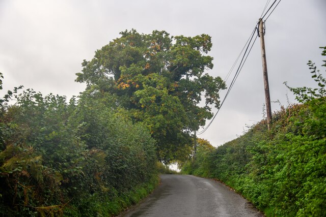
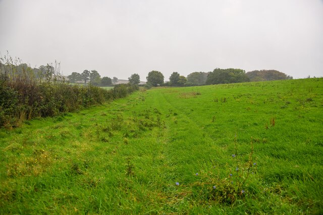
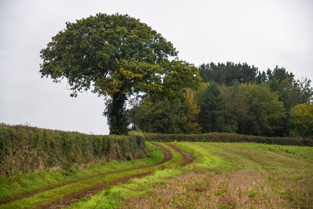
Claydowns Covert is a picturesque woodland located in Somerset, England. Covering an area of approximately 100 acres, this enchanting forest is a haven for nature enthusiasts and those seeking a peaceful retreat. The covert is nestled within the larger Claydowns estate, which is renowned for its diverse ecosystem and stunning natural beauty.

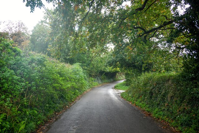
The woodland itself is characterized by a mix of deciduous and coniferous trees, creating a rich tapestry of colors throughout the year. Towering oak and beech trees dominate the landscape, providing a canopy that shelters a variety of flora and fauna. The forest floor is carpeted with a lush undergrowth of ferns, mosses, and wildflowers, adding to the sense of tranquility and natural harmony.

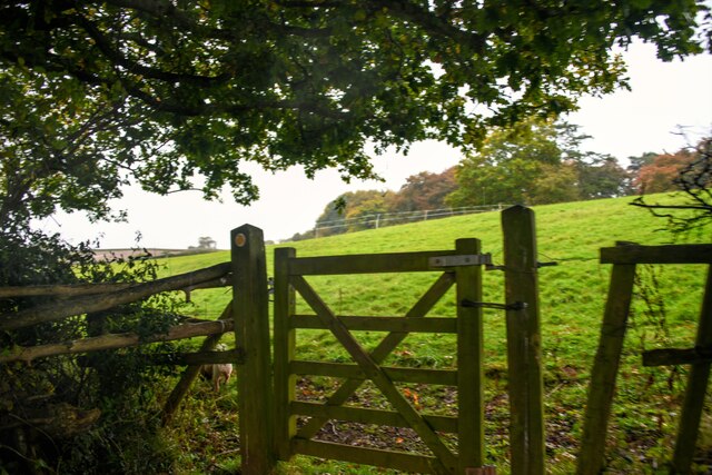
Claydowns Covert is also home to a plethora of wildlife. Birdsong fills the air as numerous species, including woodpeckers, thrushes, and owls, find refuge among the branches. Squirrels playfully scamper along the tree trunks, while deer can occasionally be spotted grazing in the clearings. The covert provides a vital habitat for these creatures, offering food, shelter, and protection from the outside world.

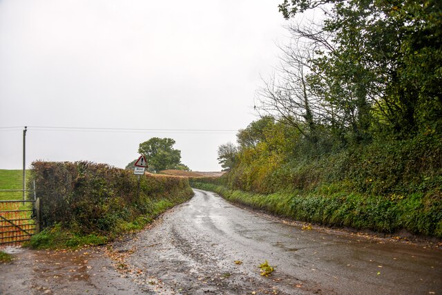
Visitors to Claydowns Covert can enjoy a range of activities. Walking trails wind through the forest, allowing visitors to explore its hidden corners and discover its hidden treasures. Picnic areas provide the perfect spot to relax and enjoy the peaceful surroundings, while birdwatching enthusiasts can set up their binoculars and observe the feathered inhabitants.

In conclusion, Claydowns Covert is a captivating woodland, offering a sanctuary of natural beauty and tranquility. Its diverse ecosystem, abundant wildlife, and scenic landscapes make it a must-visit destination for nature lovers and those seeking solace in the embrace of Somerset's enchanting woodlands.

If you have any feedback on the listing, please let us know in the comments section below.

Claydowns Covert Images

Images are sourced within 2km of 51.16369/-3.369856 or Grid Reference ST0441. Thanks to Geograph Open Source API. All images are credited.

Nettlecombe : Torre Rocks A country lane.
Nettlecombe : Torre Rocks
A country lane.
Nettlecombe : Torre Rocks Looking along Torre Rocks.
Nettlecombe : Torre Rocks
Looking along Torre Rocks.
Old Cleeve : Track A track heads to Lodge Rocks House.
Old Cleeve : Track
A track heads to Lodge Rocks House.
Old Cleeve : Field Looking out across a field.
Old Cleeve : Field
Looking out across a field.
Old Cleeve : Lodge Rocks Looking along the country lane.
Old Cleeve : Lodge Rocks
Looking along the country lane.
Old Cleeve : Lodge Rocks Looking along a country lane.
Old Cleeve : Lodge Rocks
Looking along a country lane.
Old Cleeve : Grassy Field & Horses Looking across a field to some horses.
Old Cleeve : Grassy Field & Horses
Looking across a field to some horses.
Old Cleeve : Grassy Field Looking across a grassy field.
Old Cleeve : Grassy Field
Looking across a grassy field.
Old Cleeve : Grassy Field Looking across a grassy field in the countryside.
Old Cleeve : Grassy Field
Looking across a grassy field in the countryside.
Old Cleeve : Grassy Field A right of way through the field.
Old Cleeve : Grassy Field
A right of way through the field.
Old Cleeve : Grassy Field Looking across a field.
Old Cleeve : Grassy Field
Looking across a field.
Old Cleeve : Grassy Field The right of way heads through the field.
Old Cleeve : Grassy Field
The right of way heads through the field.
Old Cleeve : Grassy Field Looking across a field.
Old Cleeve : Grassy Field
Looking across a field.
Old Cleeve : Lodge Rocks House Looking across the countryside to Lodge Rocks Hosue.
Old Cleeve : Lodge Rocks House
Looking across the countryside to Lodge Rocks Hosue.
Old Cleeve : Grassy Field Looking acorss the countryside.
Old Cleeve : Grassy Field
Looking acorss the countryside.
Old Cleeve : Grassy Field A field in the countryside.
Old Cleeve : Grassy Field
A field in the countryside.
Old Cleeve : The Grange Looking down to The Grange.
Old Cleeve : The Grange
Looking down to The Grange.
Old Cleeve : Field A stile provides access into the field.
Old Cleeve : Field
A stile provides access into the field.
Show me another place!

Claydowns Covert is located at Grid Ref: ST0441 (Lat: 51.16369, Lng: -3.369856)

Administrative County: Somerset

District: Somerset West and Taunton

Police Authority: Avon and Somerset

What 3 Words

///apparatus.potential.airship. Near Watchet, Somerset

Related Wikis

Washford railway station

Washford railway station is a station on the West Somerset Railway, a heritage railway in England. The station is situated in the village of Washford...

Washford

Washford is a village on the Washford River in the civil parish of Old Cleeve, Somerset, England. The village is next to Cleeve Abbey, one of the best...

Washford (WSMR) railway station

Washford was an intermediate station on the West Somerset Mineral Railway (WSMR), which was built primarily to carry iron ore from mines to Watchet harbour...

Old Cleeve

Old Cleeve is a village 5 miles (8 km) south east of Minehead in the Somerset West and Taunton district of Somerset, England, and also a civil parish....

Cleeve Abbey

Cleeve Abbey is a medieval monastery located near the village of Washford, in Somerset, England. It is a Grade I listed building and has been scheduled...

Torre (WSMR) railway station

Torre was a recognised stopping place, not a formal station, on the West Somerset Mineral Railway (WSMR). The railway's prime purpose was to carry iron...

Washford Radio Museum

Washford Radio Museum has been re-located to 'The Radio Museum' at the former Anchor Inn, 5, Anchor Street, Watchet, Somerset, TA23 0AZ. == References... ==

Tropiquaria

Tropiquaria Zoo is a small tropical house and zoo in West Somerset, England. It is located 16 miles (26 km) from Taunton and 9 miles (14 km) from Minehead...

Nearby Amenities

Located within 500m of 51.16369,-3.369856
Washford
Addr City: Watchet
Addr Country: GB
Addr County: Somerset
Addr Housename: Washford Station
Addr Postcode: TA23 0PP
Addr Street: Station Road
Addr Village: Washford
Fhrs Authority: West Somerset
Fhrs Id: 161831
Fhrs Local Authority Id: PI/000001926
Naptan AtcoCode: 940GZZWSWAS
Network: West Somerset Railway
Network Wikidata: Q12072724
Operator: West Somerset Railway Plc
Operator Wikidata: Q20970722
Public Transport: station
Railway: station
Start Date: 1874
Start Date Railway: 1874
Train: yes
Usage: tourism
Wikidata: Q7971489
Wikipedia: en:Washford railway station
Lat/Long: 51.1615078/-3.3688908
Post Office
Washford Post Office
Addr City: Watchet
Addr Country: GB
Addr County: Somerset
Addr Postcode: TA23 0PJ
Addr Street: Station Road
Addr Village: Washford
Brand: Post Office
Brand Wikidata: Q1783168
Brand Wikipedia: en:Post Office Ltd
Contact Website: https://www.postoffice.co.uk/branch-finder/2525496/washford
Fhrs Authority: West Somerset
Fhrs Id: 160718
Fhrs Local Authority Id: PI/000000515
Opening Hours: Mo-Fr 08:30-13:00
Operator: Post Office Ltd
Ref Pol Id: 9963
Source: OS OpenData StreetView
Lat/Long: 51.1606353/-3.3647927
Operator: West Somerset Railway plc
Railway: switch
Lat/Long: 51.1611369/-3.3700199
Railway: buffer_stop
Lat/Long: 51.1612087/-3.3699505
Operator: West Somerset Railway Heritage Trust
Railway: switch
Lat/Long: 51.1613252/-3.3696286
Operator: West Somerset Railway Heritage Trust
Railway: switch
Lat/Long: 51.1614435/-3.3692407
Operator: West Somerset Railway Heritage Trust
Railway: switch
Lat/Long: 51.1616494/-3.3686148
Operator: West Somerset Railway Heritage Trust
Railway: switch
Lat/Long: 51.1617441/-3.3684704
Operator: West Somerset Railway Heritage Trust
Railway: switch
Lat/Long: 51.1618053/-3.368252
Operator: West Somerset Railway Heritage Trust
Railway: switch
Lat/Long: 51.1618105/-3.3683378
Operator: West Somerset Railway Heritage Trust
Railway: switch
Lat/Long: 51.1618649/-3.3680888
Railway: buffer_stop
Lat/Long: 51.1621987/-3.3670671
Railway: buffer_stop
Lat/Long: 51.1622177/-3.3668956
Bus Stop
Garage
Bus: yes
Naptan AtcoCode: 3600SOA10233
Naptan Bearing: SE
Naptan CommonName: Garage
Naptan Indicator: SE-bound
Naptan NaptanCode: sotadmwd
Naptan Street: Station Road
Naptan Verified: no
Network: The Buses of Somerset
Network Wikidata: Q17018973
Operator: First South West
Operator Wikidata: Q5454172
Public Transport: platform
Ref: 15
Lat/Long: 51.1612394/-3.3670659
Historic: archaeological_site
Lat/Long: 51.1665832/-3.368655
Clyden's Cross, Prayer Cross (remains)
Historic: ruins
Source: visible
Lat/Long: 51.1668699/-3.369433
Post Box
Operator: Royal Mail
Operator Wikidata: Q638098
Post Box Type: lamp
Ref: TA23 48
Royal Cypher: EIIR
Royal Cypher Wikidata: Q33102113
Lat/Long: 51.1605928/-3.3646569
Covered: yes
Indoor: yes
Railway: buffer_stop
Lat/Long: 51.1615424/-3.3692851
Covered: yes
Indoor: yes
Railway: buffer_stop
Lat/Long: 51.1615792/-3.3693148
Give Way
Direction: backward
Lat/Long: 51.1628779/-3.3644798
Barrier: bollard
Lat/Long: 51.1604541/-3.3726817
Barrier: bollard
Lat/Long: 51.1604615/-3.3726577
Barrier: bollard
Lat/Long: 51.163142/-3.3645795
Power: pole
Lat/Long: 51.1629549/-3.369898
Power: pole
Lat/Long: 51.1632761/-3.3685542
Power: pole
Lat/Long: 51.1635183/-3.3675001
Power: pole
Lat/Long: 51.1640276/-3.3653275
Power: pole
Lat/Long: 51.1631138/-3.3712284
Power: pole
Lat/Long: 51.1632602/-3.3725293
Power: pole
Lat/Long: 51.1633762/-3.3735297
Power: pole
Lat/Long: 51.1636958/-3.3762871
Brendon Service Station
Shop: car
Lat/Long: 51.160968/-3.3670199
Bus Stop
Garage
Bus: yes
Naptan AtcoCode: 3600SOA10234
Naptan Bearing: NW
Naptan CommonName: Garage
Naptan Indicator: NW-bound
Naptan NaptanCode: sotadmwa
Naptan Street: Station Road
Naptan Verified: no
Network: The Buses of Somerset
Network Wikidata: Q17018973
Operator: First South West
Operator Wikidata: Q5454172
Public Transport: platform
Ref: 15
Lat/Long: 51.1611777/-3.3672139
Operator: West Somerset Railway Heritage Trust
Railway: switch
Lat/Long: 51.1617656/-3.3688686
Covered: yes
Indoor: yes
Railway: buffer_stop
Lat/Long: 51.1616175/-3.369342
Railway: buffer_stop
Lat/Long: 51.1618399/-3.3686452
The data included in this document is from www.openstreetmap.org. The data is made available under ODbL.

Have you been to Claydowns Covert?

Leave your review of Claydowns Covert below (or comments, questions and feedback).