Freer Moor Wood

Wood, Forest in Cumberland Copeland

England

Freer Moor Wood

Field north of minor road close to Friar Bank Wood The ploughed field is close to various small settlements, east of Pica for example; it's also north of the area of relatively low-level moorland at High Park. The notice on the gate declares that the land is private.
Field north of minor road close to Friar Bank Wood Credit: Trevor Littlewood

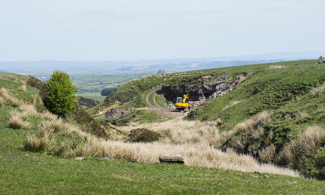
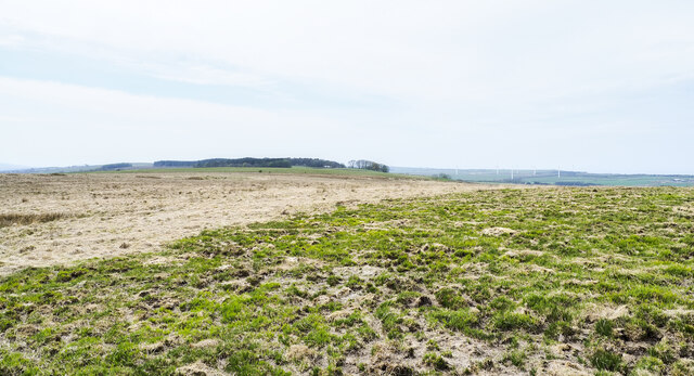
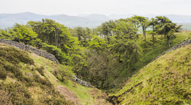
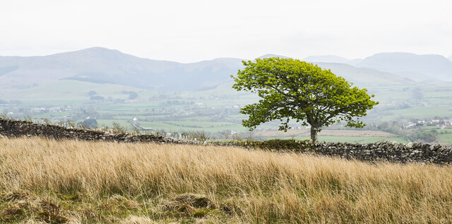
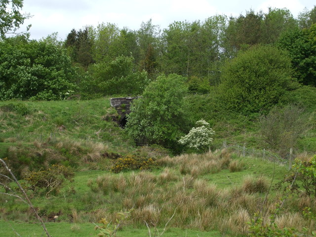
Freer Moor Wood is a picturesque forest located in the county of Cumberland, England. Covering an area of approximately 200 acres, the wood is a natural haven for both wildlife and visitors alike.

The woodland is characterized by its dense canopy of ancient oak and beech trees, which provide a rich habitat for a variety of flora and fauna. Bluebells carpet the forest floor in the spring, creating a vibrant display of color, while in the summer, the woodland is alive with the songs of numerous bird species such as woodpeckers, thrushes, and warblers.

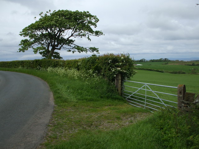
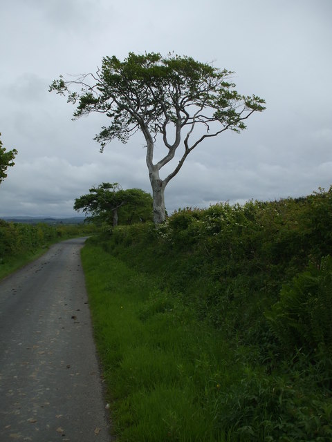
The forest is crisscrossed by a network of well-maintained footpaths, allowing visitors to explore the wood at their leisure. These paths wind through the undergrowth and alongside a tranquil stream, offering a peaceful and serene atmosphere. Along the way, visitors may come across hidden clearings, perfect for picnicking and enjoying the natural surroundings.

Freer Moor Wood is also home to a diverse range of wildlife. Deer, badgers, and foxes are often spotted roaming the forest, while the trees provide a nesting site for owls and other birds of prey. The wood is a designated Site of Special Scientific Interest (SSSI), due to its importance for conservation and preservation of the local ecosystem.

Overall, Freer Moor Wood is a captivating forest that offers a peaceful retreat from the hustle and bustle of daily life. With its ancient trees, diverse wildlife, and tranquil ambiance, it is a must-visit destination for nature enthusiasts and those seeking a connection with the natural world.

If you have any feedback on the listing, please let us know in the comments section below.

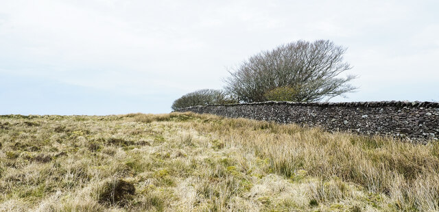
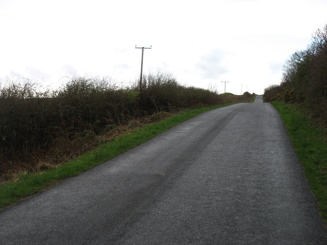
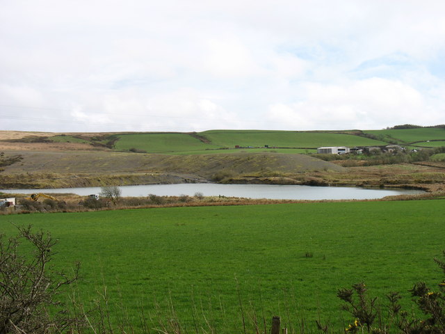
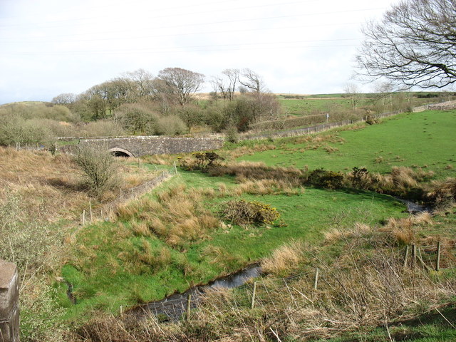
Freer Moor Wood Images

Images are sourced within 2km of 54.589408/-3.4949161 or Grid Reference NY0322. Thanks to Geograph Open Source API. All images are credited.

Field north of minor road close to Friar Bank Wood The ploughed field is close to various small settlements, east of Pica for example; it's also north of the area of relatively low-level moorland at High Park. The notice on the gate declares that the land is private.
Field north of minor road close to Friar Bank Wood
The ploughed field is close to various small settlements, east of Pica for example; it's also north of the area of relatively low-level moorland at High Park. The notice on the gate declares that the land is private.
Small quarry beside Thief Gill The quarry and stream are on the north side of a minor road bounding the moorland area of High Park from where the ground slopes down quite steeply to an area named on OS maps as Dean Moor.
Small quarry beside Thief Gill
The quarry and stream are on the north side of a minor road bounding the moorland area of High Park from where the ground slopes down quite steeply to an area named on OS maps as Dean Moor.
Lightly burned vegetation at High Park High Park is an area of moorland at a relatively low level - the camera position is at around 220 m. above sea level. An area of vegetation has been burned, presumably purposely and with good intent, in an attempt at some form of control. Similar burning was observed on nearby Lake District hills of the Blake Fell / Gavel Fell group. Periodic burning of heather is practised on moorland managed as grouse moor, but that's surely not what is going on here.
Lightly burned vegetation at High Park
High Park is an area of moorland at a relatively low level - the camera position is at around 220 m. above sea level. An area of vegetation has been burned, presumably purposely and with good intent, in an attempt at some form of control. Similar burning was observed on nearby Lake District hills of the Blake Fell / Gavel Fell group. Periodic burning of heather is practised on moorland managed as grouse moor, but that's surely not what is going on here.
Moorland on High Park High Park is an area of moorland at a relatively low level - the camera position is at around 230 m. above sea level. The nearer vegetation has been burned, presumably purposely and with good intent, in an attempt at some form of control. Similar burning was observed on nearby Lake District hills of the Blake Fell / Gavel Fell group. Periodic burning of heather is practised on moorland managed as grouse moor, but that's surely not what is going on here.
Tutehill Wood is in the distance.
Moorland on High Park
High Park is an area of moorland at a relatively low level - the camera position is at around 230 m. above sea level. The nearer vegetation has been burned, presumably purposely and with good intent, in an attempt at some form of control. Similar burning was observed on nearby Lake District hills of the Blake Fell / Gavel Fell group. Periodic burning of heather is practised on moorland managed as grouse moor, but that's surely not what is going on here. Tutehill Wood is in the distance.
Larch trees in cleft of stream In late April the larches are in 'new leaf'. The cleft is that of a stream which according to OS mapping fades away as do others in the area; it's assumed that the waters somehow enter Dub Beck.
The western hills of the Lake District are seen hazily in the distance.
Larch trees in cleft of stream
In late April the larches are in 'new leaf'. The cleft is that of a stream which according to OS mapping fades away as do others in the area; it's assumed that the waters somehow enter Dub Beck. The western hills of the Lake District are seen hazily in the distance.
Lone tree beyond dry stone wall The wall crosses the High Park area of moorland.
Hills of the western side of the Lake District are in the distance; Blake Fell is to the left.
Lone tree beyond dry stone wall
The wall crosses the High Park area of moorland. Hills of the western side of the Lake District are in the distance; Blake Fell is to the left.
Moorland alongside wall The moorland is part of the area known as High Park.
Moorland alongside wall
The moorland is part of the area known as High Park.
High Park Climbed from road to SSW via old gate and then over rough vegetation to trig on grey morning.

Name: High Park
Hill number: 5289
Height: 247m / 810ft
Area: 34B: Lake District - Central & Western Fells
Class: Hu
Grid ref: NY 04294 21200
Summit feature: trig point
Drop: 119m
Col: 128m  NY056207
High Park
Climbed from road to SSW via old gate and then over rough vegetation to trig on grey morning. Name: High Park Hill number: 5289 Height: 247m / 810ft Area: 34B: Lake District - Central & Western Fells Class: Hu Grid ref: NY 04294 21200 Summit feature: trig point Drop: 119m Col: 128m NY056207
A track on Dean Moor It seems that this track is less used than it once was.
A track on Dean Moor
It seems that this track is less used than it once was.
The lane to Pica
The lane to Pica
The remains of works near Wilson Park
Keekle High Bridge Looking upstream
Keekle High Bridge
Looking upstream
Partially Hidden Railway bridge over the River Keekle, part of the old Cleator & Workington Junction Railway.
Partially Hidden
Railway bridge over the River Keekle, part of the old Cleator & Workington Junction Railway.
Pica village Pica is an old mining community situated 182m asl.
Pica village
Pica is an old mining community situated 182m asl.
Railway Bridge Abutments Stone abutments are all that remain of the bridge that carried the Cleator & Workington Junction Railway.
Railway Bridge Abutments
Stone abutments are all that remain of the bridge that carried the Cleator & Workington Junction Railway.
Country lane near Gilgarren Farmland belonging to Kelmore Hill Farm on the right of the hedge.
Country lane near Gilgarren
Farmland belonging to Kelmore Hill Farm on the right of the hedge.
Road into Gilgarren
Road into Gilgarren
Sparse looking trees alongside a country lane
Show me another place!

Freer Moor Wood is located at Grid Ref: NY0322 (Lat: 54.589408, Lng: -3.4949161)

Administrative County: Cumbria

District: Copeland

Police Authority: Cumbria

What 3 Words

///awoken.lightens.whisker. Near Distington, Cumbria

Related Wikis

Oatlands railway station

Oatlands railway station served the village of Pica and Oatlands Colliery in the former English county of Cumberland, now part of Cumbria. == Location... ==

Branthwaite Edge

Branthwaite Edge is a hamlet in Cumbria, England. == References ==

Distington railway station

Distington railway station was opened jointly by the Cleator and Workington Junction Railway (C&WJR) and the LNWR and Furness Joint Railway (The Joint...

Common End, Cumbria

Common End is a hamlet within the civil parish of Distington in Cumbria, England. Common End was on the A595 road until it was by-passed. == References ==
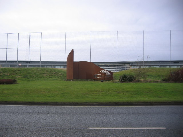
Lakes College

Lakes College is a further education institute located at Lillyhall, Cumberland, England, between the towns of Workington and Whitehaven. The college offers...

Browtop

Browtop is a village in Cumbria, England. It is also an area of Keswick where Francis Galton stayed (In Galton's biography, Karl Pearson states that "Browtop...

Distington

Distington () is a large village and civil parish in Cumbria, England, 3 miles (4.8 km) south of Workington and 4 miles (6.4 km) north of Whitehaven. Historically...

Lamplugh railway station

Lamplugh railway station was built by the Whitehaven, Cleator and Egremont Railway. It served the scattered community of Lamplugh, Cumbria, England....

Nearby Amenities

Located within 500m of 54.589408,-3.4949161
Home Farm (N bound)
Naptan AtcoCode: 090050043420
Naptan Bearing: NW
Naptan BusStopType: CUS
Naptan CommonName: Home Farm (N bound)
Naptan Indicator: opp
Naptan Landmark: Home Farm
Naptan NaptanCode: cumatpga
Naptan Street: No name
Naptan Verified: no
Source: naptan_import
Lat/Long: 54.592985/-3.4994561
Power: tower
Lat/Long: 54.5876165/-3.4943572
Power: tower
Lat/Long: 54.5897692/-3.4929953
Power: tower
Lat/Long: 54.5850875/-3.4970737
Lime Kiln Wood
Natural: wood
Lat/Long: 54.5888322/-3.492173
Feather Knott
Place: locality
Lat/Long: 54.5868952/-3.501285
The data included in this document is from www.openstreetmap.org. The data is made available under ODbL.

Have you been to Freer Moor Wood?

Leave your review of Freer Moor Wood below (or comments, questions and feedback).