Church Wood

Wood, Forest in Cumberland Copeland

England

Church Wood

Old Boundary Marker on Red Beck Road Parish Boundary Marker against the parapet of the bridge over Hole Beck on the north side of Red Beck Road. On the boundary of Cleator Moor and Arlecdon and Frizington parishes. See also <span class="nowrap"><a title="https://www.lakesguides.co.uk/photos/BQI59.jpg" rel="nofollow ugc noopener" href="https://www.lakesguides.co.uk/photos/BQI59.jpg">Link</a><img style="margin-left:2px;" alt="External link" title="External link - shift click to open in new window" src="https://s1.geograph.org.uk/img/external.png" width="10" height="10"/></span>.

Milestone Society National ID: CU_CLARFR01pb
Old Boundary Marker on Red Beck Road Credit: Colin Smith

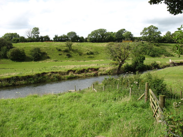
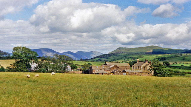
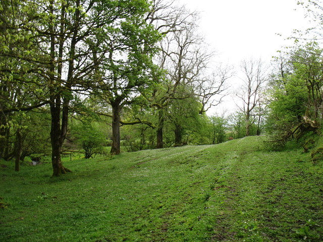
Church Wood is a serene and idyllic forest located in the picturesque region of Cumberland, England. Nestled amidst the rolling hills and lush greenery, this woodland area spans over a significant expanse of approximately 100 acres. It is a captivating combination of ancient woodland and newer plantations, offering a unique blend of natural beauty and historical significance.

The woodland is predominantly composed of native tree species such as oak, beech, and birch, which have flourished here for centuries. These majestic trees create a dense canopy, allowing only dappled sunlight to filter through, providing a cool and tranquil ambiance. The forest floor is adorned with a rich variety of flora, including bluebells, ferns, and wild garlic, creating a vibrant and colorful carpet.

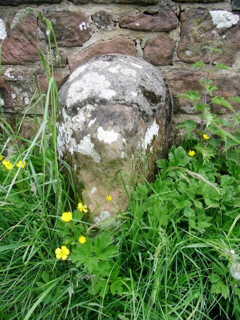
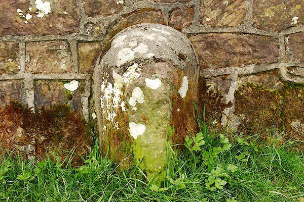
Church Wood derives its name from the presence of an ancient and dilapidated church located within its boundaries. This historical relic adds an enchanting aura to the woodland, evoking a sense of mystery and intrigue. Visitors are often drawn to explore the remnants of the church, which dates back several centuries, and discover its fascinating history.

The wood offers a plethora of recreational activities for nature enthusiasts, including walking trails, birdwatching, and nature photography. Its tranquil atmosphere and abundance of wildlife make it a haven for bird species such as woodpeckers, buzzards, and various songbirds. Additionally, the woodland is home to a diverse range of small mammals, including foxes, badgers, and squirrels, further enhancing its ecological significance.

Church Wood, Cumberland, is a cherished natural gem that captivates visitors with its timeless beauty and historical charm. Its combination of ancient woodland, diverse flora and fauna, and remnants of an old church make it a truly enchanting destination for nature lovers and history buffs alike.

If you have any feedback on the listing, please let us know in the comments section below.

Church Wood Images

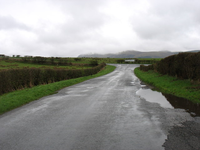
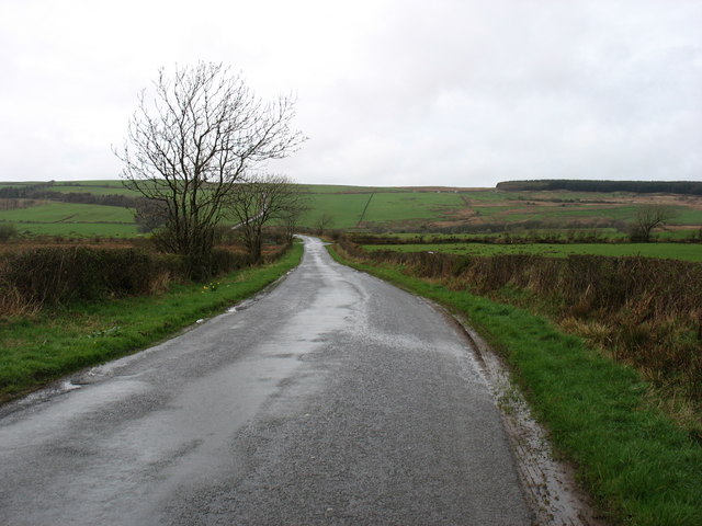
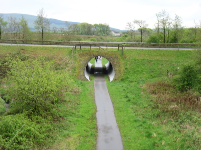
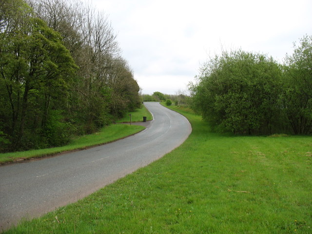
Images are sourced within 2km of 54.537529/-3.4971611 or Grid Reference NY0316. Thanks to Geograph Open Source API. All images are credited.

Old Boundary Marker on Red Beck Road Parish Boundary Marker against the parapet of the bridge over Hole Beck on the north side of Red Beck Road. On the boundary of Cleator Moor and Arlecdon and Frizington parishes. See also <span class="nowrap"><a title="https://www.lakesguides.co.uk/photos/BQI59.jpg" rel="nofollow ugc noopener" href="https://www.lakesguides.co.uk/photos/BQI59.jpg">Link</a><img style="margin-left:2px;" alt="External link" title="External link - shift click to open in new window" src="https://s1.geograph.org.uk/img/external.png" width="10" height="10"/></span>.

Milestone Society National ID: CU_CLARFR01pb
Old Boundary Marker on Red Beck Road
Parish Boundary Marker against the parapet of the bridge over Hole Beck on the north side of Red Beck Road. On the boundary of Cleator Moor and Arlecdon and Frizington parishes. See also LinkExternal link. Milestone Society National ID: CU_CLARFR01pb
The River Ehen One wonders whether this river is ever confused with the (much better known) River Eden!
The River Ehen
One wonders whether this river is ever confused with the (much better known) River Eden!
Eastward towards Ennerdale from near Cleator Moor A fine panorama of the mountains around Ennerdale, seen from A5086 Cleator - Frizington road by Holbeck Farm. To the left is Murton Fell (1,461 ft.), Blake Fell (1,626 ft.), then Great Borne (2,018 ft.) and Starling Dodd (2,077 ft.) shining in sunlight NE of Ennerdale Water, while rather nearer on the right is Grike (1,556 ft.) joined to the Ennerdale Fells which line the south side of Ennerdale Water.
Eastward towards Ennerdale from near Cleator Moor
A fine panorama of the mountains around Ennerdale, seen from A5086 Cleator - Frizington road by Holbeck Farm. To the left is Murton Fell (1,461 ft.), Blake Fell (1,626 ft.), then Great Borne (2,018 ft.) and Starling Dodd (2,077 ft.) shining in sunlight NE of Ennerdale Water, while rather nearer on the right is Grike (1,556 ft.) joined to the Ennerdale Fells which line the south side of Ennerdale Water.
Approaching the A5086 The hill in the distance is Grike, south-west of Ennerdale Water.
Approaching the A5086
The hill in the distance is Grike, south-west of Ennerdale Water.
The minor road from Arlecdon to Whitehaven
The drive to Parkside
Cycle track at Winder The cycle track is on the line of a disused railway. The overbridge carries a fairly new (ca. 2000) private access road to the Eskett Quarries, which relieved Winder itself of the heavy traffic.
Cycle track at Winder
The cycle track is on the line of a disused railway. The overbridge carries a fairly new (ca. 2000) private access road to the Eskett Quarries, which relieved Winder itself of the heavy traffic.
The road to Eskett Quarries This private road was built, I think about 15 years ago, to relieve the village of Winder from heavy quarry traffic.
The road to Eskett Quarries
This private road was built, I think about 15 years ago, to relieve the village of Winder from heavy quarry traffic.
Woodland near Winder Pleasant country on the footpath to Rowrah. If, of course, you can ignore the activity in the quarry behind you!
Woodland near Winder
Pleasant country on the footpath to Rowrah. If, of course, you can ignore the activity in the quarry behind you!
St Bees Head from the air Cleator Moor is in the foreground, Whitehaven is on the coast to the right, Egremont is on the left.
St Bees Head from the air
Cleator Moor is in the foreground, Whitehaven is on the coast to the right, Egremont is on the left.
Birks Road in Cleator Moor
The Sure Start Centre in Cleator Moor
The Recycling Centre at Frizington Not identified on the map and difficult to find using road signs.
The Recycling Centre at Frizington
Not identified on the map and difficult to find using road signs.
Rough ground at Frizington The sign says "No Trespassing, No Footpath".
Rough ground at Frizington
The sign says "No Trespassing, No Footpath".
Looking towards Frizington from the B5294 outside the old vicarage This is taken from just outside of where I live.
Looking towards Frizington from the B5294 outside the old vicarage
This is taken from just outside of where I live.
Acre Walls Farmland Acre Walls farm itself is in the Dark woods mid photo and the background is the western lake district mountains.
Acre Walls Farmland
Acre Walls farm itself is in the Dark woods mid photo and the background is the western lake district mountains.
Arlecdon Hill from the road
Bridge over Windergill Beck. Poor planning to have to put the telegraph pole just there.
Bridge over Windergill Beck.
Poor planning to have to put the telegraph pole just there.
Show me another place!

Church Wood is located at Grid Ref: NY0316 (Lat: 54.537529, Lng: -3.4971611)

Administrative County: Cumbria

District: Copeland

Police Authority: Cumbria

What 3 Words

///zaps.concerned.pats. Near Frizington, Cumbria

Nearby Locations

Church Wood

Related Wikis

St Paul, Frizington

St Paul's is in Frizington, Cumbria, England. It is an active Anglican parish church in the deanery of Calder, and the diocese of Carlisle. Its benefice...

Yeathouse railway station

Yeathouse railway station was a later addition to the Whitehaven, Cleator and Egremont Railway. It served the communities of Yeathouse and Eskett, near...

Frizington railway station

Frizington railway station was built by the Whitehaven, Cleator and Egremont Railway. It served the industrial Parkside area of Frizington, Cumbria, England...

High Leys

High Leys is located to the south-east of Rowrah in Cumbria (map), along the C2C cycle route prior to Sheriffs Gate. The status of national nature reserve...

Eskett railway station

Eskett railway station was short-lived as a passenger station. it was built by the Whitehaven, Cleator and Egremont Railway to serve the hamlet of Eskett...

Arlecdon

Arlecdon is a village in the Borough of Copeland in Cumbria, England, near the town of Whitehaven. == Church == St Michael's Parish church is an historic...

Cleator Moor Celtic F.C.

Cleator Moor Celtic Football Club is a football club based in Cleator Moor, Cumbria, England. The club are currently members of the West Lancashire League...

Winder railway station

Winder railway station was built by the Whitehaven, Cleator and Egremont Railway. It served the village of Winder, Frizington, Cumbria, England. ��2�...

Nearby Amenities

Located within 500m of 54.537529,-3.4971611
Frizington
Place: village
Source: npe
Wikidata: Q5505085
Wikipedia: en:Frizington
Lat/Long: 54.539383/-3.4937716
Mini Roundabout
Direction: clockwise
Lat/Long: 54.5403622/-3.495137
Post Box
Ref: CA26 29
Lat/Long: 54.5367365/-3.4941217
Post Box
Ref: CA26 81
Lat/Long: 54.5407327/-3.495127
Bus Stop
Kangol Factory
Local Ref: AT
Naptan AtcoCode: 090050010336
Naptan Bearing: S
Naptan CommonName: Kangol Factory
Naptan Indicator: at
Naptan Landmark: factory car park
Naptan NaptanCode: cumatjtm
Naptan Street: A5086
Naptan Verified: no
Shelter: yes
Source: naptan_import
Lat/Long: 54.5397006/-3.494904
Bus Stop
Freemasons Hall
Naptan AtcoCode: 090050010337
Naptan Bearing: N
Naptan CommonName: Freemasons Hall
Naptan Indicator: o/s
Naptan Landmark: Freemasons Hall
Naptan NaptanCode: cumatjtp
Naptan Street: A5086
Naptan Verified: no
Source: naptan_import
Lat/Long: 54.5378395/-3.4946666
Mowbray Farm Road End
Local Ref: AT
Naptan AtcoCode: 090050010340
Naptan Bearing: S
Naptan BusStopType: CUS
Naptan CommonName: Mowbray Farm Road End
Naptan Indicator: at
Naptan Landmark: track to refuse depot
Naptan NaptanCode: cumatjwa
Naptan Street: A5086
Naptan Verified: no
Source: naptan_import
Lat/Long: 54.5366504/-3.4941594
Bus Stop
Main Street- Chemist
Naptan AtcoCode: 090050012716
Naptan Bearing: N
Naptan CommonName: Main Street- Chemist
Naptan Indicator: o/s
Naptan Landmark: Chemist Shop
Naptan NaptanCode: cumatmaw
Naptan Street: A5086
Naptan Verified: no
Source: naptan_import
Lat/Long: 54.5412135/-3.494388
Turning Circle
Lat/Long: 54.5393491/-3.4902519
Pharmacy
Boots
Addr City: Frizington
Addr Housenumber: 6-8
Addr Postcode: CA26 3SA
Addr Street: Main Street
Brand Wikidata: Q6123139
Operator: Boots
Phone: +44 1946 810352
Lat/Long: 54.5411805/-3.4944891
Post Box
Ref: CA26 125
Lat/Long: 54.5359181/-3.5013827
Grit Bin
Lat/Long: 54.5380857/-3.497022
Turning Circle
Lat/Long: 54.5374081/-3.4950758
Stephen Burns
Addr City: Frizington
Addr Housenumber: 151
Addr Postcode: CA26 3SB
Addr Street: Main Street
Shop: bookmaker
Lat/Long: 54.5415619/-3.4938286
F Irving & Sons.
Addr City: Frizington
Addr Housenumber: 53
Addr Postcode: CA26 3SB
Addr Street: Main Street
Craft: carpenter
Phone: +44 1946 810473
Lat/Long: 54.5414777/-3.4938569
F Irving & Sons
Addr City: Frizington
Addr Housenumber: 153
Addr Postcode: CA26 3SB
Addr Street: Main Street
Phone: +44 1946 810473
Shop: funeral_directors
Website: https://www.irvingsfunerals.com/
Lat/Long: 54.5414223/-3.4938481
Traffic Signals
Lat/Long: 54.5408256/-3.4946686
Thompson's Bakery
Addr City: Frizington
Addr Housenumber: 165
Addr Postcode: CA26 3SB
Addr Street: Main Street
Phone: +44 1946 810572
Shop: bakery
Lat/Long: 54.5410205/-3.494346
Post Office
Frizington Post Office
Addr City: Frizington
Addr Country: GB
Addr Postcode: CA26 3SA
Addr Street: Main Street
Branch: Frizington
Brand: Post Office
Brand Wikidata: Q1783168
Check Date: 2022-05-27
Check Date Opening Hours: 2022-05-27
Contact Website: https://www.postoffice.co.uk/branch-finder/2844109/frizington
Opening Hours: Mo 08:30-17:00; Tu-Fr 09:00-17:00; Sa 09:00-12:00
Ref Pol Id: 11409
Lat/Long: 54.5407907/-3.4951465
Lifestyle Choice
Addr City: Frizington
Addr Street: Main Street
Shop: convenience
Lat/Long: 54.5407419/-3.4949994
Cafe
Lingla Cafe
Name En: Lingla Cafe
Lat/Long: 54.5386521/-3.496551
Simply Booze
Addr City: Frizington
Addr Street: Frizington Road
Shop: alcohol
Lat/Long: 54.5400037/-3.495293
Noexit: yes
Lat/Long: 54.5394198/-3.4915382
Power: pole
Lat/Long: 54.5389746/-3.5022021
Power: pole
Lat/Long: 54.5392813/-3.5007642
Power: pole
Lat/Long: 54.5396646/-3.4990751
Power: pole
Lat/Long: 54.5403804/-3.4987014
Power: pole
Lat/Long: 54.5387023/-3.5034635
Power: pole
Lat/Long: 54.538428/-3.5046809
Power: pole
Lat/Long: 54.5387562/-3.490656
Noexit: yes
Lat/Long: 54.536279/-3.5030291
Give Way
Direction: forward
Lat/Long: 54.5356327/-3.5031398
Power: pole
Lat/Long: 54.5402788/-3.4962363
Power: pole
Lat/Long: 54.5400229/-3.4974716
Power: pole
Lat/Long: 54.53862/-3.501958
Power: pole
Lat/Long: 54.5376185/-3.5013265
Power: pole
Lat/Long: 54.5410731/-3.4983333
The data included in this document is from www.openstreetmap.org. The data is made available under ODbL.

Have you been to Church Wood?

Leave your review of Church Wood below (or comments, questions and feedback).