South Cleeve Copse

Wood, Forest in Somerset Somerset West and Taunton

England

South Cleeve Copse

House at Old Hayes
House at Old Hayes Credit: Rob Purvis

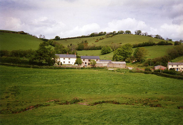
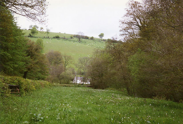
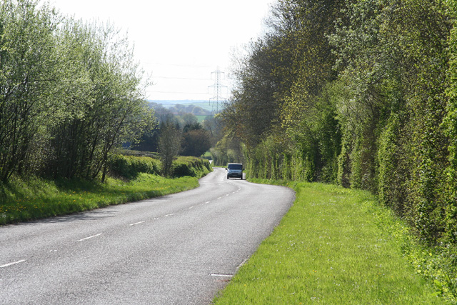
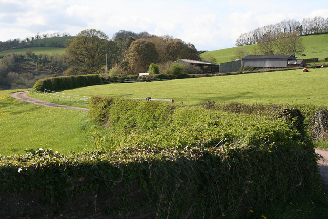
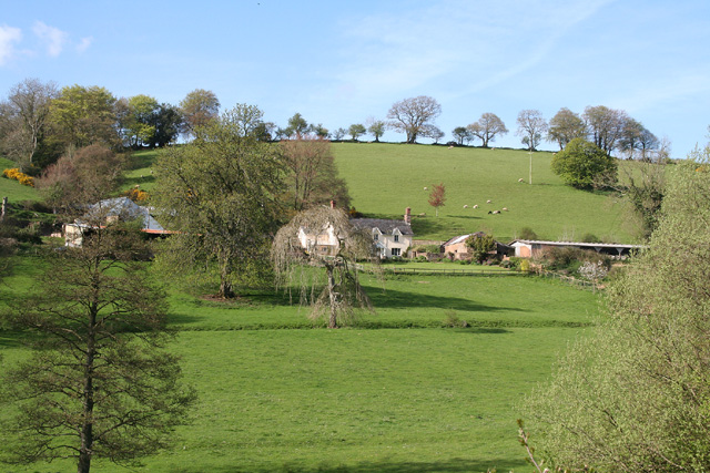
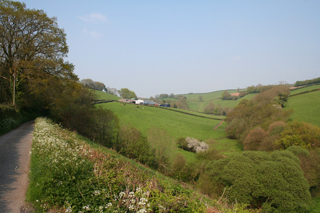
South Cleeve Copse, located in Somerset, England, is a picturesque wood or forest spanning approximately 100 acres. Situated in the beautiful countryside, it offers a serene and tranquil environment for visitors to enjoy.

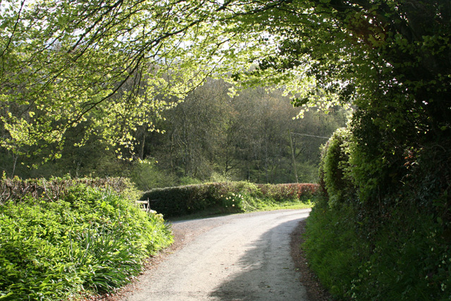
The copse is predominantly composed of deciduous trees, including oak, beech, and ash, which create a diverse and vibrant ecosystem. The tall and majestic trees provide ample shade and shelter, making it an ideal habitat for a variety of wildlife species.

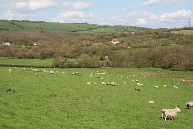
Walking through South Cleeve Copse, one can admire the carpet of wildflowers that bloom in the spring and summer months, adding bursts of color to the landscape. The copse is also home to a rich array of wildlife, such as deer, badgers, foxes, and a wide range of bird species. Birdwatchers can delight in the opportunity to spot woodpeckers, owls, and various songbirds that call this woodland their home.

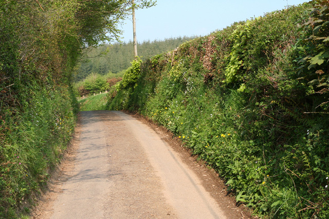
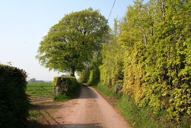
The copse is crisscrossed by a network of well-maintained footpaths, allowing visitors to explore the area and enjoy the natural beauty at their own pace. These paths wind through the forest, leading to hidden clearings and secluded spots, perfect for picnics or simply taking a moment to appreciate the tranquility.

South Cleeve Copse is a popular destination for nature enthusiasts, hikers, and families looking to reconnect with nature. Its peaceful atmosphere, beautiful scenery, and diverse wildlife make it an enchanting woodland to visit throughout the year.

If you have any feedback on the listing, please let us know in the comments section below.

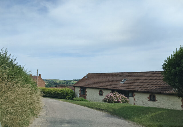
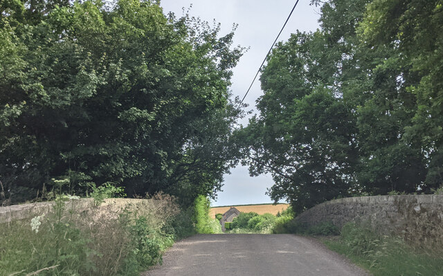
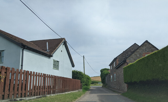
South Cleeve Copse Images

Images are sourced within 2km of 51.020979/-3.4104863 or Grid Reference ST0125. Thanks to Geograph Open Source API. All images are credited.

House at Old Hayes
House at Old Hayes
Bridge at Petton crossing the route of the abandoned Taunton to Barnstaple railway line
Houses at Petton
Houses at Petton
Chipstable: Kingston Farm and Mill Two spring-fed ponds each provided a mere 20 minutes operation for the 19th century waterwheel at the mill, now a private residence. The mill was purely for the use of the farm: it was not a manor or parish flour mill
Chipstable: Kingston Farm and Mill
Two spring-fed ponds each provided a mere 20 minutes operation for the 19th century waterwheel at the mill, now a private residence. The mill was purely for the use of the farm: it was not a manor or parish flour mill
Bampton: near Raddington In the Batherm valley near Batherm Bridge
Bampton: near Raddington
In the Batherm valley near Batherm Bridge
Clayhanger: Denscombe Mill A public footpath runs through the property – according to the OS 1:25,000 map – to Hookhays Farm. The remains of the watermill have long been converted but the miller’s house survives. In 1792 the estate was described as a ‘well-accuftomed Water Grist Mill .. good dwelling houfe .. one acre of orchard .. fourteen acres of .. meadow and pafture ..’ [Source: Sherborne Mercury 21 May 1792]
Clayhanger: Denscombe Mill
A public footpath runs through the property – according to the OS 1:25,000 map – to Hookhays Farm. The remains of the watermill have long been converted but the miller’s house survives. In 1792 the estate was described as a ‘well-accuftomed Water Grist Mill .. good dwelling houfe .. one acre of orchard .. fourteen acres of .. meadow and pafture ..’ [Source: Sherborne Mercury 21 May 1792]
Bampton: towards Hookways Farm In the Batherm valley looking north east
Bampton: towards Hookways Farm
In the Batherm valley looking north east
Bampton: church at Petton The neo-Romanesque structure, characterised by the apse and windows, dates from the 19th century. Looking north-north-east
Bampton: church at Petton
The neo-Romanesque structure, characterised by the apse and windows, dates from the 19th century. Looking north-north-east
Bampton: houses by the B3227 road Looking north-north-east. While the overhead transmission line is close, the track of the old Taunton – Barnstaple railway is closer still, a field’s length beyond the houses
Bampton: houses by the B3227 road
Looking north-north-east. While the overhead transmission line is close, the track of the old Taunton – Barnstaple railway is closer still, a field’s length beyond the houses
Clayhanger: the B3227 at Leigh Wood Looking west on the road to Shillingford and Bampton
Clayhanger: the B3227 at Leigh Wood
Looking west on the road to Shillingford and Bampton
Clayhanger: near Berry Farm Farm access road and public footpath – the path runs through to Batherm Bridge. Looking north west from the bridge over the abandoned Taunton – Barnstaple railway, closed in the 1960s
Clayhanger: near Berry Farm
Farm access road and public footpath – the path runs through to Batherm Bridge. Looking north west from the bridge over the abandoned Taunton – Barnstaple railway, closed in the 1960s
Chipstable: Washers Farm Looking north-north-east. The farm faces south in an east-west valley; below it a stream runs westwards from Raddington to join the Batherm near Batherm Bridge
Chipstable: Washers Farm
Looking north-north-east. The farm faces south in an east-west valley; below it a stream runs westwards from Raddington to join the Batherm near Batherm Bridge
Upton: by the entrance to Ranscombe Farm Looking north west on the lane from Blackwell to Skilgate
Upton: by the entrance to Ranscombe Farm
Looking north west on the lane from Blackwell to Skilgate
Chipstable: lane at Raddington Bottom Looking north east near Rectory Farm
Chipstable: lane at Raddington Bottom
Looking north east near Rectory Farm
Skilgate: near Bittescombe Hill Farm Looking north east on the lane from Blackwell
Skilgate: near Bittescombe Hill Farm
Looking north east on the lane from Blackwell
Skilgate: Bittescombe Hill Farm Farm buildings by the lane from Blackwell to Heydon Hill. Looking east
Skilgate: Bittescombe Hill Farm
Farm buildings by the lane from Blackwell to Heydon Hill. Looking east
Skilgate: lane with beech tree and hedge Looking north-north-east
Skilgate: lane with beech tree and hedge
Looking north-north-east
St Michael's church, Raddington Isolated from lanes, the C13 church <span class="nowrap"><a title="http://webapp1.somerset.gov.uk/her/details.asp?prn=41129" rel="nofollow ugc noopener" href="http://webapp1.somerset.gov.uk/her/details.asp?prn=41129">Link</a><img style="margin-left:2px;" alt="External link" title="External link - shift click to open in new window" src="https://s1.geograph.org.uk/img/external.png" width="10" height="10"/></span> sits on the lower slopes of a deep valley, Raddington Bottom. Seen from a gateway on Hill Lane.
St Michael's church, Raddington
Isolated from lanes, the C13 church LinkExternal link sits on the lower slopes of a deep valley, Raddington Bottom. Seen from a gateway on Hill Lane.
Show me another place!

South Cleeve Copse is located at Grid Ref: ST0125 (Lat: 51.020979, Lng: -3.4104863)

Administrative County: Somerset

District: Somerset West and Taunton

Police Authority: Avon and Somerset

What 3 Words

///certified.protrude.proclaims. Near Wiveliscombe, Somerset

Related Wikis

Petton, Devon

Petton, also known as Petton Cross, is an English village in the civil parish of Bampton, the district of Mid Devon, and the county of Devon. It lies on...

Clayhanger, Devon

Clayhanger is a hamlet and civil parish in the Mid Devon district of Devon, England. At the time of the 2011 census it had a population of 127. == Roman... ==

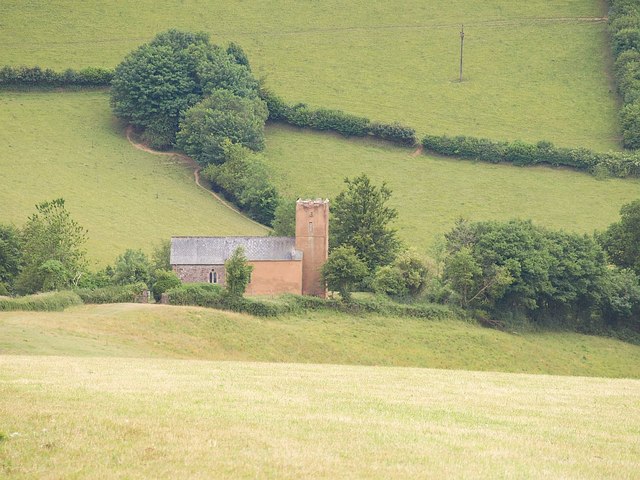
Church of St John, Skilgate

The Anglican Church of St John in Skilgate, Somerset, England was built in the 14th century. It is a Grade II* listed building. == History == The church...

Skilgate

Skilgate is a village and civil parish 5 miles (8 km) east of Dulverton and 8 miles (13 km) west of Wiveliscombe in the Somerset West and Taunton district...

Church of All Saints, Chipstable

The Church of All Saints is an Anglican church in Chipstable, Somerset, England which probably dates from the early 13th century. It is located in the...

Chipstable

Chipstable is a village and civil parish in Somerset, England, situated beside Heydon Hill 10 miles (16.1 km) west of Taunton. The parish has a population...

Shillingford, Devon

Shillingford is a village two miles (3 km) northeast of Bampton on the River Batherm in Mid Devon, England, close to the border with West Somerset. It...

Upton, Somerset

Upton is a village and civil parish north of Skilgate in Somerset, England. It is situated on a hill above the eastern end of Wimbleball Lake. == History... ==

Nearby Amenities

Located within 500m of 51.020979,-3.4104863
Power: pole
Lat/Long: 51.0212869/-3.4040827
Power: pole
Lat/Long: 51.0202628/-3.4091923
Power: pole
Lat/Long: 51.0198848/-3.4106004
Power: pole
Source: bing
Lat/Long: 51.0170569/-3.4080631
Power: pole
Source: bing
Lat/Long: 51.0171075/-3.4094726
Power: pole
Source: bing
Lat/Long: 51.0171792/-3.4111556
The data included in this document is from www.openstreetmap.org. The data is made available under ODbL.

Have you been to South Cleeve Copse?

Leave your review of South Cleeve Copse below (or comments, questions and feedback).