Clintsbrow Wood

Wood, Forest in Cumberland Copeland

England

Clintsbrow Wood

Egremont Castle The west gatehouse and curtain wall
Egremont Castle Credit: Kevin Waterhouse

Clintsbrow Wood is a charming forest located in the heart of Cumberland, a historic county in northwestern England. Spanning over 500 acres, this woodland is renowned for its natural beauty, diverse flora, and rich wildlife. It is a beloved destination for nature enthusiasts and hikers who seek tranquility and a chance to immerse themselves in the great outdoors.

The wood is predominantly made up of broadleaf trees, including oak, ash, beech, and sycamore, which create a dense canopy providing shade and shelter. The forest floor is adorned with a vibrant carpet of bluebells, foxgloves, and wild garlic during the springtime, painting a picturesque scene straight out of a fairy tale.

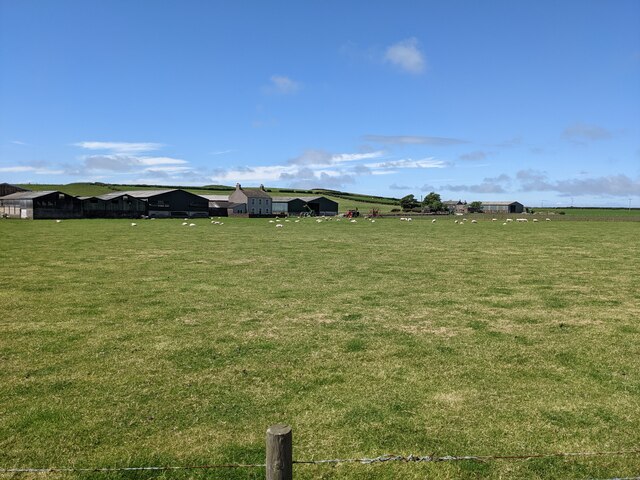
Home to a variety of fauna, Clintsbrow Wood offers a haven for wildlife. Squirrels frolic among the treetops, while rabbits and hares can be spotted darting through the undergrowth. The forest is also a sanctuary for numerous bird species, such as woodpeckers, song thrushes, and tawny owls, filling the air with their melodious calls.

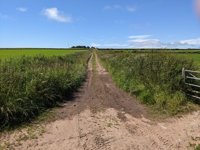
Traversing Clintsbrow Wood is a delightful experience, thanks to the network of well-maintained footpaths and trails that wind through the forest. These paths cater to all levels of fitness, allowing visitors to choose between leisurely strolls or more challenging hikes. The wood is also intersected by a babbling stream, enhancing the serene atmosphere and providing a picturesque setting for picnics or moments of quiet contemplation.

Clintsbrow Wood truly is a natural gem, offering a peaceful retreat for those seeking solace in nature's embrace. Whether you are a seasoned hiker, a wildlife enthusiast, or simply someone looking to escape the hustle and bustle of daily life, this Cumberland forest is a must-visit destination.

If you have any feedback on the listing, please let us know in the comments section below.

Clintsbrow Wood Images

Images are sourced within 2km of 54.492667/-3.5389683 or Grid Reference NY0011. Thanks to Geograph Open Source API. All images are credited.

Egremont Castle The west gatehouse and curtain wall
Egremont Castle
The west gatehouse and curtain wall
Egremont Castle Gate House The original castle was built on a mound above the River Ehen on the site of a Danish fort following the conquest of Cumberland in 1092 by William II of England.  The present castle was built by William Meschin, who founded the castle between 1120 and 1135. Further additions were made in the 13th century. It eventually fell into disuse and became the ruin it is today.

<span class="nowrap"><a title="https://en.wikipedia.org/wiki/Egremont_Castle" rel="nofollow ugc noopener" href="https://en.wikipedia.org/wiki/Egremont_Castle">Link</a><img style="margin-left:2px;" alt="External link" title="External link - shift click to open in new window" src="https://s1.geograph.org.uk/img/external.png" width="10" height="10"/></span>
Egremont Castle Gate House
The original castle was built on a mound above the River Ehen on the site of a Danish fort following the conquest of Cumberland in 1092 by William II of England. The present castle was built by William Meschin, who founded the castle between 1120 and 1135. Further additions were made in the 13th century. It eventually fell into disuse and became the ruin it is today. LinkExternal link
A bridleway near Loughrigg
The lane to Watson Hill Farm
A grassy field near Loughrigg farm
The road junction at Loughrigg There is information about the type of signpost here: <a title="https://www.geograph.org.uk/photo/4562007" href="https://www.geograph.org.uk/photo/4562007">Link</a>
The road junction at Loughrigg
There is information about the type of signpost here: Link
Wireless masts near Bigrigg Why do they need two masts? Neither seems to be 'full' of aerials.
Wireless masts near Bigrigg
Why do they need two masts? Neither seems to be 'full' of aerials.
A reservoir near Bigrigg The grass bank makes it unobtrusive in the landscape.
A reservoir near Bigrigg
The grass bank makes it unobtrusive in the landscape.
Houses at Bigrigg
Houses at Bigrigg
An unclassified road through the woods at Bigrigg
The road between Egremont and Gulley Flatts
Cycle Route 72 leaves the unclassified road to join the old railway line
Looking east from the cycleway Towards the hamlet of Cleator, with Dent hill in the distance.
Looking east from the cycleway
Towards the hamlet of Cleator, with Dent hill in the distance.
Cycle Route 72 on the old railway track
The main street of Egremont
A closed garage near the A595
Briscoemill Bridge over the River Ehen
Cottages at Briscoe Mill
Show me another place!

Clintsbrow Wood is located at Grid Ref: NY0011 (Lat: 54.492667, Lng: -3.5389683)

Administrative County: Cumbria

District: Copeland

Police Authority: Cumbria

What 3 Words

///hindered.zoomed.dodges. Near Egremont, Cumbria

Related Wikis

Gillfoot railway station

Gillfoot railway station was on the Whitehaven, Cleator and Egremont Railway line half a mile north of Egremont station, in Cumbria, England. == History... ==

Egremont railway station

Egremont railway station was built by the Whitehaven, Cleator and Egremont Railway as the first southern terminus of what would become the Moor Row to...

Woodend, Egremont

Woodend is a village near Egremont, Cumbria, England. The village had a station on the Whitehaven, Cleator and Egremont Railway but it closed in 1947....

Egremont, Cumbria

Egremont is a market town, civil parish and two electoral wards in Cumbria, England, and historically part of Cumberland. It is situated just outside...

Nearby Amenities

Located within 500m of 54.492667,-3.5389683
Traffic Calming: cushion
Lat/Long: 54.4893839/-3.5350843
Gill Foot
Place: hamlet
Lat/Long: 54.4903412/-3.5338529
Traffic Calming: cushion
Lat/Long: 54.4891756/-3.5355408
Traffic Calming: cushion
Lat/Long: 54.4887764/-3.5357624
Generator Method: photovoltaic
Generator Output Electricity: yes
Generator Source: solar
Generator Type: solar_photovoltaic_panel
Location: roof
Power: generator
Lat/Long: 54.4887962/-3.535564
Generator Method: photovoltaic
Generator Output Electricity: yes
Generator Source: solar
Generator Type: solar_photovoltaic_panel
Location: roof
Power: generator
Lat/Long: 54.488317/-3.5371263
Generator Method: photovoltaic
Generator Output Electricity: yes
Generator Source: solar
Generator Type: solar_photovoltaic_panel
Location: roof
Power: generator
Lat/Long: 54.4883872/-3.5369903
Power: pole
Lat/Long: 54.4950231/-3.545268
Power: pole
Lat/Long: 54.4942262/-3.5452566
Power: pole
Lat/Long: 54.4932258/-3.5453061
Power: pole
Lat/Long: 54.4923171/-3.545329
Power: pole
Lat/Long: 54.491238/-3.5453823
Power: pole
Lat/Long: 54.4906448/-3.5454052
The data included in this document is from www.openstreetmap.org. The data is made available under ODbL.

Have you been to Clintsbrow Wood?

Leave your review of Clintsbrow Wood below (or comments, questions and feedback).