The Shrubbery

Wood, Forest in Devon Mid Devon

England

The Shrubbery

Bradninch : High Street A parade takes place to mark 12th Night in Bradninch.
Bradninch : High Street Credit: Lewis Clarke

The Shrubbery, located in Devon, England, is a captivating wood and forest area that offers visitors a serene and peaceful natural experience. Covering an expansive area of lush greenery, The Shrubbery is a haven for nature enthusiasts and those seeking tranquility amidst the beautiful Devon landscape.

The woodlands of The Shrubbery are abundant with a diverse range of trees, including oak, beech, and birch, creating a picturesque and enchanting atmosphere. The forest floor is blanketed with an array of wildflowers during the spring and summer months, adding bursts of vibrant colors to the already breathtaking scenery.

The Shrubbery is home to a rich variety of wildlife, making it an ideal destination for nature lovers and bird watchers. Visitors may encounter various woodland creatures such as deer, foxes, and rabbits, as well as an assortment of bird species, including woodpeckers, owls, and songbirds.

Numerous walking trails wind their way through The Shrubbery, allowing visitors to explore and immerse themselves in the natural beauty of the woodlands. The trails range in difficulty, catering to both casual strollers and avid hikers. Along the paths, benches and picnic areas provide opportunities for visitors to rest and enjoy a leisurely moment surrounded by nature.

The Shrubbery is a popular destination for families, as it offers a playground area for children to enjoy. Additionally, the woodlands provide an excellent backdrop for outdoor activities such as nature photography, sketching, and even yoga retreats.

Overall, The Shrubbery in Devon is a stunning wood and forest area that provides a rejuvenating and awe-inspiring experience for all who visit. Whether seeking solitude or embarking on an adventure, this natural haven is sure to leave a lasting impression on anyone who explores its captivating landscapes.

If you have any feedback on the listing, please let us know in the comments section below.

The Shrubbery Images

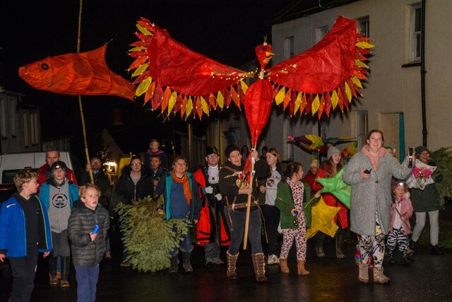
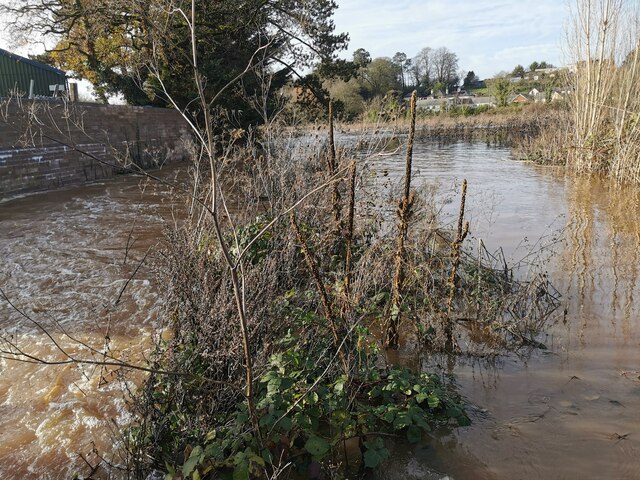
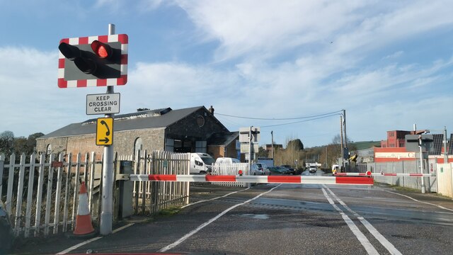
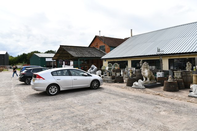
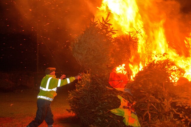
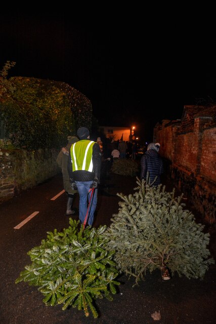
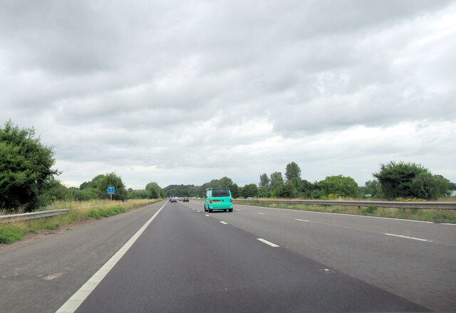
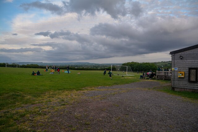
Images are sourced within 2km of 50.825677/-3.4307164 or Grid Reference SS9903. Thanks to Geograph Open Source API. All images are credited.

Bradninch : High Street A parade takes place to mark 12th Night in Bradninch.
Bradninch : High Street
A parade takes place to mark 12th Night in Bradninch.
Hele : River Culm The River Culm in the floodplain and has burst its banks.
Hele : River Culm
The River Culm in the floodplain and has burst its banks.
Hele : Station Road A van heading along a wet Station Road.
Hele : Station Road
A van heading along a wet Station Road.
Hele : Bristol to Exeter Railway Line A GWR train heads through floodwater at a slow pace.
Hele : Bristol to Exeter Railway Line
A GWR train heads through floodwater at a slow pace.
Hele : Station Road The Bristol to Exeter rail line at Station Road.
Hele : Station Road
The Bristol to Exeter rail line at Station Road.
Hele : Bristol to Exeter Railway Line A GWR train approaches.
Hele : Bristol to Exeter Railway Line
A GWR train approaches.
Hele : Station Road At the railway crossing.
Hele : Station Road
At the railway crossing.
Broad Clyst: The Antique Village
Bradninch : Cricket Pitch Looking towards a bonfire of Christmas trees on the cricket pitch.
Bradninch : Cricket Pitch
Looking towards a bonfire of Christmas trees on the cricket pitch.
Bradninch : Cricket Pitch Bonfire Looking towards Christmas trees burning on the bonfire.
Bradninch : Cricket Pitch Bonfire
Looking towards Christmas trees burning on the bonfire.
Bradninch : Cricket Ground A man tosses Christmas trees onto the bonfire.
Bradninch : Cricket Ground
A man tosses Christmas trees onto the bonfire.
Bradninch : Cricket Ground A man breathes fire onto the bonfire of Christmas trees to get the flames going.
Bradninch : Cricket Ground
A man breathes fire onto the bonfire of Christmas trees to get the flames going.
Bradninch : Kensham Avenue People drag their Christmas trees through the streets to be burnt.
Bradninch : Kensham Avenue
People drag their Christmas trees through the streets to be burnt.
The M5 north at B 242.5 marker
Bradninch : Playing Field A field in Bradninch used for recreation.
Bradninch : Playing Field
A field in Bradninch used for recreation.
Old Milestone on Cullompton Hill, Bradninch Carved stone post by the UC road, in parish of Bradninch (Mid Devon District), foot of Cullompton Hill, opposite Fore Street, on path by brick pillar, on North side of road. Exeter tombstone erected by the Exeter turnpike trust in the 19th century.

Inscription reads:-
10
MILES
TO
EXETER

Devon & Dartmoor HER number: MDV74110 <span class="nowrap"><a title="https://www.heritagegateway.org.uk/Gateway/Results_Single.aspx?uid=MDV74110&resourceID=104" rel="nofollow ugc noopener" href="https://www.heritagegateway.org.uk/Gateway/Results_Single.aspx?uid=MDV74110&resourceID=104">Link</a><img style="margin-left:2px;" alt="External link" title="External link - shift click to open in new window" src="https://s1.geograph.org.uk/img/external.png" width="10" height="10"/></span>

Milestone Society National ID: DV_EXCMo10
Old Milestone on Cullompton Hill, Bradninch
Carved stone post by the UC road, in parish of Bradninch (Mid Devon District), foot of Cullompton Hill, opposite Fore Street, on path by brick pillar, on North side of road. Exeter tombstone erected by the Exeter turnpike trust in the 19th century. Inscription reads:- 10 MILES TO EXETER Devon & Dartmoor HER number: MDV74110 LinkExternal link Milestone Society National ID: DV_EXCMo10
M5 crossing Station Road at Hele
Near Clyst Hayes
Near Clyst Hayes
Show me another place!

The Shrubbery is located at Grid Ref: SS9903 (Lat: 50.825677, Lng: -3.4307164)

Administrative County: Devon

District: Mid Devon

Police Authority: Devon and Cornwall

What 3 Words

///sailor.splice.upholding. Near Bradninch, Devon

Nearby Locations

Bradninch The Shrubbery

Related Wikis

Bradninch Guildhall

Bradninch Guildhall is a municipal building in Fore Street, Bradninch, Devon, England. The structure, which is now used as a community events venue, is...

Bradninch

Bradninch is a small town, civil parish and manor in Devon, England, lying about 3 mi (5 km) south of Cullompton. Much of the surrounding farmland belongs...

Hele, Devon

Hele is a village in Devon, England, lying about one mile (1.6 km) SSW of Bradninch and 10 miles (16 km) NNE of Exeter, on the River Culm. The village...

Manor of Silverton

The manor of Silverton was an historic manor in the parish of Silverton in Devon. The last version of the manor house was Silverton Park (also called Egremont...

Nearby Amenities

Located within 500m of 50.825677,-3.4307164
Beacon Cross
Junction: yes
Lat/Long: 50.8290892/-3.4341102
Bus Stop
Townlands
Bus: yes
Naptan AtcoCode: 1100DEC10585
Naptan Bearing: SW
Naptan BusStopType: MKD
Naptan Indicator: SW-bound
Naptan LocalityName: Bradninch
Naptan NaptanCode: dvndtmwa
Naptan NptgLocality: E0045287
Naptan Status: act
Naptan StopType: BCT
Naptan Street: Hele Road
Naptan TimingStatus: OTH
Operator: Stagecoach
Public Transport: platform
Shelter: yes
Source: naptan
Lat/Long: 50.8236088/-3.4258244
Turning Circle
Lat/Long: 50.8234975/-3.4282022
Turning Circle
Lat/Long: 50.8225538/-3.4270054
Addr City: Bradninch
Addr Housenumber: 5
Addr Street: Townlands
Lat/Long: 50.8234385/-3.4265022
Addr City: Bradninch
Addr Housenumber: 10
Addr Street: Townlands
Lat/Long: 50.8230755/-3.4268251
Addr City: Bradninch
Addr Housenumber: 11
Addr Street: Townlands
Lat/Long: 50.8229768/-3.4268962
Addr City: Bradninch
Addr Housenumber: 14
Addr Street: Townlands
Lat/Long: 50.8227552/-3.4271003
Peakfield Cross Ways
Junction: yes
Lat/Long: 50.8254974/-3.4357209
Turning Circle
Lat/Long: 50.8229822/-3.4293207
Roman Coin
Historic: archaeological_site
Lat/Long: 50.8267714/-3.4354813
Shelter
Shelter Type: public_transport
Lat/Long: 50.8236166/-3.4257756
Post Box
Bradninch West End
Brand: Royal Mail
Brand Wikidata: Q638098
Brand Wikipedia: en:Royal Mail
Collection Times: Mo-Fr 16:15; Sa 10:30
Operator: Royal Mail
Operator Wikidata: Q638098
Post Box Type: wall
Ref: EX5 289
Lat/Long: 50.8247743/-3.4271277
Entrance: main
Lat/Long: 50.8222949/-3.4280861
Entrance: yes
Lat/Long: 50.8221593/-3.428209
Entrance: yes
Lat/Long: 50.8222053/-3.4283529
Entrance: yes
Lat/Long: 50.8219985/-3.4280316
Entrance: yes
Lat/Long: 50.8221146/-3.4279385
Smiling Daisies
Office: wedding_planner
Lat/Long: 50.8224599/-3.4265705
Grit Bin
Lat/Long: 50.821616/-3.432276
Bench
Lat/Long: 50.8243518/-3.4279101
Waste Basket
Lat/Long: 50.8242952/-3.4280071
Information: board
Tourism: information
Lat/Long: 50.8242959/-3.4280427
Waste Basket
Waste Basket: dog
Lat/Long: 50.8243774/-3.428058
Crossing
Crossing: yes
Lat/Long: 50.8237212/-3.429256
Addr Housenumber: 62
Lat/Long: 50.8237437/-3.4294116
Addr Housenumber: 58
Lat/Long: 50.8236049/-3.4296733
Addr Housenumber: 70
Lat/Long: 50.8235597/-3.4297695
Addr Housenumber: 17
Addr Street: Bowley Meadow
Lat/Long: 50.8230943/-3.4293865
Addr Housenumber: 14
Addr Street: Bowley Meadow
Lat/Long: 50.8229515/-3.4296644
Addr Housenumber: 15
Addr Street: Bowley Meadow
Lat/Long: 50.822997/-3.429579
Addr Housenumber: 16
Addr Street: Bowley Meadow
Lat/Long: 50.823052/-3.4294819
Addr Housenumber: 18
Addr Street: Bowley Meadow
Lat/Long: 50.8229801/-3.4289964
Addr Housenumber: 19
Addr Street: Bowley Meadow
Lat/Long: 50.8229431/-3.4288976
Addr Housenumber: 20
Addr Street: Bowley Meadow
Lat/Long: 50.8229029/-3.4288055
Addr Housenumber: 21
Addr Street: Bowley Meadow
Lat/Long: 50.8228461/-3.4286724
Addr Housenumber: 22
Addr Street: Bowley Meadow
Lat/Long: 50.8227816/-3.4286145
Addr Housenumber: 23
Addr Street: Bowley Meadow
Lat/Long: 50.8227207/-3.4285924
Addr Housenumber: 24
Addr Street: Bowley Meadow
Lat/Long: 50.8226562/-3.4283525
Addr Housenumber: 25
Addr Street: Bowley Meadow
Lat/Long: 50.8227015/-3.4282615
Addr Housenumber: 9
Addr Street: Bowley Meadow
Lat/Long: 50.8226144/-3.4289454
Addr Housenumber: 10
Addr Street: Bowley Meadow
Lat/Long: 50.822644/-3.4290364
Addr Housenumber: 11
Addr Street: Bowley Meadow
Lat/Long: 50.8226876/-3.4291274
Addr Housenumber: 12
Addr Street: Bowley Meadow
Lat/Long: 50.8227276/-3.4292156
Addr Housenumber: 13
Addr Street: Bowley Meadow
Lat/Long: 50.8227677/-3.4293177
Addr Housenumber: 24
Addr Street: Townlands
Lat/Long: 50.8237206/-3.4269014
Addr Housenumber: 15
Addr Street: Townlands
Lat/Long: 50.824004/-3.4263255
Bus Stop
Townlands
Bench: no
Bus: yes
Naptan AtcoCode: 1100DEC10584
Naptan Bearing: NE
Naptan BusStopType: MKD
Naptan Indicator: NE-bound
Naptan LocalityName: Bradninch
Naptan NaptanCode: dvndtmtm
Naptan NptgLocality: E0045287
Naptan Status: act
Naptan StopType: BCT
Naptan Street: Hele Road
Naptan TimingStatus: OTH
Operator: Stagecoach
Public Transport: platform
Shelter: no
Source: naptan
Lat/Long: 50.8240944/-3.4253108
Addr Housenumber: 1
Addr Street: Dukes Orchard
Lat/Long: 50.8255592/-3.4236125
Addr City: Exeter
Addr Housenumber: 23
Addr Postcode: EX5 4QT
Addr Street: Passmore Road
Addr Suburb: Bradninch
Lat/Long: 50.8232082/-3.4315377
Addr City: Exeter
Addr Housenumber: 24
Addr Postcode: EX5 4QT
Addr Street: Passmore Road
Addr Suburb: Bradninch
Lat/Long: 50.8232328/-3.4314758
Addr City: Exeter
Addr Housenumber: 25
Addr Postcode: EX5 4QT
Addr Street: Passmore Road
Addr Suburb: Bradninch
Lat/Long: 50.823266/-3.4314158
Addr City: Exeter
Addr Housenumber: 29
Addr Street: Passmore Road
Lat/Long: 50.8232522/-3.4323075
Addr City: Exeter
Addr Housenumber: 28
Addr Street: Passmore Road
Lat/Long: 50.8231848/-3.4323095
Addr City: Exeter
Addr Housenumber: 27
Addr Street: Passmore Road
Lat/Long: 50.8231161/-3.4323214
Addr City: Exeter
Addr Housenumber: 26
Addr Street: Passmore Road
Lat/Long: 50.8230178/-3.4323298
Addr City: Exeter
Addr Housenumber: 29
Addr Street: Passmore Road
Lat/Long: 50.8233884/-3.4321909
Addr City: Exeter
Addr Housenumber: 30
Addr Street: Passmore Road
Lat/Long: 50.8234246/-3.4320703
Addr City: Exeter
Addr Housenumber: 34
Addr Street: Passmore Road
Lat/Long: 50.8235882/-3.4315819
Addr City: Exeter
Addr Housenumber: 35
Addr Street: Passmore Road
Lat/Long: 50.8236219/-3.4314949
Addr City: Exeter
Addr Housenumber: 36
Addr Street: Passmore Road
Lat/Long: 50.8236644/-3.431402
Addr City: Exeter
Addr Housenumber: 37
Addr Street: Passmore Road
Lat/Long: 50.8237056/-3.4313091
Addr City: Exeter
Addr Housenumber: 38
Addr Street: Passmore Road
Lat/Long: 50.8237456/-3.4312241
Addr City: Exeter
Addr Housenumber: 39
Addr Street: Passmore Road
Lat/Long: 50.8237718/-3.4311568
Addr City: Exeter
Addr Street: Passmore Road
Lat/Long: 50.8230869/-3.4311089
Addr City: Exeter
Addr Street: Passmore Road
Lat/Long: 50.8231093/-3.4310377
Addr City: Exeter
Addr Street: Passmore Road
Lat/Long: 50.8231293/-3.4309744
Addr City: Exeter
Addr Street: Passmore Road
Lat/Long: 50.8231493/-3.4309072
Addr City: Exeter
Addr Street: Passmore Road
Lat/Long: 50.8231768/-3.430836
Addr City: Exeter
Addr Street: Passmore Road
Lat/Long: 50.8231993/-3.4307748
Addr City: Exeter
Addr Street: Passmore Road
Lat/Long: 50.8232205/-3.4306976
Addr City: Exeter
Addr Postcode: EX5 4QT
Addr Street: Passmore Road
Addr Suburb: Bradninch
Lat/Long: 50.8229357/-3.4313338
Addr City: Exeter
Addr Postcode: EX5 4QT
Addr Street: Passmore Road
Addr Suburb: Bradninch
Lat/Long: 50.8228883/-3.4313892
Addr City: Exeter
Addr Postcode: EX5 4QT
Addr Street: Passmore Road
Addr Suburb: Bradninch
Lat/Long: 50.822852/-3.4314287
Addr City: Exeter
Addr Postcode: EX5 4QT
Addr Street: Passmore Road
Addr Suburb: Bradninch
Lat/Long: 50.8228108/-3.4314722
Addr City: Exeter
Addr Postcode: EX5 4QT
Addr Street: Passmore Road
Addr Suburb: Bradninch
Lat/Long: 50.8227746/-3.4315137
Addr City: Exeter
Addr Postcode: EX5 4QT
Addr Street: Passmore Road
Addr Suburb: Bradninch
Lat/Long: 50.8227396/-3.4315553
Addr City: Exeter
Addr Street: Passmore Road
Lat/Long: 50.8234928/-3.4308573
Addr City: Exeter
Addr Street: Passmore Road
Lat/Long: 50.8234665/-3.4309364
Addr City: Exeter
Addr Street: Passmore Road
Lat/Long: 50.8234478/-3.4310036
Addr City: Exeter
Addr Street: Passmore Road
Lat/Long: 50.8234291/-3.4310689
Addr City: Exeter
Addr Street: Passmore Road
Lat/Long: 50.8234004/-3.4311381
Addr City: Exeter
Addr Street: Passmore Road
Lat/Long: 50.8230356/-3.4318024
Addr City: Exeter
Addr Street: Passmore Road
Lat/Long: 50.822957/-3.4318439
Addr City: Exeter
Addr Street: Passmore Road
Lat/Long: 50.8228733/-3.4318775
Addr City: Exeter
Addr Housenumber: 62
Addr Street: Townlands
Lat/Long: 50.8232086/-3.4289091
Addr City: Exeter
Addr Housenumber: 61
Addr Street: Townlands
Lat/Long: 50.8231662/-3.4288182
Addr City: Exeter
Addr Housenumber: 60
Addr Street: Townlands
Lat/Long: 50.8231225/-3.4287213
Addr City: Exeter
Addr Housenumber: 59
Addr Street: Townlands
Lat/Long: 50.823085/-3.4286205
Addr City: Exeter
Addr Housenumber: 63
Addr Street: Townlands
Lat/Long: 50.8232936/-3.429093
Addr City: Exeter
Addr Housenumber: 64
Addr Street: Townlands
Lat/Long: 50.8233285/-3.4291938
Addr City: Exeter
Addr Housenumber: 65
Addr Street: Townlands
Lat/Long: 50.8233648/-3.4292887
Addr City: Exeter
Addr Housenumber: 66
Addr Street: Townlands
Lat/Long: 50.8234222/-3.4294054
Addr City: Exeter
Addr Housenumber: 34
Addr Street: West End Road
Lat/Long: 50.8254353/-3.4261205
Addr City: Exeter
Addr Housenumber: 30
Addr Street: West End Road
Lat/Long: 50.8258837/-3.4249757
Addr City: Exeter
Addr Housenumber: 9
Addr Street: West End Road
Lat/Long: 50.8257988/-3.4246831
Addr City: Exeter
Addr Housename: Butters Cottage
Addr Postcode: EX5 4QW
Addr Street: West End Road
Addr Suburb: Bradninch
Lat/Long: 50.8260666/-3.4244753
Addr City: Exeter
Addr Housenumber: 25
Addr Street: Westfield
Lat/Long: 50.8212733/-3.4298122
Addr City: Exeter
Addr Housenumber: 27
Addr Street: Westfield
Lat/Long: 50.8212877/-3.429949
Addr City: Exeter
Addr Housenumber: 29
Addr Street: Westfield
Lat/Long: 50.8213021/-3.430089
Addr City: Exeter
Addr Housename: Pandora
Addr Housenumber: 31
Addr Street: Westfield
Lat/Long: 50.8213226/-3.4302779
Addr City: Exeter
Addr Housenumber: 33
Addr Street: Westfield
Lat/Long: 50.8213329/-3.4303756
Addr City: Exeter
Addr Housenumber: 35
Addr Street: Westfield
Lat/Long: 50.8212918/-3.430584
Addr City: Exeter
Addr Housenumber: 37
Addr Street: Westfield
Lat/Long: 50.8212836/-3.430685
Addr City: Exeter
Addr Housenumber: 39
Addr Street: Westfield
Lat/Long: 50.821263/-3.4308804
Addr City: Exeter
Addr Housename: Fosters Road
Addr Housenumber: 41
Addr Street: Westfield
Lat/Long: 50.8212486/-3.4309651
Addr City: Exeter
Addr Housenumber: 43
Addr Street: Westfield
Lat/Long: 50.8212198/-3.4311637
Addr City: Exeter
Addr Housenumber: 45
Addr Street: Westfield
Lat/Long: 50.8212157/-3.4312452
Addr City: Exeter
Addr Housenumber: 23
Addr Street: Westfield
Lat/Long: 50.8212548/-3.4297112
Addr City: Exeter
Addr Housenumber: 18
Addr Street: Westfield
Lat/Long: 50.8213958/-3.4286505
Addr City: Exeter
Addr Housenumber: 20
Addr Street: Westfield
Lat/Long: 50.8214143/-3.4287417
Addr City: Exeter
Addr Housenumber: 22
Addr Street: Westfield
Lat/Long: 50.8214307/-3.4289013
Addr City: Exeter
Addr Housenumber: 24
Addr Street: Westfield
Lat/Long: 50.8214534/-3.4290283
Addr City: Exeter
Addr Housenumber: 26
Addr Street: Westfield
Lat/Long: 50.821474/-3.4291683
Addr City: Exeter
Addr Housenumber: 28
Addr Street: Westfield
Lat/Long: 50.8214986/-3.4292953
Addr City: Exeter
Addr Housenumber: 30
Addr Street: Westfield
Lat/Long: 50.8215007/-3.4294614
Addr City: Exeter
Addr Housenumber: 32
Addr Street: Westfield
Lat/Long: 50.8215316/-3.4296047
Addr City: Exeter
Addr Housenumber: 34
Addr Street: Westfield
Lat/Long: 50.821548/-3.4297285
Addr City: Exeter
Addr Housenumber: 36
Addr Street: Westfield
Lat/Long: 50.8215686/-3.4298555
Addr City: Exeter
Addr Housenumber: 38
Addr Street: Westfield
Lat/Long: 50.8215871/-3.4300183
Addr City: Exeter
Addr Housenumber: 40
Addr Street: Westfield
Lat/Long: 50.8216097/-3.4301518
Addr City: Exeter
Addr Housenumber: 42
Addr Street: Westfield
Lat/Long: 50.8216221/-3.4303179
Addr City: Exeter
Addr Housenumber: 44
Addr Street: Westfield
Lat/Long: 50.8216488/-3.4304417
Natural: tree_stump
Lat/Long: 50.8289838/-3.4342341
Stubbs
Place: locality
Lat/Long: 50.826949/-3.4309109
Generator Method: photovoltaic
Generator Output Electricity: yes
Generator Source: solar
Generator Type: solar_photovoltaic_panel
Location: roof
Power: generator
Lat/Long: 50.8234283/-3.432038
Generator Method: photovoltaic
Generator Output Electricity: yes
Generator Source: solar
Generator Type: solar_photovoltaic_panel
Location: roof
Power: generator
Lat/Long: 50.8235079/-3.4317416
Generator Method: photovoltaic
Generator Output Electricity: yes
Generator Source: solar
Generator Type: solar_photovoltaic_panel
Location: roof
Power: generator
Lat/Long: 50.8233681/-3.4281662
Generator Method: photovoltaic
Generator Output Electricity: yes
Generator Source: solar
Generator Type: solar_photovoltaic_panel
Location: roof
Power: generator
Lat/Long: 50.822975/-3.4289816
Generator Method: photovoltaic
Generator Output Electricity: yes
Generator Source: solar
Generator Type: solar_photovoltaic_panel
Location: roof
Power: generator
Lat/Long: 50.8229386/-3.4288783
Generator Method: photovoltaic
Generator Output Electricity: yes
Generator Source: solar
Generator Type: solar_photovoltaic_panel
Location: roof
Power: generator
Lat/Long: 50.8229056/-3.4287858
Generator Method: photovoltaic
Generator Output Electricity: yes
Generator Source: solar
Generator Type: solar_photovoltaic_panel
Location: roof
Power: generator
Lat/Long: 50.8228386/-3.4286504
Generator Method: photovoltaic
Generator Output Electricity: yes
Generator Source: solar
Generator Type: solar_photovoltaic_panel
Location: roof
Power: generator
Lat/Long: 50.8227827/-3.4286208
Generator Method: photovoltaic
Generator Output Electricity: yes
Generator Source: solar
Generator Type: solar_photovoltaic_panel
Location: roof
Power: generator
Lat/Long: 50.8227158/-3.4285712
Generator Method: photovoltaic
Generator Output Electricity: yes
Generator Source: solar
Generator Type: solar_photovoltaic_panel
Location: roof
Power: generator
Lat/Long: 50.8226531/-3.4283084
Generator Method: photovoltaic
Generator Output Electricity: yes
Generator Source: solar
Generator Type: solar_photovoltaic_panel
Location: roof
Power: generator
Lat/Long: 50.8226972/-3.4282172
Generator Method: photovoltaic
Generator Output Electricity: yes
Generator Source: solar
Generator Type: solar_photovoltaic_panel
Location: roof
Power: generator
Lat/Long: 50.82226/-3.4288099
Generator Method: photovoltaic
Generator Output Electricity: yes
Generator Source: solar
Generator Type: solar_photovoltaic_panel
Location: roof
Power: generator
Lat/Long: 50.8223142/-3.4287322
Generator Method: photovoltaic
Generator Output Electricity: yes
Generator Source: solar
Generator Type: solar_photovoltaic_panel
Location: roof
Power: generator
Lat/Long: 50.8223854/-3.4286544
Generator Method: photovoltaic
Generator Output Electricity: yes
Generator Source: solar
Generator Type: solar_photovoltaic_panel
Location: roof
Power: generator
Lat/Long: 50.8224379/-3.4285685
Generator Method: photovoltaic
Generator Output Electricity: yes
Generator Source: solar
Generator Type: solar_photovoltaic_panel
Location: roof
Power: generator
Lat/Long: 50.8252035/-3.4240171
Generator Method: photovoltaic
Generator Output Electricity: yes
Generator Source: solar
Generator Type: solar_photovoltaic_panel
Location: roof
Power: generator
Lat/Long: 50.824156/-3.4245774
Generator Method: photovoltaic
Generator Output Electricity: yes
Generator Source: solar
Generator Type: solar_photovoltaic_panel
Location: roof
Power: generator
Lat/Long: 50.8215215/-3.4316563
Generator Method: photovoltaic
Generator Output Electricity: yes
Generator Source: solar
Generator Type: solar_photovoltaic_panel
Location: roof
Power: generator
Lat/Long: 50.8214571/-3.429017
Generator Method: photovoltaic
Generator Output Electricity: yes
Generator Source: solar
Generator Type: solar_photovoltaic_panel
Location: roof
Power: generator
Lat/Long: 50.8221671/-3.4303085
Generator Method: photovoltaic
Generator Output Electricity: yes
Generator Source: solar
Generator Type: solar_photovoltaic_panel
Location: roof
Power: generator
Lat/Long: 50.8222832/-3.4307283
Generator Method: photovoltaic
Generator Output Electricity: yes
Generator Source: solar
Generator Type: solar_photovoltaic_panel
Location: roof
Power: generator
Lat/Long: 50.8235269/-3.4297653
Generator Method: photovoltaic
Generator Output Electricity: yes
Generator Source: solar
Generator Type: solar_photovoltaic_panel
Location: roof
Power: generator
Lat/Long: 50.8232964/-3.42919
Generator Method: photovoltaic
Generator Output Electricity: yes
Generator Source: solar
Generator Type: solar_photovoltaic_panel
Location: roof
Power: generator
Lat/Long: 50.8230956/-3.4293416
Generator Method: photovoltaic
Generator Output Electricity: yes
Generator Source: solar
Generator Type: solar_photovoltaic_panel
Location: roof
Power: generator
Lat/Long: 50.8230465/-3.429426
Generator Method: photovoltaic
Generator Output Electricity: yes
Generator Source: solar
Generator Type: solar_photovoltaic_panel
Location: roof
Power: generator
Lat/Long: 50.8230016/-3.4295119
Generator Method: photovoltaic
Generator Output Electricity: yes
Generator Source: solar
Generator Type: solar_photovoltaic_panel
Location: roof
Power: generator
Lat/Long: 50.8229525/-3.429599
Generator Method: photovoltaic
Generator Output Electricity: yes
Generator Source: solar
Generator Type: solar_photovoltaic_panel
Location: roof
Power: generator
Lat/Long: 50.8231024/-3.4286831
Generator Method: photovoltaic
Generator Output Electricity: yes
Generator Source: solar
Generator Type: solar_photovoltaic_panel
Location: roof
Power: generator
Lat/Long: 50.8242504/-3.4274332
Generator Method: photovoltaic
Generator Output Electricity: yes
Generator Source: solar
Generator Type: solar_photovoltaic_panel
Location: roof
Power: generator
Lat/Long: 50.8241919/-3.4275083
Generator Method: photovoltaic
Generator Output Electricity: yes
Generator Source: solar
Generator Type: solar_photovoltaic_panel
Location: roof
Power: generator
Lat/Long: 50.8243715/-3.4267023
Generator Method: photovoltaic
Generator Output Electricity: yes
Generator Source: solar
Generator Type: solar_photovoltaic_panel
Location: roof
Power: generator
Lat/Long: 50.8240791/-3.4240838
Direction: SSE
Generator Method: photovoltaic
Generator Output Electricity: yes
Generator Solar Modules: 13
Generator Source: solar
Generator Type: solar_photovoltaic_panel
Location: roof
Power: generator
Lat/Long: 50.8236389/-3.4289596
Direction: SSE
Generator Method: photovoltaic
Generator Output Electricity: yes
Generator Solar Modules: 13
Generator Source: solar
Generator Type: solar_photovoltaic_panel
Location: roof
Power: generator
Lat/Long: 50.823716/-3.428794
Generator Method: photovoltaic
Generator Output Electricity: yes
Generator Source: solar
Generator Type: solar_photovoltaic_panel
Location: roof
Power: generator
Lat/Long: 50.825133/-3.4236977
Generator Method: photovoltaic
Generator Output Electricity: yes
Generator Source: solar
Generator Type: solar_photovoltaic_panel
Location: roof
Power: generator
Lat/Long: 50.8251518/-3.4238021
Generator Method: photovoltaic
Generator Output Electricity: yes
Generator Source: solar
Generator Type: solar_photovoltaic_panel
Location: roof
Power: generator
Lat/Long: 50.8251694/-3.4238925
Generator Method: photovoltaic
Generator Output Electricity: yes
Generator Source: solar
Generator Type: solar_photovoltaic_panel
Location: roof
Power: generator
Lat/Long: 50.8234308/-3.4303463
Give Way
Direction: backward
Lat/Long: 50.8253907/-3.4240914
Give Way
Direction: backward
Lat/Long: 50.8237778/-3.4258292
Ash
Genus: Fraxinus
Natural: tree_stump
Lat/Long: 50.8265921/-3.4354168
Natural: tree_stump
Lat/Long: 50.8274171/-3.4368316
The data included in this document is from www.openstreetmap.org. The data is made available under ODbL.

Have you been to The Shrubbery?

Leave your review of The Shrubbery below (or comments, questions and feedback).