Combe Wood

Wood, Forest in Devon Mid Devon

England

Combe Wood
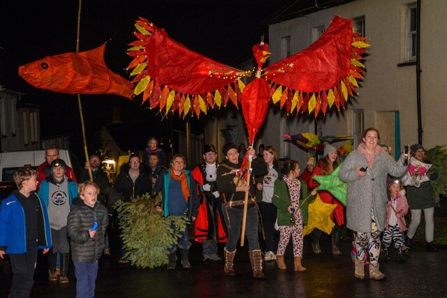
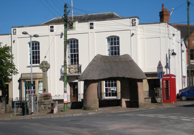
Bradninch : High Street A parade takes place to mark 12th Night in Bradninch.
Bradninch : High Street Credit: Lewis Clarke

Combe Wood is a picturesque woodland located in Devon, England. Situated near the village of Combe Martin, this enchanting forest covers an area of approximately 375 acres. Known for its natural beauty and tranquility, Combe Wood offers visitors a peaceful retreat away from the hustle and bustle of everyday life.

The woodland is predominantly made up of broadleaf trees, including oak, beech, and chestnut, creating a diverse and vibrant ecosystem. The dense canopy provides shelter for a variety of wildlife, such as deer, badgers, and a wide range of bird species. Nature enthusiasts will delight in the opportunity to observe these creatures in their natural habitat.

Combe Wood is crisscrossed by a network of well-maintained footpaths, making it an ideal destination for walkers and hikers. The trails wind through the forest, offering stunning views of the surrounding countryside and glimpses of the nearby coastline. Visitors can explore the wood at their own pace, choosing from a range of routes that cater to different abilities and interests.

In addition to its natural beauty, Combe Wood also holds historical significance. The wood has been a part of the local landscape for centuries and has witnessed the passage of time. Evidence of past human activity, such as old quarry works and boundary walls, can still be seen within the woodland.

Combe Wood attracts visitors year-round, with each season offering its own unique charm. In spring, the forest bursts into life with a vibrant display of wildflowers, while autumn brings a riot of colors as the leaves change. Whether seeking solace in nature or embarking on an adventure, a visit to Combe Wood promises a memorable experience for all.

If you have any feedback on the listing, please let us know in the comments section below.

Combe Wood Images

Images are sourced within 2km of 50.821063/-3.4387529 or Grid Reference SS9803. Thanks to Geograph Open Source API. All images are credited.

Bradninch : High Street A parade takes place to mark 12th Night in Bradninch.
Bradninch : High Street
A parade takes place to mark 12th Night in Bradninch.
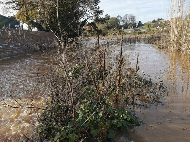
Hele : River Culm The River Culm in the floodplain and has burst its banks.
Hele : River Culm
The River Culm in the floodplain and has burst its banks.
Hele : Station Road A van heading along a wet Station Road.
Hele : Station Road
A van heading along a wet Station Road.
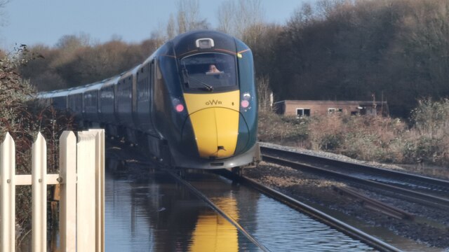
Hele : Bristol to Exeter Railway Line A GWR train heads through floodwater at a slow pace.
Hele : Bristol to Exeter Railway Line
A GWR train heads through floodwater at a slow pace.
Hele : Station Road The Bristol to Exeter rail line at Station Road.
Hele : Station Road
The Bristol to Exeter rail line at Station Road.
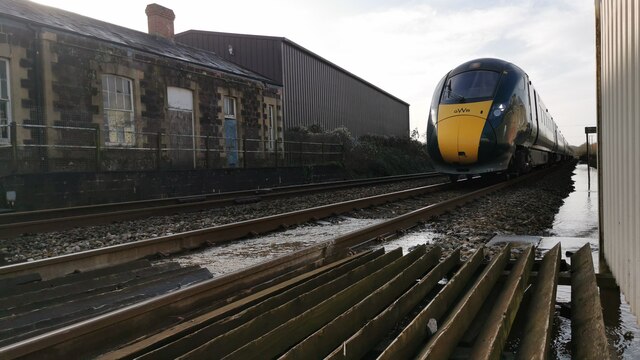
Hele : Bristol to Exeter Railway Line A GWR train approaches.
Hele : Bristol to Exeter Railway Line
A GWR train approaches.
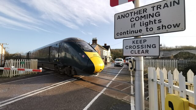
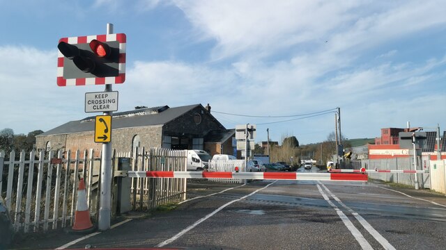
Hele : Station Road At the railway crossing.
Hele : Station Road
At the railway crossing.
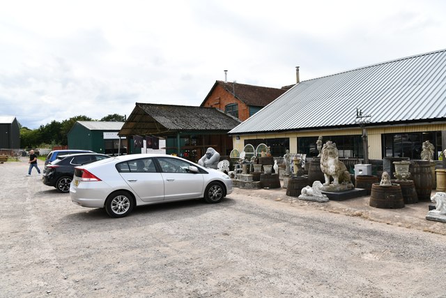
Broad Clyst: The Antique Village
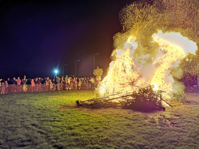
Bradninch : Cricket Pitch Looking towards a bonfire of Christmas trees on the cricket pitch.
Bradninch : Cricket Pitch
Looking towards a bonfire of Christmas trees on the cricket pitch.
Bradninch : Cricket Pitch Bonfire Looking towards Christmas trees burning on the bonfire.
Bradninch : Cricket Pitch Bonfire
Looking towards Christmas trees burning on the bonfire.
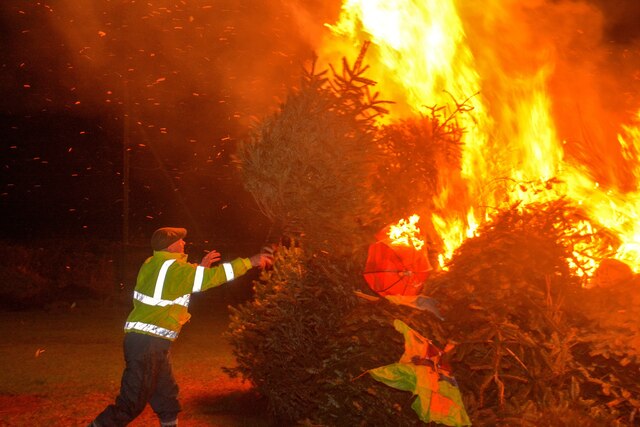
Bradninch : Cricket Ground A man tosses Christmas trees onto the bonfire.
Bradninch : Cricket Ground
A man tosses Christmas trees onto the bonfire.
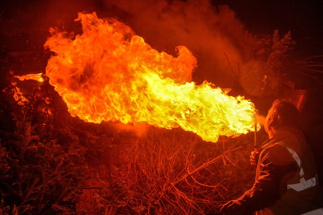
Bradninch : Cricket Ground A man breathes fire onto the bonfire of Christmas trees to get the flames going.
Bradninch : Cricket Ground
A man breathes fire onto the bonfire of Christmas trees to get the flames going.
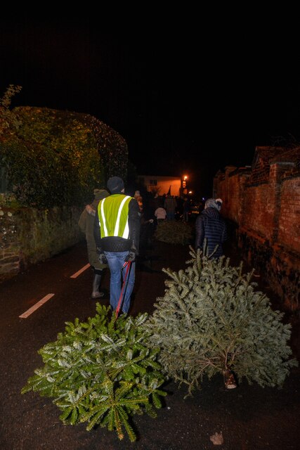
Bradninch : Kensham Avenue People drag their Christmas trees through the streets to be burnt.
Bradninch : Kensham Avenue
People drag their Christmas trees through the streets to be burnt.
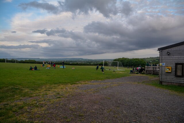
Bradninch : Playing Field A field in Bradninch used for recreation.
Bradninch : Playing Field
A field in Bradninch used for recreation.
M5 at bridge over farm track
M5 crossing Station Road at Hele
Farmland
Farmland
Near Clyst Hayes
Near Clyst Hayes
Show me another place!

Combe Wood is located at Grid Ref: SS9803 (Lat: 50.821063, Lng: -3.4387529)

Administrative County: Devon

District: Mid Devon

Police Authority: Devon and Cornwall

What 3 Words

///sunblock.viewing.magpie. Near Bradninch, Devon

Nearby Locations

Bradninch Combe Wood

Related Wikis

Hele, Devon

Hele is a village in Devon, England, lying about one mile (1.6 km) SSW of Bradninch and 10 miles (16 km) NNE of Exeter, on the River Culm. The village...

Bradninch Guildhall

Bradninch Guildhall is a municipal building in Fore Street, Bradninch, Devon, England. The structure, which is now used as a community events venue, is...

Manor of Silverton

The manor of Silverton was an historic manor in the parish of Silverton in Devon. The last version of the manor house was Silverton Park (also called Egremont...

Silverton Park

Silverton Park, also known locally as Egremont House, was a large neoclassical mansion in the parish of Silverton, Devon, England. == History == It was...

Bradninch

Bradninch is a small town, civil parish and manor in Devon, England, lying about 3 mi (5 km) south of Cullompton. Much of the surrounding farmland belongs...

Beare

Beare is a village in the civil parish of Broadclyst in Devon, England. == References == == External links == Media related to Beare at Wikimedia Commons

Silverton, Devon

Silverton is a large village and civil parish, about 8 miles (13 km) north of Exeter, in the English county of Devon. It is one of the oldest villages...

Dolbury

Dolbury is another local name for the Iron Age hill fort or enclosure at Killerton Park in Devon, England. It is referred to as such in several books and...

Nearby Amenities

Located within 500m of 50.821063,-3.4387529
Direction: backward
Maxspeed: 30 mph
Maxspeed Type: GB:nsl_restricted
Source Maxspeed: sign
Traffic Sign: maxspeed
Lat/Long: 50.8205474/-3.4339982
Telephone
Booth: KX100
Covered: booth
Note: Found broken 2011-12-05
Lat/Long: 50.8212487/-3.4326154
Bench
Lat/Long: 50.8212887/-3.4326542
Grit Bin
Lat/Long: 50.821616/-3.432276
Addr City: Exeter
Addr Housenumber: 51
Addr Street: Westfield
Lat/Long: 50.8211437/-3.4317076
Addr City: Exeter
Addr Housenumber: 53
Addr Street: Westfield
Lat/Long: 50.8211251/-3.4318249
Addr City: Exeter
Addr Housenumber: 55
Addr Street: Westfield
Lat/Long: 50.8211169/-3.4320007
Addr City: Exeter
Addr Housenumber: 57
Addr Street: Westfield
Lat/Long: 50.8211107/-3.4320919
Disused: yes
Disused Addr City: Exeter
Disused Addr Housenumber: 61
Disused Addr Street: Westfield
Lat/Long: 50.8210531/-3.4323785
Brand: National Grid
Brand Wikidata: Q1465461
Material: wood
Operator: National Grid Electricity Distribution
Operator Old: Western Power Distribution
Operator Wikidata: Q7988183
Owner: National Grid Electricity Distribution (South West) Plc
Owner Wikidata: Q114397866
Power: pole
Lat/Long: 50.8186702/-3.4331625
Brand: National Grid
Brand Wikidata: Q1465461
Material: wood
Operator: National Grid Electricity Distribution
Operator Old: Western Power Distribution
Operator Wikidata: Q7988183
Owner: National Grid Electricity Distribution (South West) Plc
Owner Wikidata: Q114397866
Power: pole
Lat/Long: 50.8195988/-3.4330713
Brand: National Grid
Brand Wikidata: Q1465461
Material: wood
Operator: National Grid Electricity Distribution
Operator Old: Western Power Distribution
Operator Wikidata: Q7988183
Owner: National Grid Electricity Distribution (South West) Plc
Owner Wikidata: Q114397866
Power: pole
Lat/Long: 50.8206113/-3.4326532
Brand: National Grid
Brand Wikidata: Q1465461
Material: wood
Operator: National Grid Electricity Distribution Plc
Operator Old: Western Power Distribution
Operator Wikidata: Q7988183
Owner: National Grid Electricity Distribution (South West) Plc
Owner Wikidata: Q114397866
Power: pole
Lat/Long: 50.823125/-3.4428414
Power: pole
Lat/Long: 50.8231876/-3.4415106
Power: pole
Lat/Long: 50.8232323/-3.440194
Power: pole
Lat/Long: 50.8236117/-3.4399216
Power: pole
Lat/Long: 50.823909/-3.439722
Power: pole
Lat/Long: 50.8242199/-3.4424143
Power: pole
Lat/Long: 50.823651/-3.4423913
Power: pole
Lat/Long: 50.8227952/-3.4405014
Power: pole
Lat/Long: 50.822331/-3.4408086
Brand: National Grid
Brand Wikidata: Q1465461
Material: wood
Operator: National Grid Electricity Distribution Plc
Operator Old: Western Power Distribution
Operator Wikidata: Q7988183
Owner: National Grid Electricity Distribution (South West) Plc
Owner Wikidata: Q114397866
Power: pole
Lat/Long: 50.8204401/-3.4452614
Brand: National Grid
Brand Wikidata: Q1465461
Material: wood
Operator: National Grid Electricity Distribution Plc
Operator Old: Western Power Distribution
Operator Wikidata: Q7988183
Owner: National Grid Electricity Distribution (South West) Plc
Owner Wikidata: Q114397866
Power: pole
Lat/Long: 50.8210374/-3.4446605
Brand: National Grid
Brand Wikidata: Q1465461
Material: wood
Operator: National Grid Electricity Distribution Plc
Operator Old: Western Power Distribution
Operator Wikidata: Q7988183
Owner: National Grid Electricity Distribution (South West) Plc
Owner Wikidata: Q114397866
Power: pole
Lat/Long: 50.8218887/-3.4439625
Power: pole
Lat/Long: 50.8185364/-3.4446256
Power: pole
Lat/Long: 50.8187345/-3.4440689
Power: pole
Lat/Long: 50.8189411/-3.443499
Higher Hill Cross
Junction: yes
Lat/Long: 50.8199882/-3.4346449
Brand: National Grid
Brand Wikidata: Q1465461
Material: wood
Operator: National Grid Electricity Distribution Plc
Operator Old: Western Power Distribution
Operator Wikidata: Q7988183
Owner: National Grid Electricity Distribution (South West) Plc
Owner Wikidata: Q114397866
Power: pole
Lat/Long: 50.8225683/-3.443348
Give Way
Direction: backward
Lat/Long: 50.820003/-3.434692
Give Way
Direction: backward
Lat/Long: 50.8199691/-3.4346062
The data included in this document is from www.openstreetmap.org. The data is made available under ODbL.

Have you been to Combe Wood?

Leave your review of Combe Wood below (or comments, questions and feedback).