Roadway Wood

Wood, Forest in Somerset Somerset West and Taunton

England

Roadway Wood

Sign Post near Croydon Hill Trig Point
Sign Post near Croydon Hill Trig Point Credit: thejackrustles

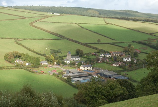
Roadway Wood is a charming woodland located in Somerset, England. Situated in the heart of the county, the wood is a popular destination for nature enthusiasts and outdoor adventurers. Covering an area of approximately 50 acres, Roadway Wood offers a tranquil escape from the hustle and bustle of everyday life.

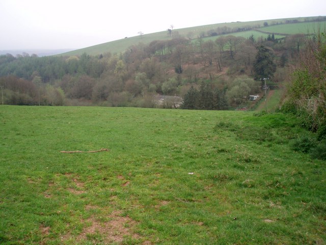
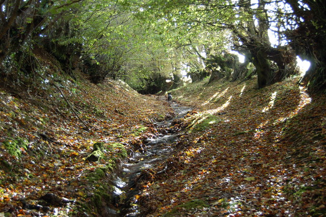
The wood is characterized by its dense canopy of trees, predominantly consisting of oak, beech, and birch. These towering trees provide a rich habitat for a diverse range of wildlife, including birds, insects, and small mammals. It is not uncommon to spot species such as woodpeckers, deer, and squirrels while exploring the wood's winding pathways.

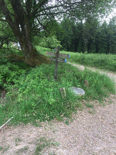
Roadway Wood boasts a network of well-maintained trails that meander through the woodland, allowing visitors to fully immerse themselves in the natural beauty of the surroundings. These paths are suitable for walkers of all abilities, with some even wheelchair accessible.

Nature lovers will delight in the wood's flora, with carpets of bluebells and wildflowers adorning the forest floor during the spring months. The wood also features a small stream, adding to its picturesque charm.

For those seeking a peaceful retreat, Roadway Wood offers several picnic areas where visitors can relax and enjoy the serenity of the surroundings. Additionally, the wood holds educational events and guided walks, providing an opportunity for visitors to learn more about the local ecology and conservation efforts.

In conclusion, Roadway Wood is a captivating woodland in Somerset, offering a haven for wildlife and a sanctuary for those seeking solace in nature. Its diverse flora and fauna, well-maintained trails, and tranquil ambiance make it a must-visit destination for nature enthusiasts and outdoor lovers alike.

If you have any feedback on the listing, please let us know in the comments section below.

Roadway Wood Images

Images are sourced within 2km of 51.127565/-3.4570759 or Grid Reference SS9837. Thanks to Geograph Open Source API. All images are credited.

Sign Post near Croydon Hill Trig Point
Langham Hill Pit foundations This was an iron ore mine and this pit was sunk in 1865-66 and a second hand rotative beam pumping and winding engine was brought over from South Wales. This had a 25" cylinder. It was later moved to Burrow Farm were it was installed in 1879. These foundations were excavated in 1995 and include the engine house, boiler house for two boiler, chimney base and flywheel pit. The shaft is nearby and fenced off.
Langham Hill Pit foundations
This was an iron ore mine and this pit was sunk in 1865-66 and a second hand rotative beam pumping and winding engine was brought over from South Wales. This had a 25" cylinder. It was later moved to Burrow Farm were it was installed in 1879. These foundations were excavated in 1995 and include the engine house, boiler house for two boiler, chimney base and flywheel pit. The shaft is nearby and fenced off.
Bearland Wood Iron Mine ventilation furnace chimney This is a Scheduled Ancient Monument and was used to ventilate underground iron mine workings by means of a furnace. The chimney was built c1860 but mining had ceased in the area by 1883.
Bearland Wood Iron Mine ventilation furnace chimney
This is a Scheduled Ancient Monument and was used to ventilate underground iron mine workings by means of a furnace. The chimney was built c1860 but mining had ceased in the area by 1883.
LUXBOROUGH, St Mary's Church, Somerset St Mary's Church
LUXBOROUGH, St Mary's Church, Somerset
St Mary's Church
Slowley Farm Looking north west from across the valley on the Treborough - Court Farm lane
Slowley Farm
Looking north west from across the valley on the Treborough - Court Farm lane
Lower Court Farm, Treborough Virtually the end of the lane from Treborough
Lower Court Farm, Treborough
Virtually the end of the lane from Treborough
The Royal Oak at Luxborough This part of Luxborough is known as Kingsbridge. The Inn did feature in the Daily Telegraph's Best UK pub a few years ago!
The Royal Oak at Luxborough
This part of Luxborough is known as Kingsbridge. The Inn did feature in the Daily Telegraph's Best UK pub a few years ago!
Lower road bridge at Pooltown, Luxborough The infant Washford river, having started higher up as Tarr Water, first runs west, here turns north through Luxborough then runs NE through Roadwater to enter the Bristol Channel at Watchet
Lower road bridge at Pooltown, Luxborough
The infant Washford river, having started higher up as Tarr Water, first runs west, here turns north through Luxborough then runs NE through Roadwater to enter the Bristol Channel at Watchet
St. Mary's Church Luxborough This unusual little church has an elevated position just above the part of Luxborough known as Churchtown.
St. Mary's Church Luxborough
This unusual little church has an elevated position just above the part of Luxborough known as Churchtown.
Nurcott Farm. This smart farm now offers holiday cottages to rent.
Nurcott Farm.
This smart farm now offers holiday cottages to rent.
Coming down from Monkham Wood. The lane ahead is Stout's Way Lane.
Coming down from Monkham Wood.
The lane ahead is Stout's Way Lane.
Des Res. This stunning house is approached by a long private drive on the other side of the Washford River which runs through the garden. The photograph is taken from the lane between Luxborough and Roadwater.
Des Res.
This stunning house is approached by a long private drive on the other side of the Washford River which runs through the garden. The photograph is taken from the lane between Luxborough and Roadwater.
View across the Valley Taken on a drizzly spring day, the solitary house in the bottom of the valley is on the lane to Chargot House.
View across the Valley
Taken on a drizzly spring day, the solitary house in the bottom of the valley is on the lane to Chargot House.
Lane to Pooltown
Lane to Pooltown
Slowley Farm Near Luxborough
Slowley Farm
Near Luxborough
Part of The Samaritans Way (South West) Torrential rain had recently washed away the thin layer of soil to expose the bedrock down the centre of this old and little-used bridleway.
Part of The Samaritans Way (South West)
Torrential rain had recently washed away the thin layer of soil to expose the bedrock down the centre of this old and little-used bridleway.
Churchtown viewed from Samaritans Way Churchtown, with it historic church, is one of the three hamlets which make up the Parish of Luxborough.
Churchtown viewed from Samaritans Way
Churchtown, with it historic church, is one of the three hamlets which make up the Parish of Luxborough.
Collyhill Wood From the footpath to Kennisham Hill.
Collyhill Wood
From the footpath to Kennisham Hill.
Show me another place!

Roadway Wood is located at Grid Ref: SS9837 (Lat: 51.127565, Lng: -3.4570759)

Administrative County: Somerset

District: Somerset West and Taunton

Police Authority: Avon and Somerset

What 3 Words

///riders.quitter.jokes. Near Minehead, Somerset

Related Wikis

Luxborough

Luxborough is a small village and civil parish located some 6 miles (9.7 km) south of Dunster, lying amongst the Brendon Hills and the Exmoor National...

St Mary's Church, Luxborough

The Anglican St Mary's Church at Luxborough within the English county of Somerset dates from the 13th century. It is a Grade II listed building.The chancel...

Luxborough Road railway station

Luxborough Road (sometimes referred to as "Langham" or "Langham Hill") was an intermediate station on the West Somerset Mineral Railway (WSMR), which was...

Rodhuish Common

Rodhuish Common is a univallate Iron Age hill fort in the West Somerset district of Somerset, England. There is a small oval enclosure which is thought...

Gupworthy railway station

Gupworthy (sometimes referred to as "Goosemoor") was originally intended as an intermediate station on the West Somerset Mineral Railway (WSMR), but neither...

Brendon Hills

The Brendon Hills are a range of hills in west Somerset, England. The hills merge level into the eastern side of Exmoor and are included within the Exmoor...

Church of St Peter, Williton

The Anglican Church of St Peter in Williton in the English county of Somerset is recorded in the National Heritage List for England as a designated Grade...

St Peter's Church, Treborough

The Anglican St Peter's Church at Treborough within the English county of Somerset dates from the 14th century. It is a Grade II* listed building.Although...

Nearby Amenities

Located within 500m of 51.127565,-3.4570759
Kingsbridge
Place: hamlet
Source: OS_OpenData_StreetView
Lat/Long: 51.1296773/-3.4529334
Pooltown
Place: hamlet
Source: OS_OpenData_StreetView
Lat/Long: 51.1264588/-3.4511738
Defibrillator
Emergency: defibrillator
Ref GB The Circuit: 66C3135C-2765-41BA-A18F-AE3301128281
Lat/Long: 51.1285727/-3.4523611
Post Box
Operator: Royal Mail
Post Box Type: wall
Ref: TA23 39
Royal Cypher: EIIR
Royal Cypher Wikidata: Q33102113
Lat/Long: 51.1294657/-3.4526736
Telephone
Booth: K6
Covered: booth
Listed Status: Grade II
Lat/Long: 51.1293526/-3.45257
Information: guidepost
Tourism: information
Lat/Long: 51.1293937/-3.4525941
The data included in this document is from www.openstreetmap.org. The data is made available under ODbL.

Have you been to Roadway Wood?

Leave your review of Roadway Wood below (or comments, questions and feedback).