Ball Copse

Wood, Forest in Somerset Somerset West and Taunton

England

Ball Copse

Ordnance Survey Cut Mark This OS cut mark can be found on the wall of Huntsham. It marks a point 72.713m above mean sea level.
Ordnance Survey Cut Mark Credit: Adrian Dust

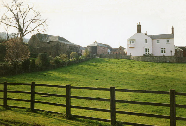
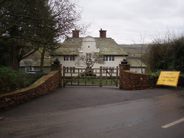
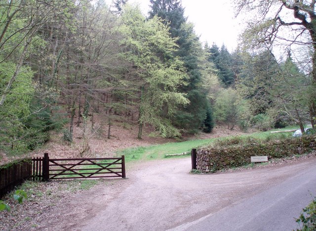
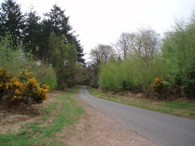
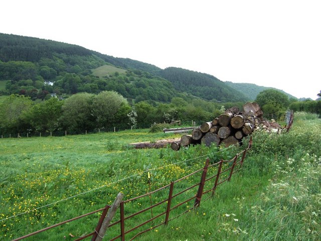
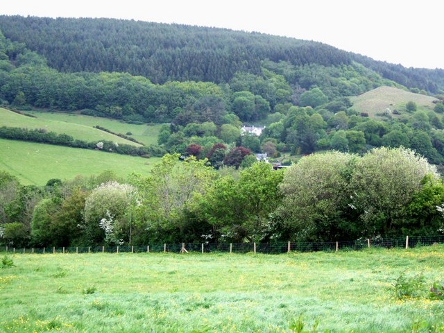
Ball Copse is a picturesque woodland located in Somerset, England. Situated on the outskirts of the village of Ball, it covers an area of approximately 20 acres. This enchanting forest is known for its diverse range of tree species, creating a rich and vibrant ecosystem.

The woodland is predominantly made up of broadleaf trees such as oak, beech, and ash, which provide a dense canopy, offering shade and shelter to various wildlife species. The forest floor is adorned with a carpet of bluebells in the springtime, creating a breathtaking display of vibrant colors.

Ball Copse is home to a variety of fauna, including woodland birds, such as woodpeckers and owls, which can be heard echoing through the trees. Small mammals like squirrels and hedgehogs can also be spotted scurrying through the undergrowth. The woodland is also known for its diverse insect population, with butterflies and dragonflies fluttering around during the warmer months.

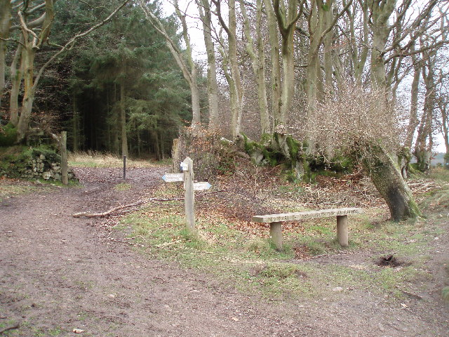
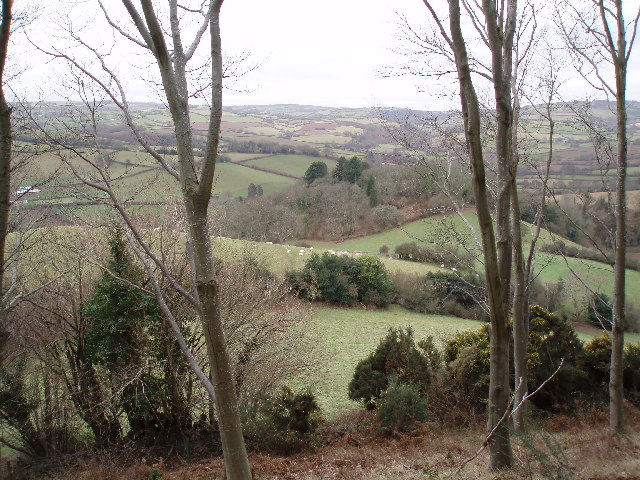
The forest is a popular destination for nature enthusiasts, walkers, and families, who come to enjoy the tranquility and natural beauty it offers. It provides numerous walking trails, allowing visitors to explore the wood and discover its hidden gems. The well-maintained paths wind through the trees, offering glimpses of stunning vistas and allowing visitors to immerse themselves in the peaceful ambiance of the woodland.

Overall, Ball Copse is a captivating woodland that showcases the natural beauty of Somerset. With its diverse flora and fauna, it provides a serene escape from the hustle and bustle of everyday life, attracting both locals and tourists alike.

If you have any feedback on the listing, please let us know in the comments section below.
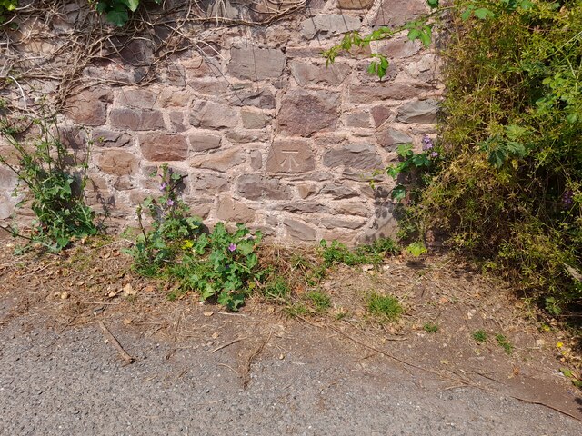
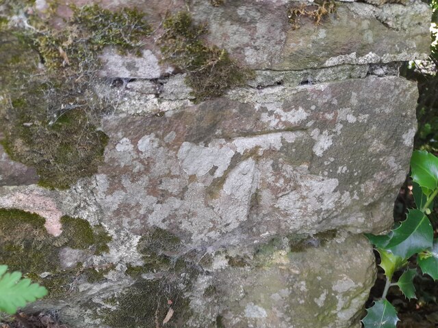
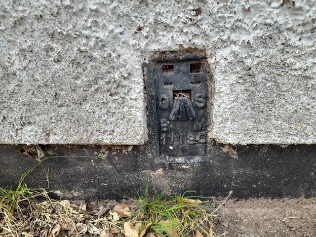
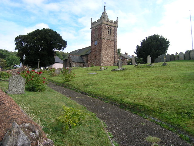
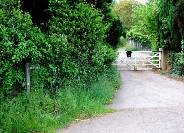
Ball Copse Images

Images are sourced within 2km of 51.178164/-3.4872413 or Grid Reference SS9643. Thanks to Geograph Open Source API. All images are credited.

Ordnance Survey Cut Mark This OS cut mark can be found on the wall of Huntsham. It marks a point 72.713m above mean sea level.
Ordnance Survey Cut Mark
This OS cut mark can be found on the wall of Huntsham. It marks a point 72.713m above mean sea level.
Ordnance Survey Cut Mark This OS cut mark can be found on the east parapet of Cow Bridge. It marks a point 62.410m above mean sea level.
Ordnance Survey Cut Mark
This OS cut mark can be found on the east parapet of Cow Bridge. It marks a point 62.410m above mean sea level.
Ordnance Survey Flush Bracket (11195) This OS Flush Bracket can be found on the NE angle of the school house. It marks a point 77.073m above mean sea level.
Ordnance Survey Flush Bracket (11195)
This OS Flush Bracket can be found on the NE angle of the school house. It marks a point 77.073m above mean sea level.
Ordnance Survey Cut Mark This OS cut mark can be found on the SW angle of St Petrock's Church. It marks a point 81.800m above mean sea level.
Ordnance Survey Cut Mark
This OS cut mark can be found on the SW angle of St Petrock's Church. It marks a point 81.800m above mean sea level.
Timberscombe, Somerset The church of St Petrock
Timberscombe, Somerset
The church of St Petrock
Minehead: Higher Hopcott Farmhouse and barns. The farm was for sale with 117.47 acres in 2001. The barn on the left with the half-hipped roof was once water-powered. A leat still runs by
Minehead: Higher Hopcott
Farmhouse and barns. The farm was for sale with 117.47 acres in 2001. The barn on the left with the half-hipped roof was once water-powered. A leat still runs by
House at Cowbridge Cross. This very smart house is quietly situated on the lane to Wootton Courtenay. The sign bears testimony to the fact that a large proportion of the passing traffic has four legs.
House at Cowbridge Cross.
This very smart house is quietly situated on the lane to Wootton Courtenay. The sign bears testimony to the fact that a large proportion of the passing traffic has four legs.
Woodland Bridleway near Wootton Courtenay This photograph looks south towards Exmoor, the bridleway goes to Ranscombe Farm.
Woodland Bridleway near Wootton Courtenay
This photograph looks south towards Exmoor, the bridleway goes to Ranscombe Farm.
Trig Point above Wootton Courtenay. Coloured white to make it easy to spot amongst the trees, this trig point is at a height of 295m. Behind the photographer is a clear view towards the Bristol Channel.
Trig Point above Wootton Courtenay.
Coloured white to make it easy to spot amongst the trees, this trig point is at a height of 295m. Behind the photographer is a clear view towards the Bristol Channel.
Hole's Corner The signpost reads left to Croydon Hill and right to Selworthy. There is an inscription on the front of the seat which reads, "In memory of Gary Draper from his friends."
Hole's Corner
The signpost reads left to Croydon Hill and right to Selworthy. There is an inscription on the front of the seat which reads, "In memory of Gary Draper from his friends."
West Somerset Farmland. The tracks through the woods here mostly run along the contours allowing plenty of opportunity to appreciate the views.
West Somerset Farmland.
The tracks through the woods here mostly run along the contours allowing plenty of opportunity to appreciate the views.
Nutcombe Bottom This is the entrance to the car park at Nutcombe Bottom, which sounds like something out of a children's story. There are marked forest trails in Nutcombe Bottom itself and cycle trails in the adjacent Whits Wood, all of which start from here.
Nutcombe Bottom
This is the entrance to the car park at Nutcombe Bottom, which sounds like something out of a children's story. There are marked forest trails in Nutcombe Bottom itself and cycle trails in the adjacent Whits Wood, all of which start from here.
Woodland Road. The light green trees edging the road are birches which have just come into leaf. Photograph taken looking down the road towards Dunster.
Woodland Road.
The light green trees edging the road are birches which have just come into leaf. Photograph taken looking down the road towards Dunster.
Coombe Cottage Gateway, Callins The lane from Minehead through the village of Alcombe comes to a dead end at Callins. A track continues on into a wood, and almost doubling back is this trackway to Coombe cottage, a private dwelling.
Coombe Cottage Gateway, Callins
The lane from Minehead through the village of Alcombe comes to a dead end at Callins. A track continues on into a wood, and almost doubling back is this trackway to Coombe cottage, a private dwelling.
Opposite Totterdown Farm Stacked logs in a field opposite Totterdown Farm near Timberscombe. The white building in the hills is "Burnells" I think.
Opposite Totterdown Farm
Stacked logs in a field opposite Totterdown Farm near Timberscombe. The white building in the hills is "Burnells" I think.
Looking towards Knowle Hill A meadow full of buttercups bordered by a multi-species hedge and beyond that the heavily wooded hills behind which lie Minehead and the sea. This view is from opposite Totterdown Farm looking towards Knowle Hill. The white building is, I believe, Burnells.
Looking towards Knowle Hill
A meadow full of buttercups bordered by a multi-species hedge and beyond that the heavily wooded hills behind which lie Minehead and the sea. This view is from opposite Totterdown Farm looking towards Knowle Hill. The white building is, I believe, Burnells.
Entrance to Totterdown Farm This gate is the entrance to Totterdown Farm and the little wooden sign shows that it is also the route of a bridleway.
Entrance to Totterdown Farm
This gate is the entrance to Totterdown Farm and the little wooden sign shows that it is also the route of a bridleway.
Callins - The track to Hopcott The lane from Alcombe runs out here at Callins, but a track continues to Hopcott.
Callins - The track to Hopcott
The lane from Alcombe runs out here at Callins, but a track continues to Hopcott.
Show me another place!

Ball Copse is located at Grid Ref: SS9643 (Lat: 51.178164, Lng: -3.4872413)

Administrative County: Somerset

District: Somerset West and Taunton

Police Authority: Avon and Somerset

What 3 Words

///grower.habits.sprayer. Near Minehead, Somerset

Related Wikis

Dunster Park and Heathlands

Dunster Park and Heathlands (grid reference SS955441) is a 466.6 hectare biological Site of Special Scientific Interest in Somerset, notified in 2000....

Grabbist Hillfort

Grabbist Hillfort is an Iron Age oval hillfort or defended enclosure, west of Dunster in Somerset, England. The site is 885.8 feet (270.0 m) long and 219...

Wootton Courtenay

Wootton Courtenay is a village and civil parish on Exmoor in the Somerset West and Taunton district of Somerset, England. The parish includes the hamlets...

Long Wood Enclosure

Long Wood Enclosure is an enclosure which may have been a univallate Iron Age hill fort, in the West Somerset district of Somerset, England. The hill fort...

Black Ball Camp

Black Ball Camp is an Iron Age hillfort South West of Dunster, Somerset, England on the northern summit of Gallox Hill. It is a Scheduled Monument.It is...

West Somerset College

West Somerset College (is sometimes abbreviated to WSC and was previously known as West Somerset Community College prior to the college re-brand in September...

The Kildare Lodge Inn

The Kildare Lodge Inn in Minehead, Somerset, England, was built in 1905/6, and is located at 18 Townsend Road, to the south east of the town centre of...

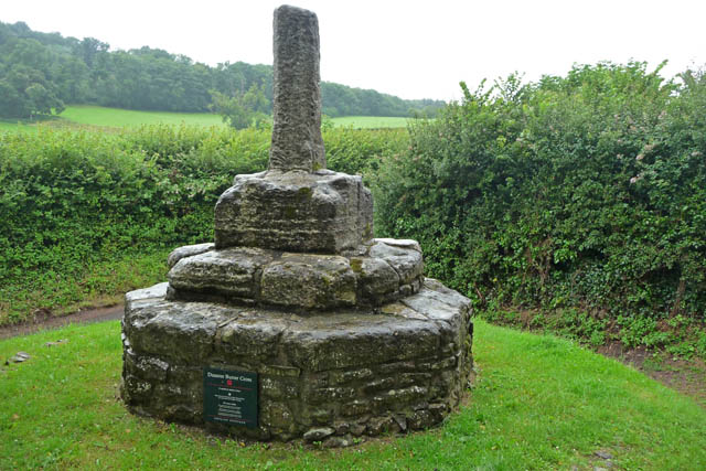
Dunster Butter Cross

The Butter Cross in Dunster within the English county of Somerset is a Grade II* listed building and scheduled monument. The cross was originally erected...

Have you been to Ball Copse?

Leave your review of Ball Copse below (or comments, questions and feedback).