Daws Wood

Wood, Forest in Somerset Somerset West and Taunton

England

Daws Wood

Halscombe Farm, near Dulverton: aerial 2021
Halscombe Farm, near Dulverton: aerial 2021 Credit: Chris

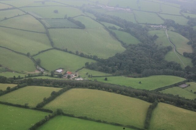
Daws Wood is a beautiful woodland located in Somerset, England. Spread across an area of approximately 100 acres, it is a popular destination for nature enthusiasts and outdoor enthusiasts alike. The wood is situated near the charming village of Daws, nestled amidst the rolling hills of the Somerset countryside.

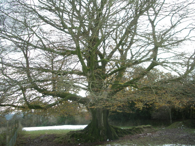
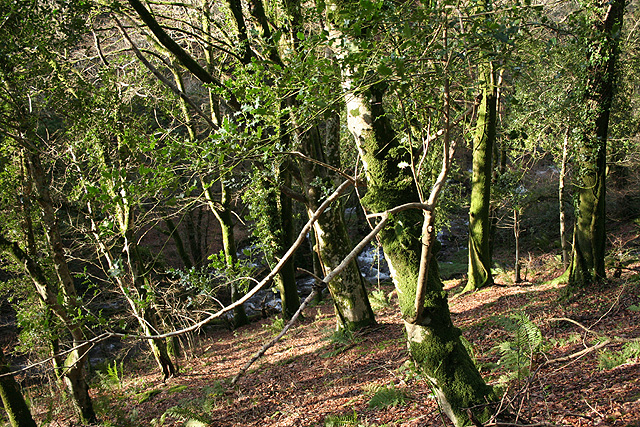
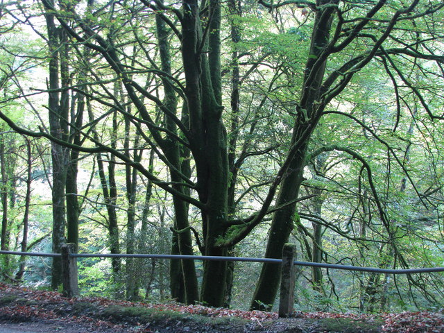
Daws Wood boasts a diverse range of tree species, including oak, beech, and ash, which create a rich and vibrant landscape throughout the year. The woodland is home to a variety of wildlife, such as deer, foxes, badgers, and many species of birds, making it a haven for nature lovers and photographers.

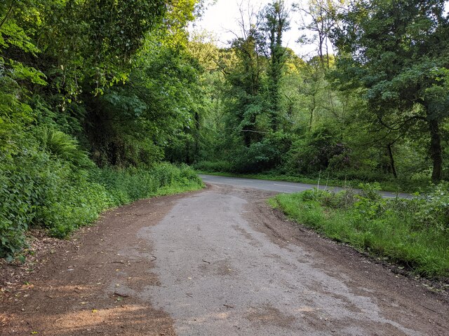
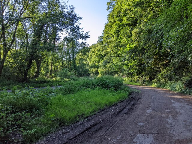
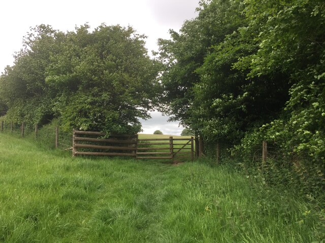
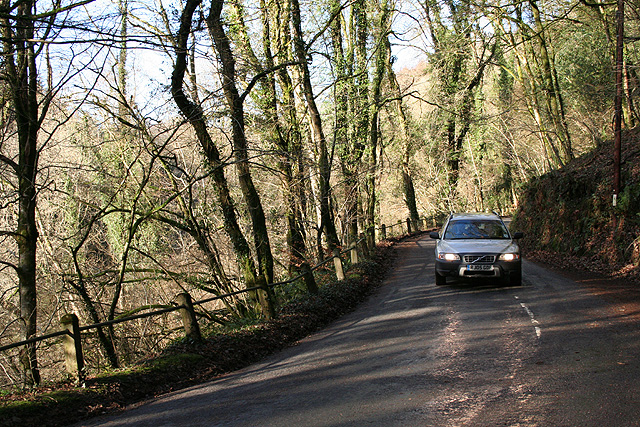
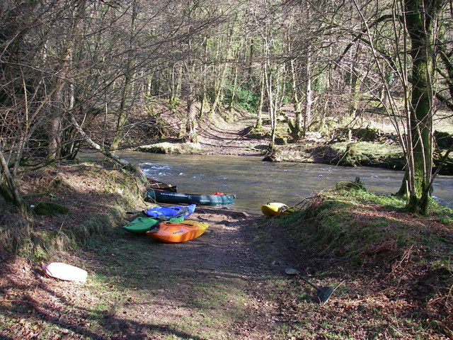
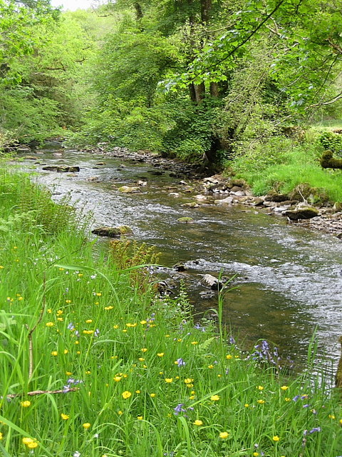
Visitors to Daws Wood can enjoy a network of well-maintained walking trails that wind through the forest, allowing for peaceful and serene strolls. These trails provide opportunities to explore the wood's unique flora and fauna, as well as discover hidden gems such as tranquil ponds and clear streams.

In addition to its natural beauty, Daws Wood also has historical significance. It is believed to have been part of an ancient forest that covered much of Somerset in the past. The wood has remnants of old boundary walls and the remains of an Iron Age hill fort, adding an extra layer of interest for history enthusiasts.

Overall, Daws Wood offers a delightful escape from urban life, providing visitors with a chance to immerse themselves in the tranquility and beauty of nature. Whether one seeks a peaceful walk, wildlife spotting, or a glimpse into the region's history, Daws Wood is a must-visit destination in Somerset.

If you have any feedback on the listing, please let us know in the comments section below.
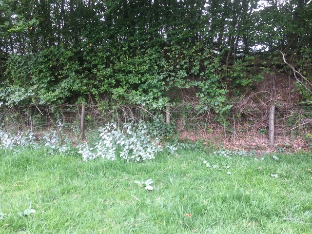
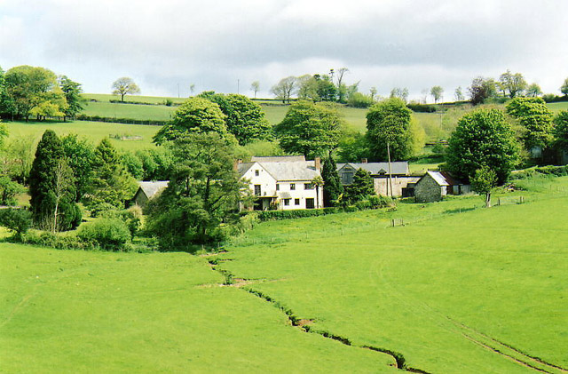
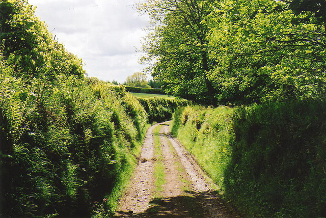
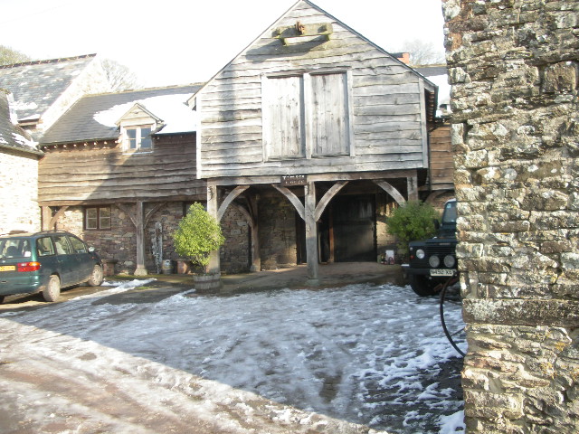
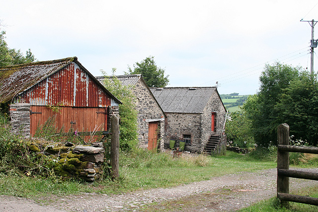
Daws Wood Images

Images are sourced within 2km of 51.063101/-3.5326428 or Grid Reference SS9230. Thanks to Geograph Open Source API. All images are credited.

Halscombe Farm, near Dulverton: aerial 2021
Layby on the A396, looking south
Layby on the A396, looking north
Nearly there, path to Court Down
Court Down Trig Point Flush Bracket S3968
White nettles near Court Down Chalky soil spraying up onto plants, found this an odd sight
White nettles near Court Down
Chalky soil spraying up onto plants, found this an odd sight
Dulverton: Northcombe Farm View from the footpath to Court Down. The water-powered millhouse at Northcombe has been converted into a camping barn; the shrouds of the overshot waterwheel survive outside
Dulverton: Northcombe Farm
View from the footpath to Court Down. The water-powered millhouse at Northcombe has been converted into a camping barn; the shrouds of the overshot waterwheel survive outside
Dulverton: track running south to Jury Cross The track appears to head towards Pixton Park, just beyond Jury Cross
Dulverton: track running south to Jury Cross
The track appears to head towards Pixton Park, just beyond Jury Cross
North Coombe Farm Camping Barn Wonderful spot to stay, to walk, to relax
North Coombe Farm Camping Barn
Wonderful spot to stay, to walk, to relax
majestic hedge bank beech (Fagus Sylvatica) One of many magnificent trees in the Dulverton area
majestic hedge bank beech (Fagus Sylvatica)
One of many magnificent trees in the Dulverton area
Dulverton: Stockham Former farm buildings. Looking east-north-east
Dulverton: Stockham
Former farm buildings. Looking east-north-east
Brompton Regis: the A396 in the Exe Valley River and road adjoin. Looking west-south-west on the edge of Brockhole Wood
Brompton Regis: the A396 in the Exe Valley
River and road adjoin. Looking west-south-west on the edge of Brockhole Wood
Dulverton: Looseall Wood By the B3223 road to Exmoor and Simonsbath. Looking west-north-west
Dulverton: Looseall Wood
By the B3223 road to Exmoor and Simonsbath. Looking west-north-west
Dulverton: the B3223 in Looseall Wood The road to Exmoor and Simonsbath in the steep-sided valley of a Barle tributary. Looking north
Dulverton: the B3223 in Looseall Wood
The road to Exmoor and Simonsbath in the steep-sided valley of a Barle tributary. Looking north
Ford over the Exe A ford where a private track crosses the river Exe
Ford over the Exe
A ford where a private track crosses the river Exe
Baronsdown Deer Sanctuary The sanctuary is run by the League Against Cruel Sports and the high fencing can be seen behind the white notice.
Baronsdown Deer Sanctuary
The sanctuary is run by the League Against Cruel Sports and the high fencing can be seen behind the white notice.
River Exe The river Exe (or Little Exe as it is known locally above the Exe/Barle junction) near Barlynch Farm.
River Exe
The river Exe (or Little Exe as it is known locally above the Exe/Barle junction) near Barlynch Farm.
Looseall Wood
Looseall Wood
Show me another place!

Daws Wood is located at Grid Ref: SS9230 (Lat: 51.063101, Lng: -3.5326428)

Administrative County: Somerset

District: Somerset West and Taunton

Police Authority: Avon and Somerset

What 3 Words

///cackling.pixel.laces. Near Dulverton, Somerset

Related Wikis

Barlynch Priory

Barlynch Priory (also known as St Nicholas's Priory and sometimes spelled Barlich Priory) in Brompton Regis, Somerset, England was an Augustinian priory...

Dulverton Rural District

Dulverton was a rural district in Somerset, England, from 1894 to 1974. It was created in 1894 under the Local Government Act 1894. In 1974 it was abolished...

Dulverton

Dulverton is a town and civil parish in west Somerset, England, near the border with Devon. The town had a population of 1,408 at the 2011 Census. The...

Church of St Mary, Brompton Regis

The Anglican Church of St Mary in Brompton Regis, Somerset, England was built in the 13th century. It is a Grade II* listed building. == History == The...

Church of All Saints, Dulverton

The Anglican Church of All Saints in Dulverton, Somerset, England was built in the 15th century and largely rebuilt in the 1850s. It is a Grade II* listed...

Oldberry Castle

Oldberry Castle (sometimes called Oldbury Castle) is an Iron Age hill fort north west of Dulverton, Somerset, England. It lies approximately 0.5 miles...

Dulverton Town Hall

Dulverton Town Hall is a municipal building in Fore Street in Dulverton, Somerset, England. The building, which is the meeting place of Dulverton Town...

Northmoor, Dulverton

Northmoor is an historic estate in the parish of Dulverton in Somerset, England. The Victorian mansion house known as Northmoor House is set amongst steep...

Nearby Amenities

Located within 500m of 51.063101,-3.5326428
Post Box
Operator: Royal Mail
Operator Wikidata: Q638098
Post Box Type: wall
Ref: TA22 43
Royal Cypher: VR
Royal Cypher Wikidata: Q33102356
Lat/Long: 51.0653942/-3.5370918
Parking
Lat/Long: 51.0635098/-3.5354093
Power: pole
Lat/Long: 51.0653052/-3.5333904
Power: pole
Lat/Long: 51.0647627/-3.532737
Power: pole
Lat/Long: 51.0659592/-3.5341905
Power: pole
Lat/Long: 51.0664525/-3.5329459
Power: pole
Lat/Long: 51.0670332/-3.5314694
Power: pole
Lat/Long: 51.0671198/-3.5300032
Power: pole
Lat/Long: 51.0673733/-3.532706
Higher Stockham Wood
Place: locality
Lat/Long: 51.0611357/-3.533249
Daws Wood
Place: locality
Lat/Long: 51.0629884/-3.5324685
Cripplecleeve Plantation
Place: locality
Lat/Long: 51.063977/-3.5285424
Little Redway Plantation
Place: locality
Lat/Long: 51.0643811/-3.5262032
Blackbeards Copse
Place: locality
Lat/Long: 51.0642393/-3.5350023
Natural: spring
Lat/Long: 51.0659292/-3.5326967
The data included in this document is from www.openstreetmap.org. The data is made available under ODbL.

Have you been to Daws Wood?

Leave your review of Daws Wood below (or comments, questions and feedback).