Cladswell

Settlement in Worcestershire Wychavon

England

Cladswell

The Salt Way joins The Ridgeway at New End
The Salt Way joins The Ridgeway at New End Credit: Jeff Gogarty

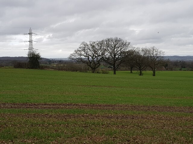
Cladswell is a small village located in the county of Worcestershire, England. Situated near the River Severn, it is nestled in a picturesque rural setting surrounded by lush green fields and rolling hills. The village is part of the Wychavon District and falls within the administrative boundaries of the town of Pershore.

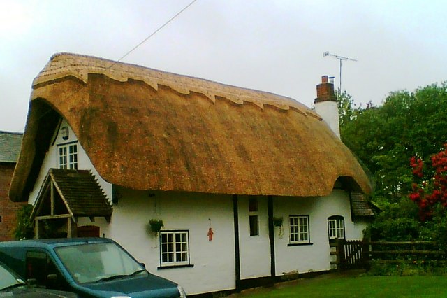
With a population of approximately 500 residents, Cladswell exudes a charming and tranquil atmosphere. Its origins date back centuries, and evidence of its historical significance can be found in the form of ancient buildings and landmarks scattered throughout the village. The local parish church, St. Mary's, is a noteworthy example, boasting stunning medieval architecture and serving as a focal point for the community.

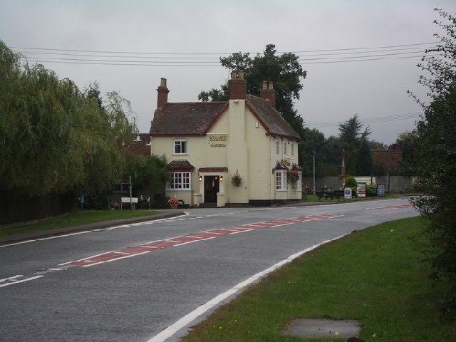
Despite its small size, Cladswell offers a range of amenities to its residents. These include a village hall, a primary school, and a quaint local pub that serves as a social hub for villagers and visitors alike. The surrounding countryside provides ample opportunities for outdoor activities such as hiking, cycling, and fishing, attracting nature enthusiasts and tourists throughout the year.

While Cladswell is primarily a residential area, it benefits from its proximity to nearby towns and cities. Pershore, located just a few miles away, provides residents with access to a wider range of services, including supermarkets, shops, and healthcare facilities.

Overall, Cladswell offers a peaceful and idyllic lifestyle, making it an attractive place to live for those seeking a tight-knit community in a rural setting.

If you have any feedback on the listing, please let us know in the comments section below.

Cladswell Images

Images are sourced within 2km of 52.227348/-1.932621 or Grid Reference SP0458. Thanks to Geograph Open Source API. All images are credited.

The Salt Way joins The Ridgeway at New End
Nevill Arms at New End Take from where the Millennium Way joins the Ridgeway.
Nevill Arms at New End
Take from where the Millennium Way joins the Ridgeway.
Deer running across a field Near 145 Park Farm, Alcester and taken from the Millennium Way.
Deer running across a field
Near 145 Park Farm, Alcester and taken from the Millennium Way.
Junction of Alcester Heath and Whitemoor Road, Warwickshire
Pond on The Ridgeway, near to New End
House with helicopter, The Ridgeway
Power lines crossing near the Monarch's Way
View over North Worcestershire from the Ridgeway Beyond the hills in the distant is the Teme Valley. The land in between was originally mainly the Forest of Feckenham.
View over North Worcestershire from the Ridgeway
Beyond the hills in the distant is the Teme Valley. The land in between was originally mainly the Forest of Feckenham.
Tree next to the Monarch's Way
Cattle near Lower Park Farm, New End Taken from the Monarch's Way.
Cattle near Lower Park Farm, New End
Taken from the Monarch's Way.
Power lines above horses
Wires crossing near Monarch's Way
Dilapidated gate into waste ground
Cookhill - Brackenhurst sewage pumping station
Trees and pylon near The Ridgeway
Ridgeway Donkeys and a trig pillar on the Ridgeway, a road that as the name suggests runs along a ridge from Redditch.  Being a road along a hill top, it attracted ribbon development for big houses  in the days before planning controls.
Ridgeway
Donkeys and a trig pillar on the Ridgeway, a road that as the name suggests runs along a ridge from Redditch. Being a road along a hill top, it attracted ribbon development for big houses in the days before planning controls.
The Nevill Arms, New End Only just within this grid square, the Nevill Arms pub at the junction of the A441 and the Salt Way (B4090), New End, is a recognisable local landmark.
The Nevill Arms, New End
Only just within this grid square, the Nevill Arms pub at the junction of the A441 and the Salt Way (B4090), New End, is a recognisable local landmark.
Butler's Coppice Looking from near the SW corner of the square on Alcester Heath.
Butler's Coppice
Looking from near the SW corner of the square on Alcester Heath.
Show me another place!

Cladswell is located at Grid Ref: SP0458 (Lat: 52.227348, Lng: -1.932621)

Administrative County: Worcestershire

District: Wychavon

Police Authority: West Mercia

What 3 Words

///sisters.reworked.fighters. Near Inkberrow, Worcestershire

Nearby Locations

Cladswell

Related Wikis

Cookhill

Cookhill is a village and civil parish in Worcestershire, England, on the county border near Alcester. It is close to a former Cistercian Priory of the...

Cookhill Priory

Cookhill Priory was a Cistercian nunnery near Cookhill in Worcestershire, England. == History == The Priory is believed to be founded by Isabel de Mauduit...

Holberrow Green

Holberrow Green is a village in Worcestershire, England. == External links == Media related to Holberrow Green at Wikimedia Commons

Redditch (UK Parliament constituency)

Redditch is a constituency in Worcestershire, England, represented in the House of Commons of the UK Parliament since 2017 by Rachel Maclean of the Conservative...

Nearby Amenities

Located within 500m of 52.227348,-1.932621
Power: tower
Source: bing
Lat/Long: 52.2241927/-1.9346888
Power: tower
Source: bing
Lat/Long: 52.2276706/-1.934158
Power: tower
Source: bing
Lat/Long: 52.2305909/-1.9337209
Barrier: kissing_gate
Foot: yes
Lat/Long: 52.2290285/-1.9272965
Barrier: yes
Lat/Long: 52.230669/-1.9320426
Power: pole
Lat/Long: 52.2300124/-1.9301538
Power: pole
Lat/Long: 52.2294349/-1.9303349
Power: pole
Lat/Long: 52.2290562/-1.9304569
Power: pole
Lat/Long: 52.2283367/-1.9306782
Location Transition: yes
Power: pole
Lat/Long: 52.2276861/-1.9305146
Power: pole
Lat/Long: 52.2302325/-1.9296281
Upper Cladswell Farm
Power: pole
Transformer: distribution
Voltage Primary: 11000
Lat/Long: 52.2300037/-1.9296516
Power: pole
Lat/Long: 52.2308325/-1.9295617
Power: pole
Lat/Long: 52.2233691/-1.930127
Cladswell
Power: pole
Transformer: distribution
Voltage Primary: 11000
Lat/Long: 52.2274905/-1.9284962
Location Transition: yes
Power: pole
Lat/Long: 52.2269726/-1.9295027
Power: pole
Lat/Long: 52.2264358/-1.9304918
Cladswell Lane
Power: pole
Transformer: distribution
Voltage Primary: 11000
Lat/Long: 52.2263298/-1.9312522
Power: pole
Lat/Long: 52.2258147/-1.9304247
Power: pole
Lat/Long: 52.2250002/-1.9303382
Power: pole
Lat/Long: 52.2242169/-1.9301686
The data included in this document is from www.openstreetmap.org. The data is made available under ODbL.

Have you been to Cladswell?

Leave your review of Cladswell below (or comments, questions and feedback).