Underwood Plantation

Wood, Forest in Somerset Somerset West and Taunton

England

Underwood Plantation

The old Methodist Chapel, Wheddon Cross Built in 1893 to replace an earlier chapel, it is now a private residence. In the foreground is the A396 Tiverton to Minehead road.
The old Methodist Chapel, Wheddon Cross Credit: Martin Tester

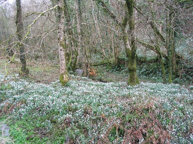
Underwood Plantation, located in Somerset, is a sprawling woodland retreat nestled in the heart of a lush forest. Spanning over vast acres, this idyllic estate is a haven for nature lovers and those seeking solace in the tranquil surroundings.

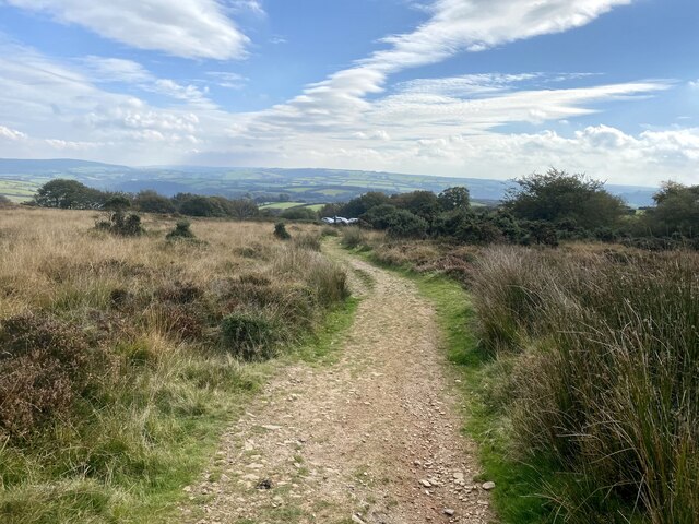
The centerpiece of Underwood Plantation is its magnificent wood, filled with a diverse array of trees ranging from towering oaks to delicate birches. This pristine forest provides a haven for various species of flora and fauna, making it a prime destination for hikers, birdwatchers, and nature enthusiasts. The well-maintained trails meander through the woods, offering visitors an opportunity to immerse themselves in the beauty of nature.

The plantation itself boasts a rich history, dating back to the 18th century. Once a thriving hub for agricultural activities, the estate has since been transformed into a conservation area, preserving its natural beauty for generations to come. The carefully preserved historic buildings scattered throughout the property serve as a reminder of its storied past.

Visitors to Underwood Plantation can partake in a range of outdoor activities. From guided nature walks to picnic areas and camping grounds, there are ample opportunities to enjoy the great outdoors. The estate also offers educational programs and workshops, allowing visitors to deepen their understanding of the local ecosystem and conservation efforts.

Overall, Underwood Plantation is a picturesque retreat that offers a harmonious blend of history and natural beauty. Whether exploring the enchanting woodlands, learning about the area's past, or simply basking in the serenity of the surroundings, this Somerset plantation has something for everyone seeking respite in nature.

If you have any feedback on the listing, please let us know in the comments section below.

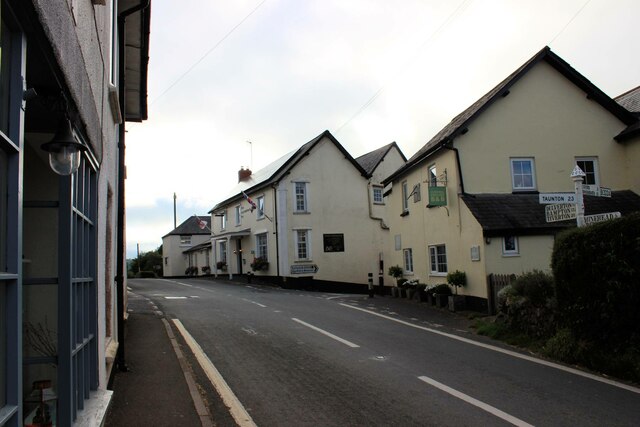
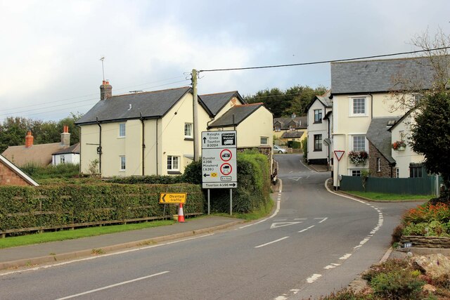
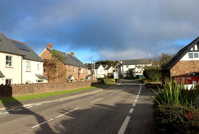
Underwood Plantation Images

Images are sourced within 2km of 51.149086/-3.556708 or Grid Reference SS9140. Thanks to Geograph Open Source API. All images are credited.

The old Methodist Chapel, Wheddon Cross Built in 1893 to replace an earlier chapel, it is now a private residence. In the foreground is the A396 Tiverton to Minehead road.
The old Methodist Chapel, Wheddon Cross
Built in 1893 to replace an earlier chapel, it is now a private residence. In the foreground is the A396 Tiverton to Minehead road.
The Rest & Be Thankful Inn, Wheddon Cross Looking north along the A396 Tiverton to Minehead road. Immediately beyond the Inn is the very restricted junction where the B3224 crosses.
The Rest & Be Thankful Inn, Wheddon Cross
Looking north along the A396 Tiverton to Minehead road. Immediately beyond the Inn is the very restricted junction where the B3224 crosses.
Village information board, Wheddon Cross Wheddon Cross lies in the parish of Cutcombe. The village was developed when the Bampton to Minehead turnpike (now the A396) was built in the 1820s, bypassing the village of Cutcombe.
Village information board, Wheddon Cross
Wheddon Cross lies in the parish of Cutcombe. The village was developed when the Bampton to Minehead turnpike (now the A396) was built in the 1820s, bypassing the village of Cutcombe.
Norman Cottage, Wheddon Cross The pair of thatched semi-detached cottages (late C18-early C19) are Grade II listed buildings, see: <span class="nowrap"><a title="https://britishlistedbuildings.co.uk/101345718-norman-cottage-cutcombe#.YVcPs33TXIU" rel="nofollow ugc noopener" href="https://britishlistedbuildings.co.uk/101345718-norman-cottage-cutcombe#.YVcPs33TXIU">Link</a><img style="margin-left:2px;" alt="External link" title="External link - shift click to open in new window" src="https://s1.geograph.org.uk/img/external.png" width="10" height="10"/></span> . The whole block including the nearer 3rd cottage appears to be known as 'Norman Cottage'. Beyond, the road for Cutcombe veers off to the right with the village war memorial at the junction.
I've subsequently discovered that the just-visible telephone kiosk is a K6 type which apparently warrants it being Grade II listed too! See: <span class="nowrap"><a title="https://britishlistedbuildings.co.uk/101057316-k6-telephone-kiosk-wheddon-cross-cutcombe#.YVcQ2H3TXIU" rel="nofollow ugc noopener" href="https://britishlistedbuildings.co.uk/101057316-k6-telephone-kiosk-wheddon-cross-cutcombe#.YVcQ2H3TXIU">Link</a><img style="margin-left:2px;" alt="External link" title="External link - shift click to open in new window" src="https://s1.geograph.org.uk/img/external.png" width="10" height="10"/></span> .
Norman Cottage, Wheddon Cross
The pair of thatched semi-detached cottages (late C18-early C19) are Grade II listed buildings, see: LinkExternal link . The whole block including the nearer 3rd cottage appears to be known as 'Norman Cottage'. Beyond, the road for Cutcombe veers off to the right with the village war memorial at the junction. I've subsequently discovered that the just-visible telephone kiosk is a K6 type which apparently warrants it being Grade II listed too! See: LinkExternal link .
Wheddon Cross, the cross roads Looking south along the A396 Minehead to Tiverton road. On the right are Sundial House & The Rest and be Thankful Inn. In between is the very restricted junction where the B3224 crosses.
Wheddon Cross, the cross roads
Looking south along the A396 Minehead to Tiverton road. On the right are Sundial House & The Rest and be Thankful Inn. In between is the very restricted junction where the B3224 crosses.
Wheddon Cross, the cross roads The road markings on the B3224 from Exford give some idea of the restricted nature of the junction it makes with the A396.
Wheddon Cross, the cross roads
The road markings on the B3224 from Exford give some idea of the restricted nature of the junction it makes with the A396.
Approaching Wheddon Cross from the west The Rest and be Thankful Inn is prominent at the crossroads. In the immediate foreground the petrol station sign casts a shadow across the B3224.
Approaching Wheddon Cross from the west
The Rest and be Thankful Inn is prominent at the crossroads. In the immediate foreground the petrol station sign casts a shadow across the B3224.
Bridleway to Dunkery Bridge
Sheep in a field at Long Lane Head Near to Dunkery Gate.
Sheep in a field at Long Lane Head
Near to Dunkery Gate.
Long Lane Head The north end of Long Lane <a href="https://www.geograph.org.uk/photo/4429729">SS9039 : West Somerset : Long Lane</a> from Luckwell Bridge
Long Lane Head
The north end of Long Lane SS9039 : West Somerset : Long Lane from Luckwell Bridge
Cutcombe : B3224 Looking along the B3224.
Cutcombe : B3224
Looking along the B3224.
Snow Drop Valley North Hawkwell Woods in early spring.
Snow Drop Valley
North Hawkwell Woods in early spring.
Cutcombe: near Luckwell Bridge A footpath and bridleway leads to West Mill and on to Wheddon Cross, by the river Quarme. Since this photograph was taken the fields have been fenced in. The track follows the course of the leat to the mill, now filled in
Cutcombe: near Luckwell Bridge
A footpath and bridleway leads to West Mill and on to Wheddon Cross, by the river Quarme. Since this photograph was taken the fields have been fenced in. The track follows the course of the leat to the mill, now filled in
Blagdon Cross The B3224 at Blagdon Cross, Somerset. Enroute, Land's End to John O'Groats.
Blagdon Cross
The B3224 at Blagdon Cross, Somerset. Enroute, Land's End to John O'Groats.
Modern Mosaic The side wall of the public conveniences in Wheddon Cross car park have been decorated with this large mosaic of Exmoor. The bottom right hand corner identifies it as a "Community Project 1992-1995."
Modern Mosaic
The side wall of the public conveniences in Wheddon Cross car park have been decorated with this large mosaic of Exmoor. The bottom right hand corner identifies it as a "Community Project 1992-1995."
Bridleway to Blagdon Wood Could this be a tunnel of green gloom?
Bridleway to Blagdon Wood
Could this be a tunnel of green gloom?
The Bridge at Luckwell Bridge This old narrow bridge now spans the River Quarme in the centre of the small community of Luckwell Bridge.  It is easily missed by motorists speeding along the B3224 between Wheddon Cross and Exford.
The Bridge at Luckwell Bridge
This old narrow bridge now spans the River Quarme in the centre of the small community of Luckwell Bridge. It is easily missed by motorists speeding along the B3224 between Wheddon Cross and Exford.
Cottages along the side of the (B3224) road at Luckwell Bridge The nearest cottage was a former blacksmith's shop now called The Old Forge where pack ponies and working horses could be shod. The adjoining cottage was once The Red Lion Inn.  On the end of the inn is a mounting block, and a Victorian letterbox is set in the wall. The point where Long Lane joins the main road is just visible.
Cottages along the side of the (B3224) road at Luckwell Bridge
The nearest cottage was a former blacksmith's shop now called The Old Forge where pack ponies and working horses could be shod. The adjoining cottage was once The Red Lion Inn. On the end of the inn is a mounting block, and a Victorian letterbox is set in the wall. The point where Long Lane joins the main road is just visible.
Show me another place!

Underwood Plantation is located at Grid Ref: SS9140 (Lat: 51.149086, Lng: -3.556708)

Administrative County: Somerset

District: Somerset West and Taunton

Police Authority: Avon and Somerset

What 3 Words

///horseshoe.unrated.downhill. Near Porlock, Somerset

Related Wikis

Timberscombe

Timberscombe is a village and civil parish on the River Avill 2.5 miles (4 km) south-west of Dunster, and 5.5 miles (9 km) south of Minehead within the...

Cutcombe

Cutcombe is a village and civil parish 9 miles (14 km) south of Minehead and north of Dulverton straddling the ridge between Exmoor and the Brendon Hills...

Church of St John, Cutcombe

The Anglican Church of St John in Cutcombe, Somerset, England was built in the 13th and 14th centuries. It is a Grade II* listed building. == History... ==

Dunkery Hill

Dunkery Beacon at the summit of Dunkery Hill is the highest point on Exmoor and in Somerset, England. It is also the highest point in southern England...

Sweetworthy

Sweetworthy is the site of two Iron Age hill forts or enclosures at Luccombe, 4 kilometres (2 mi) south of Porlock, Somerset, England. They are on the...

Wootton Courtenay

Wootton Courtenay is a village and civil parish on Exmoor in the Somerset West and Taunton district of Somerset, England. The parish includes the hamlets...

Luccombe, Somerset

Luccombe or Luckham is a village and civil parish in the Exmoor National Park in the English county of Somerset. It at the foot of the moor's highest hill...

Brendon Hills

The Brendon Hills are a range of hills in west Somerset, England. The hills merge level into the eastern side of Exmoor and are included within the Exmoor...

Nearby Amenities

Located within 500m of 51.149086,-3.556708
The data included in this document is from www.openstreetmap.org. The data is made available under ODbL.

Have you been to Underwood Plantation?

Leave your review of Underwood Plantation below (or comments, questions and feedback).