Clachan of Glendaruel
Settlement in Argyllshire
Scotland
Clachan of Glendaruel

The requested URL returned error: 429 Too Many Requests
If you have any feedback on the listing, please let us know in the comments section below.
Clachan of Glendaruel Images
Images are sourced within 2km of 56.009178/-5.214301 or Grid Reference NR9984. Thanks to Geograph Open Source API. All images are credited.


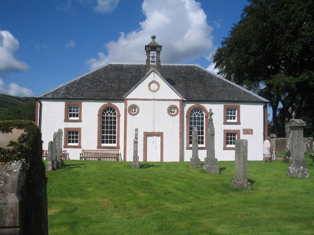
![Kilmodan Parish Kirk Dedicated to St Modan, an Irish monk who in 522 AD built a chapel at what became Dryburgh Abbey. Later he became a hermit near Dumbarton, and his relics were housed at Rosneath on the Clyde. The parish of Kilmodan takes its name from him, and the church at Benderloch is also dedicated to St Modan. Note the [<a href="https://www.geograph.org.uk/photo/2606989">NR9984 : Sandstone Plaques</a>] on the right-hand side.](https://s0.geograph.org.uk/geophotos/02/60/69/2606972_4e09544f.jpg)


Clachan of Glendaruel is located at Grid Ref: NR9984 (Lat: 56.009178, Lng: -5.214301)
Unitary Authority: Argyll and Bute
Police Authority: Argyll and West Dunbartonshire
What 3 Words
///prance.yacht.bulldozer. Near Lochgilphead, Argyll & Bute
Nearby Locations
Related Wikis

Glendaruel
Glendaruel (Gaelic: Gleann Dà Ruadhail) is a glen in the Cowal peninsula in Argyll and Bute, Scotland. The main settlement in Glendaruel is the Clachan...

Auchenbreck Castle
Auchenbreck Castle (also spelt Auchinbreck) is located in Argyll and Bute, Scotland. Its remains are situated in Kilmodan parish, near the mouth of Glendaruel...
Kilmodan
Kilmodan is a civil parish situated on the Cowal Peninsula, in Argyll and Bute, in Scotland. It includes the valley of Glendaruel and surrounding areas...
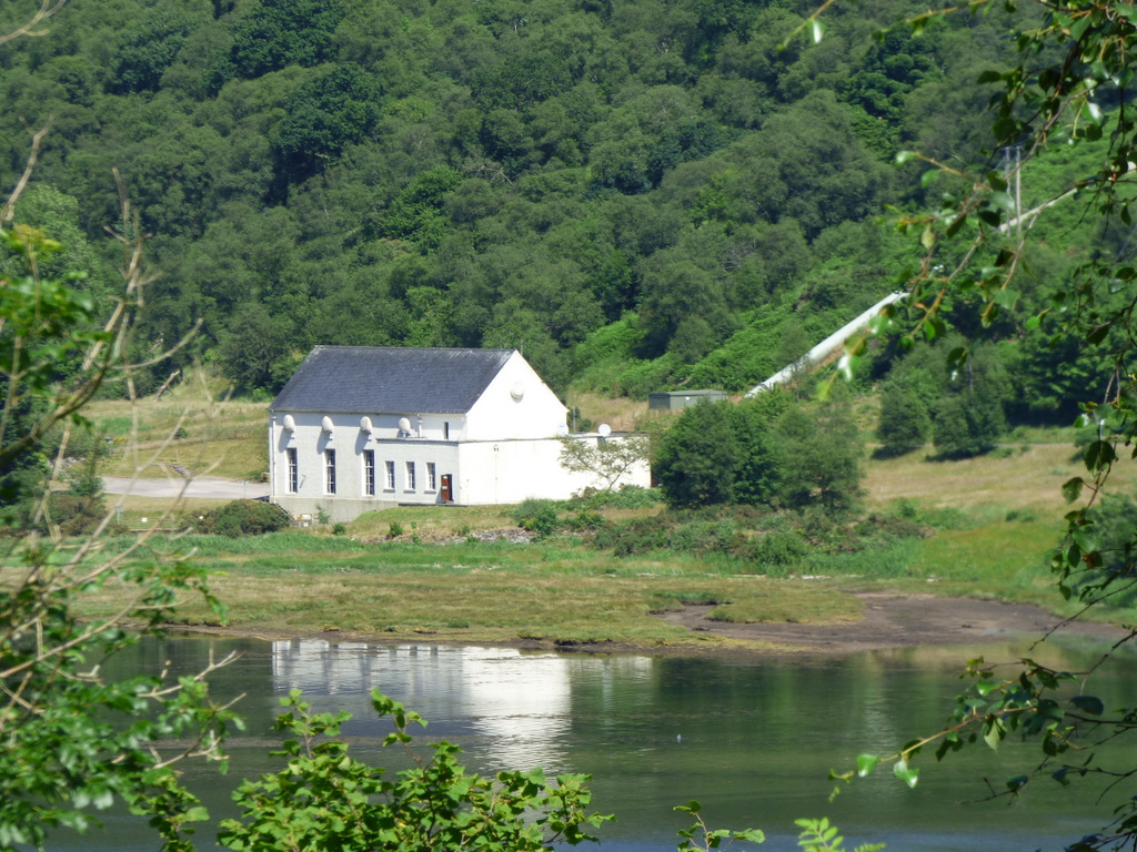
Striven Hydro-Electric Scheme
Striven Hydro-Electric Scheme is a small-scale hydro-electric power station, built by the North of Scotland Hydro-Electric Board and commissioned in 1951...
Nearby Amenities
Located within 500m of 56.009178,-5.214301Have you been to Clachan of Glendaruel?
Leave your review of Clachan of Glendaruel below (or comments, questions and feedback).