Brake Plantation

Wood, Forest in Devon Mid Devon

England

Brake Plantation

Bampton : Oakfordbridge - Highleigh Mill A bridge across to Highleigh Mill, but it doesn't look passable today due to the River Exe. Debris is also forming on the bridge.
Bampton : Oakfordbridge - Highleigh Mill Credit: Lewis Clarke

Brake Plantation is a picturesque woodland area located in the heart of Devon, England. Covering a vast expanse of approximately 200 acres, this enchanting forest is renowned for its diverse flora and fauna, making it a haven for nature enthusiasts and wildlife lovers alike.

The plantation is predominantly composed of a mixture of deciduous and evergreen trees, including oak, beech, birch, and pine. These towering trees create a dense canopy, providing shelter and a tranquil atmosphere for visitors to enjoy. The forest floor is adorned with an array of wildflowers, ferns, and mosses, adding to the enchanting beauty of the surroundings.

Visitors can explore the woodland through a network of well-maintained trails, allowing for leisurely walks and hikes. The paths wind through the forest, offering glimpses of an abundance of wildlife, such as deer, squirrels, and a variety of bird species. It is not uncommon to catch sight of a red kite soaring above the treetops or hear the melodic song of a nightingale.

Beyond its natural beauty, Brake Plantation also boasts a rich historical significance. The area was once a thriving iron ore mine during the Industrial Revolution, and remnants of this industrial past can still be seen today, adding an intriguing layer to the woodland's allure.

Overall, Brake Plantation in Devon is a captivating destination that seamlessly combines natural splendor with a touch of history. Whether it's a leisurely stroll among the trees or an exploration of its diverse wildlife, this enchanting woodland offers an unforgettable experience for visitors of all ages.

If you have any feedback on the listing, please let us know in the comments section below.

Brake Plantation Images

Images are sourced within 2km of 50.992321/-3.5649642 or Grid Reference SS9022. Thanks to Geograph Open Source API. All images are credited.
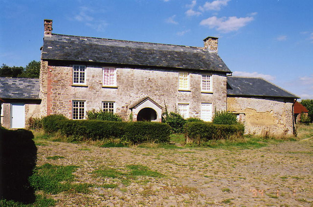
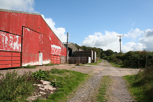
Bampton : Oakfordbridge - Highleigh Mill A bridge across to Highleigh Mill, but it doesn't look passable today due to the River Exe. Debris is also forming on the bridge.
Bampton : Oakfordbridge - Highleigh Mill
A bridge across to Highleigh Mill, but it doesn't look passable today due to the River Exe. Debris is also forming on the bridge.
Bampton : Oakfordbridge - Bark House Hotel Tea Garden Two scarecrows welcome people into the team garden, although it's a little damp today.
Bampton : Oakfordbridge - Bark House Hotel Tea Garden
Two scarecrows welcome people into the team garden, although it's a little damp today.
Bampton : Oakfordbridge - A396 Churches Fire security van braves the flooded road.
Bampton : Oakfordbridge - A396
Churches Fire security van braves the flooded road.
Bampton : Oakfordbridge - A396 The road passes The Bark House Hotel.
Bampton : Oakfordbridge - A396
The road passes The Bark House Hotel.
Bampton : Oakfordbridge - A396 Looking towards somebody crossing through the floodwaters.
Bampton : Oakfordbridge - A396
Looking towards somebody crossing through the floodwaters.
Bampton : Oakfordbridge - A396 The flooded A396 in Oakfordbridge.
Bampton : Oakfordbridge - A396
The flooded A396 in Oakfordbridge.
Bampton : Oakfordbridge - A396 The flooded A396 in Oakfordbridge.
Bampton : Oakfordbridge - A396
The flooded A396 in Oakfordbridge.
Bampton : Oakfordbridge - A396 Looking along the A396 where water has flooded the road.
Bampton : Oakfordbridge - A396
Looking along the A396 where water has flooded the road.
Bampton : Oakfordbridge - A396 A tractor passes through the floodwater.
Bampton : Oakfordbridge - A396
A tractor passes through the floodwater.
Bampton : Oakfordbridge - A396 The road has become impossible to pass at Oakfordbridge.
Bampton : Oakfordbridge - A396
The road has become impossible to pass at Oakfordbridge.
Bampton : Oakfordbridge - A396 Looking along the A396 which is closed due to flooding.
Bampton : Oakfordbridge - A396
Looking along the A396 which is closed due to flooding.
Oakford: Spurway Barton Derelict outbuildings near a ruined farmhouse. A public footpath runs by. The Spurway family had settled here by 1244 and the property remained in the family's hands until well into the 20th century [Source: W G Hoskins. Devon. 1992]
Oakford: Spurway Barton
Derelict outbuildings near a ruined farmhouse. A public footpath runs by. The Spurway family had settled here by 1244 and the property remained in the family's hands until well into the 20th century [Source: W G Hoskins. Devon. 1992]
Oakford: East Mildon By a public footpath from Ford Farm to Esworthy. The farmhouse was shuttered and deserted in 2003
Oakford: East Mildon
By a public footpath from Ford Farm to Esworthy. The farmhouse was shuttered and deserted in 2003
Oakford: near Ford Farm On a public footpath towards East Mildon. Looking west-north-west. It should be noted, perhaps, that the present day Ford Farm has been built near High Bolham and is not at the place shown on the 1940s Ordnance Survey map. The old building was being converted to a private house recently. The old farm had a remote barn which contained a water-powered threshing machine. By 2003 the waterwheel had gone but the course of the leat was still apparent
Oakford: near Ford Farm
On a public footpath towards East Mildon. Looking west-north-west. It should be noted, perhaps, that the present day Ford Farm has been built near High Bolham and is not at the place shown on the 1940s Ordnance Survey map. The old building was being converted to a private house recently. The old farm had a remote barn which contained a water-powered threshing machine. By 2003 the waterwheel had gone but the course of the leat was still apparent
Oakford: Ford Farm Barns by a track from Combe Water to High Bolham. Looking east-south-east
Oakford: Ford Farm
Barns by a track from Combe Water to High Bolham. Looking east-south-east
Oakford: Red Deer House Previously Red Deer Farm, it stands by the old Bampton – South Molton turnpike, now the B3227, and offers bed and breakfast. Looking north-north-west
Oakford: Red Deer House
Previously Red Deer Farm, it stands by the old Bampton – South Molton turnpike, now the B3227, and offers bed and breakfast. Looking north-north-west
Oakford: towards East Tapps Farmland and woodland, seen from the lane near Hutswell. Evening light. Bentley, the historian of Oakford, writing in the early 1980s, noted that a sluice gate and a millpond survived at East Tapps: the farm clearly used water power in the 19th century. In the 18th or earlier centuries a windmill seems to have existed on the estate. Fields here were known as ‘Windmill’ and ‘Outer Windmill’ in 1839.
Oakford: towards East Tapps
Farmland and woodland, seen from the lane near Hutswell. Evening light. Bentley, the historian of Oakford, writing in the early 1980s, noted that a sluice gate and a millpond survived at East Tapps: the farm clearly used water power in the 19th century. In the 18th or earlier centuries a windmill seems to have existed on the estate. Fields here were known as ‘Windmill’ and ‘Outer Windmill’ in 1839.
Brushford: Higher Upcott and Upcott Farm Seen from the Oldways End-Exebridge Road. Higher Upcott is the building to the left
Brushford: Higher Upcott and Upcott Farm
Seen from the Oldways End-Exebridge Road. Higher Upcott is the building to the left
Show me another place!

Brake Plantation is located at Grid Ref: SS9022 (Lat: 50.992321, Lng: -3.5649642)

Administrative County: Devon

District: Mid Devon

Police Authority: Devon and Cornwall

What 3 Words

///shampoos.cold.apart. Near Dulverton, Somerset

Related Wikis

Oakford, Devon

Oakford is a village and civil parish in the Mid Devon district of Devon, England. It is located three miles (5 km) south west of Bampton and eight miles...

Oakfordbridge

Oakfordbridge is a village in Devon, England. == References == The geographic coordinates are from the Ordnance Survey. == External links == Media related...

Briggins Moor

Briggins Moor is a 15.3 hectare biological Site of Special Scientific Interest in Somerset, notified in 1994. The site is south of Dulverton and close...

River Barle

The River Barle runs from the Chains on northern Exmoor, in Somerset, England to join the River Exe at Exebridge, Devon. The river and the Barle Valley...

Have you been to Brake Plantation?

Leave your review of Brake Plantation below (or comments, questions and feedback).