Broomclose Copse

Wood, Forest in Devon Mid Devon

England

Broomclose Copse

Stoodleigh Beacon and the fields of Devon
Stoodleigh Beacon and the fields of Devon Credit: Roger A Smith

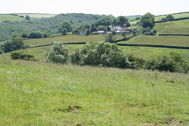
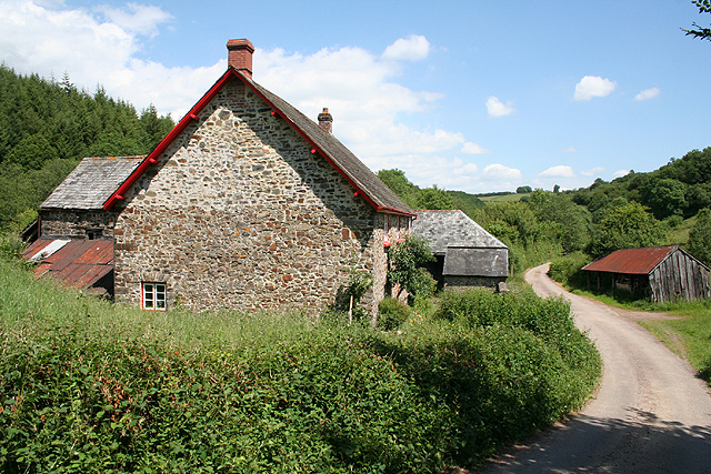
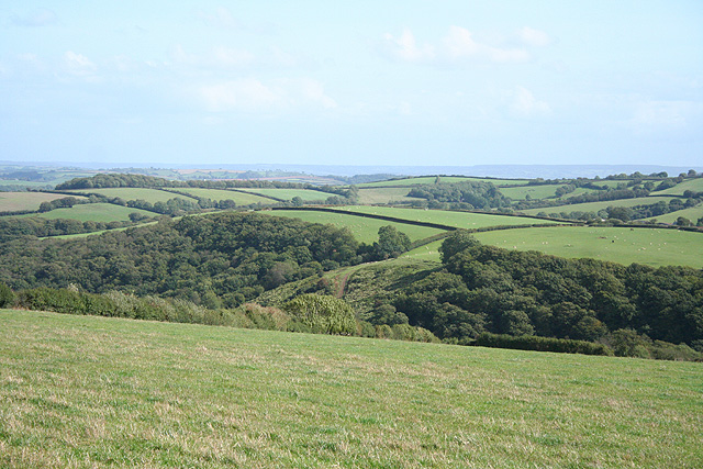
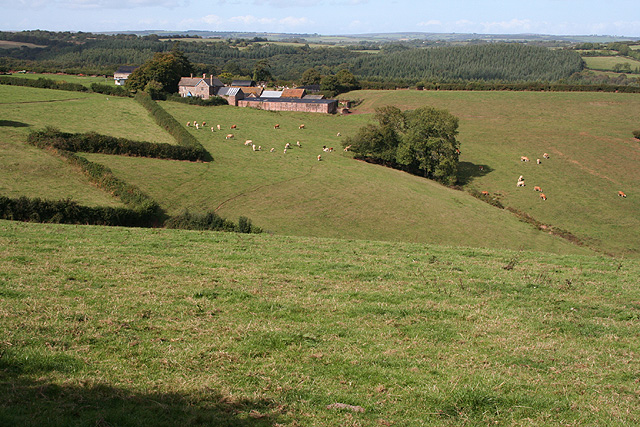
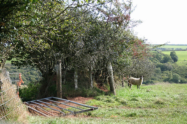
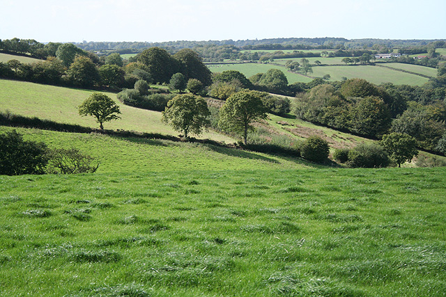
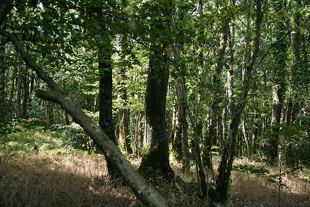
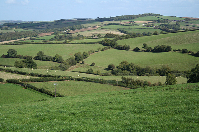
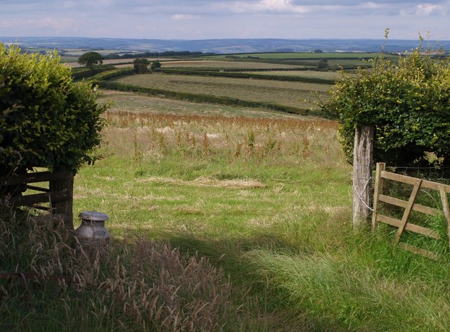
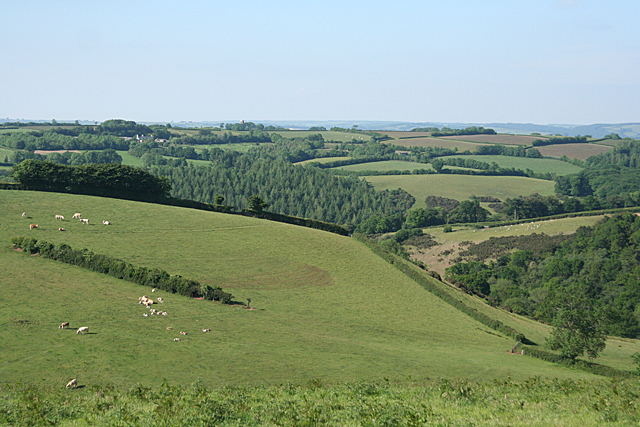
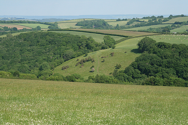
Broomclose Copse is a picturesque woodland located in Devon, England. Situated in the southern part of the county, it covers an area of approximately 50 acres. The copse is characterized by its dense growth of trees, consisting mainly of oak, beech, and ash, with an understory of ferns and wildflowers. The woodland is part of a larger network of forests and woodlands in the region, providing a vital habitat for various plant and animal species.

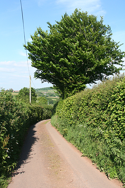
The copse is known for its tranquil atmosphere and natural beauty, attracting visitors and nature enthusiasts throughout the year. It offers a range of walking trails that wind through the trees, allowing visitors to explore its diverse ecosystem. These paths offer opportunities to spot wildlife such as deer, squirrels, and a variety of bird species. The copse is also home to several rare and protected species, including the endangered hazel dormouse.

Broomclose Copse is managed by the local authorities in collaboration with conservation organizations to ensure the preservation of its natural habitat. Efforts are made to maintain a healthy balance between human activity and the preservation of the woodland's ecological integrity. Regular maintenance includes tree thinning, removal of invasive species, and the creation of nesting sites for birds.

The copse is a popular destination for nature walks, picnics, and photography. It provides a peaceful escape from the hustle and bustle of urban life, allowing visitors to immerse themselves in the natural beauty of Devon's woodlands. With its rich biodiversity and scenic charm, Broomclose Copse is a true gem of the region.

If you have any feedback on the listing, please let us know in the comments section below.

Broomclose Copse Images

Images are sourced within 2km of 50.958352/-3.5644632 or Grid Reference SS9018. Thanks to Geograph Open Source API. All images are credited.

Stoodleigh Beacon and the fields of Devon
Stoodleigh: by Coleford Bottom Looking south towards Great Coleford farm
Stoodleigh: by Coleford Bottom
Looking south towards Great Coleford farm
Stoodleigh: Aldridge Mill The watermill is thought to be the structure standing to the left, behind the miller’s house. There was a farm or smallholding here as well, judging by the adjoining barns. Looking east
Stoodleigh: Aldridge Mill
The watermill is thought to be the structure standing to the left, behind the miller’s house. There was a farm or smallholding here as well, judging by the adjoining barns. Looking east
Stoodleigh: radio mast At Stoodleigh Beacon and close to a triangulation pillar. Looking north-north-west near Whitnole Cross
Stoodleigh: radio mast
At Stoodleigh Beacon and close to a triangulation pillar. Looking north-north-west near Whitnole Cross
Stoodleigh: near Whitnole Cross Looking south east towards Rifton Wood
Stoodleigh: near Whitnole Cross
Looking south east towards Rifton Wood
Stoodleigh: near West Whitnole Looking south towards Blatchworthy
Stoodleigh: near West Whitnole
Looking south towards Blatchworthy
Stoodleigh: towards Thorne Farm Looking north-north-west by the entrance to Thorne Farm
Stoodleigh: towards Thorne Farm
Looking north-north-west by the entrance to Thorne Farm
Stoodleigh: above Rifton Wood Looking south-south-east by a sharp bend on the lane from Great Coleford to Broadmead Cross
Stoodleigh: above Rifton Wood
Looking south-south-east by a sharp bend on the lane from Great Coleford to Broadmead Cross
Stoodleigh: near Broadmead Farm Looking west-north-west. Blindwell farm is near the skyline, beyond the square, on the right
Stoodleigh: near Broadmead Farm
Looking west-north-west. Blindwell farm is near the skyline, beyond the square, on the right
Stoodleigh: Great Wood By the road from Spurway Mill to Broadmead Cross, looking west-north-west
Stoodleigh: Great Wood
By the road from Spurway Mill to Broadmead Cross, looking west-north-west
Stoodleigh: above Throwcombe Cross Looking east over farmland. Waspley Farm is hidden in the valley, out of shot. On the 1940s Ordnance Survey map it appears as Warbrightsleigh Barton
Stoodleigh: above Throwcombe Cross
Looking east over farmland. Waspley Farm is hidden in the valley, out of shot. On the 1940s Ordnance Survey map it appears as Warbrightsleigh Barton
Rifton Lane A no through road leading off the A361 link road at Rifton Gate, this lane leads to the farms at Rifton and then continues as Stoodleigh Bridleway 9, descending towards the Iron Mill Stream valley.
Rifton Lane
A no through road leading off the A361 link road at Rifton Gate, this lane leads to the farms at Rifton and then continues as Stoodleigh Bridleway 9, descending towards the Iron Mill Stream valley.
Gateway beside Rifton Lane A milk churn stands beside this gateway giving a view across fields to the east of <a href="https://www.geograph.org.uk/photo/502205">SS8917 : Rifton Lane</a> - the same trees can be seen in the distance  .
Gateway beside Rifton Lane
A milk churn stands beside this gateway giving a view across fields to the east of SS8917 : Rifton Lane - the same trees can be seen in the distance .
Stoodleigh: above Great Coleford Lane to Rull and Stoodleigh
Stoodleigh: above Great Coleford
Lane to Rull and Stoodleigh
Stoodleigh: above Coleford Bottom Seen by the entrance to Thorne Farm
Stoodleigh: above Coleford Bottom
Seen by the entrance to Thorne Farm
Stoodleigh: above Wapsley The farm is hidden in a steep valley. Seen from the lane between Stoodleigh Beacon and Great Coleford
Stoodleigh: above Wapsley
The farm is hidden in a steep valley. Seen from the lane between Stoodleigh Beacon and Great Coleford
Stoodleigh: towards Rifton Wood Seen from a lane near Stoodleigh Beacon
Stoodleigh: towards Rifton Wood
Seen from a lane near Stoodleigh Beacon
Stoodleigh: above Rifton Wood Way beyond the square, on the skyline, runs the lane between Rifton Gate and Haydon Cross - a ridge road
Stoodleigh: above Rifton Wood
Way beyond the square, on the skyline, runs the lane between Rifton Gate and Haydon Cross - a ridge road
Show me another place!

Broomclose Copse is located at Grid Ref: SS9018 (Lat: 50.958352, Lng: -3.5644632)

Administrative County: Devon

District: Mid Devon

Police Authority: Devon and Cornwall

What 3 Words

///boots.forgotten.bracing. Near Tiverton, Devon

Related Wikis

Stoodleigh

Stoodleigh is a village and civil parish in the Mid Devon district of Devon, England, located 6 miles (10 km) north of Tiverton and 5 miles (8 km) south...

Oakford, Devon

Oakford is a village and civil parish in the Mid Devon district of Devon, England. It is located three miles (5 km) south west of Bampton and eight miles...

Loxbeare

Loxbeare is a village and civil parish in Devon, England. The church is from the twelfth century and the tower is probably Norman. It is dedicated to St...

Oakfordbridge

Oakfordbridge is a village in Devon, England. == References == The geographic coordinates are from the Ordnance Survey. == External links == Media related...

Castle Close

Castle Close is a circular earthwork located near Stoodleigh in Mid Devon, England at OS grid reference SS937181. It is described on maps as a settlement...

Washfield

Washfield is a village, parish and former manor in Devon, England, situated about 2 miles north-west of Tiverton. The parish church is dedicated to St...

Calverleigh

Calverleigh (anciently Calwoodleigh) is a village and former civil parish and manor, now in the parish of Loxbeare, in the Mid Devon district, in the county...

Cove, Devon

Cove is a small village in the county of Devon, England. It is 4 miles north of Tiverton and 2 miles from Bampton in the Exe Valley some 450 feet above...

Have you been to Broomclose Copse?

Leave your review of Broomclose Copse below (or comments, questions and feedback).